Atlas Anatolia ist eine interaktive Karte der UNESCO-Welterbestätten mit Schwerpunkt auf archäologischen und kulturellen Stätten weltweit. Dieser Leitfaden ergänzt die offizielle UNESCO-Welterbeliste durch evidenzbasierte Darstellungen, standortbezogene Zeitleisten und wissenschaftlichen Kontext zu 319 veröffentlichten archäologischen Stätten.
TL;DR: Ein interaktiver, kontinentübergreifender Atlas kartiert 319 archäologische Stätten und konzentriert sich auf evidenzbasierte Darstellungen antiker Zivilisationen und des kulturellen Erbes. Die Inhalte sind nach Kontinenten gegliedert und bieten kartenbasierte Erkundung, mehrsprachige Darstellungen, wissenschaftlichen Kontext sowie querverwiesene Werkzeuge wie einen Wissensgraphen und eine interaktive Zeitleiste. Konzipiert für Forschende und Lernende, legt er Wert auf glaubwürdige Annotationen, kontinentübergreifende Vergleiche und laufende Aktualisierungen, die neue Forschungsergebnisse und Datenqualität widerspiegeln.
„Welterbe ist nicht allein eine Auszeichnung für Schönheit; es ist ein Versprechen, dass die Menschheit sich weigern wird zu vergessen, was die Erde noch birgt.“
— Paraphrase des Geistes der UNESCO-Welterbekonvention (1972)
India
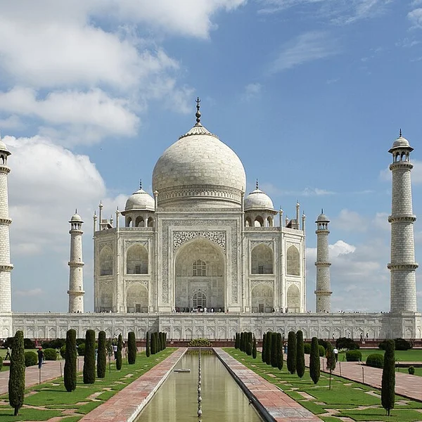
Taj Mahal
Das weiße Marmormausoleum, das Shah Jahan am Ufer des Yamuna in Agra für seine Frau Mumtaz Mahal erbauen ließ
Italy
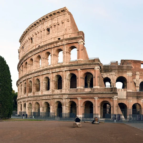
Colosseum
Das Kolosseum, das ikonische flavische Amphitheater Roms, war Schauplatz von Gladiatorenkämpfen und öffentlich
Jordan
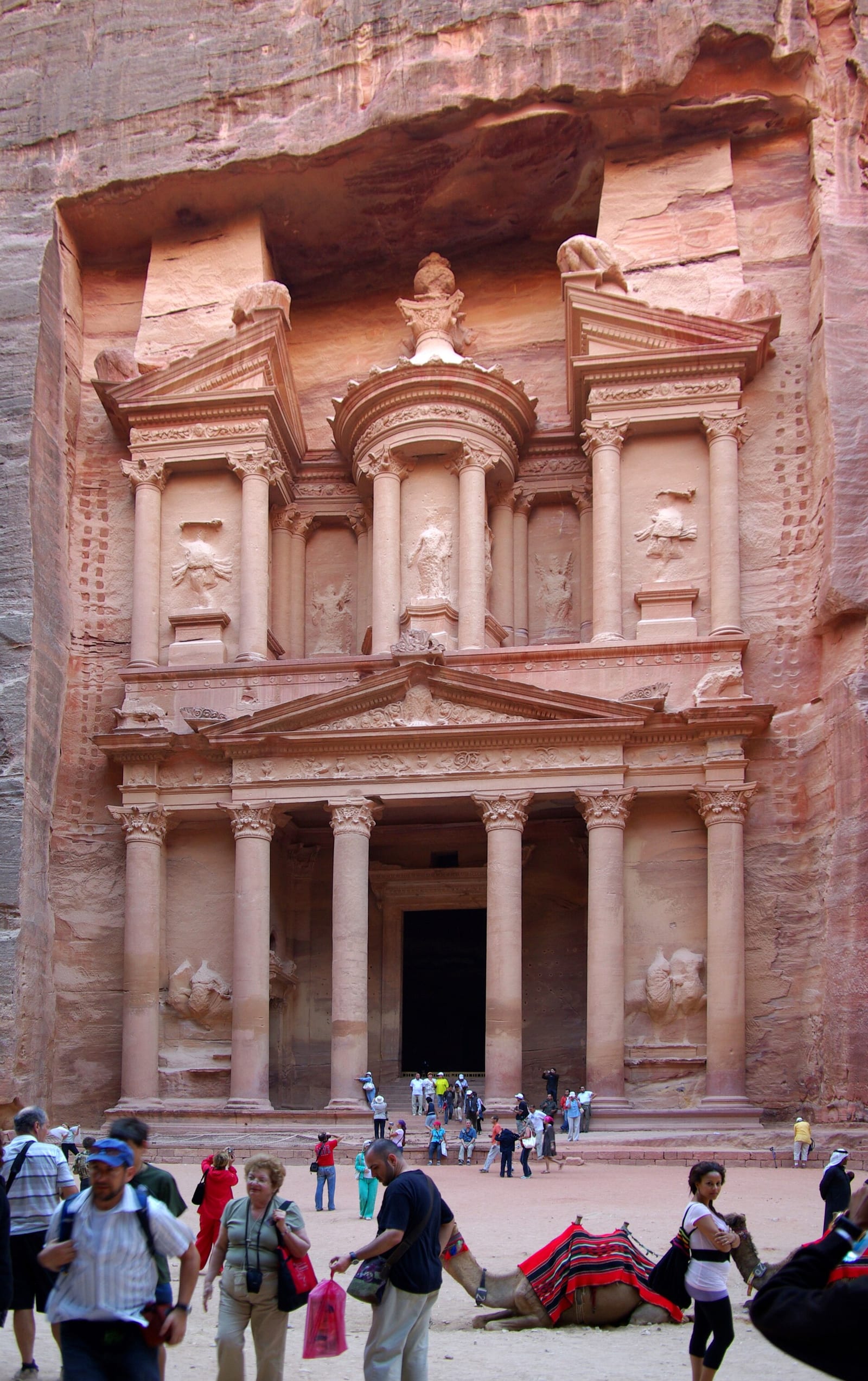
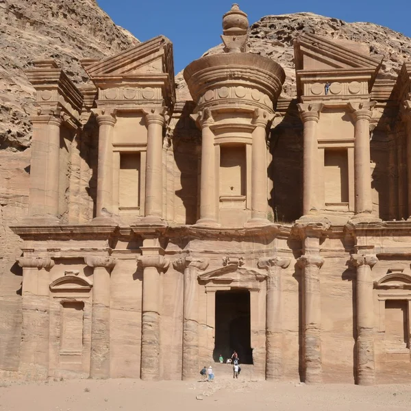
Petra
Petra, die nabatäische Hauptstadt von ca. 300 v. Chr. bis 700 n. Chr., ist berühmt für ihre in den Fels gehaue
Peru
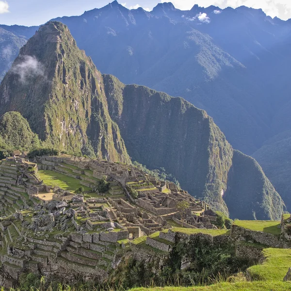
Machu Picchu
Eine Inka-Zitadelle, erbaut um 1450 n. Chr., liegt Machu Picchu auf einem Bergrücken in Peru. Während der span
Egypt
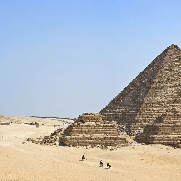
Pyramids of Giza
Die Pyramiden von Gizeh, monumentale Grabmäler der Pharaonen des Alten Reiches Khufu, Khafre und Menkaure, ste
Cambodia
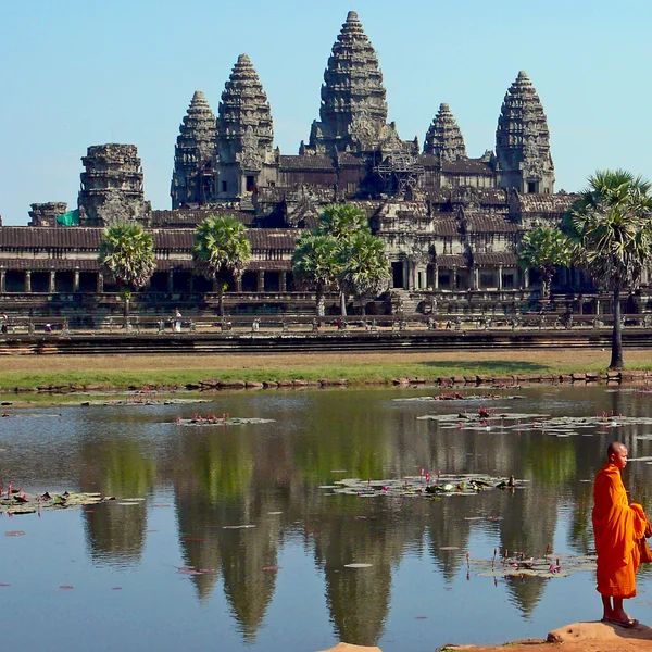
Angkor Wat
Angkor Wat, das größte religiöse Monument der Welt, wurde als hinduistischer Tempel zu Ehren Vishnus vom Khmer
Einleitung
Zweck und Umfang des interaktiven Atlas
Die Stätten sind nach Kontinenten gegliedert, um regionale Geschichten und interkulturelle Verbindungen zu beleuchten. Jeder Abschnitt stellt ikonische Wahrzeichen neben weniger bekannten Orten vor, um Muster von Besiedlung, Handel und kulturellem Austausch sichtbar zu machen.
Hauptmerkmale: kartenbasierte Erkundung, mehrsprachige Inhalte, wissenschaftlicher Kontext
- Kartenbasierte Erkundung: Georeferenzierte Karten, interaktive Ebenen und räumliche Abfragen zur Navigation durch Stätten auf einer globalen Leinwand.
- Mehrsprachige Inhalte zur Erweiterung der Zugänglichkeit und Unterstützung vielfältiger Leserschaften.
- Wissenschaftlicher Kontext durch Metadaten, Zeitleisten und Querverweise, die jede Stätte in ihren historischen Rahmen einbetten.
Wir legen den Schwerpunkt auf archäologische und kulturelle Welterbestätten und schließen reine Naturerbestätten aus. Das Ergebnis ist ein fokussierter, evidenzbasierter Leitfaden, der ansprechendes Erzählen mit strengem Kontext verbindet.
Das Welterbe ist keine Liste isolierter Monumente – es ist eine Karte davon, wie menschliche Gesellschaften über Kontinente hinweg bauten, Handel trieben, glaubten und regierten. Ein archäologischer Atlas macht diese Verbindungen sichtbar.
1. Afrika: Antike Zivilisationen und archäologische Höhepunkte
Wichtige Fundstätten-Cluster nach Region
Afrikas archäologische Landschaft konzentriert sich auf Flusstäler, Küstengürtel und Wüstenhandelskorridore. Der Nilkorridor verankert Nordostafrika mit monumentalen Gräbern, Tempeln und städtischen Grundrissen, die religiöses Leben und Verwaltung beleuchten – von den Pyramiden von Gizeh bis Abu Simbel. Ostafrika zeigt Binnenlandnetzwerke, die Hochlandsiedlungen mit Oasen entlang von Karawanenrouten verbanden. Sahel und Sahara bewahren an die Wüste angepasste Siedlungen und Felskunst, die langfristige kulturelle Resilienz offenbaren. Westafrika beherbergt urbane Zentren und Handelsdrehkreuze, die mit dem transsaharischen Austausch verbunden sind. Das südliche Afrika bewahrt Felskunsttraditionen und frühe urbane Formen, die von lokalen Ökologien geprägt wurden.
Egypt
Pyramids of Giza
Die Pyramiden von Gizeh, monumentale Grabmäler der Pharaonen des Alten Reiches Khufu, Khafre und Menkaure, ste
Egypt
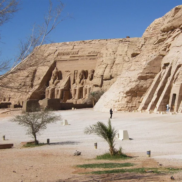
Abu Simbel
Die beiden Felsentempel von Abu Simbel, von Ramses II. (ca. 1264–1244 v. Chr.) in Nubien aus dem Fels gehauen,
Ethiopia
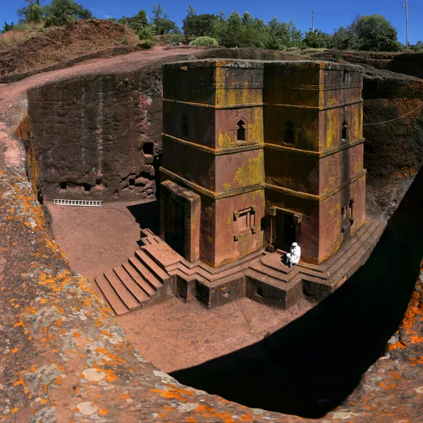
Lalibela
Ein Komplex aus 11 monolithischen Felsenkirchen, die im 12.–13. Jahrhundert gehauen wurden und den Höhepunkt d
Bemerkenswerte Epochen und vertretene Zivilisationen
Zu den Schlüsselperioden gehören Königreiche entlang des Nils und des Nildeltas, die Entstehung monumentaler Architektur in West- und Nordostafrika sowie ausgefeilte Stadtplanung in den Binnenregionen. Der Befund spiegelt eine Kontinuität von Siedlungsstrategien, sich entwickelnden Handelsnetzwerken und sich wandelnder Regierungsführung wider. Diese Auswahl betont die langfristige kulturelle Entwicklung, von Petroglyphen bis zu monumentalen Ensembles, die Gemeinschaftsleben und rituelle Praxis beleuchten.
Interaktive Kartentipps für Afrika
- Verwenden Sie kontinentweite Filter, um Kulturstätten von gemischten oder unsicheren Ausweisungen zu trennen.
- Schalten Sie Epochenebenen um, um Übergänge von früher monumentaler Aktivität zu späterer Urbanisierung zu vergleichen.
- Fahren Sie über Marker, um Metadaten, Datierungsspannen und regionale Zugehörigkeiten anzuzeigen.
- Vergleichen Sie Cluster nebeneinander mit dem Wissensgraphen, um Verbindungen zwischen Zivilisationen nachzuverfolgen.
2. Amerika: Präkolumbische und frühhistorische Stätten
Kulturlandschaften und urbane Zentren auf den Kontinenten
Die Amerikas präsentieren dichte Kulturlandschaften, die zeremonielle Räume, befestigte Siedlungen und zeremonielle Plätze mit alltäglichen Wohnvierteln verbinden. Von den urbanen Kernen mesoamerikanischer und andiner Städte — Machu Picchu, Chichén Itzá, Teotihuacán — bis hin zu ausgedehnten zeremoniellen Ebenen offenbaren diese Stätten soziale Organisation, rituelles Leben und architektonische Innovation. Küstennahe Handelsnetzwerke und Hinterlandregionen im Binnenland zeigen, wie Gemeinschaften über große Entfernungen hinweg verbunden waren.
Peru
Machu Picchu
Eine Inka-Zitadelle, erbaut um 1450 n. Chr., liegt Machu Picchu auf einem Bergrücken in Peru. Während der span
Mexico
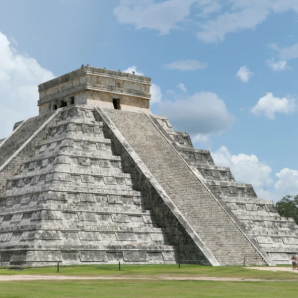
Chichén Itzá
Ein bedeutendes Maya-Toltekisches Zeremonialzentrum aus der Zeit 600–1200 n. Chr., mit der ikonischen Stufenpy
Mexico
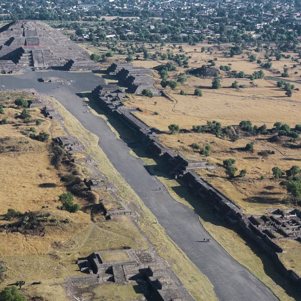
Teotihuacan
Teotihuacan, die 'Stadt der Götter', war eine riesige Metropole und ein zeremonielles Zentrum in Zentralmexiko
!Machu Picchu im andinen Nebelwald
- Urbane Grundrisse umfassen Rasterpläne, erhöhte Wasserreservoirs und zeremonielle Zentren, die das tägliche Leben lenkten.
- Kulturlandschaften umfassen oft Häfen, terrassierte Felder und heilige Bezirke, die in das umgebende Gelände integriert sind.
- Die architektonische Vielfalt reicht von monumentalen Pyramiden über Lehmziegelplattformen bis hin zu Steinkomplexen.
Chronologien und dargestellte Epochen
Die Abfolge umfasst frühe landwirtschaftliche Gemeinschaften, die Hochphase der Urbanisierung und Übergangsperioden, die mit Kontakt- und Austauschnetzwerken verbunden sind. Die Chronologien heben Aufstiegs- und Niedergangsphasen hervor, die durch Umweltbelastungen, soziopolitische Dynamiken und interkulturelle Interaktionen geprägt wurden. Das Archiv betont die Kontinuität ritueller Praxis neben Veränderungen in Herrschaft und Ressourcenverwaltung.
- Übergänge von der Präklassik zur Klassik in Mesoamerika veranschaulichen sich wandelnde politische und zeremonielle Architekturen.
- Andine Zivilisationen zeigen eine Entwicklung von landwirtschaftlichen Terrassen zu zentralisierten Verwaltungszentren.
- Nachkontaktliche Schichten offenbaren synkretistische Praktiken und Anpassung im kolonialzeitlichen Umfeld.
Filtern Sie nach Epoche, um Stätten der Neuen Welt entlang einer gemeinsamen zeitlichen Achse auszurichten — und Sie beginnen, zeitgleiche Entwicklungen zu erkennen, die kein Einzelstättenführer zeigen kann.
Nutzung der Zeitleiste zum Vergleich von Stätten der Neuen Welt
- Filtern Sie nach Epoche, um Stätten entlang einer gemeinsamen zeitlichen Achse auszurichten und zeitgleiche Entwicklungen zu beobachten.
- Vergleichen Sie den Status von Stätten, etwa Erhaltungsgrad oder Forschungsintensität, über Regionen hinweg.
- Nutzen Sie den Wissensgraphen, um Handelsrouten, religiöse Netzwerke und administrative Hierarchien nachzuverfolgen, die Gemeinschaften verbanden.
3. Asien: Antike Reiche und transkontinentaler Austausch
Schlüsselzivilisationen und ihre archäologischen Spuren
Asien beherbergt ein Geflecht altehrwürdiger Zivilisationen, deren Archäologie monumentale Architektur, Stadtplanung und sakrale Landschaften umspannt. Von den Flusszivilisationen des Ganges- und Jangtse-Beckens bis zu den kaiserlichen Hauptstädten und zeremoniellen Zentren des eurasischen Kernlandes – Taj Mahal, Angkor Wat, die Verbotene Stadt, Varanasi, Bodh Gaya, Topkapi-Palast – offenbaren materielle Spuren von Herrschaft, Religion und Alltagsleben über Jahrtausende hinweg.
India
Taj Mahal
Das weiße Marmormausoleum, das Shah Jahan am Ufer des Yamuna in Agra für seine Frau Mumtaz Mahal erbauen ließ
Cambodia
Angkor Wat
Angkor Wat, das größte religiöse Monument der Welt, wurde als hinduistischer Tempel zu Ehren Vishnus vom Khmer

China
Forbidden City
Der weitläufige Ming-Qing-Kaiserpalast im Herzen Pekings – fast tausend Gebäude innerhalb zinnoberroter Mauern
India
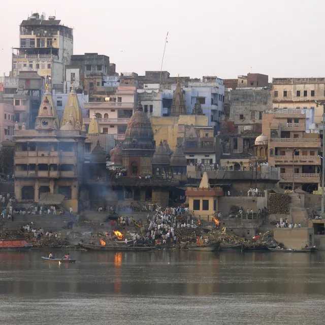
Varanasi
Eine der ältesten kontinuierlich bewohnten Städte der Welt — am Ganges in Uttar Pradesh — deren Ghats, der Kas
India
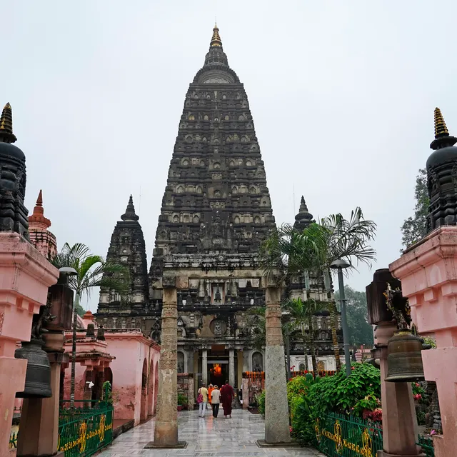
Bodh Gaya
Der Ort, an dem Siddhartha Gautama unter dem Bodhi-Baum Erleuchtung erlangte – gekennzeichnet durch den emporr
- Zentralasiatische Kerne zeigen Karawanenstadt-Grundrisse und Festungskomplexe, die für den transkontinentalen Austausch wesentlich waren.
- Südasiatische urbane Heiligtümer, Königspaläste und Tempelbezirke beleuchten Ritual und Staatskunst.
- Ostasiatische kaiserliche Stätten bewahren Rasterpläne, Verteidigungsanlagen und religiösen Synkretismus über dynastische Wechsel hinweg.
Repräsentierte Interaktionsnetzwerke und Handelsrouten
Archäologische Fußabdrücke kartieren die Bewegung von Gütern, Menschen und Ideen entlang weiträumiger Netzwerke. Straßenstationen, Hafenanlagen und Terrakotta-Symbole zeigen das Ausmaß des Austauschs über Wüsten, Steppen und Küstenlinien hinweg. Das Zusammenspiel kultureller Einflüsse wird in hybriden Architekturformen und Pilgerkorridoren sichtbar, die sakrale Orte verbinden.
- Handelskorridore verbinden rohstoffreiche Hinterländer mit urbanen Zentren und Häfen.
- Religiöse und wissenschaftliche Zentren fungieren als Knotenpunkte innerhalb größerer Austauschnetze.
- Die materielle Kultur zeigt gemeinsame Technologien wie Metallurgie und Mauerwerkstechniken, die über Regionen hinweg übertragen wurden.
Navigation durch Asiens Stätten mit Filtern und Ebenen
- Verwenden Sie Epochenfilter, um Stätten von der frühen Urbanisierung bis zur kaiserlichen Neuordnung einzuordnen.
- Wenden Sie Zivilisations-Tags an, um administrative Hauptstädte mit religiösen Komplexen zu vergleichen.
- Schalten Sie Ebenen für Architekturstile, Verteidigungsanlagen oder zeremonielle Landschaften um, um regionale Muster zu erkennen.
Hinweis: Der Atlas kartiert 319 veröffentlichte archäologische Fußabdrücke, mit geopolitischen und wissenschaftlichen Kontexten zur Unterstützung vergleichender Studien. Für umfassendere Zusammenhänge erkunden Sie den Wissensgraphen und die Interaktive Zeitleiste, um asiatische Stätten in kontinentale Narrative einzuordnen.
4. Europa: Klassische bis mittelalterliche Archäologie im kontinentalen Maßstab
Konzentration der Stätten nach Epoche und Kultur
Europas archäologische Überlieferung umfasst klassische, mittelalterliche und nachklassische Perioden, mit dichten Clustern um städtische Zentren, religiöse Mittelpunkte und imperiale Grenzen. Die Karte zeichnet Korridore vom antiken Griechenland und Rom nach — das Kolosseum, die Akropolis von Athen, Pompeji — bis zu Klöstern und Befestigungen der späteren Jahrhunderte, darunter Mont-Saint-Michel, die Kathedrale von Chartres und Meteora.
Italy
Colosseum
Das Kolosseum, das ikonische flavische Amphitheater Roms, war Schauplatz von Gladiatorenkämpfen und öffentlich
Greece
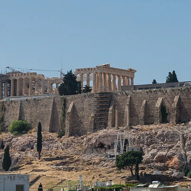
Acropolis of Athens
Die befestigte Kalkstein-Zitadelle, die sich über Athen erhebt – gekrönt vom Parthenon, Erechtheion und den Pr
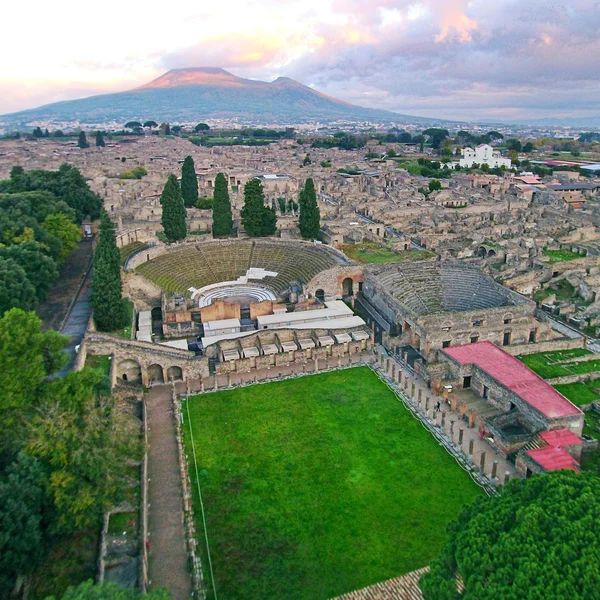
Italy
Pompeii
Die römische Stadt Pompeji wurde bei dem katastrophalen Ausbruch des Vesuvs im Jahr 79 n. Chr. verschüttet, wo
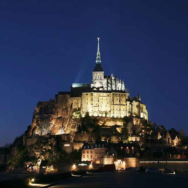
France
Mont-Saint-Michel
Die befestigte Abtei auf einer Granit-Gezeiteninsel vor der Küste der Normandie – ein Benediktinerkloster, des
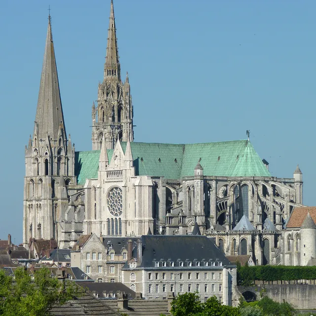
France
Chartres Cathedral
Die hochgotische Kathedrale südwestlich von Paris — nach 1194 größtenteils neu erbaut mit Doppeltürmen, einem

Greece
Meteora
Ein Wald aus Sandsteintürmen in Thessalien, Griechenland – gekrönt von byzantinischen und postbyzantinischen K
- Klassische Kerne umfassen öffentliche Gebäudekomplexe, Theater und Forenanlagen.
- Mittelalterliche Ensembles betonen Burgen, Kathedralen und befestigte Städte.
- Ländliche und zeremonielle Landschaften veranschaulichen den Wandel von agrarischen Siedlungen zu Pilgerwegen.
Integration von kulturellem und natürlichem Erbe in Europa
Stätten verbinden oft gebautes Erbe mit den umgebenden Landschaften, die das tägliche Leben prägten. Der Atlas verknüpft architektonische Erzählungen mit Gelände, Wasserwegen und Verteidigungslinien und hilft so, den Einfluss der Geografie auf Standortwahl und Erhaltung zu verstehen.
- Befestigte Landschaften richten sich nach Flusstälern und Verteidigungsperimetern aus.
- Heilige Bezirke liegen in Hügel- und Küstenökologien, die Zugang und rituelle Praxis lenkten.
- Städtische Raster spiegeln Planungsprinzipien wider, die an lokale Topografie und Materialien angepasst wurden.
Europäische Stätten erzählen durch Zeitleisten
Zeitleisten-Ebenen veranschaulichen die Entwicklung von der Antike bis ins Mittelalter. Sie können Regierungsführung, religiösen Einfluss und städtische Form über Regionen hinweg vergleichen. Der Wissensgraph verortet europäische Stätten in einer kontinentalen Chronologie von Austausch, Konflikt und kultureller Wiederbelebung.
Vergleichen Sie Meilensteine wie Urbanisierungsschübe und Festungserweiterungen über Regionen hinweg — und Europa wirkt nicht länger wie eine Liste berühmter Ruinen, sondern beginnt, sich als eine zusammenhängende Geschichte zu lesen.
- Vergleichen Sie Meilensteine wie Urbanisierungsschübe und Festungserweiterungen über Regionen hinweg.
- Verknüpfen Sie Patronagenetzwerke mit architektonischen Transformationen und Stilwechseln.
- Querverweisen Sie Stättenstatus, Forschungsintensität und Erhaltungsgeschichten entlang eines europäischen Bogens.
Hinweis: Der Atlas kartiert 319 veröffentlichte archäologische Stätten, wobei Europa ein zentrales Kontinuum in der kontinentalen Erzählung bildet. Erkunden Sie verwandte Ressourcen über den Wissensgraphen und die Interaktive Zeitleiste, um die europäische Archäologie in breitere Muster einzuordnen.
5. Ozeanien und Australien: Indigenes Erbe und Küstenzivilisationen
Charakteristische archäologische Themen nach Region
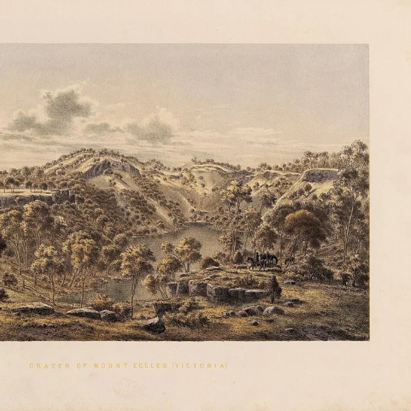
Ozeanien präsentiert ein Mosaik aus meeresnahen Gesellschaften, Binnentraditionen und inselspezifischen Anpassungen. Der Atlas beleuchtet Siedlungsmuster, Seefahrtstechnologien und rituelle Landschaften — darunter Budj Bim und Uluru — die langwährende Verbindungen zwischen Menschen und ozeanischen Umwelten widerspiegeln.

- Maritime Reise- und Navigationstraditionen prägen die Verteilung der Stätten entlang von Küsten und Archipelen.
- Felskunst, Muschelhaufen und zeremonielle Plattformen erhellen rituelle Praktiken und soziale Organisation.
- Adaptive architektonische Formen reagieren auf tropische und subtropische Klimata, einschließlich klimaangepasster Behausungen und Gemeinschaftsräume.
Küsten- und Inselstättenmuster
Küstengürtel beherbergen dichte Konzentrationen von Siedlungen, Ritualkomplexen und Handelszentren. Inselgeographien offenbaren vielschichtige Phasen der Erkundung, des Ressourcenmanagements und des kulturellen Austauschs über Meerengen und Lagunen hinweg.
- Hafenorientierte Komplexe markieren Verbindungen zwischen Inselgruppen und festländischen Ressourcen.
- Lagunen- und Riffstätten bewahren Subsistenzstrategien, die an die marine Biodiversität gebunden sind.
- Verteidigungs- und Zeremonialbauten gruppieren sich in Küstennähe, wo Zugangskontrolle strategisch war.
Mehrsprachige Beschreibungen und wissenschaftlicher Kontext für Ozeanien
Der Atlas bietet mehrsprachige Glossare und regionalspezifische Anmerkungen, um vielfältige Wissenstraditionen widerzuspiegeln. Wissenschaftliche Anmerkungen betonen Datierungsdebatten, Analysen der materiellen Kultur und die Rolle mündlicher Überlieferungen bei der Interpretation.
Hinweis: Der Atlas kartiert 319 veröffentlichte archäologische Stätten, wobei Ozeanien durch Küsten- und Inseltraditionen vertreten ist, die meeresorientierte Lebensweisen unterstreichen. Für regionenübergreifende Perspektiven erkunden Sie den Wissensgraphen und die Interaktive Zeitleiste, die im Atlas verfügbar sind.
6. Wie man erkundet: Interaktive Techniken und Werkzeuge
Karteninteraktionen: Zoomen, Verschieben und Ebenenumschaltung
Navigieren Sie in der interaktiven Weltkulturerbe-Karte mit intuitiven Zoom- und Schwenkfunktionen. Jede Aktion offenbart reichhaltigeren Kontext für georeferenzierte Stätten. Ebenen-Umschalter ermöglichen es Ihnen, sich auf archäologisches und kulturelles Erbe zu konzentrieren, indem Sie zwischen kulturellen, natürlichen und gemischten Ausweisungen wechseln.
Verwenden Sie Kontinent- oder Epochenfilter, um Cluster hervorzuheben, und vergleichen Sie dann Dichtemuster über Regionen hinweg. Die Rasterausrichtung unterstützt die präzise Lokalisierung von Stätten in dichten städtischen Kontexten. Räumliche Abfragen zeigen benachbarte Stätten auf, um Netzwerke der Besiedlung und des Austauschs zu veranschaulichen.
Jordan
Petra
Petra, die nabatäische Hauptstadt von ca. 300 v. Chr. bis 700 n. Chr., ist berühmt für ihre in den Fels gehaue
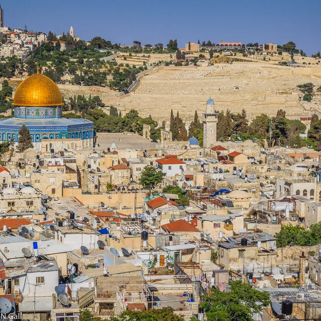
Israel
Old City of Jerusalem
Das ummauerte Herz Jerusalems – etwa ein Quadratkilometer, heilig für Judentum, Christentum und Islam – wo die
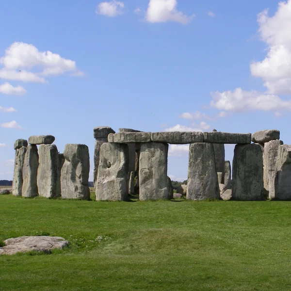
United Kingdom
Stonehenge
Stonehenge ist ein prähistorisches megalithisches Monument in Wiltshire, England, das in Phasen zwischen 3100
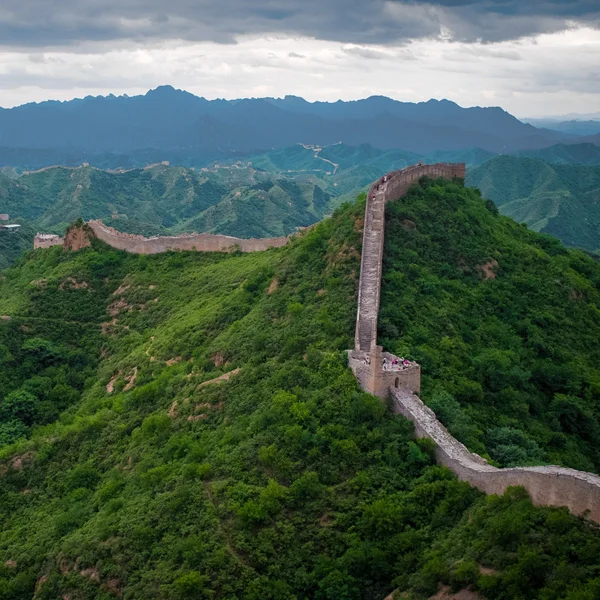
China
Great Wall of China
Das weitläufige Grenzbefestigungssystem Nordchinas – stampflehmige Qin-Mauern und die ikonischen steinernen Mi
Zeitstrahl-Erkundung: Epochen, Zivilisationen und Stättenstatus
Der integrierte Zeitstrahl filtert Ergebnisse nach Epochen wie klassisch, mittelalterlich oder vormodern. Sie können Stätten nach Zivilisation oder kultureller Tradition ausrichten, um überregionale Vergleiche anzustellen. Statusindikatoren der Stätten zeigen Erhaltungsmaßnahmen, Zugangsniveaus und Forschungsaktivität, sofern verfügbar.
Zeitstrahl-Überlagerungen visualisieren zeitliche Überschneidungen zwischen städtischen Zentren und rituellen Landschaften. Ein Seitenpanel hebt Übergänge in der Herrschaftsform und architektonische Innovationen hervor und hilft den Leserinnen und Lesern, kontinentale Narrative zu verfolgen, ohne die Kartenansicht zu verlassen.
Stättenseiten: Metadaten, wissenschaftlicher Kontext und Querverweise
Jede Stättenseite bündelt Metadaten, Geokoordinaten, Datierung und Primärquellen. Wissenschaftliche Anmerkungen bieten prägnanten Kontext, Datierungsdebatten und Höhepunkte der materiellen Kultur, die für Archäologie und kulturelles Erbe relevant sind. Querverweise verlinken auf verwandte Stätten und regionale Essays.
Querverweise ermöglichen die schnelle Erkundung verbundener Kontexte wie Handelsnetzwerke oder religiöser Komplexe. Interne Links zum Wissensgraphen unterstützen tiefere Untersuchungen der Beziehungen zwischen Stätten, Epochen und Regionen.
Beginnen Sie mit der Karte, grenzen Sie nach Epoche ein, öffnen Sie drei Stättenseiten nebeneinander im Vergleich — so übertrifft ein Atlas eine statische UNESCO-Liste.
7. Mehrsprachiger und wissenschaftlicher Kontext: Das Verständnis vertiefen
Sprachoptionen und Überlegungen zur Übersetzung
Die interaktive Weltkulturerbe-Karte unterstützt mehrsprachige Inhalte, um Forschende und Studierende in verschiedenen Regionen zu unterstützen. Ursprüngliche Stättennarrative werden mit Übersetzungen kombiniert, um den Zugang zu archäologischen und kulturellen Kontexten zu erweitern. Übersetzungsanmerkungen beleuchten Datierungsdebatten und terminologische Unterschiede, um die wissenschaftliche Nuance zu bewahren.
Wie wissenschaftliche Anmerkungen Stättennarrative bereichern
Anmerkungen bieten präzise Datierungsperspektiven, Höhepunkte der materiellen Kultur und archäologisch fundierte Interpretationen. Sie verbinden einzelne Stätten mit übergeordneten regionalen Chronologien und Austauschnetzwerken und helfen Ihnen, den Kontext über oberflächliche Merkmale hinaus zu erfassen.
Kontinentübergreifende Vergleiche durch kontextuelle Essays
Kontextuelle Essays rahmen Ähnlichkeiten und Unterschiede archäologischer Entwicklungsverläufe über Kontinente hinweg. Sie beleuchten, wie Handelsrouten, Stadtplanung und rituelle Praktiken die regionale Entwicklung prägten, und würdigen zugleich einzigartige lokale Geschichten. Sie bieten zudem vergleichende Einblicke, ohne eine einzelne Erzählung zu priorisieren.
- Sprachoptionen — Originalerzählungen sowie Übersetzungen und Glossarbegriffe. Warum das wichtig ist: breitere Zugänglichkeit und präzise Terminologie über Kulturen hinweg.
- Wissenschaftliche Anmerkungen — Datierungsdebatten, Anmerkungen zur materiellen Kultur, regionaler Kontext. Warum das wichtig ist: tieferes Verständnis und glaubwürdige Interpretation für Forschende.
- Kontextuelle Essays — Kontinentübergreifende Vergleiche und narrative Pfade. Warum das wichtig ist: hilft Leserinnen und Lesern, größere Muster zu erkennen, ohne ortsspezifische Details zu verlieren.
Der Atlas verankert Wissen durch querverwiesene Verbindungen über den Wissensgraphen und verwandte Werkzeuge und ermöglicht es Nutzerinnen und Nutzern, Beziehungen zwischen Stätten, Epochen und Regionen zu erkunden.
!Stonehenge in der Salisbury Plain
FAQ
Wie werden Stätten im Atlas georeferenziert?
Jeder archäologischen Stätte werden präzise Koordinaten zugewiesen, um eine genaue Platzierung auf der interaktiven Karte zu ermöglichen. Die Georeferenzierung kombiniert historische Aufzeichnungen, Ausgrabungsberichte und Archivquellen, um den Standort mit dokumentierter Unsicherheit – sofern zutreffend – festzulegen.
Das System unterstützt mehrere Koordinatenformate und enthält Metadaten zur Quelle der Platzierung. Dieser Ansatz gewährleistet eine konsistente, navigierbare Darstellung über Kontinente und Epochen hinweg.
Welche Kriterien bestimmen Aufnahme und Kategorisierung von Stätten?
Die Aufnahme konzentriert sich auf Stätten mit klarer archäologischer oder kultureller Bedeutung, die zu unserem Verständnis vergangener menschlicher Aktivität beitragen. Jeder Eintrag wird hinsichtlich Grundriss, Monumentalität und historischem Wert innerhalb der archäologischen Erzählung bewertet.
Stätten werden in Anlehnung an etablierte UNESCO-Kriterien als kulturell, natürlich oder gemischt kategorisiert, wobei dieser Atlas archäologische und kulturelle Aspekte betont. Die Klassifikation unterstützt gezieltes Filtern nach Epoche, Zivilisation und Region.
Können Nutzerinnen und Nutzer Daten oder Anmerkungen beitragen?
Nutzer können sich mit dem Atlas auseinandersetzen, indem sie Stättenseiten durchsehen, wissenschaftliche Anmerkungen hinzufügen und kontextuelle Verbindungen über den Wissensgraphen vorschlagen. Annotationen sind darauf ausgelegt, die wissenschaftliche Integrität und die Genauigkeit der Verknüpfungen zu bewahren.
Beiträge durchlaufen einen Validierungsprozess, um Zuverlässigkeit und Übereinstimmung mit veröffentlichten Quellen zu gewährleisten. Feedback hilft, Metadaten, Querverweise und kontextuelle Essays zu verfeinern, ohne die geografischen Kerndaten zu verändern.
Was sind häufige Anwendungsfälle für die FAQ-Ressourcen?
- Abgleich der Geolokalisierung mit veröffentlichten Karten für die Forschungsplanung
- Identifizierung von Stätten mit überlappenden kulturellen Traditionen oder Handelsnetzwerken
- Erkundung von Provenienz- und Datierungsdebatten anhand annotierter Notizen
Wie geht der Atlas mit Aktualisierungen der Stättendaten um?
Aktualisierungen folgen einem strukturierten Arbeitsablauf, der neue Forschungsergebnisse, überarbeitete Datierungen und erweiterte Stättenbeschreibungen einbezieht. Änderungen werden protokolliert, um Transparenz und Nachvollziehbarkeit in der Wissensbasis zu gewährleisten.
Schlussfolgerung
Überlegungen zum Wert eines kontinentübergreifenden archäologischen Atlas
Durch die Verknüpfung von Stätten über Kontinente hinweg gewinnen Sie einen kohärenten Rahmen für vielfältige Narrative. Der Atlas hebt Muster des Austauschs, der urbanen Entwicklung und der kulturellen Kontinuität hervor, die unser Verständnis der antiken Welten bereichern. Er priorisiert archäologisches und kulturelles Erbe mit klarem Kontext, nicht isolierte Listen.
Mit 319 veröffentlichten, kartierten archäologischen Stätten bietet der Atlas eine georeferenzierte Grundlage für vergleichende Studien. Mehrsprachige Inhalte und wissenschaftliche Annotationen tragen dazu bei, komplexe Interpretationen zugänglich und glaubwürdig zu halten.
Zukünftige Richtungen für die kartengestützte Erkundung des Kulturerbes
Erwarten Sie erweiterte thematische Ebenen, die neue Entdeckungen und laufende Ausgrabungen widerspiegeln, zusammen mit präziseren Datierungsdebatten im Wissensgraphen. Genauere Filterung nach Epoche, Zivilisation und materieller Kultur wird tiefere analytische Arbeit für Forschende und Lehrende gleichermaßen unterstützen.
Geplante Verbesserungen umfassen reichhaltigere kontinentübergreifende Narrative, die Stätten in breitere Austauschnetzwerke einordnen. Wir werden granulare Metadaten, verbesserte Quellentransparenz und interdisziplinäre Perspektiven verfolgen, um das Erzählen über Stätten zu stärken.
- Ausweitung regionaler Fallstudien, um lokale Kontexte innerhalb globaler Muster zu beleuchten
- Verbesserung der Zugänglichkeit durch optimierte Sprachoptionen und Glossarbegriffe
- Erhöhung der Interoperabilität mit externen Kulturerbe-Datenbanken und öffentlichen Katalogen
India
Taj Mahal
Das weiße Marmormausoleum, das Shah Jahan am Ufer des Yamuna in Agra für seine Frau Mumtaz Mahal erbauen ließ
Italy
Colosseum
Das Kolosseum, das ikonische flavische Amphitheater Roms, war Schauplatz von Gladiatorenkämpfen und öffentlich
Jordan
Petra
Petra, die nabatäische Hauptstadt von ca. 300 v. Chr. bis 700 n. Chr., ist berühmt für ihre in den Fels gehaue
Cambodia
Angkor Wat
Angkor Wat, das größte religiöse Monument der Welt, wurde als hinduistischer Tempel zu Ehren Vishnus vom Khmer
Peru
Machu Picchu
Eine Inka-Zitadelle, erbaut um 1450 n. Chr., liegt Machu Picchu auf einem Bergrücken in Peru. Während der span
Egypt
Pyramids of Giza
Die Pyramiden von Gizeh, monumentale Grabmäler der Pharaonen des Alten Reiches Khufu, Khafre und Menkaure, ste
Wie es weitergeht
Erkunden Sie alle 319 Stätten auf der interaktiven Karte, verfolgen Sie Verbindungen im Wissensgraphen oder vergleichen Sie zwei Stätten direkt nebeneinander. Für offizielle UNESCO-Dokumentationen siehe die UNESCO-Welterbeliste und die interaktive UNESCO-Karte.