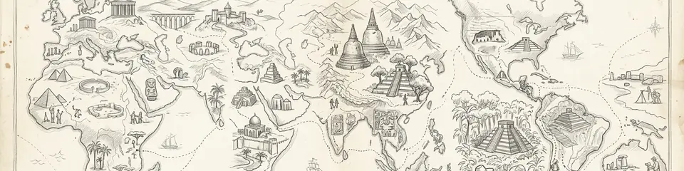
Atlas Anatolia, dünya genelindeki arkeolojik ve kültürel varlıklara odaklanan UNESCO dünya mirası alanlarının etkileşimli bir haritasıdır. Bu rehber, resmi UNESCO Dünya Mirası Listesi'ni kanıta dayalı anlatılar, alan bazlı zaman çizelgeleri ve yayımlanmış 319 arkeolojik alan genelinde akademik bağlamla tamamlar.
Özet: Kıtaları kapsayan etkileşimli bir atlas, antik uygarlıkların ve kültürel mirasın kanıta dayalı anlatılarına odaklanarak 319 arkeolojik alanı haritalandırır. İçerik kıtalara göre düzenlenir; harita tabanlı keşif, çok dilli anlatılar, akademik bağlam ve bilgi grafiği ile etkileşimli zaman çizelgesi gibi çapraz referanslı araçlar sunar. Araştırmacılar ve öğrenciler için tasarlanan atlas, güvenilir açıklamaları, kıtalar arası karşılaştırmaları ve yeni bilimsel çalışmaları ve veri kalitesini yansıtacak şekilde sürekli güncellenmeyi vurgular.
"Dünya Mirası yalnızca bir güzellik nişanı değildir; insanlığın, yeryüzünün hâlâ barındırdıklarını unutmayı reddedeceğine dair bir taahhüttür."
— UNESCO Dünya Mirası Sözleşmesi ruhunun yorumlanmış hali (1972)
India
Taj Mahal
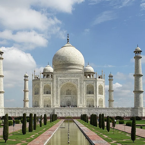
Şah Cihan'ın eşi Mümtaz Mahal için Agra'da Yamuna Nehri kıyısında inşa ettirdiği beyaz mermer türbe — Babür mi
Italy
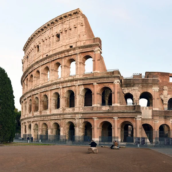
Colosseum
Kolezyum, Roma'nın ikonik Flavian Amfitiyatrosu, gladyatör dövüşlerine ve halka açık gösterilere ev sahipliği
Jordan
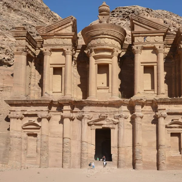
Petra
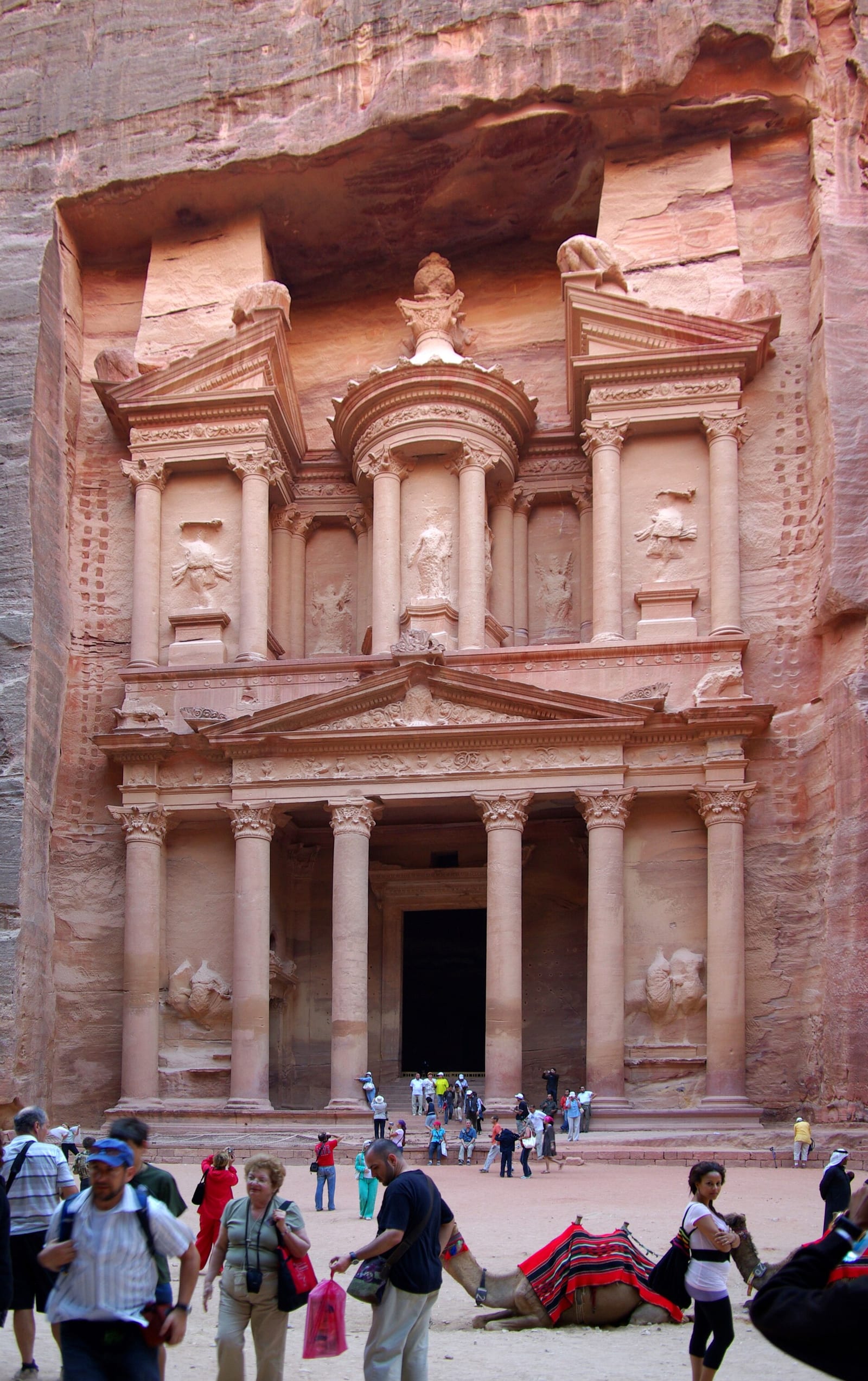
Petra, MÖ ~300'den MS 700'e kadar Nebati krallığının başkenti, kayaya oyulmuş mezarları ve sofistike su sistem
Peru
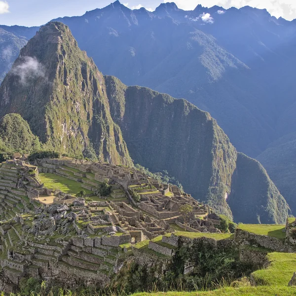
Machu Picchu
MS 1450 civarında inşa edilmiş bir İnka kalesi olan Machu Picchu, Peru'da bir dağ sırtının tepesinde yer alır.
Egypt
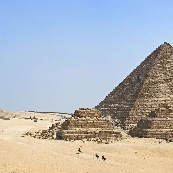
Pyramids of Giza
Giza Piramitleri, Eski Krallık firavunları Khufu, Khafre ve Menkaure'nin anıtsal mezarları olup, antik Mısır m

Cambodia
Angkor Wat
Dünyanın en büyük dini anıtı olan Angkor Wat, Khmer kralı Suryavarman II tarafından Vishnu'ya adanmış bir Hind
Giriş
Etkileşimli atlasın amacı ve kapsamı
Alanlar, bölgesel tarihleri ve kültürler arası bağlantıları aydınlatmak için kıtalara göre düzenlenmiştir. Her bölüm, yerleşim, ticaret ve kültürel alışveriş örüntülerini ortaya çıkarmak için ikonik simge yapıların yanı sıra daha az bilinen yerleri de öne çıkarır.
Temel özellikler: harita tabanlı keşif, çok dilli içerik, akademik bağlam
- Harita tabanlı keşif: Alanları küresel bir tuval üzerinde gezinmek için coğrafi referanslı haritalar, etkileşimli katmanlar ve mekânsal sorgular.
- Erişilebilirliği genişletmek ve farklı okuyucuları desteklemek için çok dilli içerik.
- Her alanı tarihsel çerçevesine yerleştiren üst veriler, zaman çizelgeleri ve çapraz referanslar aracılığıyla akademik bağlam.
Yalnızca doğal nitelikteki alanları hariç tutarak arkeolojik ve kültürel dünya mirası varlıklarına vurgu yapıyoruz. Sonuç, ilgi çekici hikâye anlatımını titiz bağlamla birleştiren, odaklanmış ve kanıta dayalı bir rehberdir.
Dünya mirası, izole anıtların bir listesi değildir — insan toplumlarının kıtalar boyunca nasıl inşa ettiğini, ticaret yaptığını, ibadet ettiğini ve yönettiğini gösteren bir haritadır. Bir arkeolojik atlas bu bağlantıları görünür kılar.
1. Afrika: Antik Uygarlıklar ve Arkeolojik Öne Çıkanlar
Bölgelere göre başlıca sit kümeleri
Afrika'nın arkeolojik peyzajı nehir vadileri, kıyı şeritleri ve çöl ticaret koridorları etrafında şekillenir. Nil koridoru, Giza Piramitleri'nden Abu Simbel'e kadar dini yaşamı ve yönetimi aydınlatan anıtsal mezarlar, tapınaklar ve kentsel yerleşim düzenleriyle Kuzeydoğu Afrika'yı sabitler. Doğu Afrika, yayla yerleşimlerini kervan yolları boyunca vahalarla bağlayan iç ağları gösterir. Sahel ve Sahra, uzun vadeli kültürel direnci ortaya koyan çöle uyum sağlamış yerleşimleri ve kaya sanatını korur. Batı Afrika, Sahra ötesi alışverişlere bağlı kentsel merkezleri ve ticaret merkezlerini barındırır. Güney Afrika, yerel ekolojilerle şekillenmiş kaya sanatı geleneklerini ve erken kentsel biçimleri korur.
Egypt
Pyramids of Giza
Giza Piramitleri, Eski Krallık firavunları Khufu, Khafre ve Menkaure'nin anıtsal mezarları olup, antik Mısır m
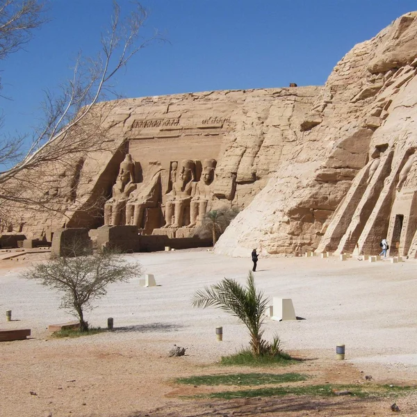
Egypt
Abu Simbel
Abu Simbel'in ikiz kaya tapınakları, Nubia'da Ramesses II tarafından (MÖ yaklaşık 1264–1244) oyulmuş olup deva
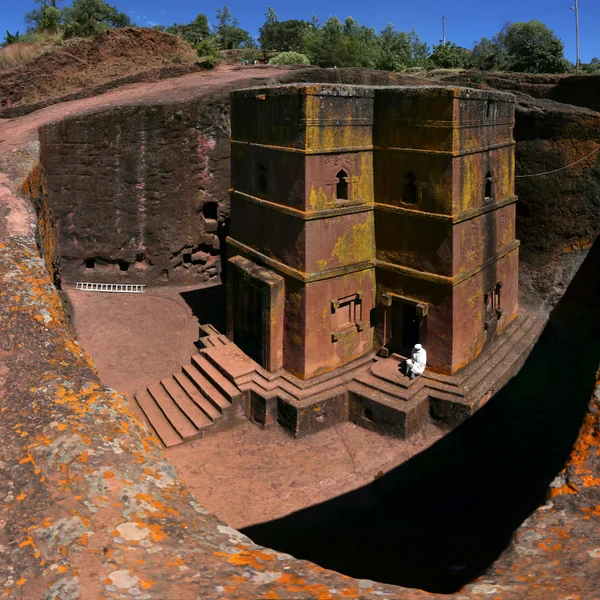
Ethiopia
Lalibela
12.–13. yüzyıllarda oyulmuş 11 monolitik kaya kilisesinden oluşan bir kompleks, Etiyopya ortaçağ mimarisinin v
Temsil edilen önemli dönemler ve uygarlıklar
Önemli dönemler arasında Nil ve Nil Deltası boyunca krallıklar, batı ve kuzeydoğu Afrika'da anıtsal mimarinin ortaya çıkışı ve iç bölgelerde sofistike kentsel planlama yer alır. Kayıt, yerleşim stratejilerinin sürekliliğini, gelişen ticaret ağlarını ve gelişen yönetimi yansıtır. Bu seçimler, petrogliflerden anıtsal topluluklara kadar topluluk yaşamını ve ritüel pratiğini aydınlatan uzun süreli kültürel gelişimi vurgular.
Afrika için etkileşimli harita ipuçları
- Kültürel sitleri karma veya belirsiz tanımlamalardan ayırmak için kıta geneli filtreleri kullanın.
- Erken anıtsal faaliyetten sonraki kentleşmeye geçişleri karşılaştırmak için dönem katmanlarını açıp kapatın.
- Meta verileri, tarihleme aralıklarını ve bölgesel bağlantıları görüntülemek için işaretçilerin üzerine gelin.
- Uygarlıklar arasındaki bağlantıları izlemek için kümeleri bilgi grafiği ile yan yana karşılaştırın.
2. Amerika: Kolomb Öncesi ve Erken Tarihi Sitler
Kıtalar boyunca kültürel peyzajlar ve kentsel merkezler
Amerika kıtası; törensel alanları, tahkim edilmiş yerleşimleri ve tören meydanlarını gündelik mahallelerle harmanlayan yoğun kültürel peyzajlar sunar. Mezoamerikan ve And kentlerinin — Machu Picchu, Chichén Itzá, Teotihuacán — kentsel çekirdeklerinden geniş tören düzlüklerine uzanan bu sit alanları; toplumsal örgütlenmeyi, ritüel yaşamı ve mimari yeniliği gözler önüne serer. Kıyı ticaret ağları ve iç bölgelerdeki art alanlar, toplulukların uçsuz bucaksız mesafeler boyunca nasıl bağlantı kurduğunu gösterir.
Peru
Machu Picchu
MS 1450 civarında inşa edilmiş bir İnka kalesi olan Machu Picchu, Peru'da bir dağ sırtının tepesinde yer alır.
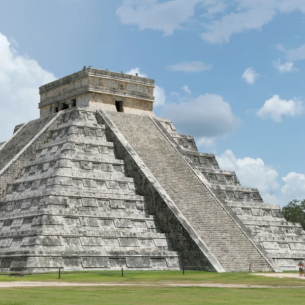
Mexico
Chichén Itzá
MS 600–1200 yılları arasında önemli bir Maya-Toltek tören merkezi; ikonik Kukulcán basamaklı piramidi ve Mezoa
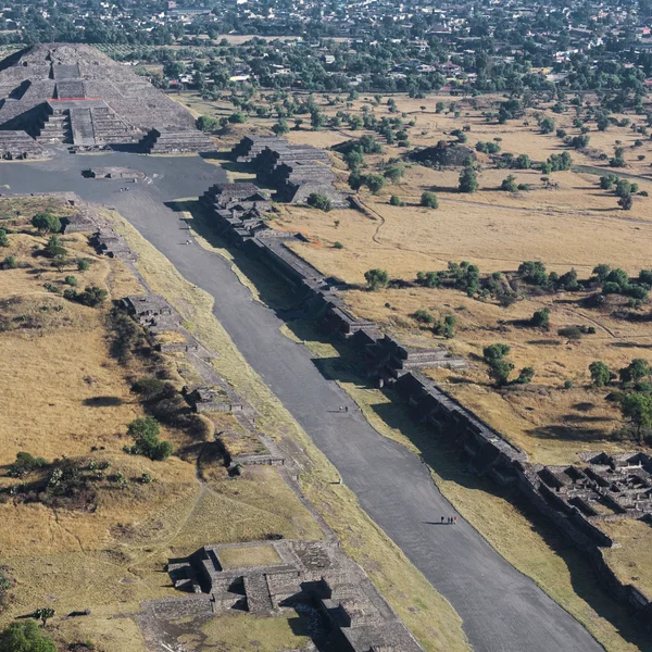
Mexico
Teotihuacan
Teotihuacan, 'Tanrıların Şehri', orta Meksika'da geniş bir metropol ve törensel merkezdi, MÖ 100'den MS 650'ye
!And bulut ormanındaki Machu Picchu
- Kentsel ayak izleri; ızgara planlarını, yükseltilmiş su rezervuarlarını ve gündelik yaşamı yönlendiren tören merkezlerini içerir.
- Kültürel peyzajlar çoğu zaman limanları, teraslanmış tarlaları ve çevre araziyle bütünleşmiş kutsal bölgeleri kapsar.
- Mimari çeşitlilik; anıtsal piramitlerden kerpiç platformlara ve taş komplekslere kadar uzanır.
Sergilenen kronolojiler ve dönemler
Dizilim; erken tarım topluluklarını, kentleşmenin zirve dönemini ve temas ile değişim ağlarına bağlı geçiş süreçlerini kapsar. Kronolojiler; çevresel baskılar, sosyopolitik dinamikler ve kültürlerarası etkileşimlerle biçimlenen yükseliş ve çöküş evrelerini öne çıkarır. Arşiv; yönetim ve kaynak yönetimindeki değişimlerin yanı sıra ritüel pratikteki sürekliliği vurgular.
- Mezoamerika'daki Klasik Öncesi'nden Klasik'e geçişler, gelişen siyasi ve törensel mimarileri örnekler.
- And uygarlıkları; tarım teraslarından merkezi yönetim merkezlerine doğru bir ilerleme gösterir.
- Temas sonrası katmanlar; sömürge dönemi ortamlarındaki senkretik pratikleri ve uyarlanmayı açığa çıkarır.
Yeni Dünya sit alanlarını ortak bir zamansal eksende hizalamak için döneme göre filtreleyin — böylece tek bir sit rehberinin gösteremeyeceği eşzamanlı gelişmeleri görmeye başlarsınız.
Yeni Dünya sit alanlarını karşılaştırmak için zaman çizelgesini kullanma
- Sit alanlarını ortak bir zamansal eksende hizalamak ve eşzamanlı gelişmeleri gözlemlemek için döneme göre filtreleyin.
- Bölgeler arasında korunma düzeyi veya araştırma yoğunluğu gibi sit durumlarını karşılaştırın.
- Toplulukları birbirine bağlayan ticaret yollarını, dini ağları ve idari hiyerarşileri izlemek için bilgi grafiğinden yararlanın.
3. Asya: Antik İmparatorluklar ve Kıtalararası Değişim
Başlıca uygarlıklar ve arkeolojik ayak izleri
Asya, arkeolojisi anıtsal mimariyi, şehir planlamacılığını ve kutsal peyzajları kapsayan uzun ömürlü medeniyetlerin bir dokusuna ev sahipliği yapar. Ganj ve Yangtze havzalarının nehir medeniyetlerinden Avrasya'nın kalbindeki imparatorluk başkentlerine ve tören merkezlerine — Tac Mahal, Angkor Wat, Yasak Şehir, Varanasi, Bodh Gaya, Topkapı Sarayı — maddi izler, bin yıllar boyunca yönetimi, dini ve günlük yaşamı ortaya koyar.
India
Taj Mahal
Şah Cihan'ın eşi Mümtaz Mahal için Agra'da Yamuna Nehri kıyısında inşa ettirdiği beyaz mermer türbe — Babür mi
Cambodia
Angkor Wat
Dünyanın en büyük dini anıtı olan Angkor Wat, Khmer kralı Suryavarman II tarafından Vishnu'ya adanmış bir Hind

China
Forbidden City
Pekin'in kalbindeki geniş Ming–Qing imparatorluk sarayı — kırmızı duvarlar içinde yaklaşık bin bina — avluları
India
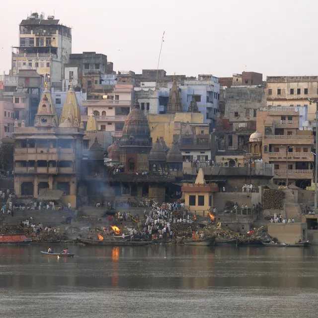
Varanasi
Dünyanın en eski sürekli yerleşim gören şehirlerinden biri — Uttar Pradesh'te Ganj Nehri kıyısında — ghatları,
India
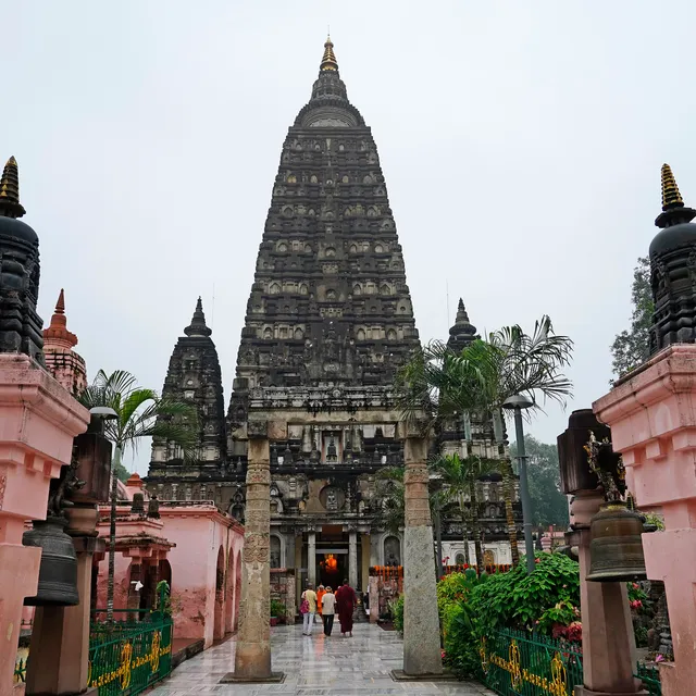
Bodh Gaya
Siddhartha Gautama'nın Bodhi ağacı altında aydınlanmaya ulaştığı yer — Hindistan'ın Bihar eyaletindeki yüksele
- Orta Asya çekirdekleri, kıtalararası alışverişin ayrılmaz bir parçası olan kervan şehri yerleşimlerini ve kale komplekslerini gösterir.
- Güney Asya kentsel kutsal alanları, kraliyet sarayları ve tapınak bölgeleri ritüel ve devlet yönetimini aydınlatır.
- Doğu Asya imparatorluk alanları, hanedan değişimleri boyunca ızgara planlarını, savunma yapılarını ve dini senkretizmi korur.
Temsil edilen etkileşim ağları ve ticaret yolları
Arkeolojik ayak izleri, malların, insanların ve fikirlerin uzun mesafeli ağlar boyunca hareketini haritalandırır. Yol istasyonları, liman tesisleri ve pişmiş toprak semboller, çöller, bozkırlar ve kıyı şeritleri boyunca alışverişin ölçeğini gösterir. Kültürel etkilerin etkileşimi, melez mimari formlarda ve kutsal alanları birbirine bağlayan hac koridorlarında belirgindir.
- Ticaret koridorları, kaynak açısından zengin iç bölgeleri kentsel merkezler ve limanlarla birbirine bağlar.
- Dini ve bilimsel merkezler, daha geniş alışveriş ağları içinde düğüm noktaları olarak işlev görür.
- Maddi kültür, bölgeler arasında aktarılan metalurji ve taş işçiliği teknikleri gibi paylaşılan teknolojileri gösterir.
Asya'daki alanlarda filtreler ve katmanlarla gezinme
- Erken kentleşmeden imparatorluk yeniden yapılanmasına kadar alanları hizalamak için dönem filtrelerini kullanın.
- İdari başkentleri dini komplekslerle karşılaştırmak için medeniyet etiketlerini uygulayın.
- Bölgesel desenleri ortaya çıkarmak için mimari stiller, savunma yapıları veya tören peyzajları için katmanları değiştirin.
Not: Atlas, karşılaştırmalı çalışmayı desteklemek için jeopolitik ve bilimsel bağlamla birlikte 319 yayınlanmış arkeolojik ayak izini haritalandırır. Daha geniş ilişkiler için, Asya alanlarını kıtasal anlatılar içine yerleştirmek üzere Bilgi grafiğini ve Etkileşimli zaman çizelgesini keşfedin.
4. Avrupa: Kıta Ölçeğinde Klasikten Orta Çağ Arkeolojisine
Dönemlere ve kültürlere göre sit alanlarının yoğunluğu
Avrupa'nın arkeolojik kayıtları klasik, ortaçağ ve post-klasik dönemleri kapsar; kentsel çekirdekler, dini merkezler ve imparatorluk sınırları çevresinde yoğun kümelenmeler görülür. Harita, antik Yunan ve Roma'dan — Kolezyum, Atina Akropolisi, Pompeii — sonraki yüzyılların manastır ve tahkimatlarına, Mont-Saint-Michel, Chartres Katedrali ve Meteora dahil olmak üzere uzanan koridorları izler.
Italy
Colosseum
Kolezyum, Roma'nın ikonik Flavian Amfitiyatrosu, gladyatör dövüşlerine ve halka açık gösterilere ev sahipliği
Greece
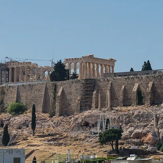
Acropolis of Athens
Atina'nın üzerinde yükselen, Parthenon, Erechtheion ve Propylaea ile taçlandırılmış, surla çevrili kireçtaşı k
Italy
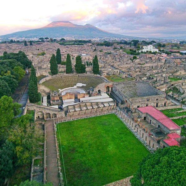
Pompeii
Roma şehri Pompeii, MS 79'da Vezüv Yanardağı'nın felaketle sonuçlanan patlamasında gömülmüş, olağanüstü korunm
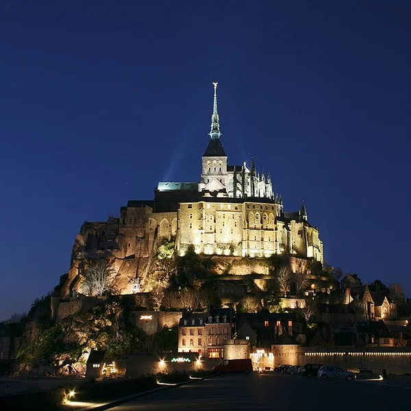
France
Mont-Saint-Michel
Normandiya kıyılarında granit bir gelgit adası üzerinde tahkim edilmiş manastır — sivri uçlu silueti kumluk dü

France
Chartres Cathedral
Paris'in güneybatısındaki Yüksek Gotik katedral — 1194'ten sonra büyük ölçüde yeniden inşa edilmiş, çift kulel

Greece
Meteora
Yunanistan'ın Teselya bölgesinde bir kumtaşı zirveler ormanı — Bizans ve Bizans sonrası manastırlarla taçlandı
- Klasik çekirdekler; sivil kompleksleri, tiyatroları ve forum düzenlerini içerir.
- Ortaçağ yapı toplulukları; kaleleri, katedralleri ve surlarla çevrili kasabaları öne çıkarır.
- Kırsal ve törensel peyzajlar, tarımsal yerleşimlerden hac yollarına geçişi gösterir.
Avrupa'da kültürel ve doğal mirasın bütünleşmesi
Sit alanları genellikle inşa edilmiş mirası, günlük yaşamı biçimlendiren çevre peyzajlarıyla harmanlar. Atlas, mimari anlatıları arazi, su yolları ve savunma hatlarıyla ilişkilendirerek okuyucuların coğrafyanın yerleşim ve koruma üzerindeki etkisini kavramasına yardımcı olur.
- Tahkim edilmiş peyzajlar, nehir vadileri ve savunma çevreleriyle hizalanır.
- Kutsal alanlar, erişimi ve ritüel pratiğini yönlendiren tepe üstü ve kıyı ekolojileri içinde yer alır.
- Kentsel ızgaralar, yerel topografyaya ve malzemelere uyarlanmış planlama ilkelerini yansıtır.
Zaman çizelgeleri aracılığıyla Avrupa sit alanı hikâye anlatımı
Zaman çizelgesi katmanları, antik çağdan ortaçağ dönemine uzanan evrimi gösterir. Bölgeler arasında yönetim biçimini, dini etkiyi ve kentsel formu karşılaştırabilirsiniz. Bilgi grafiği, Avrupa sit alanlarını kıtasal bir değiş tokuş, çatışma ve kültürel canlanma kronolojisi içine yerleştirir.
Bölgeler arasında kentleşme atılımları ve kale genişlemeleri gibi dönüm noktalarını karşılaştırın — böylece Avrupa, ünlü harabeler listesi gibi görünmekten çıkıp tek bir bağlantılı hikâye olarak okunmaya başlar.
- Bölgeler arasında kentleşme atılımları ve kale genişlemeleri gibi dönüm noktalarını karşılaştırın.
- Hamilik ağlarını mimari dönüşümler ve üslup değişimleriyle ilişkilendirin.
- Avrupa yayı boyunca sit alanı statülerini, araştırma yoğunluğunu ve koruma geçmişlerini çapraz referanslayın.
Not: Atlas, 319 yayımlanmış arkeolojik sit alanını haritalandırır; Avrupa, kıtasal anlatıda merkezi bir süreklilik oluşturur. Avrupa arkeolojisini daha geniş örüntüler içinde konumlandırmak için Bilgi grafiği ve Etkileşimli zaman çizelgesi aracılığıyla ilgili kaynakları keşfedin.
!Mont-Saint-Michel yüksek gelgitte
5. Okyanusya ve Avustralya: Yerli Mirası ve Kıyı Uygarlıkları
Bölgelere göre ayırt edici arkeolojik temalar
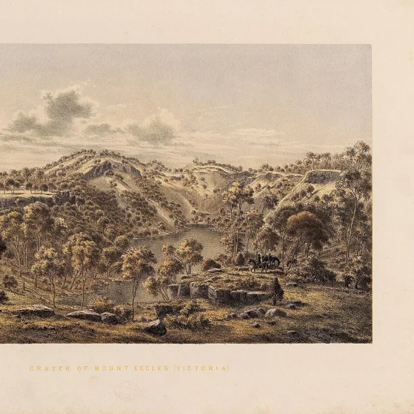
Okyanusya; denizle bağlantılı toplumlar, iç bölge gelenekleri ve adalara özgü uyarlamalardan oluşan bir mozaik sunar. Atlas; Budj Bim ve Uluru dahil olmak üzere, insanlarla okyanus ortamları arasındaki uzun süreli bağlantıları yansıtan yerleşim örüntülerini, denizcilik teknolojilerini ve ritüel peyzajlarını öne çıkarır.

- Deniz yolculuğu ve seyir gelenekleri, kıyı şeritleri ve takımadalar boyunca sit alanı dağılımını şekillendirir.
- Kaya sanatı, kabuk yığınları ve tören platformları; ritüel uygulamaları ve toplumsal örgütlenmeyi aydınlatır.
- Uyarlanabilir mimari biçimler; iklime uyarlanmış konutlar ve ortak kullanım alanları dahil olmak üzere tropikal ve subtropikal iklimlere yanıt verir.
Kıyı ve ada sit alanı örüntüleri
Kıyı şeritleri; yoğun yerleşim, ritüel kompleksleri ve ticaret merkezleri barındırır. Ada coğrafyaları; boğazlar ve lagünler boyunca keşif, kaynak yönetimi ve kültürel alışverişin katmanlı evrelerini ortaya koyar.
- Liman odaklı kompleksler, ada grupları ile anakara kaynakları arasındaki bağlantıları işaret eder.
- Lagün ve resif sit alanları, deniz biyoçeşitliliğine bağlı geçim stratejilerini korur.
- Savunma ve tören yapıları, erişim kontrolünün stratejik olduğu kıyı şeritlerinin yakınında kümelenir.
Okyanusya için çok dilli açıklamalar ve bilimsel bağlam
Atlas; farklı bilgi geleneklerini yansıtmak amacıyla çok dilli sözlükler ve bölgeye özgü açıklamalar sağlar. Bilimsel notlar; tarihleme tartışmalarını, maddi kültür analizlerini ve sözlü tarihlerin yorumlamadaki rolünü vurgular.
Not: Atlas, 319 yayımlanmış arkeolojik sit alanını haritalandırır; Okyanusya, deniz öncelikli yaşam biçimlerini vurgulayan kıyı ve ada gelenekleriyle temsil edilir. Bölgeler arası bakış açıları için atlas içinde bulunan Bilgi grafiği ve Etkileşimli zaman çizelgesi bağlantılarını keşfedin.
6. Nasıl Keşfedilir: Etkileşimli Teknikler ve Araçlar
Harita etkileşimleri: yakınlaştırma, kaydırma ve katman anahtarları
Dünya Mirası İnteraktif Haritası’nda sezgisel yakınlaştırma ve kaydırma kontrolleriyle gezinin. Her eylem, coğrafi referanslı alanlar için daha zengin bağlam ortaya çıkarır. Katman anahtarları, kültürel, doğal ve karma atamalar arasında geçiş yaparak arkeolojik ve kültürel mirasa odaklanmanızı sağlar.
Kıta veya çağ filtrelerini kullanarak kümeleri öne çıkarın, ardından bölgeler arasındaki yoğunluk örüntülerini karşılaştırın. Izgara yakalama, yoğun kentsel bağlamlarda hassas alan konumlandırmayı destekler. Mekânsal sorgular, yerleşim ve değişim ağlarını göstermek için bitişik alanları ortaya çıkarır.
Jordan
Petra
Petra, MÖ ~300'den MS 700'e kadar Nebati krallığının başkenti, kayaya oyulmuş mezarları ve sofistike su sistem
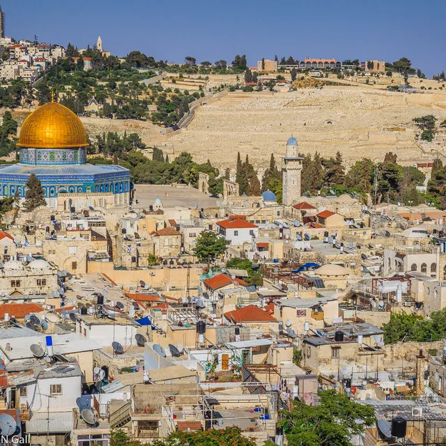
Israel
Old City of Jerusalem
Kudüs'ün surlarla çevrili kalbi — Yahudilik, Hıristiyanlık ve İslam için kutsal sayılan yaklaşık bir kilometre
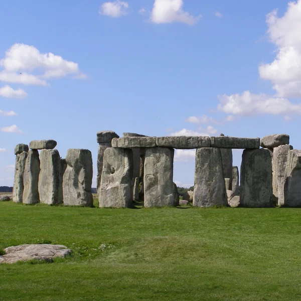
United Kingdom
Stonehenge
Stonehenge, İngiltere'nin Wiltshire kentinde, MÖ 3100 ile 1600 yılları arasında evreler halinde inşa edilmiş t
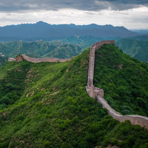
China
Great Wall of China
Kuzey Çin'in geniş sınır tahkimat sistemi — sıkıştırılmış toprak Qin duvarları ve ikonik taş Ming siperleri —
Zaman çizelgesi keşfi: çağlar, uygarlıklar ve alan durumu
Entegre zaman çizelgesi, sonuçları klasik, ortaçağ veya modern öncesi gibi çağlara göre filtreler. Bölgeler arası karşılaştırmalar için alanları uygarlık veya kültürel geleneğe göre hizalayabilirsiniz. Alan durumu göstergeleri, mevcut olduğunda koruma çabalarını, erişim düzeylerini ve araştırma faaliyetlerini gösterir.
Zaman çizelgesi katmanları, kentsel merkezler ile ritüel peyzajları arasındaki zamansal örtüşmeleri görselleştirir. Bir yan panel, yönetim değişimlerini ve mimari yenilikleri vurgulayarak okuyucuların harita görünümünden ayrılmadan kıtasal anlatıları izlemesine yardımcı olur.
Alan sayfaları: üst veri, bilimsel bağlam ve çapraz referanslar
Her alan sayfası, üst verileri, coğrafi koordinatları, tarihlendirmeyi ve birincil kaynakları bir araya getirir. Bilimsel notlar, arkeoloji ve kültürel mirasla ilgili özlü bağlam, tarihlendirme tartışmaları ve maddi kültür öne çıkanlarını sunar. Çapraz referanslar, ilgili alanlara ve bölgesel makalelere bağlantı verir.
Çapraz referanslar, ticaret ağları veya dini kompleksler gibi bağlantılı bağlamların hızlı keşfini sağlar. Bilgi grafiğine verilen iç bağlantılar, alanlar, çağlar ve bölgeler arasındaki ilişkilere yönelik daha derin araştırmaları destekler.
Haritayla başlayın, çağa göre daraltın, Karşılaştır bölümünde üç alan sayfasını yan yana açın — bir atlas, statik bir UNESCO listesini böyle geride bırakır.
7. Çok Dilli ve Bilimsel Bağlam: Anlayışı Geliştirmek
Dil seçenekleri ve çeviri hususları
Dünya Mirası İnteraktif Haritası, bölgeler arası araştırmacılara ve öğrencilere yardımcı olmak için çok dilli içeriği destekler. Özgün alan anlatıları, arkeolojik ve kültürel bağlamlara erişimi genişletmek için çevirilerle eşleştirilir. Çeviri notları, bilimsel inceliği korumak için tarihlendirme tartışmalarını ve terminoloji farklılıklarını aydınlatır.
Bilimsel açıklamalar alan anlatılarını nasıl zenginleştirir
Ek açıklamalar, özlü tarihleme perspektifleri, maddi kültür öne çıkanları ve arkeolojik olarak bilgilendirilmiş yorumlar sunar. Bireysel siteleri daha geniş bölgesel kronolojilere ve değişim ağlarına bağlayarak, yüzey özelliklerinin ötesindeki bağlamı kavramanıza yardımcı olurlar.
Bağlamsal denemeler aracılığıyla kıtalar arası karşılaştırmalar
Bağlamsal denemeler, kıtalar arasındaki arkeolojik gidişatlardaki benzerlikleri ve farklılıkları çerçeveler. Ticaret yollarının, kentsel planlamanın ve ritüel uygulamaların bölgesel gelişimi nasıl şekillendirdiğini aydınlatırken benzersiz yerel tarihleri onurlandırırlar. Ayrıca, herhangi bir tek anlatıyı öncelemeden karşılaştırmalı içgörüler sağlarlar.
- Dil seçenekleri — Özgün anlatılar artı çeviriler ve sözlük terimleri. Neden önemli: kültürler arası daha geniş erişilebilirlik ve kesin terminoloji.
- Akademik ek açıklamalar — Tarihleme tartışmaları, maddi kültür notları, bölgesel bağlam. Neden önemli: araştırmacılar için daha derin anlayış ve güvenilir yorum.
- Bağlamsal denemeler — Kıtalar arası karşılaştırmalar ve anlatı yolları. Neden önemli: okuyucuların siteye özgü ayrıntıyı kaybetmeden daha büyük örüntüleri görmesine yardımcı olur.
Atlas, Bilgi grafiği ve ilgili araçlar aracılığıyla çapraz referanslı bağlantılarla bilgiyi sabitler; kullanıcıların siteler, çağlar ve bölgeler arasındaki ilişkileri keşfetmesini sağlar.
!Salisbury Ovası'ndaki Stonehenge
SSS
Atlas içinde siteler nasıl coğrafi olarak referanslanır?
Her arkeolojik site, etkileşimli haritada doğru yerleştirmeyi sağlamak için hassas koordinatlarla atanır. Coğrafi referanslama, belgelenmiş belirsizliğin geçerli olduğu yerlerde konumu belirlemek için tarihsel kayıtları, kazı raporlarını ve arşiv kaynaklarını birleştirir.
Sistem birden çok koordinat biçimini destekler ve yerleştirmenin kaynağına ilişkin üst verileri içerir. Bu yaklaşım, kıtalar ve çağlar boyunca tutarlı, gezinilebilir bir temsiliyet sağlar.
Site dahil etme ve kategorizasyonu hangi ölçütler belirler?
Dahil etme, geçmiş insan etkinliğine ilişkin anlayışımıza katkıda bulunan, açık arkeolojik veya kültürel öneme sahip sitelere odaklanır. Her girdi, arkeolojik anlatı içindeki plan, anıtsallık ve tarihsel değer açısından değerlendirilir.
Siteler, yerleşik UNESCO ölçütleri doğrultusunda kültürel, doğal veya karma olarak kategorize edilir; ancak bu atlas arkeolojik ve kültürel yönleri vurgular. Sınıflandırma, çağ, uygarlık ve bölgeye göre hedefli filtrelemeyi destekler.
Kullanıcılar veri veya ek açıklama katkısında bulunabilir mi?
Kullanıcılar, atlas ile site sayfalarını inceleyerek, akademik notlar ekleyerek ve bilgi grafiği aracılığıyla bağlamsal bağlantılar önererek etkileşim kurabilirler. Ek açıklamalar, akademik bütünlüğü ve bağlantı doğruluğunu korumak için tasarlanmıştır.
Katkılar, güvenilirliği ve yayımlanmış kaynaklarla uyumu sürdürmek için bir doğrulama sürecinden geçer. Geri bildirim, temel jeo-uzamsal verileri değiştirmeden üst verilerin, çapraz referansların ve bağlamsal makalelerin iyileştirilmesine yardımcı olur.
SSS kaynakları için yaygın kullanım örnekleri nelerdir?
- Araştırma planlaması için coğrafi konumu yayımlanmış haritalarla çapraz kontrol etme
- Örtüşen kültürel geleneklere veya ticaret ağlarına sahip siteleri belirleme
- Ek açıklamalı notlar aracılığıyla köken ve tarihlendirme tartışmalarını keşfetme
Atlas, site verilerine yapılan güncellemeleri nasıl ele alır?
Güncellemeler, yeni bilimsel çalışmaları, revize edilmiş tarihlendirmeleri ve genişletilmiş site açıklamalarını içeren yapılandırılmış bir iş akışını izler. Değişiklikler, bilgi tabanında şeffaflığı ve izlenebilirliği korumak için günlüğe kaydedilir.
Sonuç
Kıta ölçeğinde bir arkeolojik atlasın değeri üzerine düşünceler
Kıtalar arası siteleri birbirine bağlayarak, çeşitli anlatılar için tutarlı bir çerçeve elde edersiniz. Atlas, antik dünyalara dair anlayışımızı zenginleştiren değişim, kentsel gelişim ve kültürel süreklilik örüntülerini vurgular. İzole listeler değil, net bağlamla arkeolojik ve kültürel mirasa öncelik verir.
Haritalanmış 319 yayımlanmış arkeolojik site ile atlas, karşılaştırmalı çalışma için coğrafi referanslı bir temel sağlar. Çok dilli içerik ve akademik ek açıklamalar, karmaşık yorumların erişilebilir ve güvenilir kalmasına yardımcı olur.
Harita tabanlı miras keşfi için gelecek yönelimleri
Yeni keşifleri ve devam eden kazıları yansıtan genişletilmiş tematik katmanların yanı sıra bilgi grafiğinde daha keskin tarihlendirme tartışmaları bekleyin. Dönem, medeniyet ve maddi kültüre göre daha hassas filtreleme, hem araştırmacılar hem de eğitimciler için daha derin analitik çalışmaları destekleyecektir.
Planlanan iyileştirmeler arasında, siteleri daha geniş değişim ağları içinde konumlandıran daha zengin kıtalar arası anlatılar yer almaktadır. Site hikâye anlatımını güçlendirmek için ayrıntılı üst veriler, geliştirilmiş kaynak şeffaflığı ve disiplinler arası bakış açıları izlenecektir.
- Küresel örüntüler içindeki yerel bağlamları aydınlatmak için bölgesel vaka çalışmalarını genişletmek
- Kolaylaştırılmış dil seçenekleri ve sözlük terimleri aracılığıyla erişilebilirliği artırmak
- Harici miras veritabanları ve kamu kataloglarıyla birlikte çalışabilirliği artırmak
India
Taj Mahal
Şah Cihan'ın eşi Mümtaz Mahal için Agra'da Yamuna Nehri kıyısında inşa ettirdiği beyaz mermer türbe — Babür mi
Italy
Colosseum
Kolezyum, Roma'nın ikonik Flavian Amfitiyatrosu, gladyatör dövüşlerine ve halka açık gösterilere ev sahipliği
Jordan
Petra
Petra, MÖ ~300'den MS 700'e kadar Nebati krallığının başkenti, kayaya oyulmuş mezarları ve sofistike su sistem
Cambodia
Angkor Wat
Dünyanın en büyük dini anıtı olan Angkor Wat, Khmer kralı Suryavarman II tarafından Vishnu'ya adanmış bir Hind
Peru
Machu Picchu
MS 1450 civarında inşa edilmiş bir İnka kalesi olan Machu Picchu, Peru'da bir dağ sırtının tepesinde yer alır.
Egypt
Pyramids of Giza
Giza Piramitleri, Eski Krallık firavunları Khufu, Khafre ve Menkaure'nin anıtsal mezarları olup, antik Mısır m
Buradan Sonra Nereye Gidilmeli
319 sitenin tamamını interaktif haritada keşfedin, bilgi grafiğinde bağlantıları izleyin veya iki siteyi yan yana karşılaştırın. Resmî UNESCO belgeleri için UNESCO Dünya Mirası Listesi ve UNESCO interaktif haritasına bakın.