跳到正文
Atlas Anatolia
新闻Tiny Paleolithic bird carvings unearthed in GermanyLatin graffiti recorded in Spain’s Cova Dones cave sanctuary
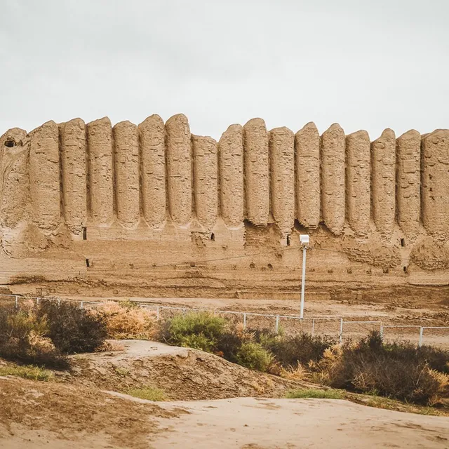
Earthen ruins of Ancient Merv on the Central Asian Silk Road

Jialiang Gao www.peace-on-earth.org dead link (CC BY-SA 3.0)

指南14 分钟阅读

故事

香料与丝绸:改变古代世界的十座沙漠城市

从马里卜大坝和希巴姆的高塔,到交河悬崖城堡和梅尔夫的土筑巨城——两大干旱贸易弧线如何在远离埃及、美索不达米亚和中国湿润农业核心区的地方构建起城市生活。

Atlas Anatolia

本文涉及的遗址

在地图上查看
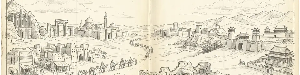
Graphite pencil sketch banner for “Incense and Silk: Ten Desert Cities That Moved the Ancient World”

Ancient wealth was not only grown beside the Nile or the Yellow River. Across the world’s great deserts, merchants and kings built oasis cities that stored water, taxed caravans, and broadcast religion along corridors later nicknamed the Incense Road and the Silk Road.

This guide links ten Atlas Anatolia sites in two complementary batches. Use the Arabia compare set beside the Silk Road oasis set — then open the full ten-site compare for classroom assignments.

"Frankincense and silk bound deserts into corridors — caravans wrote cities into sand, and sand still writes their ruins."

— Editorial synthesis of Incense Road and Silk Road oasis archaeology

Southern Arabia: water, gods, and incense

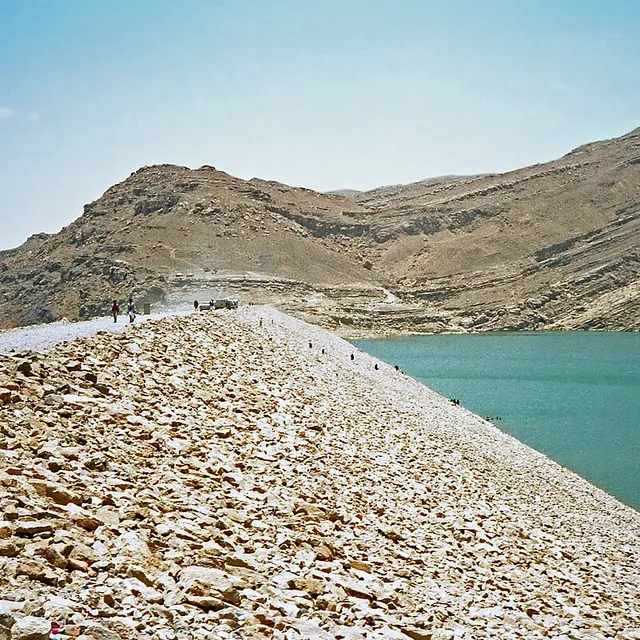
South Arabia’s prosperity rested on irrigated oases and the aromatics of frankincense and myrrh. At Marib Dam, Sabaean engineers diverted monsoon floods into canal networks that kept an oasis green for more than a thousand years. The dam’s later collapse entered Arabian historical memory as a civilisational turning point.

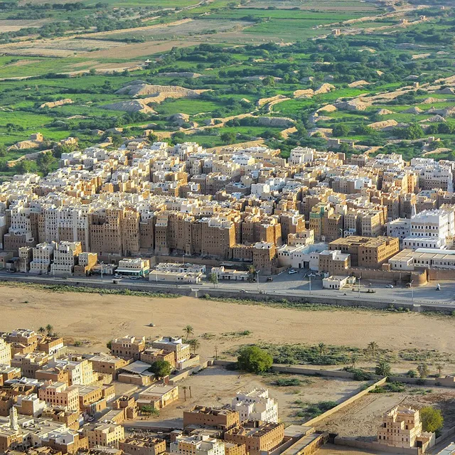
Shibam Wadi Hadhramaut Yemen
Shibam Wadi Hadhramaut Yemen | Jialiang Gao www.peace-on-earth.org dead link (CC BY-SA 3.0)

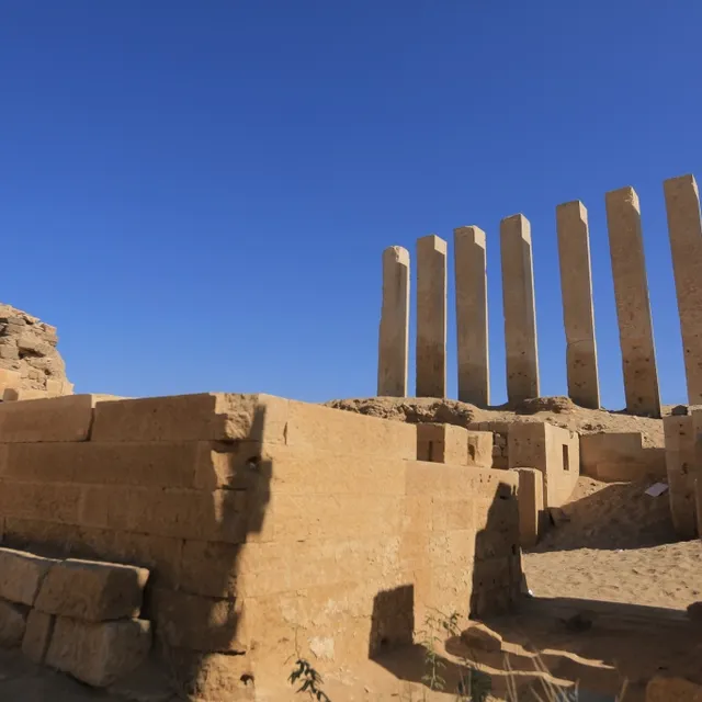
Near Marib, the Temple of Awwam (Mahram Bilqis) housed the cult of Almaqah — a pilgrimage and inscription archive for royal piety. Inland at Sirwah, fortifications and the inscription of Karibʾil Watar narrate early Sabaean expansion when highland seats still rivalled oasis capitals.

Marib dam
Marib dam | Bernard Gagnon (CC BY-SA 3.0)

Further north, Qaryat al-Faw on the Empty Quarter’s edge shows what a desert caravan capital looked like under Kinda: frescoed houses, temples of Kahl, and Roman imports deep in Arabia. Later still, Shibam in Wadi Hadramawt perfected vertical mud-brick urbanism — the so-called “Manhattan of the Desert” — tying the Hadramawt to Indian Ocean diasporas.

Shibam Hadhramaut, Yemen banner
Shibam Hadhramaut, Yemen banner | Shibam_Wadi_Hadhramaut_Yemen.jpg: Jialiang Gao www.peace-on-earth.org derivative work: JamesA (CC BY-SA 3.0)

The Silk Road’s desert cities

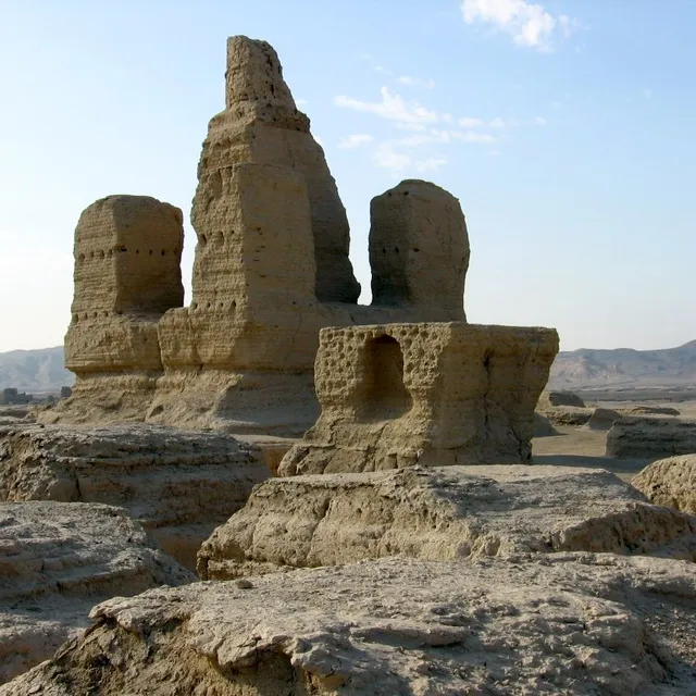
On the northern and southern skirts of the Taklamakan, and on the Murghab delta beyond, cities answered a related problem: how to sustain urban density where rainfall fails. Jiaohe carved a capital into a loess mesa west of Turpan; sprawling Gaochang later rose as Qocho, a Uyghur Buddhist (and Manichaean) metropolis with mud-brick walls still scanning the plain.

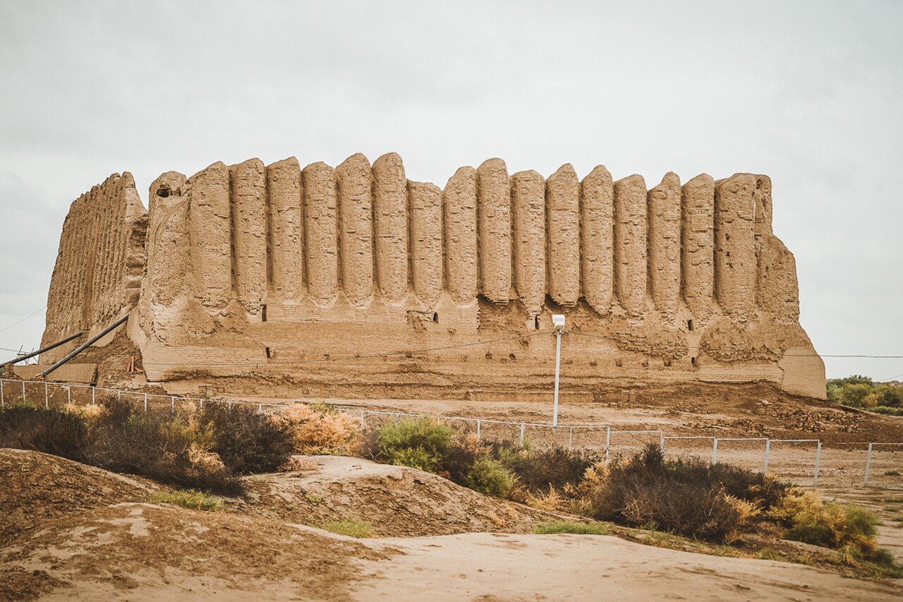
Great Icehouse in Merv, Turkmenistan
Great Icehouse in Merv, Turkmenistan | 13299achan (CC BY-SA 4.0)

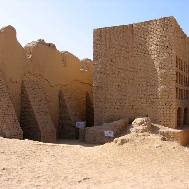
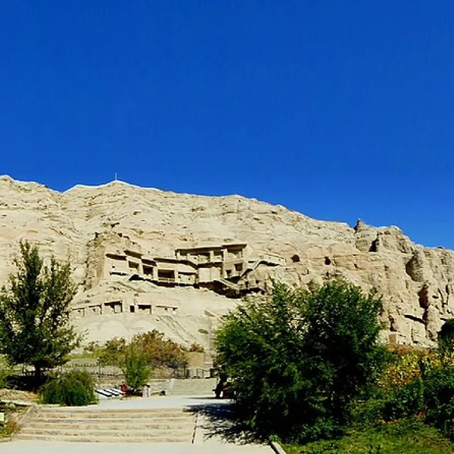
Monasteries, not only markets, defined the corridor. The Kizil Caves preserve early Silk Road Buddhist painting for the Tocharian-speaking kingdom of Kucha. Farther south, Niya left wooden houses and Kharoṣṭhī tablets under sand — bureaucracy of an oasis frozen in place. Westward, Ancient Merv stacked Hellenistic–Parthian–Sasanian–Islamic cities until the Mongol catastrophe of 1221 ended its medieval greatness.

Why compare these two arcs?

Both corridors forced the same adaptations: hydraulic control, fortification on scarce fertile strips, multilingual elites, and religions that travelled with cargo. Differences matter too — South Arabia’s monsoon diversion dams vs Central Asia’s qanat/canal deltas; Sabaean temple archives vs Tocharian–Uyghur grottoes; aromatic resins vs silk and paper.

Atlas Anatolia labels claims as Confirmed, Inferred, or Debated on each site page. Start with the dams and walls; then open evidence blocks before trusting legendary Queen of Sheba associations or precise population numbers for Merv.

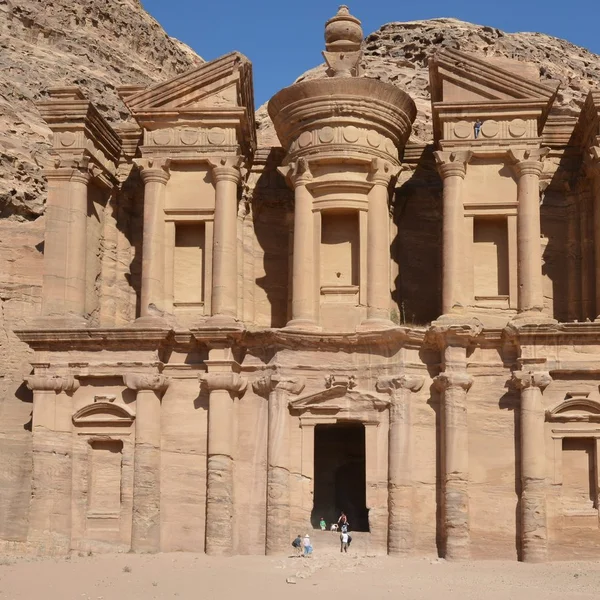
Explore Hegra and Petra for Nabataean links on Arabia’s northern fringe, or the Chinese grotto timeline for Silk Road imperial context.

Last updated: July 2026

如何引用本页

Atlas Anatolia. (2026). 香料与丝绸:改变古代世界的十座沙漠城市. Atlas Anatolia. https://atlasanatolia.com/zh/stories/incense-silk-roads-desert-cities

内容采用 CC BY-SA 4.0 许可——转载时需注明出处。

相关遗址

在地图上查看
Great Dam of Marib

Great Dam of Marib

Yemen

这座宏伟的土石大坝灌溉了古代也门萨巴王国的首都马里卜绿洲——它是古代近东最大的水利工程之一,维持了密集农业超过千年,后在古代晚期因灾难性溃坝而废弃。

Temple of Awwam

Temple of Awwam

Yemen

阿尔马卡(萨巴王国主神)的主庙,坐落于古马里卜以东的椭圆形围地内——传统上称为马哈拉姆·比尔基斯(“比勒基斯的圣所”),是前伊斯兰时期南阿拉伯最大、最重要的宗教建筑群之一。

Sirwah

Sirwah

Yemen

马里卜以西的一座早期萨巴政治与祭祀中心,以巨石墙环绕,阿尔玛卡神庙占据主导——铭文与防御工事使西尔瓦赫成为香料王国早期保存最完好的首都之一。

Qaryat al-Faw

Qaryat al-Faw

Saudi Arabia

位于阿拉伯空白之地边缘的一座重要商队城市,肯德王国都城——发掘出土的房屋、神庙、墓葬和壁画揭示了一个连接南阿拉伯乳香路线与海湾及黎凡特的世界性沙漠贸易中心。

Shibam

Shibam

Yemen

也门哈德拉毛谷地中一座耸立着土坯塔楼的防御城墙城市——常被称为“沙漠中的曼哈顿”——中世纪的哈德拉毛都市主义在此将垂直高密度化作为应对洪泛区限制和防御需求的完美解决方案。

Jiaohe

Jiaohe

China

一座壮观的崖顶古城,坐落于吐鲁番附近的黄土台地上,两河夹峙——曾是车师前国都城,后为丝绸之路上重要驻军城镇,虽被荒漠风沙遗弃,但街道、佛寺和凿入黄土地的民居遗迹犹存。

Gaochang

Gaochang

China

吐鲁番以东广阔的绿洲都城土坯废墟——中文资料称高昌,回鹘王国时期称Qocho/Khocho——一座佛教、后为摩尼教-佛教的丝绸之路大都市,城墙仍在沙漠中勾勒出巨大的城市轮廓。

Kizil Caves

Kizil Caves

China

丝绸之路北线最早的大型佛教石窟寺群,开凿于库车附近木扎尔特河岸的崖壁上——壁画风格融合印度-伊朗与中亚特征,早于并影响了后来的中国石窟艺术。

Niya

Niya

China

一座被沙漠吞噬的丝绸之路绿洲聚落,位于塔里木盆地南部——出土的木结构房屋、果园和双语行政文书,揭示了在贵霜和中原势力影响下,楼兰(Kroraina)文化圈中的日常生活。

Ancient Merv

Ancient Merv

Turkmenistan

中亚最伟大的绿洲城市之一——位于今土库曼斯坦穆尔加布河三角洲上的马尔吉安纳连续筑墙城市,连接着阿契美尼德、希腊化、帕提亚、萨珊和伊斯兰丝绸之路帝国,直至1221年蒙古人的毁灭。

Hegra

Hegra

Saudi Arabia

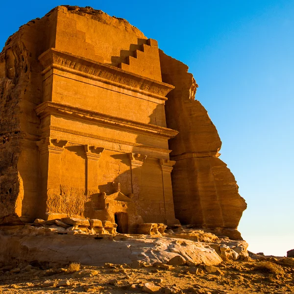
古老的纳巴泰城市黑格拉,拥有111座雕凿于砂岩露头之上的纪念性墓室立面,自公元前1世纪起作为贸易枢纽繁荣发展,直至公元106年被罗马吞并。

Petra

Petra

Jordan

佩特拉,公元前约300年至公元700年间为纳巴泰王国首都,以其岩石凿刻的陵墓和复杂的水利系统闻名,被列为联合国教科文组织世界遗产地,也是世界新七大奇迹之一。
更多故事