
Skip to content
Atlas AnatoliaAtlas Anatolia
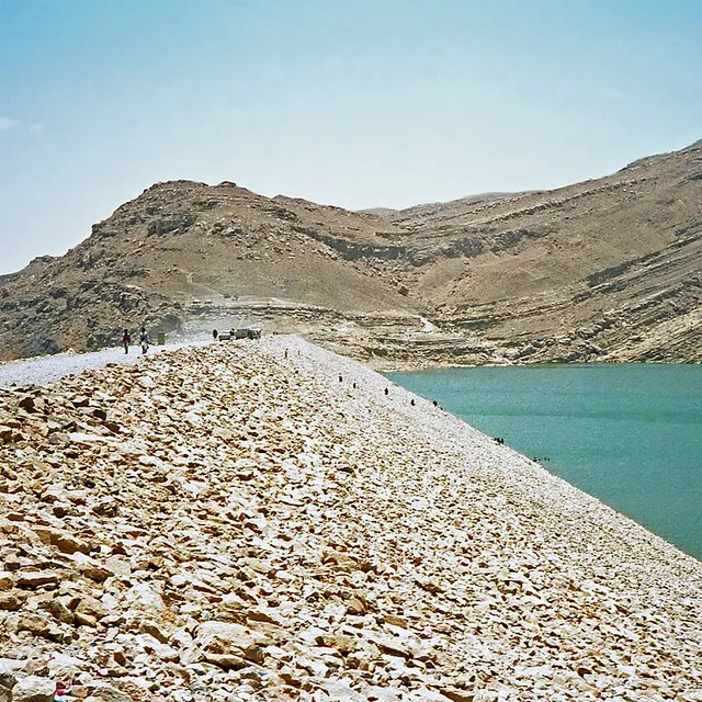
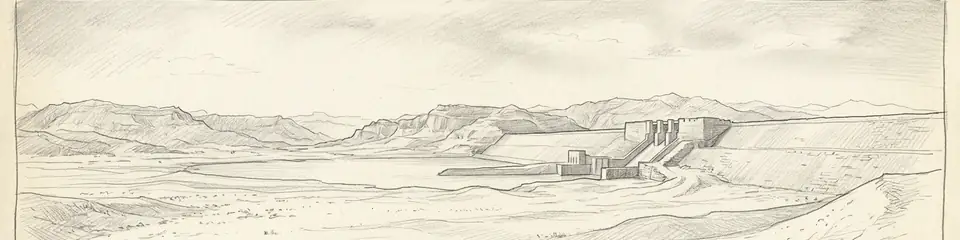
Stone abutments and spillways of the ancient Great Dam of Marib, Yemen

Continent Record

Oldest Monument in Asia

Great Dam of Marib

سد مأرب800 BCE – 570 CE

Function

Diversion dam feeding northern and southern oasis canals

Peak construction

Major phases c. 8th–6th centuries BCE; continued repair for centuries

Final breach

Catastrophic failure traditionally dated mid–late 6th century CE

UNESCO

Landmarks of Ancient Kingdom of Saba (2023)

Related capital

Marib (ancient Maryab), Sabaean royal centre nearby

The Marib Dam is the clearest surviving proof that South Arabian wealth rested not only on caravan tolls but on large-scale irrigated agriculture — hydraulic engineering on a par with Mesopotamian canal systems, adapted to monsoon wadi floods.”

Location

Overview

The Great Dam of Marib stands in the Wadi Adhanah (Dhana) in the highlands of eastern Yemen, roughly 170 kilometres east of Sanaʿa, just upstream of the ancient Sabaean capital. Construction of successive earth-and-rubble dams with cut-stone spillways and sluices began by the early first millennium BCE; epigraphic and archaeological evidence places major works between the eighth and sixth centuries BCE, with repeated repairs and enlargements under Sabaean and later rulers.

Unlike many ancient retention dams, Marib was designed primarily for controlled diversion: monsoon floods were slowed, diverted through twin northern and southern canals, and distributed across a vast oasis network capable of supporting tens of thousands of people and the frankincense-and-myrrh agricultural economy of South Arabia. Classical authors and local inscriptions celebrate Marib as a green oasis amid the desert; Quranic tradition later remembered the "flood of the dam" (sayl al-ʿArim) as a civilisational turning point.
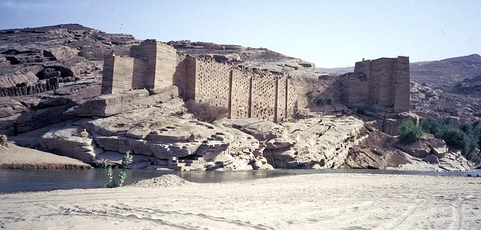
Jemen1988-022 hg
Jemen1988-022 hg

Jemen1988-022 hg | H. Grobe (CC BY-SA 3.0)

"There was for Saba a sign in their dwelling-place: two gardens, on the right and on the left. Eat of the provision of your Lord and be grateful to Him. A good land and a forgiving Lord. But they turned away, so We sent upon them the flood of the dam."
— Qurʾan 34:15–16 (Sūrat Sabaʾ), on the flood of the dam at Marib

The final catastrophic failure is conventionally dated to the mid–late sixth century CE (after centuries of repair episodes), after which the oasis contracted and the political centre of gravity in Yemen shifted toward Himyarite highland capitals. Modern hydraulic works nearby (opened 1986) sit upstream of the ancient ruins; the archaeological remains of sluices, abutments, and canal heads remain among the most important engineering monuments of the ancient Arabian peninsula.
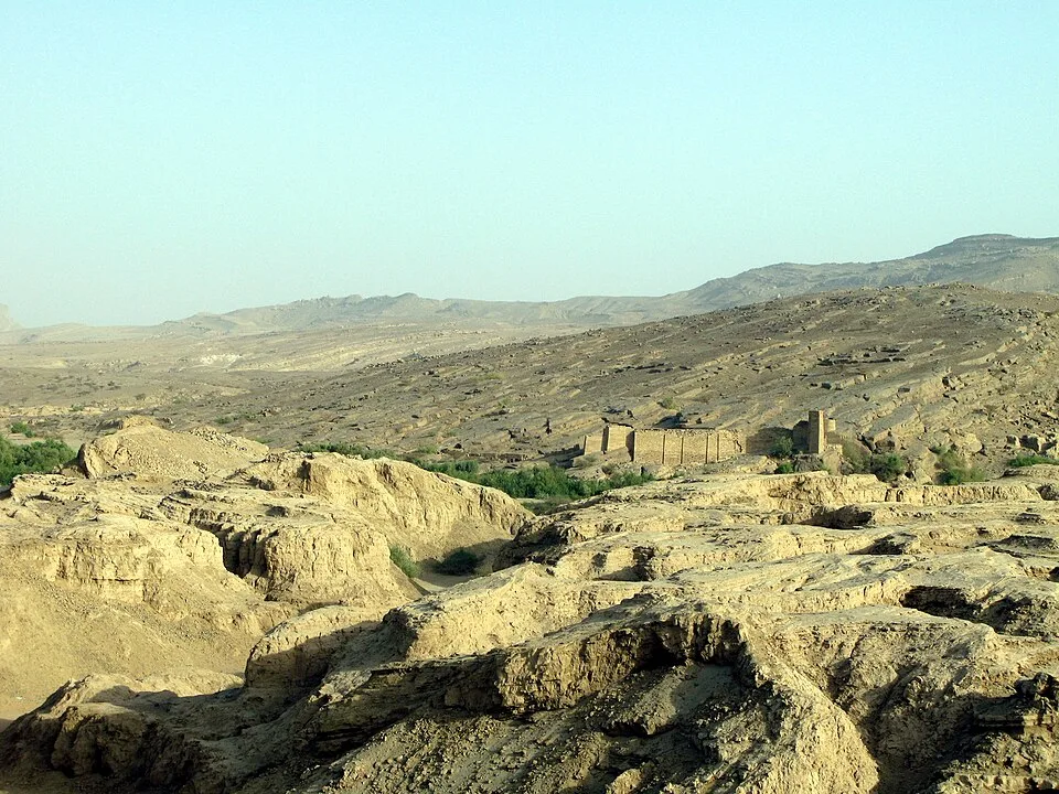
083 stari jez
083 stari jez

083 stari jez | Ljuba brank at Slovenian Wikipedia (Public domain)

Marib and its surrounding Sabaean landscape form part of UNESCO's recognition of the Landmarks of the Ancient Kingdom of Saba (inscribed 2023).
Why It Matters

The Marib Dam is the clearest surviving proof that South Arabian wealth rested not only on caravan tolls but on large-scale irrigated agriculture — hydraulic engineering on a par with Mesopotamian canal systems, adapted to monsoon wadi floods. Its eventual failure offers a rare archaeological and literary case of a fragile oasis civilisation unraveling when hydraulic infrastructure collapsed, with consequences remembered in Arabic tradition for centuries.

Stay curious

New stories and sites, once a month. No spam.

Evidence & Interpretation

Distinguishing what is well-established from what remains debated.

Well-Established Facts

2
  • Standing stone sluices, abutments, and canal-head masonry document a diversion-irrigation system on a monumental scale.
  • Sabaean and later South Arabian inscriptions record construction, repair, and ritual dedication of dam works.

Scholarly Inferences

1
  • The dam underwrote the demographic and economic base that allowed Marib to remain a major South Arabian capital for centuries.

Debated Interpretations

1
  • Exact sequences of rebuilds and the precise date of the terminal breach remain debated among epigraphers and hydrologists.

More Photos

Museum Artifacts

Community Photos

Share your experience

Have you visited this site? Upload your photos to help others discover it.

How to cite this page

Atlas Anatolia. (800). Great Dam of Marib. Atlas Anatolia. https://atlasanatolia.com/site/marib-dam

Content licensed CC BY-SA 4.0 — attribution required when reusing.

Knowledge Graph

Connections to related sites and stories.

Sources

  • Queen of Sheba: Treasures from Ancient YemenSimpson, St John (2002)
  • UNESCO — Landmarks of the Ancient Kingdom of SabaLink

Research Papers

Frequently Asked Questions

Where is Great Dam of Marib located?

Great Dam of Marib is located in Yemen.

How old is Great Dam of Marib?

Great Dam of Marib dates to approximately 800 BCE – 570 CE.

Which civilizations are associated with Great Dam of Marib?

Great Dam of Marib is associated with the Sabaean, Himyarite.

Why is Great Dam of Marib important?

The Marib Dam is the clearest surviving proof that South Arabian wealth rested not only on caravan tolls but on large-scale irrigated agriculture — hydraulic engineering on a par with Mesopotamian canal systems, adapted to monsoon wadi floods.

Is Great Dam of Marib a UNESCO World Heritage Site?

Yes — Great Dam of Marib is inscribed as a UNESCO World Heritage Site.