For roughly two hundred thousand years, our species survived in bands whose size rarely surpassed the Dunbar limit of personal recognition. People knew every face around the fire. Then, in half a dozen river valleys and mountain basins between 9000 and 2500 BCE, something snapped.
Humans began congregating in numbers that made strangers unavoidable: three thousand at Jericho, eight thousand at Catalhoyuk, forty thousand at Uruk, fifty thousand along the Indus, and hundreds of thousands across the avenues of Teotihuacan.
To live in a city meant inventing entirely new institutions to prevent neighbors from slaughtering one another over property boundaries, irrigation water, and bread rations. It required inventing writing to audit grain warehouses, standardized bricks to build tenement quarters, subterranean drains to stop cholera, and monumental temples to give disparate clans a common cosmic identity.
Below is the definitive archaeological atlas of how the urban species was born.
The Complete Atlas of Humankind’s First Cities
Explore the 16 earliest metropolises and proto-urban mounds that sparked the Urban Revolution across 6 global cradles (9000–1000 BCE).
Uruk
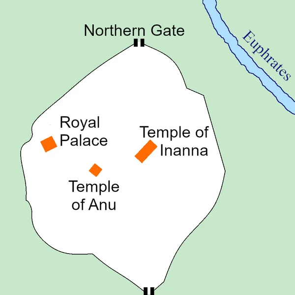
The world's inaugural city-state spanning 6 square kilometers. Pioneered bureaucratic cuneiform accounting, cylinder seals, monumental Anu Ziggurat, and the Epic of Gilgamesh.
Eanna Sacred Precinct, Limestone Temple, and archaic clay administrative tablets.
The Childe Threshold: What Actually Makes a City?
In 1950, archaeologist Vere Gordon Childe published his landmark paper defining the "Urban Revolution." Childe observed that true cities are not merely overgrown villages. A settlement becomes a city when it crosses ten structural thresholds:
- Dense, concentrated populations supported by agricultural surplus.
- Occupational specialization: full-time metalsmiths, potters, scribes, and priests who do not farm.
- Surplus extraction and tithes collected by a centralized authority.
- Monumental public architecture: temple ziggurats, citadels, and stone fortifications.
- A ruling class exempt from manual agricultural toil.
- Systems of recording and writing for economic accountability.
- Predictive sciences: arithmetic, geometry, calendars, and astronomical observation.
- Sophisticated artistic styles shared across regional boundaries.
- Long-distance foreign trade importing raw materials like tin, copper, and obsidian.
- State organization based on residence and citizenship rather than purely tribal kinship.
When you walk the ruins in this atlas, watch how different civilizations solved these ten challenges independently.
Iraq
Uruk
The world's first city — a 6-kilometre urban complex on the Euphrates in southern Mesopotamia that pioneered w
Iraq
Ur
Ur, a major Sumerian city-state in southern Mesopotamia, flourished from 3800 BCE to 500 BCE, renowned for its
Türkiye
Çatalhöyük
One of the world's earliest known proto-urban settlements, occupied from roughly 7400 to 5600 BCE. Famous for
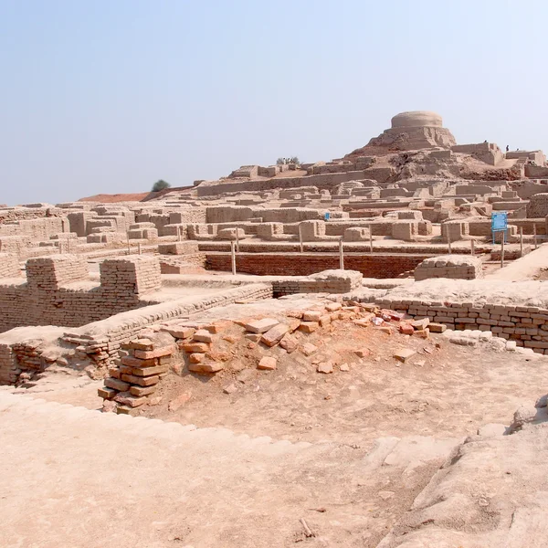
Pakistan
Mohenjo-daro
Mohenjo-daro, a principal urban center of the Indus Civilization (c. 2500–1700 BCE), exemplifies advanced Bron
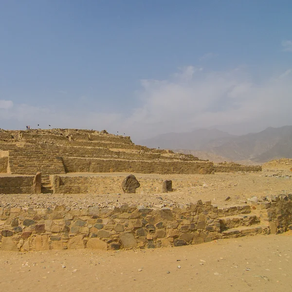
Peru
Caral
Caral, a 5,000-year-old urban center in Peru, features monumental pyramids and circular plazas, revealing comp
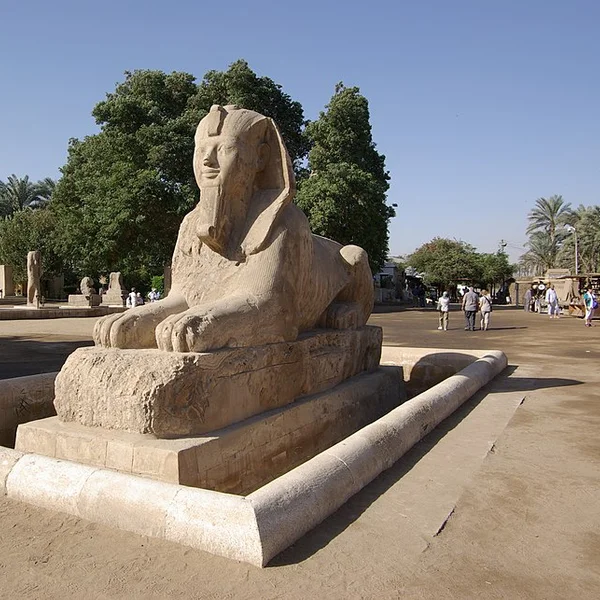
Egypt
Memphis
The ruined capital of Old Kingdom Egypt on the Nile floodplain south of Cairo — home to the colossal Ramesses
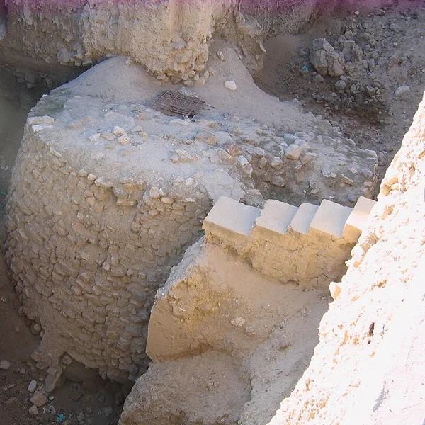
Palestine
Jericho
The world's oldest continuously inhabited city — a Neolithic settlement in the Jordan Valley where humans firs
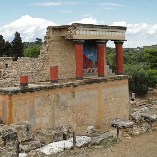
Greece
Knossos
Largest Bronze Age palace on Crete, centre of Minoan court life, fresco painting, and labyrinth myth. Arthur E
1. Lower Mesopotamia: Uruk, Eridu, and the Sumerian Metropolis
Around 4000 BCE on the shifting silt of the lower Euphrates, Uruk became the mother of all cities. While contemporary European societies were clearing forest glades with polished stone axes, Uruk was housing over 40,000 citizens behind a six-kilometer circuit of mudbrick ramparts that legend attributed to Gilgamesh.
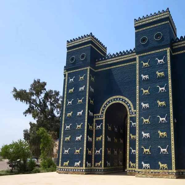
Uruk was divided into colossal ceremonial districts. In the Eanna precinct dedicated to Inanna, goddess of love and warfare, architects raised the Limestone Temple and decorated palace facades with thousands of colored clay cones pressed into wet plaster, creating mosaic tapestries of red, white, and black geometric chevrons.
It was here that writing was born. Scribes pressed reed styluses into wet river clay to balance transactions of sheep, beer jars, and barley rations. Within centuries, these pictographic tallies evolved into the wedge-shaped cuneiform script that would record the first legal codes, royal hymns, and the Epic of Gilgamesh.
Downriver, Ur commanded the Persian Gulf maritime approaches. When Leonard Woolley excavated Ur's Royal Cemetery in the 1920s, he uncovered Queen Puabi buried with twenty-three retainers, golden headdresses of lapis lazuli leaves, and bull-headed harps inlayed with shell.
2. The Indus Valley: The World's First Sanitized Metropolises
No urban civilization on Earth matched the civic hygiene and egalitarian planning of the Harappan civilization along the Indus and Ghaggar-Hakra river floodplains.
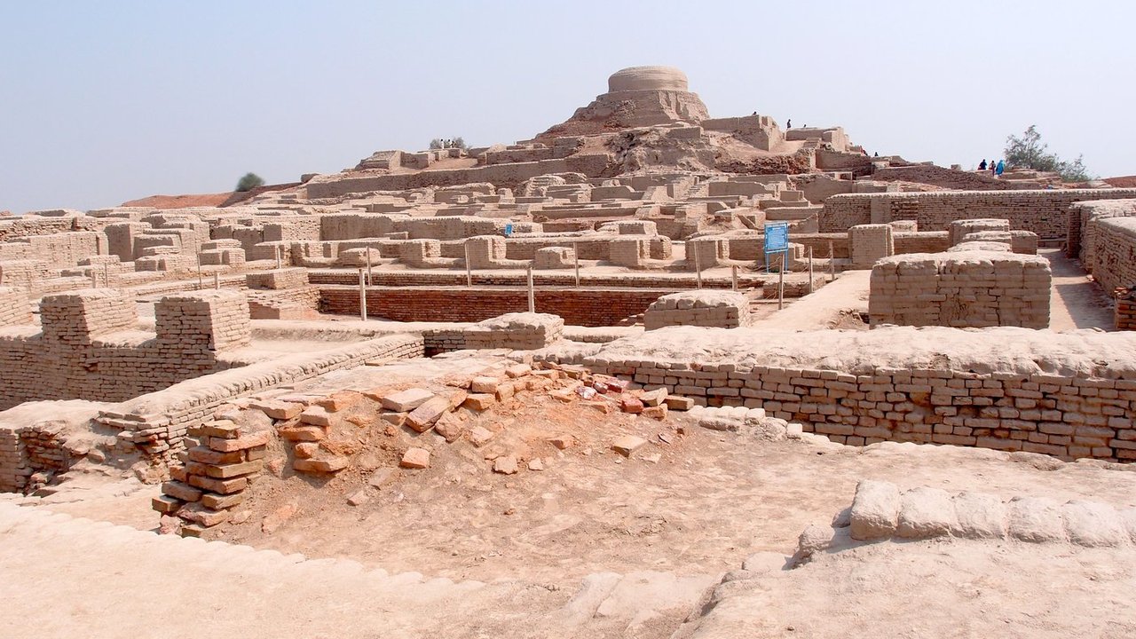
Unlike Mesopotamia and Egypt, where cities clustered around despotic royal palaces and towering temple ziggurats, Mohenjo-daro and Harappa were laid out on precise cardinal grids oriented north-to-south and east-to-west. The buildings were constructed from kiln-fired clay bricks molded to an invariant 1:2:4 ratio across a thousand-kilometer territory.
Every home, from humble two-room quarters to sprawling multi-story merchant villas, featured a private bathing room with brick-paved floors pitched toward an outlet. Waste flowed into terracotta drainpipes embedded in exterior walls, emptying into covered street sewer channels equipped with inspection sumps for municipal sanitation workers.
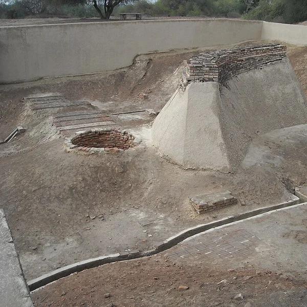
At the citadel center stood the Great Bath: an eight-foot-deep, watertight basin lined with finely fitted bricks sealed with natural bitumen asphalt. Remarkably, no royal burials, royal palaces, or dynastic monuments have ever been identified in the Indus Valley. Power appears to have been civic, merchant-led, or council-guided.
At Dholavira in the arid salt marsh of the Rann of Kutch, engineers mastered water conservation. Cut directly into the bedrock were sixteen enormous stone-lined reservoirs that captured monsoon torrents, cascading through filtration channels to sustain twenty thousand residents through dry seasons.
3. Anatolia and the Levant: The Proto-Urban Experiment
Thousands of years before Uruk fired its first temple bricks, Anatolian and Levantine communities were pioneering the social mechanics of congregate living.
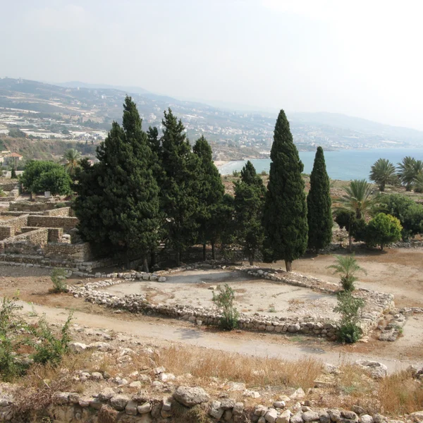
At Jericho (Tell es-Sultan) in the Jordan Rift Valley, hunter-gatherers had established a permanent settlement by 9000 BCE. By 8000 BCE, this Pre-Pottery Neolithic community had encircled their mud huts with a massive stone wall and raised the Tower of Jericho: an 8.5-meter cylindrical megalithic tower with an interior twenty-two-step helical stone staircase. This tower predates Stonehenge by five millennia.
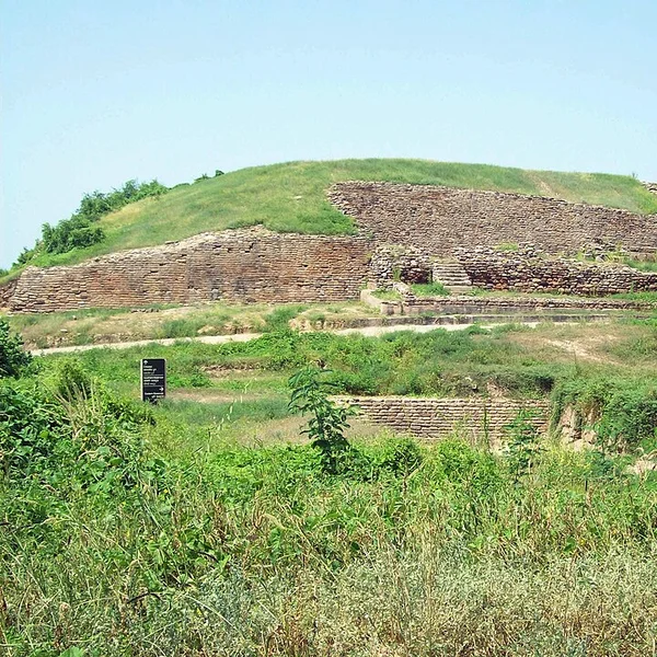
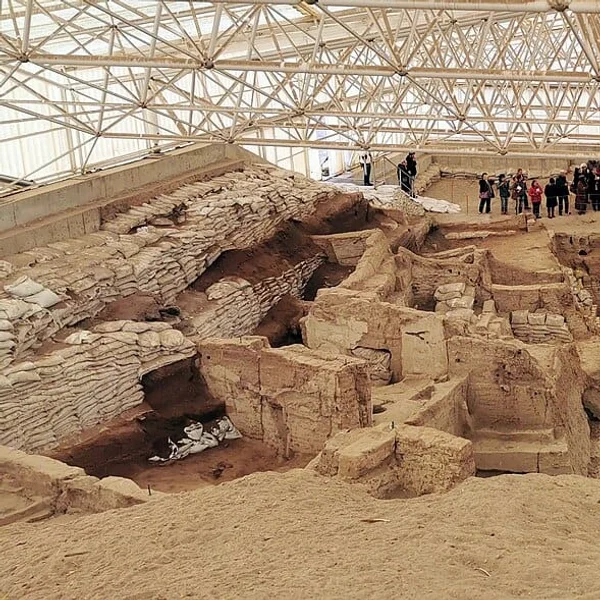
In central Anatolia on the Konya Plain, Catalhoyuk flourished between 7100 and 5600 BCE as a dense honeycomb of mudbrick houses without a single street. Residents walked across rooftops and descended into their homes through roof ladders directly above open hearths.
When a room needed renewal, the owners knocked down the upper walls, filled the lower room with clean clay, and built an exact replica on top. Over 1,500 years, this practice formed a twenty-meter-high tell. Under their sleeping platforms, Catalhoyuk families buried their ancestors with red ochre, while plaster bull bucrania (skulls) and feline wall paintings decorated the living quarters.
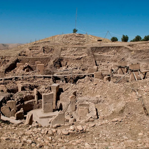
North of the Syrian border, Gobekli Tepe (c. 9500 BCE) showed that monumental ritual gathering actually came before farming. Nomadic bands gathered to quarry twenty-ton T-shaped limestone pillars carved with predatory lions, snakes, and vultures, creating the spiritual necessity that demanded agricultural surplus.
4. The Nile Corridor: Memphis and the White Wall
Egypt took a fundamentally different path to urbanism. Because the annual Nile flood renewed agricultural silt along a narrow ribbon, Egypt did not initially develop dense, competing city-states like Sumer.
Instead, when King Narmer (Menes) unified the Two Lands around 3100 BCE, he founded Memphis (Ineb-Hedj, "The White Wall") at the neck of the Nile Delta, exactly where the river valley widens into fertile wetlands.
Memphis was an administrative and religious juggernaut. It housed the royal bureaucracy that marshaled thousands of seasonal laborers to quarry, transport, and assemble the limestone blocks for the pyramids of Saqqara, Dahshur, and Giza across the western desert plateau. Centered around the grand temple of Ptah (Hut-ka-Ptah, from which the Greek name Aigyptos and the modern word Egypt derive), Memphis governed the longest unified state in antiquity.
5. The Americas: Caral and the Pre-Ceramic Enigma
For over a century, western textbooks asserted that cities required pottery, metal tools, and grain agriculture. In the late 1990s, Ruth Shady Solis's excavations at Caral in Peru's Supe Valley shattered this dogma.
Dating to 2600 BCE, Caral was contemporary with Khufu's pyramid builders in Egypt. Yet the people of Caral had no ceramics, no metal blades, and no draft animals. They built six monumental platform pyramids, the largest rising nearly thirty meters, surrounding sunken circular plazas where flute orchestras performed on thirty-two pelican-bone instruments.
Caral's engineers pioneered earthquake engineering: they packed tons of river stones into loose open-mesh bags woven from vegetable fibers (shicras). When seismic tremors struck the Andean foothills, the stones moved independently within the nets, dissipating shockwaves before they could collapse the stone facades.
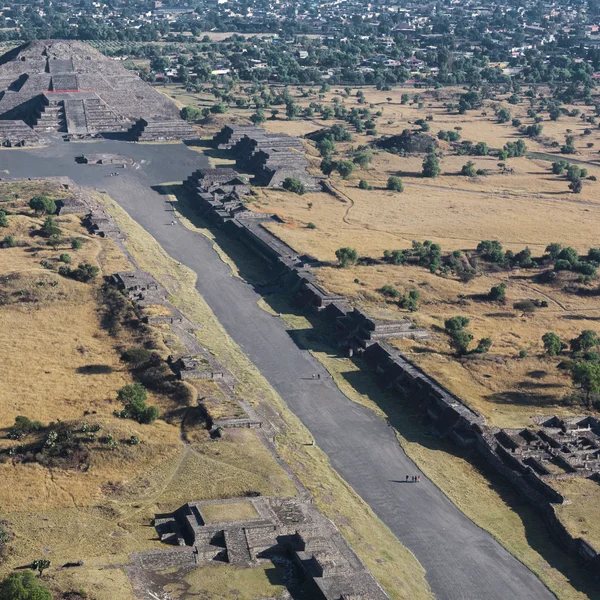
Two millennia later in central Mexico, Teotihuacan arose as the undisputed colossus of Mesoamerica, housing over 100,000 people in multi-family apartment compounds along the monumental Avenue of the Dead beneath the Pyramid of the Sun.
6. The Aegean: Knossos and the Labyrinthine Palace-Cities
In the second millennium BCE, the Mediterranean world saw Europe's first true urban civilization emerge on the island of Crete. Knossos was not a walled fortress; it was a multi-tiered palace-city centered around an open ceremonial court.
Minoan engineers built multi-story complexes with central lightwells that circulated breezes and sunlight, terracotta piping networks for potable water and stormwater drainage, and grand reception halls adorned with vivid frescoes of bull-leaping youths and saffron gatherers.
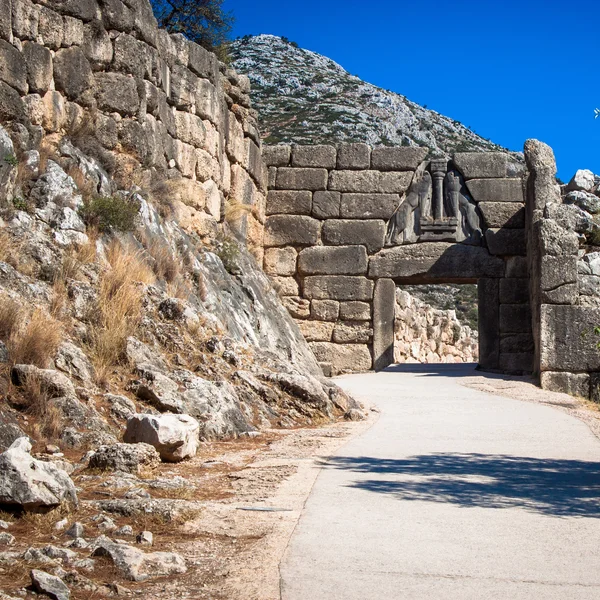
On the Greek mainland, the warrior lords of Mycenae fortified their acropolis with Cyclopean limestone blocks so heavy that later Classical Greeks believed only the giant one-eyed Cyclopes could have lifted them into place.
City | Cradle | Date Founded | Peak Population | Defining Innovation
Uruk | Lower Mesopotamia | c. 4000 BCE | 40,000 - 50,000 | Cuneiform writing, cylinder seals, monumental ziggurats
Mohenjo-daro | Indus Valley | c. 2500 BCE | 35,000 - 40,000 | Kiln-fired brick grid, covered subterranean sewers, Great Bath
Catalhoyuk | Central Anatolia | c. 7100 BCE | 8,000 - 10,000 | Rooftop street entry, contiguous mudbrick honeycomb, intramural burials
Caral | Norte Chico (Peru) | c. 2600 BCE | 3,000 (core) | Pre-ceramic platform pyramids, woven shicra seismic dissipation
Memphis | Lower Nile (Egypt) | c. 3100 BCE | 30,000 - 50,000 | Centralized Delta governance, White Wall fortress, pyramid workforce
Jericho | Jordan Rift Valley | c. 9000 BCE | 2,000 - 3,000 | Megalithic stone defense wall and 8.5m helical staircase tower
Knossos | Minoan Crete | c. 1900 BCE | 14,000 - 18,000 | Multi-story labyrinth palace, lightwells, terracotta drainage pipes
Teotihuacan | Central Mexico | c. 100 BCE | 100,000 - 125,000 | Orthogonal apartment barrios, Avenue of the Dead, obsidian monopoly
Why Did the First Cities Collapse or Evolve?
None of humankind's first cities was immortal. The very forces that allowed them to concentrate thousands of humans eventually created new vulnerabilities:
- Soil Salinization: Centuries of intensive furrow irrigation in Lower Mesopotamia deposited trace salts from the Euphrates into the arid soil. Wheat yields plummeted, forcing Sumerian cities to switch to salt-tolerant barley before political hegemony shifted north to Babylon.
- Shifting Riverbeds: In the Indus Valley, tectonic shifts and monsoonal climate shifts diverted the courses of the Indus and dried up the sacred Ghaggar-Hakra river system, rendering Mohenjo-daro and Harappa uninhabitable by 1700 BCE.
- Resource Exhaustion: Catalhoyuk cut down oak and juniper forests across the Konya plain for timber beams and plaster lime kilns, requiring ever-longer treks for firewood and wild game.
- Epidemic Vulnerability: Dense cohabitation with domesticated sheep, goats, pigs, and cattle without modern germ theory enabled zoonotic pathogens to sweep through mudbrick wards.
Yet the urban formula never died. Every modern metropolis, from New York to Tokyo and Istanbul, relies directly on the institutional architecture invented in the mud of Uruk, the fired brick of Mohenjo-daro, and the seismic foundations of Caral.