Skip to content
Atlas Anatolia
News
Classical Antiquity
2,800-year-old bone flute and Early Bronze Age idol uncovered at Troy
First Hellenistic mosaic floor in 78 years of excavations discovered at Kültepe-Kanesh
🎓Aligned with AP World History, IB Humanities & University Survey Curricula

Roman North Africa — Classroom Pack

Five cities, one compare set, one editorial guide — for secondary and introductory university courses.

Target Audience:World history, ancient civilizations, AP/IB humanities (ages 14–18) and first-year archaeology surveys.
Roman North Africa5 Sites
Cyrene
Sabratha
Bulla Regia
Cuicul (Djemila)
Apollonia
c. 631 BCE – 647 CE2–4 Classroom Sessions or Seminar Unit
Launch Side-by-Side Compare

Core Learning Objectives

Key competencies, historiographical debates, and analytical skills targeted in this unit.

Goal 01

Locate Roman African provinces on a map and connect coastal vs inland urbanism.

Goal 02

Compare Greek colonisation (Cyrene) with Roman colonisation (Cuicul, Bulla Regia).

Goal 03

Use evidence ratings on Atlas Anatolia to distinguish confirmed vs debated claims.

Goal 04

Build a short bibliography using the site’s citation tools (CC BY-SA 4.0).

🏛️Archaeological Dossiers

Featured Sites in this Unit

Every site card connects to primary excavation field reports, confirmed stratigraphy, and verified coordinates.

Compare All Sites in this Unit→
Cyrene
📍 LibyaUNESCO

Greek / Roman (Cyrenaica)

Cyrene

c. 631 BCE – 643 CE32.82°N, 21.86°E

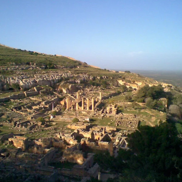
Premier Greek Dorian colony in North Africa, founded by settlers from Thera (Santorini) and later a major Roman provincial capital. Renowned for its Sanctuary of Apollo, Temple of Zeus (larger than the Parthenon), and silphium spice trade.

Sanctuary of Apollo and sacred spring fountainColossal Temple of Zeus (Doric peripteral)Greek theater modified for Roman venationes
Sabratha
📍 LibyaUNESCO

Punic / Roman (Tripolitania)

Sabratha

c. 500 BCE – 647 CE32.79°N, 12.49°E

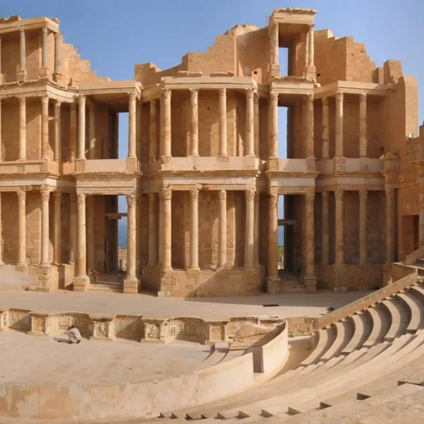
Punic trading emporium elevated to Roman imperial prominence under the Severan dynasty. Celebrated for its breathtaking sea-facing three-story scaenae frons theater (96 Corinthian marble columns) and maritime olive oil export warehouses.

Three-story scaenae frons theater (c. 190 CE)Temple of Liber Pater on the ForumOceanus marine mosaics in coastal insulae
Bulla Regia
📍 Tunisia

Numidian / Roman (Africa Proconsularis)

Bulla Regia

c. 200 BCE – 600 CE36.57°N, 9.04°E

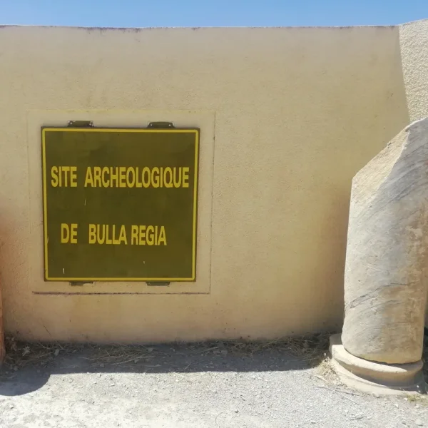
Architectural marvel of thermal adaptation: wealthy citizens built two-story villas with complete subterranean lower levels (underground peristyles, lightwells, and vaulted bedrooms) to escape brutal Mediterranean summer heat, preserving in-situ Roman mosaics in pristine condition.

House of the Hunt (subterranean peristyle & dining hall)House of Amphitrite (famous Neptune & marine triumph mosaic)Subterranean vaulted architectural air shafts
Cuicul (Djemila)
📍 AlgeriaUNESCO

Roman Empire (Numidia)

Cuicul (Djemila)

c. 96 – 600 CE36.32°N, 5.74°E

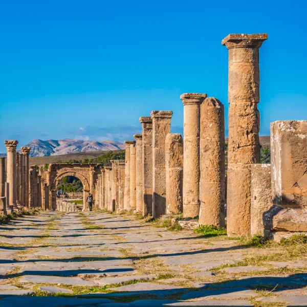
A textbook example of mountain-adapted Roman urban planning: founded as a veterans’ colony by Emperor Nerva at 900 meters elevation in northern Algeria. Its dramatic Severan Arch of Caracalla, Temple of the Severan Family, and hillside theater overlook sweeping mountain ravines.

Triumphal Arch of Caracalla (c. 216 CE)Severan Forum and Temple of the Gens SeptimiaHillside Roman Theater overlooking the Betame ravine
Apollonia
📍 LibyaUNESCO

Greek / Roman / Byzantine (Cyrenaica)

Apollonia

c. 600 BCE – 643 CE32.90°N, 21.97°E

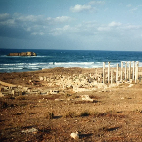
The vital maritime gateway for Cyrene on the Mediterranean coast. Its ancient harbor moles, ship-shed slipways, and coastal storehouses were submerged by tectonic subsidence following the catastrophic 365 CE Crete tsunami.

Submerged Hellenistic harbor moles & slipwaysByzantine Palace of the Dux (military governor)Three early Christian coastal basilicas with marble capitals
⚡15-Minute Classroom Workshop•15–20 min

15-Minute Workshop: Bioclimatic Architecture & Hybrid Imperial Identity

👥Small Groups (3–4 students)
01. Core Pedagogical Objective

Examine how provincial builders adapted classical Mediterranean architecture to hyper-arid desert and mountain topographies.

02. Student Group Task

Contrast Bulla Regia's subterranean peristyle villas (preserving 20°C in 45°C summer heat) with Sabratha's coastal marine theater and Cuicul's mountain ridge. Discuss how Punic and Numidian populations integrated into Roman civic life.

03. Expected Deliverable

Two distinct architectural features that prove provincial adaptation rather than rigid copying of Rome's metropolitan blueprints.

⚡Active Classroom Exercise

Compare all five Roman African cities

Side-by-side dates, evidence ratings, and geographic coordinates — shareable URL for classroom assignments.

01. ChronologySynchronize overlapping construction epochs
02. EngineeringContrast masonry, hydrology & materials
03. EvidenceEvaluate peer-reviewed excavation reports
Cyrene
1. Cyrene
Sabratha
2. Sabratha
Bulla Regia
3. Bulla Regia
Cuicul (Djemila)
4. Cuicul (Djemila)

Seminar & Essay Discussion Prompts

Structured inquiry questions designed for classroom debate, seminar discussion, and essay prompts.

1

Colonial Urban Origins: Greek Emporium vs Roman Veteran Garrison

Contrast the colonial trajectory of Cyrene (founded by 7th-century BCE Greek Dorian voyagers following the Oracle of Delphi) with Cuicul/Djemila (founded in 96 CE by Emperor Nerva for Roman military veterans). How did their divergent founding missions shape their town plans, fora, and civic institutions?

🎓Teacher Guidance & Stratigraphic Clues▾
Key field data: Cyrene's 7th-century BCE Greek sanctuary of Apollo and agora on a fertile jabal ridge vs Cuicul's (Djémila) 96 CE military veteran colony founded by Nerva on a steep spur with a rigid cardo/decumanus defensive grid.
2

Bioclimatic Pragmatism: The Subterranean Architecture of Bulla Regia

In Bulla Regia, Roman citizens excavated fully appointed subterranean peristyles 8–10 meters below ground to escape scorching Saharan summer heat. How does this demonstrate cultural accommodation and environmental pragmatism within the Roman Empire?

🎓Teacher Guidance & Stratigraphic Clues▾
Key field data: Bulla Regia's subterranean peristyle houses (e.g. House of the Hunt) carved 8–10 meters below ground with light shafts, maintaining a temperate 20–22°C microclimate during 45°C summer desert heat waves.
3

The Granary of Rome: Agricultural Wealth and Imperial Integration

North Africa supplied the vast majority of Rome's grain dole (annona) and olive oil exports. Trace how agricultural surplus materialized in urban civic competition — monumental theaters (Sabratha), triumphal arches, and lavish domestic mosaics.

🎓Teacher Guidance & Stratigraphic Clues▾
Key field data: The Roman Annona grain fleet and olive oil surplus; Sabratha's three-tiered marble seaside theater (scenae frons) funded by wealthy merchant decurions, and Cuicul's triumphal Arch of Caracalla celebrating local civic euergetism.
Open Access License (CC BY-SA 4.0)

Citation & Classroom Use Rights

✓Free for Educational Reuse

All data, text, and maps are licensed under CC BY-SA 4.0. Educators and students are free to copy, quote, and adapt these materials for lecture presentations, syllabi, homework, and research essays with attribution.

Select Citation Format:
American Psychological Association (7th Ed.)
Atlas Anatolia Editorial Board. (2026). Roman North Africa — Classroom Pack. Atlas Anatolia Archaeological Education Archive. https://atlasanatolia.com/classroom/roman-north-africa
Roman North Africa Classroom Pack | Atlas Anatolia