跳到正文
Atlas Anatolia
新闻Tiny Paleolithic bird carvings unearthed in GermanyLatin graffiti recorded in Spain’s Cova Dones cave sanctuary
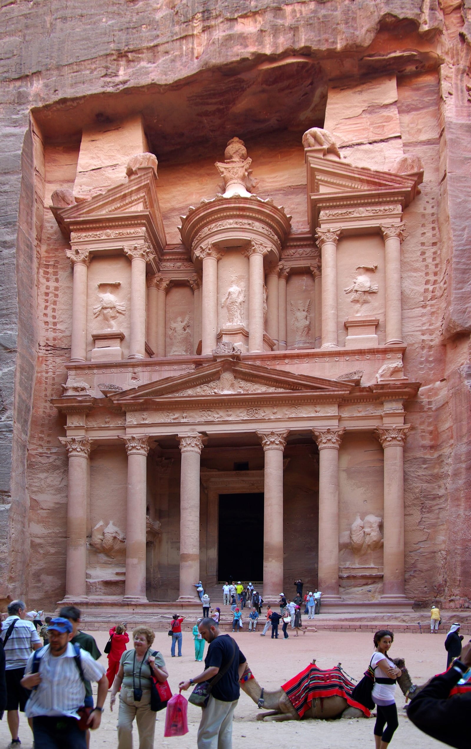
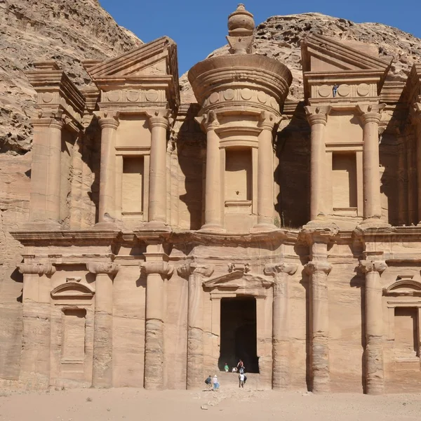
The Treasury (Al-Khazneh) carved into rose sandstone at Petra

Al-Khazneh, Petra — Wikimedia Commons / open license

指南14 分钟阅读

故事

UNESCO考古世界遗产地地图:按大洲分列的古代遗址互动指南

UNESCO世界遗产遗址互动地图,具有考古深度——319+个Atlas Anatolia遗址中的212个带有UNESCO标签的地点。可按大陆、时代和文明进行筛选;每个遗址的开放证据评级。

Atlas Anatolia

本文涉及的遗址

在地图上查看
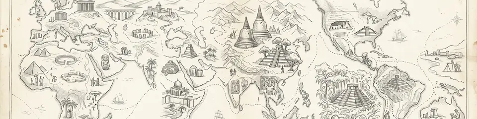
Graphite pencil sketch banner for “UNESCO Archaeological World Heritage Sites Map: Interactive Guide to Ancient Sites by Continent”

Atlas Anatolia is an interactive map of UNESCO world heritage sites focused on archaeological and cultural properties worldwide. This guide complements the official UNESCO World Heritage List with evidence-based narratives, per-site timelines, and scholarly context across 311++ published archaeological sites.

TL;DR: An interactive, continent-spanning atlas maps 311++ archaeological sites, focusing on evidence-based narratives of ancient civilizations and cultural heritage. Content is organized by continent with map-based exploration, multilingual narratives, scholarly context, and cross-referenced tools like a knowledge graph and interactive timeline. Designed for researchers and learners, it emphasizes credible annotations, cross-continental comparisons, and ongoing updates to reflect new scholarship and data quality.

"World Heritage is not a badge of beauty alone; it is a pledge that humanity will refuse to forget what the earth still holds."

— Paraphrase of the UNESCO World Heritage Convention spirit (1972)

Taj Mahal at dawn
The Taj Mahal — a UNESCO World Heritage cultural site in Agra, India

Introduction

Purpose and scope of the interactive atlas

Sites are organized by continent to illuminate regional histories and cross-cultural connections. Each section highlights iconic landmarks alongside lesser-known locales to reveal patterns of settlement, trade, and cultural exchange.

Key features: map-based exploration, multilingual content, scholarly context

  • Map-based exploration: Georeferenced maps, interactive layers, and spatial queries to navigate sites on a global canvas.
  • Multilingual content to broaden accessibility and support diverse readers.
  • Scholarly context through metadata, timelines, and cross-references that anchor each site in its historical framework.

We emphasize archaeological and cultural world heritage properties while excluding natural-only designations. The result is a focused, evidence-driven guide that pairs engaging storytelling with rigorous context.

World heritage is not a list of isolated monuments — it is a map of how human societies built, traded, worshipped, and governed across continents. An archaeological atlas makes those connections visible.


1. Africa: Ancient Civilizations and Archaeological Highlights

Major clusters of sites by region

Africa's archaeological landscape centers on river valleys, coastal belts, and desert trade corridors. The Nile corridor anchors Northeast Africa with monumental tombs, temples, and urban layouts that illuminate religious life and administration — from the Pyramids of Giza to Abu Simbel. East Africa shows inland networks linking highland settlements with oases along caravan routes. The Sahel and Sahara preserve desert-adapted settlements and rock art that reveal long term cultural resilience. West Africa hosts urban centers and trade hubs connected to trans-Saharan exchanges. Southern Africa preserves rock art traditions and early urban forms shaped by local ecologies.

Pyramids of Giza
The Pyramids of Giza — the last surviving wonder of the ancient world

Notable eras and civilizations represented

Key periods include kingdoms along the Nile and Nile Delta, the emergence of monumental architecture in west and northeast Africa, and sophisticated urban planning in interior regions. The record reflects a continuity of settlement strategies, evolving trade networks, and evolving governance. These choices emphasize long duration cultural development, from petroglyphs to monumental ensembles, that illuminate community life and ritual practice.

Interactive map tips for Africa

  • Use continent-wide filters to isolate cultural sites from mixed or uncertain designations.
  • Toggle era layers to compare transitions from early monumental activity to later urbanization.
  • Roll over markers to view metadata, dating ranges, and regional affiliations.
  • Compare clusters side by side with the knowledge graph to trace connections between civilizations.

2. Americas: Pre-Columbian and Early Historic Sites

Cultural landscapes and urban centers across the continents

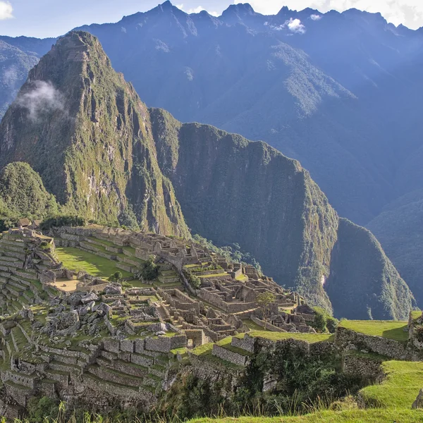
The Americas present dense cultural landscapes that blend ceremonial spaces, fortified settlements, and ceremonial plazas with everyday neighborhoods. From the urban cores of Mesoamerican and Andean cities — Machu Picchu, Chichén Itzá, Teotihuacán — to expansive ceremonial plains, these sites reveal social organization, ritual life, and architectural innovation. Coastal trade networks and inland hinterlands show how communities connected across vast distances.

Machu Picchu in the Andean cloud forest
Machu Picchu — Inca royal estate perched above the Urubamba Valley
  • Urban footprints include grid plans, elevated reservoirs, and ceremonial centers that guided daily life.
  • Cultural landscapes often encompass harbors, terraced fields, and sacred precincts integrated into the surrounding terrain.
  • Architectural diversity ranges from monumental pyramids to adobe platforms and stone complexes.

Chronologies and eras showcased

The sequence spans early agricultural communities, peak urbanization, and transitional periods tied to contact and exchange networks. Chronologies highlight rise and decline phases shaped by environmental pressures, sociopolitical dynamics, and intercultural interactions. The archive emphasizes continuity in ritual practice alongside shifts in governance and resource management.

  • Preclassic to Classic transitions in Mesoamerica illustrate evolving political and ceremonial architectures.
  • Andean civilizations show progression from agricultural terraces to centralized administrative hubs.
  • Post-contact layers reveal syncretic practices and adaptation within colonial-era settings.

Filter by era to align New World sites along a common temporal axis — and you begin to see contemporaneous developments that no single-site guide can show.

Using the timeline to compare New World sites

  • Filter by era to align sites along a common temporal axis and observe contemporaneous developments.
  • Compare site statuses, such as preservation levels or research intensity, across regions.
  • Leverage the knowledge graph to trace trade routes, religious networks, and administrative hierarchies that linked communities.

3. Asia: Ancient Empires and Transcontinental Exchange

Key civilizations and their archaeological footprints

Asia hosts a tapestry of long standing civilizations whose archaeology spans monumental architecture, urban planning, and sacred landscapes. From the riverine civilizations of the Ganges and Yangtze basins to the imperial capitals and ceremonial centers of the Eurasian heartland — Taj Mahal, Angkor Wat, the Forbidden City, Varanasi, Bodh Gaya, Topkapi Palace — material traces reveal governance, religion, and daily life across millennia.

Angkor Wat at sunrise
Angkor Wat — the largest religious monument ever constructed
  • Central Asian cores show caravan city layouts and fortress complexes integral to transcontinental exchange.
  • South Asian urban sanctuaries, royal palaces, and temple precincts illuminate ritual and statecraft.
  • East Asian imperial sites preserve grid plans, defensive works, and religious syncretism across dynastic changes.

Interaction networks and trade routes represented

Archaeological footprints map the movement of goods, people, and ideas along long-distance networks. Road stations, harbor facilities, and terracotta symbols indicate the scale of exchange across deserts, steppes, and coastlines. The interplay of cultural influences is evident in hybrid architectural forms and pilgrimage corridors linking sacred spaces.

  • Trade corridors connect resource-rich hinterlands with urban centers and ports.
  • Religious and scholarly centers function as nodes within larger exchange webs.
  • Material culture shows shared technologies, such as metallurgy and masonry techniques, transmitted across regions.

Navigating Asia's sites with filters and layers

  • Use era filters to align sites from early urbanization to imperial reorganization.
  • Apply civilization tags to compare administrative capitals with religious complexes.
  • Toggle layers for architectural styles, defensive works, or ceremonial landscapes to reveal regional patterns.

Note: The atlas maps 311++ published archaeological footprints, with geopolitical and scholarly context to support comparative study. For broader relationships, explore the Knowledge graph and the Interactive timeline to place Asian sites within continental narratives.

Forbidden City, Beijing
The Forbidden City — Ming and Qing imperial palace complex

4. Europe: Classical to Medieval Archeology on a Continent Scale

Concentration of sites by era and culture

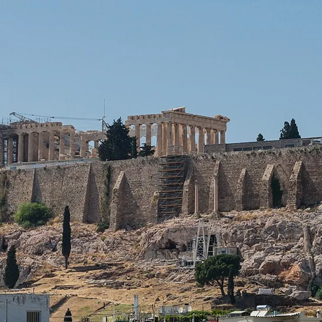
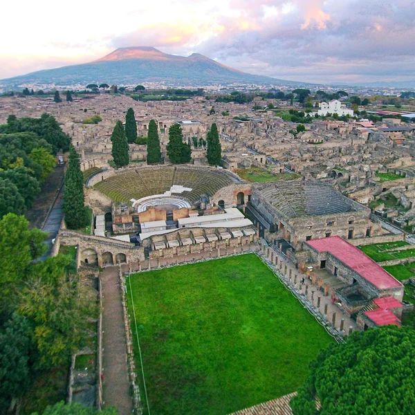
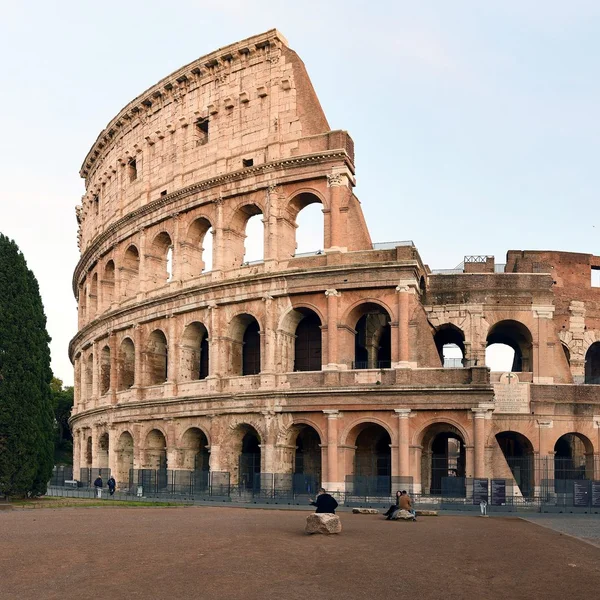
Europe's archaeological record spans classical, medieval, and post-classical periods, with dense clusters around urban cores, religious centers, and imperial frontiers. The map traces corridors from ancient Greece and Rome — the Colosseum, the Acropolis of Athens, Pompeii — to monasteries and fortifications of the later centuries, including Mont-Saint-Michel, Chartres Cathedral, and Meteora.

The Colosseum, Rome
The Colosseum — the largest ancient amphitheater ever built
  • Classical cores include civic complexes, theatres, and forum layouts.
  • Medieval ensembles emphasize castles, cathedrals, and fortified towns.
  • Rural and ceremonial landscapes illustrate shifts from agrarian settlements to pilgrimage routes.

Integration of cultural and natural heritage within Europe

Sites often blend built heritage with surrounding landscapes that shaped daily life. The atlas links architectural narratives to terrain, waterways, and defense lines, helping readers grasp geography's influence on placement and preservation.

  • Fortified landscapes align with river valleys and defensive perimeters.
  • Sacred precincts sit within hilltop and shoreline ecologies that guided access and ritual practice.
  • Urban grids reflect planning principles adapted to local topography and materials.

European site storytelling through timelines

Timeline layers illustrate the evolution from antiquity through the medieval era. You can compare governance, religious influence, and urban form across regions. The knowledge graph situates European sites within a continental chronology of exchange, conflict, and cultural revival.

Compare milestones such as urbanization pulses and fortress expansions across regions — and Europe stops looking like a list of famous ruins and starts reading as one connected story.

  • Compare milestones such as urbanization pulses and fortress expansions across regions.
  • Link patronage networks to architectural transformations and stylistic changes.
  • Cross-reference site statuses, research intensity, and preservation histories along a European arc.

Note: The atlas maps 311++ published archaeological sites, with Europe forming a central continuum in the continental narrative. Explore related resources via the Knowledge graph and the Interactive timeline to situate European archaeology within broader patterns.

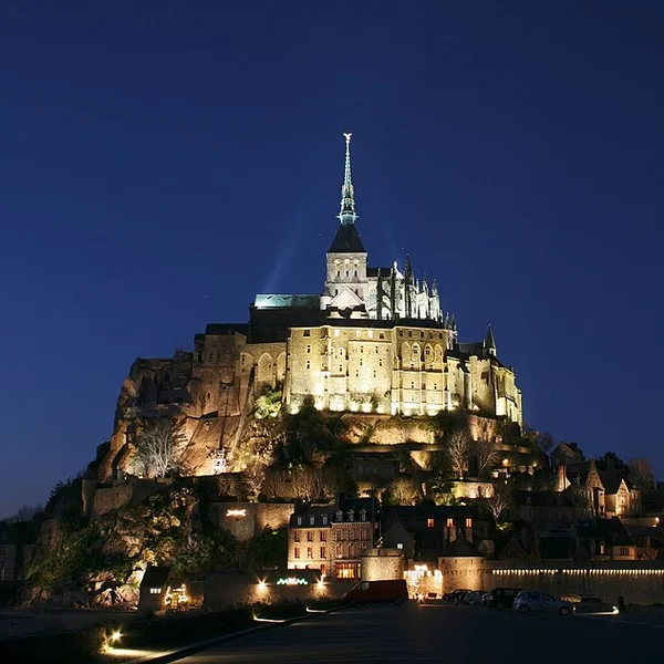
Mont-Saint-Michel at high tide
Mont-Saint-Michel — medieval abbey on a tidal island in Normandy

5. Oceania and Australia: Indigenous Heritage and Coastal Civilizations

Distinctive archaeological themes by region

Oceania presents a mosaic of maritime-adjacent societies, inland traditions, and island-specific adaptations. The atlas highlights settlement patterns, seafaring technologies, and ritual landscapes — including Budj Bim and Uluru — that reflect long-running connections between people and oceanic environments.

Budj Bim cultural landscape
Budj Bim — ancient aquaculture and stone-house settlements in Victoria, Australia
  • Maritime travel and navigation traditions shape site distribution along coastlines and archipelagos.
  • Rock art, shell middens, and ceremonial platforms illuminate ritual practices and social organization.
  • Adaptive architectural forms respond to tropical and subtropical climates, including climate-adapted housing and communal spaces.

Coastal and island site patterns

Coastal belts host dense concentrations of habitation, ritual complexes, and trade hubs. Island geographies reveal layered phases of exploration, resource management, and cultural exchange across straits and lagoons.

  • Harbor-oriented complexes mark connections between island groups and mainland resources.
  • Lagoon and reef sites preserve subsistence strategies tied to marine biodiversity.
  • Defense and ceremonial structures cluster near shorelines where access control was strategic.

Multilingual descriptions and scholarly context for Oceania

The atlas provides multilingual glossaries and region-specific annotations to reflect diverse knowledge traditions. Scholarly notes emphasize dating debates, material culture analyses, and the role of oral histories in interpretation.

Note: The atlas maps 311++ published archaeological sites, with Oceania represented through coastal and island traditions that underscore marine-first lifeways. For cross-regional perspectives, explore the Knowledge graph and the Interactive timeline available within the atlas.


6. How to Explore: Interactive Techniques and Tools

Map interactions: zoom, pan, and layer toggles

Navigate the World Heritage Interactive Map with intuitive zoom and pan controls. Each action reveals richer context for georeferenced sites. Layer toggles allow you to focus on archaeological and cultural heritage by switching between cultural, natural, and mixed designations.

Use continent or era filters to spotlight clusters, then compare density patterns across regions. Grid snapping supports precise site localization in dense urban contexts. Spatial queries reveal adjacent sites to illustrate networks of occupation and exchange.

Petra, the Treasury
Petra — Nabataean capital carved into rose-red sandstone cliffs

Timeline exploration: eras, civilizations, and site status

The integrated timeline filters results by eras such as classical, medieval, or premodern. You can align sites by civilization or cultural tradition for cross-regional comparisons. Site status indicators show preservation efforts, access levels, and research activity where available.

Timeline overlays visualize temporal overlaps between urban centers and ritual landscapes. A side panel highlights transitions in governance and architectural innovations, helping readers trace continental narratives without leaving the map view.

Site pages: metadata, scholarly context, and cross-references

Each site page consolidates metadata, geospatial coordinates, dating, and primary sources. Scholarly notes offer concise context, dating debates, and material culture highlights relevant to archaeology and cultural heritage. Cross-references link to related sites and regional essays.

Cross-references enable quick exploration of connected contexts such as trade networks or religious complexes. Internal links to the knowledge graph support deeper investigations into relationships among sites, eras, and regions.

Start with the map, narrow by era, open three site pages side by side in Compare — that is how an atlas beats a static UNESCO list.


7. Multilingual and Scholarly Context: Enhancing Understanding

Language options and translation considerations

The World Heritage Interactive Map supports multilingual content to aid researchers and students across regions. Original site narratives pair with translations to broaden access to archaeological and cultural contexts. Translation notes illuminate dating debates and terminology differences to preserve scholarly nuance.

How scholarly annotations enrich site narratives

Annotations offer concise dating perspectives, material culture highlights, and archaeologically informed interpretations. They connect individual sites to broader regional chronologies and exchange networks, helping you grasp context beyond surface features.

Cross-continent comparisons through contextual essays

Contextual essays frame similarities and differences in archaeological trajectories across continents. They illuminate how trade routes, urban planning, and ritual practices shaped regional development while honoring unique local histories. They also provide comparative insights without prioritizing any single narrative.

  • Language options — Original narratives plus translations and glossary terms. Why it matters: broader accessibility and precise terminology across cultures.
  • Scholarly annotations — Dating debates, material culture notes, regional context. Why it matters: deeper understanding and credible interpretation for researchers.
  • Contextual essays — Cross-continent comparisons and narrative pathways. Why it matters: helps readers see larger patterns without losing site-specific detail.

The atlas anchors knowledge through cross-referenced connections via the Knowledge graph and related tools, enabling users to explore relationships among sites, eras, and regions.

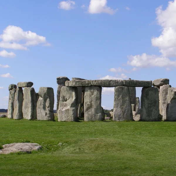
Stonehenge on Salisbury Plain
Stonehenge — Neolithic and Bronze Age monument aligned to the solstices

FAQ

How are sites georeferenced within the atlas?

Each archaeological site is assigned precise coordinates to enable accurate placement on the interactive map. Georeferencing combines historical records, excavation reports, and archival sources to establish location with documented uncertainty where applicable.

The system supports multiple coordinate formats and includes metadata on the source of the placement. This approach ensures a consistent, navigable representation across continents and eras.

What criteria determine site inclusion and categorization?

Inclusion focuses on sites with clear archaeological or cultural significance that contribute to our understanding of past human activity. Each entry is evaluated for plan, monumentality, and historical value within the archaeological narrative.

Sites are categorized as cultural, natural, or mixed in line with established UNESCO criteria, though this atlas emphasizes archaeological and cultural aspects. The classification supports targeted filtering by era, civilization, and region.

Can users contribute data or annotations?

Users can engage with the atlas by reviewing site pages, adding scholarly notes, and suggesting contextual connections through the knowledge graph. Annotations are designed to preserve scholarly integrity and linking accuracy.

Contributions undergo a validation process to maintain reliability and alignment with published sources. Feedback helps refine metadata, cross-references, and contextual essays without altering core geospatial data.

What are common use cases for the FAQ resources?

  • Cross-checking geolocation against published maps for research planning
  • Identifying sites with overlapping cultural traditions or trade networks
  • Exploring provenance and dating debates through annotated notes

How does the atlas handle updates to site data?

Updates follow a structured workflow that incorporates new scholarship, revised dating, and expanded site descriptions. Changes are logged to maintain transparency and traceability in the knowledge base.


Conclusion

Reflections on the value of a continent-spanning archaeological atlas

You gain a cohesive frame for diverse narratives by linking sites across continents. The atlas highlights patterns of exchange, urban development, and cultural continuity that enrich our understanding of ancient worlds. It prioritizes archaeological and cultural heritage with clear context, not isolated lists.

With 311++ published archaeological sites mapped, the atlas provides a georeferenced basis for comparative study. Multilingual content and scholarly annotations help keep complex interpretations accessible and credible.

Future directions for map-based heritage exploration

Expect expanded thematic layers that reflect new discoveries and ongoing excavations, alongside sharper dating debates in the knowledge graph. More precise filtering by era, civilization, and material culture will support deeper analytic work for researchers and educators alike.

Planned enhancements include richer cross-continent narratives that situate sites within broader exchange networks. We will pursue granular metadata, improved source transparency, and interdisciplinary perspectives to strengthen site storytelling.

  • Broaden regional case studies to illuminate local contexts within global patterns
  • Improve accessibility through streamlined language options and glossary terms
  • Increase interoperability with external heritage databases and public catalogs

Where to Go From Here

Explore all 311++ sites on the interactive map, trace connections in the knowledge graph, or compare two sites side by side. For official UNESCO documentation, see the UNESCO World Heritage List and UNESCO interactive map.

如何引用本页

Atlas Anatolia. (2026). UNESCO考古世界遗产地地图:按大洲分列的古代遗址互动指南. Atlas Anatolia. https://atlasanatolia.com/zh/stories/unesco-archaeological-sites-map

内容采用 CC BY-SA 4.0 许可——转载时需注明出处。

常见问题

Is there an interactive map of UNESCO world heritage sites?

Yes. Atlas Anatolia provides an interactive map of UNESCO world heritage archaeological and cultural sites at atlasanatolia.com/sites?unesco=true, with evidence ratings, timelines, and scholarly descriptions for each site. The editorial guide at /stories/unesco-archaeological-sites-map highlights 24 landmark properties across every continent.

How is Atlas Anatolia different from the official UNESCO map?

The UNESCO World Heritage Centre map (whc.unesco.org) is the authoritative source for inscription status and boundaries. Atlas Anatolia adds archaeological depth — excavation timelines, evidence confidence ratings, academic sources, Wikimedia photography, and cross-site comparison tools — for sites in its global database.

How many UNESCO sites does Atlas Anatolia cover?

Atlas Anatolia catalogues all published UNESCO World Heritage archaeological and cultural sites in its database. Use the UNESCO filter at /sites?unesco=true to browse them on the interactive map, or read the continent-by-continent guide in this article.

Can I filter UNESCO sites by continent or era?

Yes. On the Atlas Anatolia interactive map you can filter UNESCO sites by continent, historical era, civilization, and date range using the timeline slider — making it easy to compare, for example, Roman-era UNESCO sites in Europe with Khmer or Indus Valley properties in Asia.

相关遗址

在地图上查看
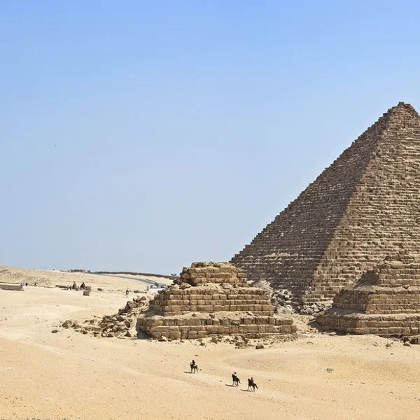
Pyramids of Giza

Pyramids of Giza

Egypt

吉萨金字塔群,作为古王国时期法老胡夫、哈夫拉和门卡拉宏伟的陵墓,代表着古埃及建筑成就与宗教表现力的巅峰。

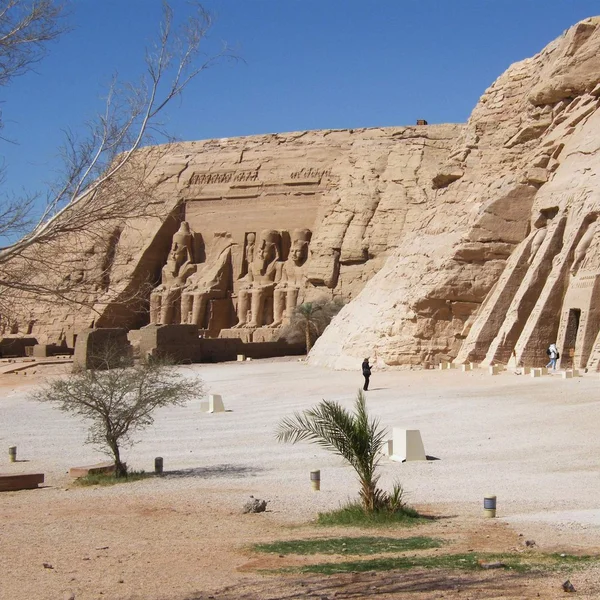
Abu Simbel

Abu Simbel

Egypt

阿布辛贝勒的双岩庙由拉美西斯二世(约公元前1264–前1244年)在努比亚雕刻而成,展示了巨大的雕像和著名的太阳对齐现象;它们在20世纪60年代被著名地搬迁,以避开上涨的纳赛尔湖。

Machu Picchu

Machu Picchu

Peru

马丘比丘是一座约建于公元1450年的印加城堡,坐落在秘鲁的山脊之上。在西班牙征服期间被废弃,直到1911年才为外界所知。

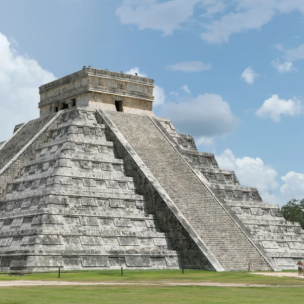
Chichén Itzá

Chichén Itzá

Mexico

一个从公元600年至1200年的重要玛雅-托尔特克祭祀中心,以标志性的库库尔坎阶梯金字塔和中美洲最大的球场之一为特色。

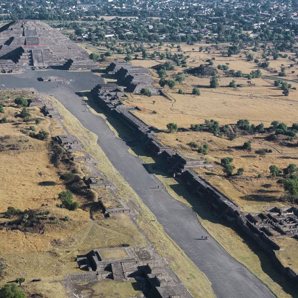
Teotihuacan

Teotihuacan

Mexico

特奥蒂瓦坎,'众神之城',是墨西哥中部的一座广阔大都市和仪式中心,在公元前100年至公元650年间主宰中美洲。

Taj Mahal

Taj Mahal

India

沙贾汗在阿格拉亚穆纳河畔为妻子穆塔兹·玛哈尔建造的白色大理石陵墓——它是莫卧儿建筑的至高杰作,也是地球上参观人数最多的联合国教科文组织世界遗产地之一,在全球对古老历史地标的搜索兴趣中常常名列前茅。
Angkor Wat

Angkor Wat

Cambodia

吴哥窟,世界上最大的宗教建筑群,最初是高棉国王苏耶跋摩二世为供奉毗湿奴而建的印度教寺庙,后来逐渐演变为佛教圣地。

Forbidden City

Forbidden City

China

位于北京心脏地带的庞大明清皇宫——朱红色城墙内近千座建筑——其庭院和城门上演了五个世纪的中国帝王史,至今仍是世界上参观人数最多的历史遗址之一。

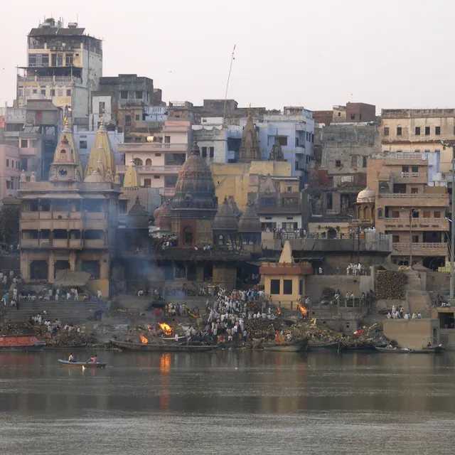
Varanasi

Varanasi

India

世界上最古老且持续有人居住的城市之一——位于北方邦的恒河畔——其河坛、喀什维什瓦纳特神庙以及马尼卡尼卡河坛的焚尸场数千年来吸引着印度教朝圣者、学者和旅行者。

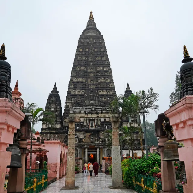
Bodh Gaya

Bodh Gaya

India

悉达多·乔达摩在菩提树下觉悟成道之地——以印度比哈尔邦高耸的摩诃菩提寺为标志——佛教最神圣的朝圣地,也是联合国教科文组织世界遗产,吸引着亚洲各地的信徒。

Colosseum

Colosseum

Italy

罗马斗兽场,罗马标志性的弗拉维露天剧场,曾举办角斗士战斗和公共演出,体现了帝国力量和工程创新。
Acropolis of Athens

Acropolis of Athens

Greece

这座坚固的石灰岩城堡矗立于雅典之上——顶部坐落着帕特农神庙、厄瑞克忒翁神庙和山门——是古典希腊最杰出的建筑群,也是欧洲游客最多的考古遗址之一。

Pompeii

Pompeii

Italy

罗马城市庞贝在公元79年维苏威火山的灾难性喷发中被掩埋,其非凡的保存状态为了解古代日常生活提供了一个无与伦比的窗口。

Mont-Saint-Michel

Mont-Saint-Michel

France

这座坚固的修道院坐落在诺曼底海岸外的一座花岗岩潮汐岛上——一座本笃会修道院,其尖顶轮廓从流沙滩上拔地而起,吸引着数百万游客,是法国最具标志性和最多被拍摄的历史遗址之一。

Chartres Cathedral

Chartres Cathedral

France

位于巴黎西南的高哥特式大教堂——1194年后大规模重建,拥有双塔尖、一座迷宫和176扇彩色玻璃窗——联合国教科文组织的杰作,其几何学、圣物崇拜和蓝色的“沙特尔”玻璃使其成为欧洲研究最多、参观最多的教堂之一。

Meteora

Meteora

Greece

希腊塞萨利的一片砂岩石柱森林——顶上坐落着拜占庭和后拜占庭时期的修道院,可通过阶梯和桥梁到达——是欧洲最引人入胜的宗教景观之一,也是一处联合国教科文组织世界遗产,吸引着数百万游客和朝圣者。

Budj Bim

Budj Bim

Australia

澳大利亚的布吉-比姆文化景观拥有世界上最古老、最庞大的石制水产养殖渠道和堰坝系统之一,由Gunditjmara人约6600年前建造。

Uluru

Uluru

Australia

一座巨大的砂岩独石,从澳大利亚中部沙漠拔地而起348米——对于阿南古族人来说,它是其朱库尔帕(创世时期)律法的活化身,是延续数万年不间断的土著文化实践之岩画与仪式遗存的所在地。乌鲁鲁于1985年归还给阿南古族传统所有者,2019年其山顶永久对登山者关闭,以承认其从未中断的神圣地位。

Great Wall of China

Great Wall of China

China

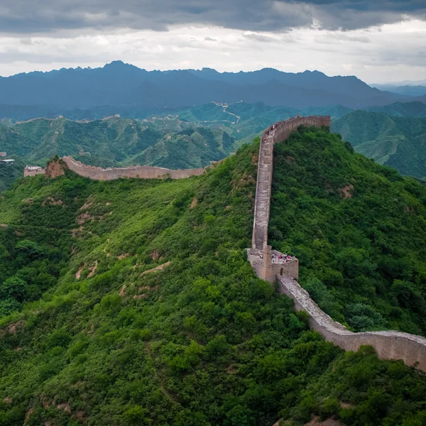
中国北方庞大的边境防御系统——秦代的夯土长城和标志性的明代石砌雉堞——仍然是全球考古图册中最为显眼的一处巨大空白。

Stonehenge

Stonehenge

United Kingdom

巨石阵是位于英格兰威尔特郡的一处史前巨石遗存,分阶段建于公元前3100年至1600年。其标志性的萨尔森石和蓝石构成了一个兼具仪式与天文意义的复合体。

Petra

Petra

Jordan

佩特拉,公元前约300年至公元700年间为纳巴泰王国首都,以其岩石凿刻的陵墓和复杂的水利系统闻名,被列为联合国教科文组织世界遗产地,也是世界新七大奇迹之一。
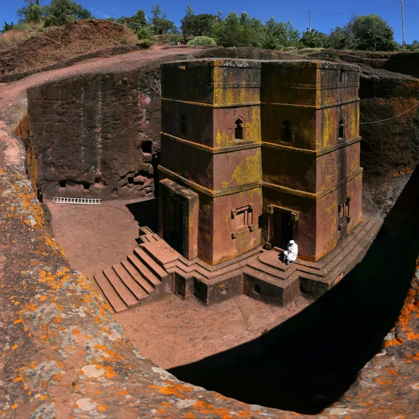
Lalibela

Lalibela

Ethiopia

一处由11座独石凿成的教堂群,建于12至13世纪,代表了埃塞俄比亚中世纪建筑与基督教奉献精神的巅峰。

Old City of Jerusalem

Old City of Jerusalem

Israel

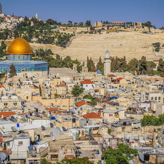
耶路撒冷的有围墙的心脏地带——约一平方公里,对犹太教、基督教和伊斯兰教而言神圣无比——西墙(哭墙)、圣墓教堂和圆顶清真寺矗立在奥斯曼时代的城墙内,层层叠叠着铁器时代、罗马、拜占庭和中世纪的考古遗迹。
更多故事