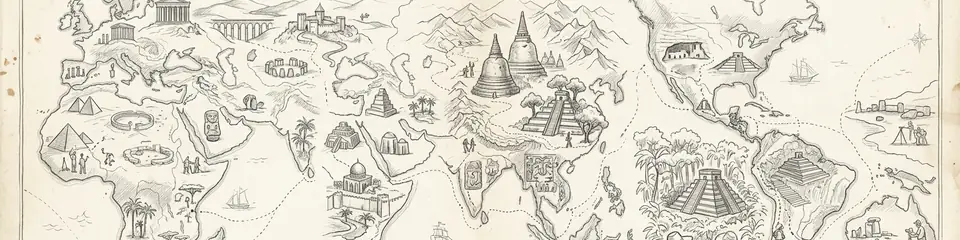
Atlas Anatolia is an interactive map of UNESCO world heritage sites focused on archaeological and cultural properties worldwide. This guide complements the official UNESCO World Heritage List with evidence-based narratives, per-site timelines, and scholarly context across 319 published archaeological sites.
TL;DR: An interactive, continent-spanning atlas maps 319 archaeological sites, focusing on evidence-based narratives of ancient civilizations and cultural heritage. Content is organized by continent with map-based exploration, multilingual narratives, scholarly context, and cross-referenced tools like a knowledge graph and interactive timeline. Designed for researchers and learners, it emphasizes credible annotations, cross-continental comparisons, and ongoing updates to reflect new scholarship and data quality.
"World Heritage is not a badge of beauty alone; it is a pledge that humanity will refuse to forget what the earth still holds."
— Paraphrase of the UNESCO World Heritage Convention spirit (1972)
India
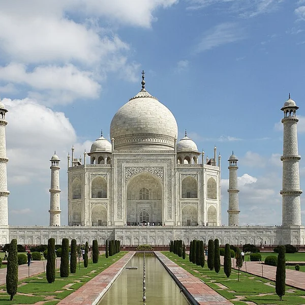
Taj Mahal
The white-marble mausoleum Shah Jahan built on the Yamuna riverbank at Agra for his wife Mumtaz Mahal — the su
Italy
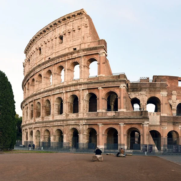
Colosseum
The Colosseum, Rome's iconic Flavian Amphitheatre, hosted gladiatorial combats and public spectacles, embodyin
Jordan
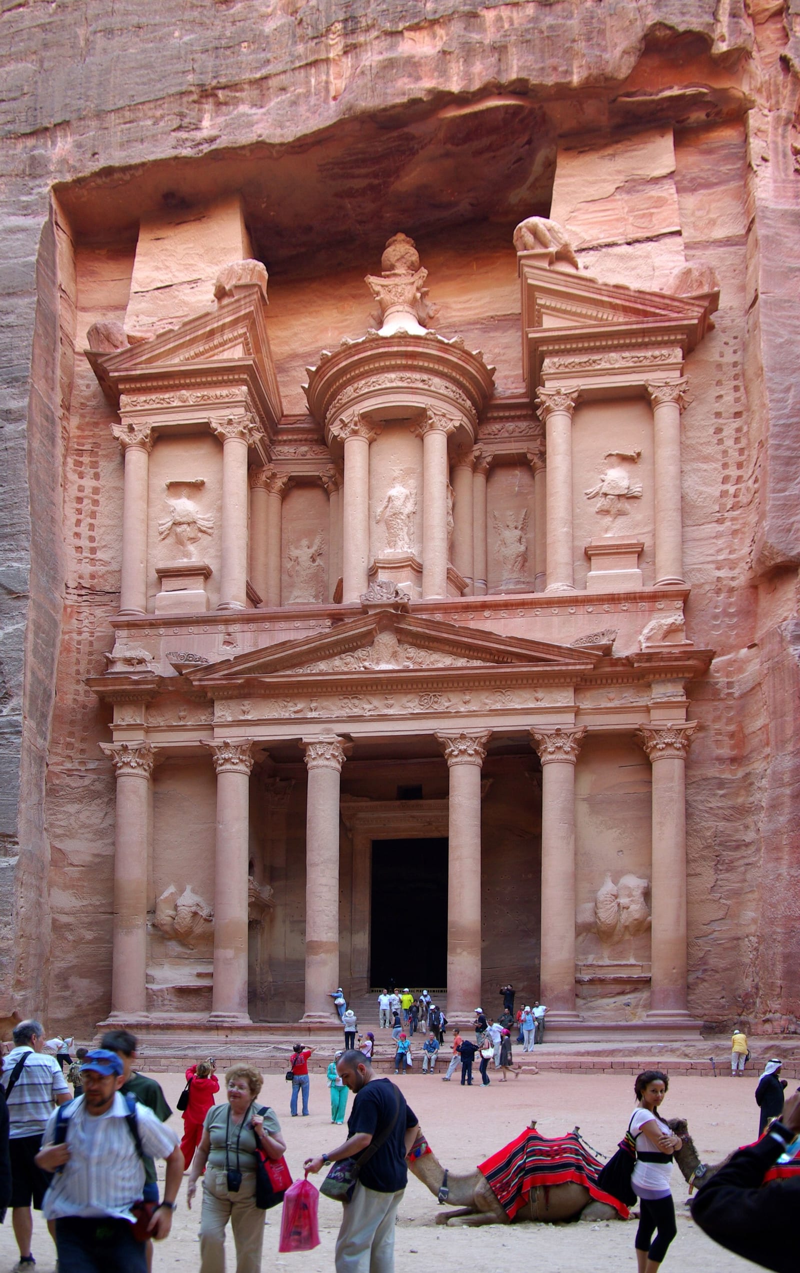
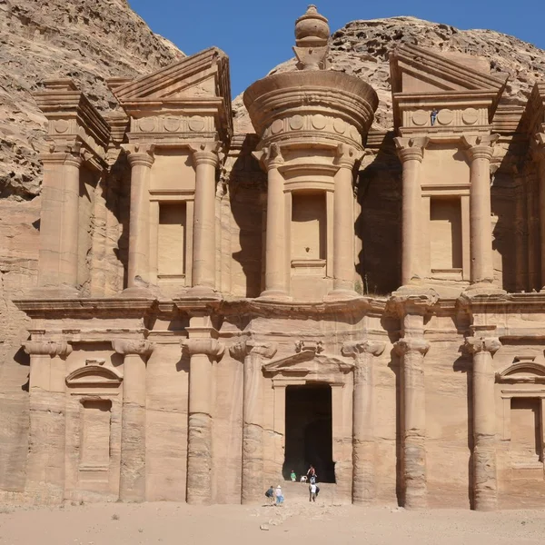
Petra
Petra, the Nabataean capital from ~300 BCE to 700 CE, is famed for its rock-cut tombs and sophisticated water
Peru
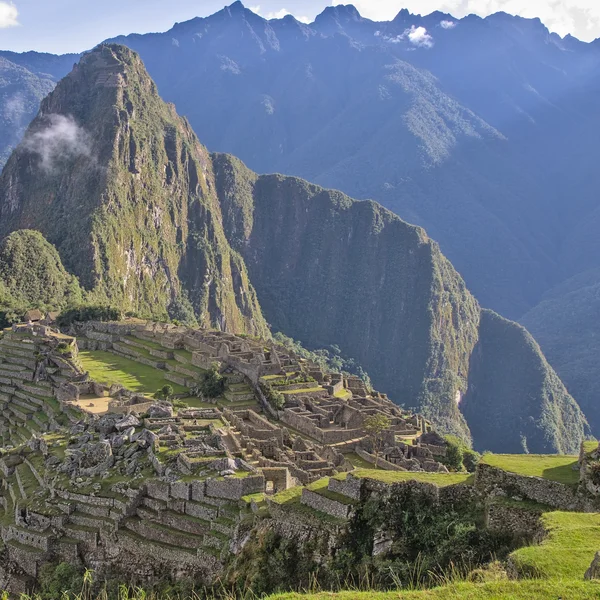
Machu Picchu
An Inca citadel built c. 1450 CE, Machu Picchu sits atop a mountain ridge in Peru. Abandoned during the Spanis
Egypt
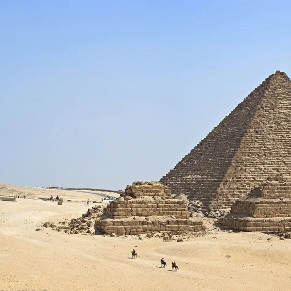
Pyramids of Giza
The Pyramids of Giza, monumental tombs of Old Kingdom pharaohs Khufu, Khafre, and Menkaure, represent the zeni

Cambodia
Angkor Wat
Angkor Wat, the world’s largest religious monument, was built as a Hindu temple dedicated to Vishnu by Khmer k
Introduction
Purpose and scope of the interactive atlas
Sites are organized by continent to illuminate regional histories and cross-cultural connections. Each section highlights iconic landmarks alongside lesser-known locales to reveal patterns of settlement, trade, and cultural exchange.
Key features: map-based exploration, multilingual content, scholarly context
- Map-based exploration: Georeferenced maps, interactive layers, and spatial queries to navigate sites on a global canvas.
- Multilingual content to broaden accessibility and support diverse readers.
- Scholarly context through metadata, timelines, and cross-references that anchor each site in its historical framework.
We emphasize archaeological and cultural world heritage properties while excluding natural-only designations. The result is a focused, evidence-driven guide that pairs engaging storytelling with rigorous context.
World heritage is not a list of isolated monuments — it is a map of how human societies built, traded, worshipped, and governed across continents. An archaeological atlas makes those connections visible.
1. Africa: Ancient Civilizations and Archaeological Highlights
Major clusters of sites by region
Africa's archaeological landscape centers on river valleys, coastal belts, and desert trade corridors. The Nile corridor anchors Northeast Africa with monumental tombs, temples, and urban layouts that illuminate religious life and administration — from the Pyramids of Giza to Abu Simbel. East Africa shows inland networks linking highland settlements with oases along caravan routes. The Sahel and Sahara preserve desert-adapted settlements and rock art that reveal long term cultural resilience. West Africa hosts urban centers and trade hubs connected to trans-Saharan exchanges. Southern Africa preserves rock art traditions and early urban forms shaped by local ecologies.
Egypt
Pyramids of Giza
The Pyramids of Giza, monumental tombs of Old Kingdom pharaohs Khufu, Khafre, and Menkaure, represent the zeni
Egypt
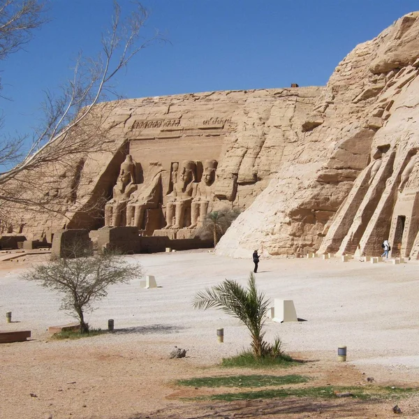
Abu Simbel
The twin rock temples of Abu Simbel, carved by Ramesses II (c. 1264–1244 BCE) in Nubia, showcase colossal stat
Ethiopia
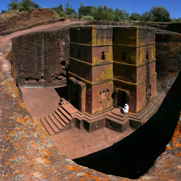
Lalibela
A complex of 11 monolithic rock-hewn churches carved in the 12th–13th centuries, representing the pinnacle of
Notable eras and civilizations represented
Key periods include kingdoms along the Nile and Nile Delta, the emergence of monumental architecture in west and northeast Africa, and sophisticated urban planning in interior regions. The record reflects a continuity of settlement strategies, evolving trade networks, and evolving governance. These choices emphasize long duration cultural development, from petroglyphs to monumental ensembles, that illuminate community life and ritual practice.
Interactive map tips for Africa
- Use continent-wide filters to isolate cultural sites from mixed or uncertain designations.
- Toggle era layers to compare transitions from early monumental activity to later urbanization.
- Roll over markers to view metadata, dating ranges, and regional affiliations.
- Compare clusters side by side with the knowledge graph to trace connections between civilizations.
2. Americas: Pre-Columbian and Early Historic Sites
Cultural landscapes and urban centers across the continents
The Americas present dense cultural landscapes that blend ceremonial spaces, fortified settlements, and ceremonial plazas with everyday neighborhoods. From the urban cores of Mesoamerican and Andean cities — Machu Picchu, Chichén Itzá, Teotihuacán — to expansive ceremonial plains, these sites reveal social organization, ritual life, and architectural innovation. Coastal trade networks and inland hinterlands show how communities connected across vast distances.
Peru
Machu Picchu
An Inca citadel built c. 1450 CE, Machu Picchu sits atop a mountain ridge in Peru. Abandoned during the Spanis
Mexico
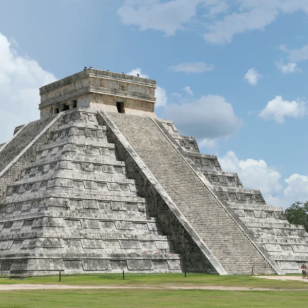
Chichén Itzá
A major Maya-Toltec ceremonial center from 600–1200 CE, featuring the iconic stepped pyramid of Kukulcán and o
Mexico
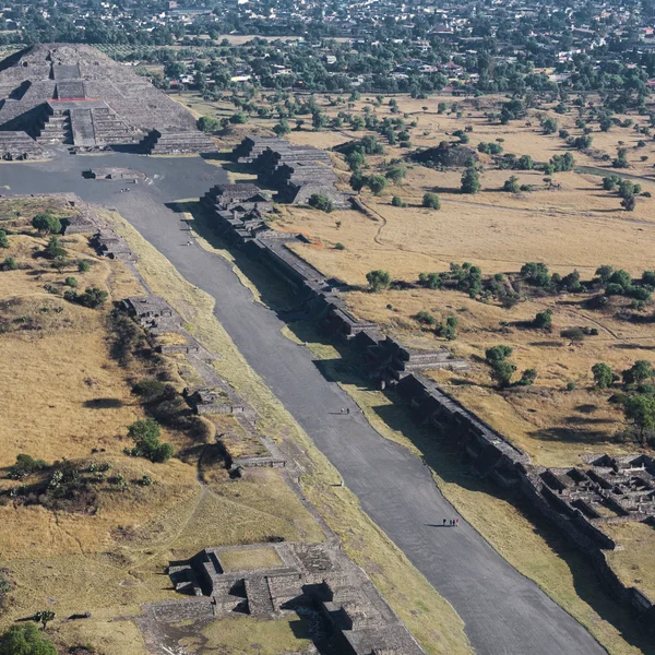
Teotihuacan
Teotihuacan, the 'City of the Gods,' was a vast metropolis and ceremonial center in central Mexico, dominating
!Machu Picchu in the Andean cloud forest
- Urban footprints include grid plans, elevated reservoirs, and ceremonial centers that guided daily life.
- Cultural landscapes often encompass harbors, terraced fields, and sacred precincts integrated into the surrounding terrain.
- Architectural diversity ranges from monumental pyramids to adobe platforms and stone complexes.
Chronologies and eras showcased
The sequence spans early agricultural communities, peak urbanization, and transitional periods tied to contact and exchange networks. Chronologies highlight rise and decline phases shaped by environmental pressures, sociopolitical dynamics, and intercultural interactions. The archive emphasizes continuity in ritual practice alongside shifts in governance and resource management.
- Preclassic to Classic transitions in Mesoamerica illustrate evolving political and ceremonial architectures.
- Andean civilizations show progression from agricultural terraces to centralized administrative hubs.
- Post-contact layers reveal syncretic practices and adaptation within colonial-era settings.
Filter by era to align New World sites along a common temporal axis — and you begin to see contemporaneous developments that no single-site guide can show.
Using the timeline to compare New World sites
- Filter by era to align sites along a common temporal axis and observe contemporaneous developments.
- Compare site statuses, such as preservation levels or research intensity, across regions.
- Leverage the knowledge graph to trace trade routes, religious networks, and administrative hierarchies that linked communities.
3. Asia: Ancient Empires and Transcontinental Exchange
Key civilizations and their archaeological footprints
Asia hosts a tapestry of long standing civilizations whose archaeology spans monumental architecture, urban planning, and sacred landscapes. From the riverine civilizations of the Ganges and Yangtze basins to the imperial capitals and ceremonial centers of the Eurasian heartland — Taj Mahal, Angkor Wat, the Forbidden City, Varanasi, Bodh Gaya, Topkapi Palace — material traces reveal governance, religion, and daily life across millennia.
India
Taj Mahal
The white-marble mausoleum Shah Jahan built on the Yamuna riverbank at Agra for his wife Mumtaz Mahal — the su
Cambodia
Angkor Wat
Angkor Wat, the world’s largest religious monument, was built as a Hindu temple dedicated to Vishnu by Khmer k

China
Forbidden City
The vast Ming–Qing imperial palace at the heart of Beijing — nearly a thousand buildings within vermilion wall
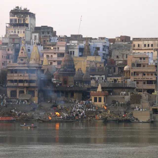
India
Varanasi
One of the world's oldest continuously inhabited cities — on the Ganges in Uttar Pradesh — whose ghats, Kashi
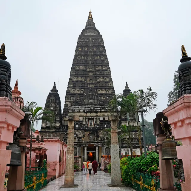
India
Bodh Gaya
The place where Siddhartha Gautama attained enlightenment under the Bodhi tree — marked by the soaring Mahabod
- Central Asian cores show caravan city layouts and fortress complexes integral to transcontinental exchange.
- South Asian urban sanctuaries, royal palaces, and temple precincts illuminate ritual and statecraft.
- East Asian imperial sites preserve grid plans, defensive works, and religious syncretism across dynastic changes.
Interaction networks and trade routes represented
Archaeological footprints map the movement of goods, people, and ideas along long-distance networks. Road stations, harbor facilities, and terracotta symbols indicate the scale of exchange across deserts, steppes, and coastlines. The interplay of cultural influences is evident in hybrid architectural forms and pilgrimage corridors linking sacred spaces.
- Trade corridors connect resource-rich hinterlands with urban centers and ports.
- Religious and scholarly centers function as nodes within larger exchange webs.
- Material culture shows shared technologies, such as metallurgy and masonry techniques, transmitted across regions.
Navigating Asia's sites with filters and layers
- Use era filters to align sites from early urbanization to imperial reorganization.
- Apply civilization tags to compare administrative capitals with religious complexes.
- Toggle layers for architectural styles, defensive works, or ceremonial landscapes to reveal regional patterns.
Note: The atlas maps 319 published archaeological footprints, with geopolitical and scholarly context to support comparative study. For broader relationships, explore the Knowledge graph and the Interactive timeline to place Asian sites within continental narratives.
4. Europe: Classical to Medieval Archeology on a Continent Scale
Concentration of sites by era and culture
Europe's archaeological record spans classical, medieval, and post-classical periods, with dense clusters around urban cores, religious centers, and imperial frontiers. The map traces corridors from ancient Greece and Rome — the Colosseum, the Acropolis of Athens, Pompeii — to monasteries and fortifications of the later centuries, including Mont-Saint-Michel, Chartres Cathedral, and Meteora.
Italy
Colosseum
The Colosseum, Rome's iconic Flavian Amphitheatre, hosted gladiatorial combats and public spectacles, embodyin
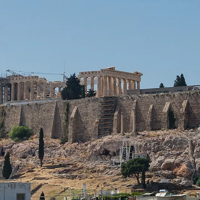
Greece
Acropolis of Athens
The fortified limestone citadel rising above Athens — crowned by the Parthenon, Erechtheion, and Propylaea — t
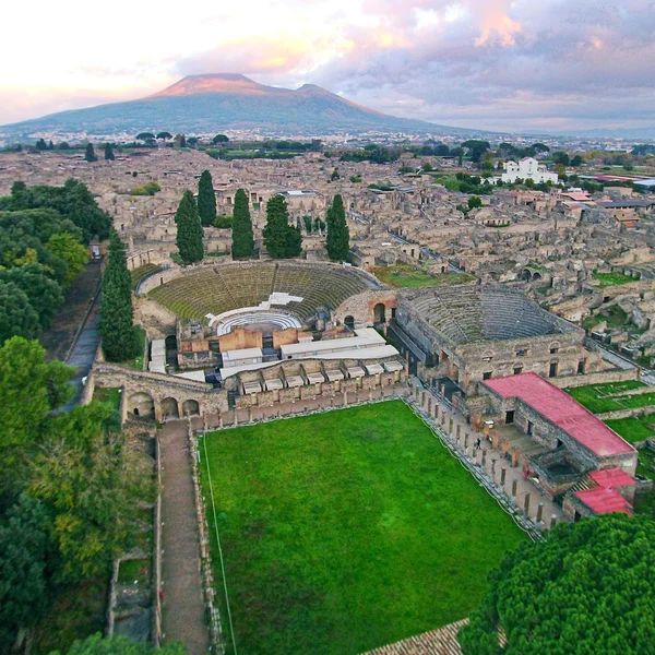
Italy
Pompeii
The Roman city of Pompeii was buried in the catastrophic eruption of Mount Vesuvius in 79 CE, its extraordinar

France
Mont-Saint-Michel
The fortified abbey on a granite tidal island off the Normandy coast — a Benedictine monastery whose spire-top

France
Chartres Cathedral
The High Gothic cathedral southwest of Paris — largely rebuilt after 1194 with twin spires, a labyrinth, and 1

Greece
Meteora
A forest of sandstone pinnacles in Thessaly, Greece — crowned by Byzantine and post-Byzantine monasteries reac
- Classical cores include civic complexes, theatres, and forum layouts.
- Medieval ensembles emphasize castles, cathedrals, and fortified towns.
- Rural and ceremonial landscapes illustrate shifts from agrarian settlements to pilgrimage routes.
Integration of cultural and natural heritage within Europe
Sites often blend built heritage with surrounding landscapes that shaped daily life. The atlas links architectural narratives to terrain, waterways, and defense lines, helping readers grasp geography's influence on placement and preservation.
- Fortified landscapes align with river valleys and defensive perimeters.
- Sacred precincts sit within hilltop and shoreline ecologies that guided access and ritual practice.
- Urban grids reflect planning principles adapted to local topography and materials.
European site storytelling through timelines
Timeline layers illustrate the evolution from antiquity through the medieval era. You can compare governance, religious influence, and urban form across regions. The knowledge graph situates European sites within a continental chronology of exchange, conflict, and cultural revival.
Compare milestones such as urbanization pulses and fortress expansions across regions — and Europe stops looking like a list of famous ruins and starts reading as one connected story.
- Compare milestones such as urbanization pulses and fortress expansions across regions.
- Link patronage networks to architectural transformations and stylistic changes.
- Cross-reference site statuses, research intensity, and preservation histories along a European arc.
Note: The atlas maps 319 published archaeological sites, with Europe forming a central continuum in the continental narrative. Explore related resources via the Knowledge graph and the Interactive timeline to situate European archaeology within broader patterns.
!Mont-Saint-Michel at high tide
5. Oceania and Australia: Indigenous Heritage and Coastal Civilizations
Distinctive archaeological themes by region
Oceania presents a mosaic of maritime-adjacent societies, inland traditions, and island-specific adaptations. The atlas highlights settlement patterns, seafaring technologies, and ritual landscapes — including Budj Bim and Uluru — that reflect long-running connections between people and oceanic environments.
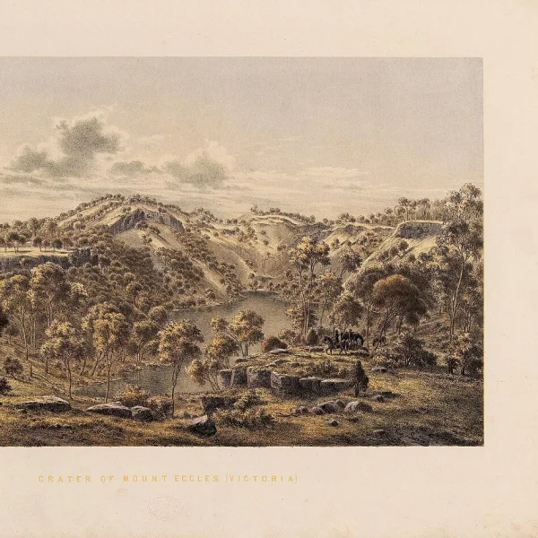

- Maritime travel and navigation traditions shape site distribution along coastlines and archipelagos.
- Rock art, shell middens, and ceremonial platforms illuminate ritual practices and social organization.
- Adaptive architectural forms respond to tropical and subtropical climates, including climate-adapted housing and communal spaces.
Coastal and island site patterns
Coastal belts host dense concentrations of habitation, ritual complexes, and trade hubs. Island geographies reveal layered phases of exploration, resource management, and cultural exchange across straits and lagoons.
- Harbor-oriented complexes mark connections between island groups and mainland resources.
- Lagoon and reef sites preserve subsistence strategies tied to marine biodiversity.
- Defense and ceremonial structures cluster near shorelines where access control was strategic.
Multilingual descriptions and scholarly context for Oceania
The atlas provides multilingual glossaries and region-specific annotations to reflect diverse knowledge traditions. Scholarly notes emphasize dating debates, material culture analyses, and the role of oral histories in interpretation.
Note: The atlas maps 319 published archaeological sites, with Oceania represented through coastal and island traditions that underscore marine-first lifeways. For cross-regional perspectives, explore the Knowledge graph and the Interactive timeline available within the atlas.
6. How to Explore: Interactive Techniques and Tools
Map interactions: zoom, pan, and layer toggles
Navigate the World Heritage Interactive Map with intuitive zoom and pan controls. Each action reveals richer context for georeferenced sites. Layer toggles allow you to focus on archaeological and cultural heritage by switching between cultural, natural, and mixed designations.
Use continent or era filters to spotlight clusters, then compare density patterns across regions. Grid snapping supports precise site localization in dense urban contexts. Spatial queries reveal adjacent sites to illustrate networks of occupation and exchange.
Jordan
Petra
Petra, the Nabataean capital from ~300 BCE to 700 CE, is famed for its rock-cut tombs and sophisticated water
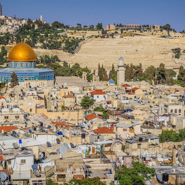
Israel
Old City of Jerusalem
The walled heart of Jerusalem — roughly one square kilometre sacred to Judaism, Christianity, and Islam — wher
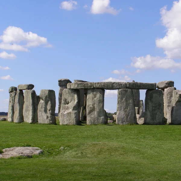
United Kingdom
Stonehenge
Stonehenge is a prehistoric megalithic monument in Wiltshire, England, erected in phases between 3100 and 1600
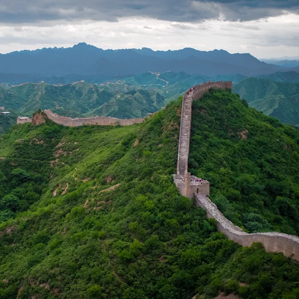
China
Great Wall of China
The vast frontier fortification system of northern China — rammed-earth Qin walls and the iconic stone Ming ba
Timeline exploration: eras, civilizations, and site status
The integrated timeline filters results by eras such as classical, medieval, or premodern. You can align sites by civilization or cultural tradition for cross-regional comparisons. Site status indicators show preservation efforts, access levels, and research activity where available.
Timeline overlays visualize temporal overlaps between urban centers and ritual landscapes. A side panel highlights transitions in governance and architectural innovations, helping readers trace continental narratives without leaving the map view.
Site pages: metadata, scholarly context, and cross-references
Each site page consolidates metadata, geospatial coordinates, dating, and primary sources. Scholarly notes offer concise context, dating debates, and material culture highlights relevant to archaeology and cultural heritage. Cross-references link to related sites and regional essays.
Cross-references enable quick exploration of connected contexts such as trade networks or religious complexes. Internal links to the knowledge graph support deeper investigations into relationships among sites, eras, and regions.
Start with the map, narrow by era, open three site pages side by side in Compare — that is how an atlas beats a static UNESCO list.
7. Multilingual and Scholarly Context: Enhancing Understanding
Language options and translation considerations
The World Heritage Interactive Map supports multilingual content to aid researchers and students across regions. Original site narratives pair with translations to broaden access to archaeological and cultural contexts. Translation notes illuminate dating debates and terminology differences to preserve scholarly nuance.
How scholarly annotations enrich site narratives
Annotations offer concise dating perspectives, material culture highlights, and archaeologically informed interpretations. They connect individual sites to broader regional chronologies and exchange networks, helping you grasp context beyond surface features.
Cross-continent comparisons through contextual essays
Contextual essays frame similarities and differences in archaeological trajectories across continents. They illuminate how trade routes, urban planning, and ritual practices shaped regional development while honoring unique local histories. They also provide comparative insights without prioritizing any single narrative.
- Language options — Original narratives plus translations and glossary terms. Why it matters: broader accessibility and precise terminology across cultures.
- Scholarly annotations — Dating debates, material culture notes, regional context. Why it matters: deeper understanding and credible interpretation for researchers.
- Contextual essays — Cross-continent comparisons and narrative pathways. Why it matters: helps readers see larger patterns without losing site-specific detail.
The atlas anchors knowledge through cross-referenced connections via the Knowledge graph and related tools, enabling users to explore relationships among sites, eras, and regions.
!Stonehenge on Salisbury Plain
FAQ
How are sites georeferenced within the atlas?
Each archaeological site is assigned precise coordinates to enable accurate placement on the interactive map. Georeferencing combines historical records, excavation reports, and archival sources to establish location with documented uncertainty where applicable.
The system supports multiple coordinate formats and includes metadata on the source of the placement. This approach ensures a consistent, navigable representation across continents and eras.
What criteria determine site inclusion and categorization?
Inclusion focuses on sites with clear archaeological or cultural significance that contribute to our understanding of past human activity. Each entry is evaluated for plan, monumentality, and historical value within the archaeological narrative.
Sites are categorized as cultural, natural, or mixed in line with established UNESCO criteria, though this atlas emphasizes archaeological and cultural aspects. The classification supports targeted filtering by era, civilization, and region.
Can users contribute data or annotations?
Users can engage with the atlas by reviewing site pages, adding scholarly notes, and suggesting contextual connections through the knowledge graph. Annotations are designed to preserve scholarly integrity and linking accuracy.
Contributions undergo a validation process to maintain reliability and alignment with published sources. Feedback helps refine metadata, cross-references, and contextual essays without altering core geospatial data.
What are common use cases for the FAQ resources?
- Cross-checking geolocation against published maps for research planning
- Identifying sites with overlapping cultural traditions or trade networks
- Exploring provenance and dating debates through annotated notes
How does the atlas handle updates to site data?
Updates follow a structured workflow that incorporates new scholarship, revised dating, and expanded site descriptions. Changes are logged to maintain transparency and traceability in the knowledge base.
Conclusion
Reflections on the value of a continent-spanning archaeological atlas
You gain a cohesive frame for diverse narratives by linking sites across continents. The atlas highlights patterns of exchange, urban development, and cultural continuity that enrich our understanding of ancient worlds. It prioritizes archaeological and cultural heritage with clear context, not isolated lists.
With 319 published archaeological sites mapped, the atlas provides a georeferenced basis for comparative study. Multilingual content and scholarly annotations help keep complex interpretations accessible and credible.
Future directions for map-based heritage exploration
Expect expanded thematic layers that reflect new discoveries and ongoing excavations, alongside sharper dating debates in the knowledge graph. More precise filtering by era, civilization, and material culture will support deeper analytic work for researchers and educators alike.
Planned enhancements include richer cross-continent narratives that situate sites within broader exchange networks. We will pursue granular metadata, improved source transparency, and interdisciplinary perspectives to strengthen site storytelling.
- Broaden regional case studies to illuminate local contexts within global patterns
- Improve accessibility through streamlined language options and glossary terms
- Increase interoperability with external heritage databases and public catalogs
India
Taj Mahal
The white-marble mausoleum Shah Jahan built on the Yamuna riverbank at Agra for his wife Mumtaz Mahal — the su
Italy
Colosseum
The Colosseum, Rome's iconic Flavian Amphitheatre, hosted gladiatorial combats and public spectacles, embodyin
Jordan
Petra
Petra, the Nabataean capital from ~300 BCE to 700 CE, is famed for its rock-cut tombs and sophisticated water
Cambodia
Angkor Wat
Angkor Wat, the world’s largest religious monument, was built as a Hindu temple dedicated to Vishnu by Khmer k
Peru
Machu Picchu
An Inca citadel built c. 1450 CE, Machu Picchu sits atop a mountain ridge in Peru. Abandoned during the Spanis
Egypt
Pyramids of Giza
The Pyramids of Giza, monumental tombs of Old Kingdom pharaohs Khufu, Khafre, and Menkaure, represent the zeni
Where to Go From Here
Explore all 319 sites on the interactive map, trace connections in the knowledge graph, or compare two sites side by side. For official UNESCO documentation, see the UNESCO World Heritage List and UNESCO interactive map.