
콘텐츠로 건너뛰기
Atlas Anatolia
디그
뉴스술라웨시 빙하기 치아에서 빈랑 사용 25,000년 전까지 소급카스타모누 폼페이오폴리스 바실리카에서 로마 모자이크와 에로스 두상 발견
Aerial view of Mound A and the concentric earthen ridges at Poverty Point, Louisiana

Wikimedia Commons

Continent Record

Oldest Monument in North America

기념물유네스코

Poverty Point

Seyfi Cem Baskin

1700 기원전 – 1100 기원전

A vast complex of concentric earthen ridges and massive mounds built around 1700 BCE by hunter-gatherers in what is now northeastern Louisiana — centuries before agriculture reached the region and more than a thousand years before the first Egyptian pyramids' contemporaries built anything comparable in North America. Poverty Point is the largest and most complex set of earthworks built anywhere in the Americas before 1000 BCE, built entirely by non-farming societies using only baskets of earth carried by hand.

311
관심 59

위치

West Carroll Parish · Louisiana · 미국

32.64°N · 91.41°W · 북아메리카

Built

c. 1700–1100 BCE, Late Archaic period — by non-agricultural hunter-gatherers

Ridges

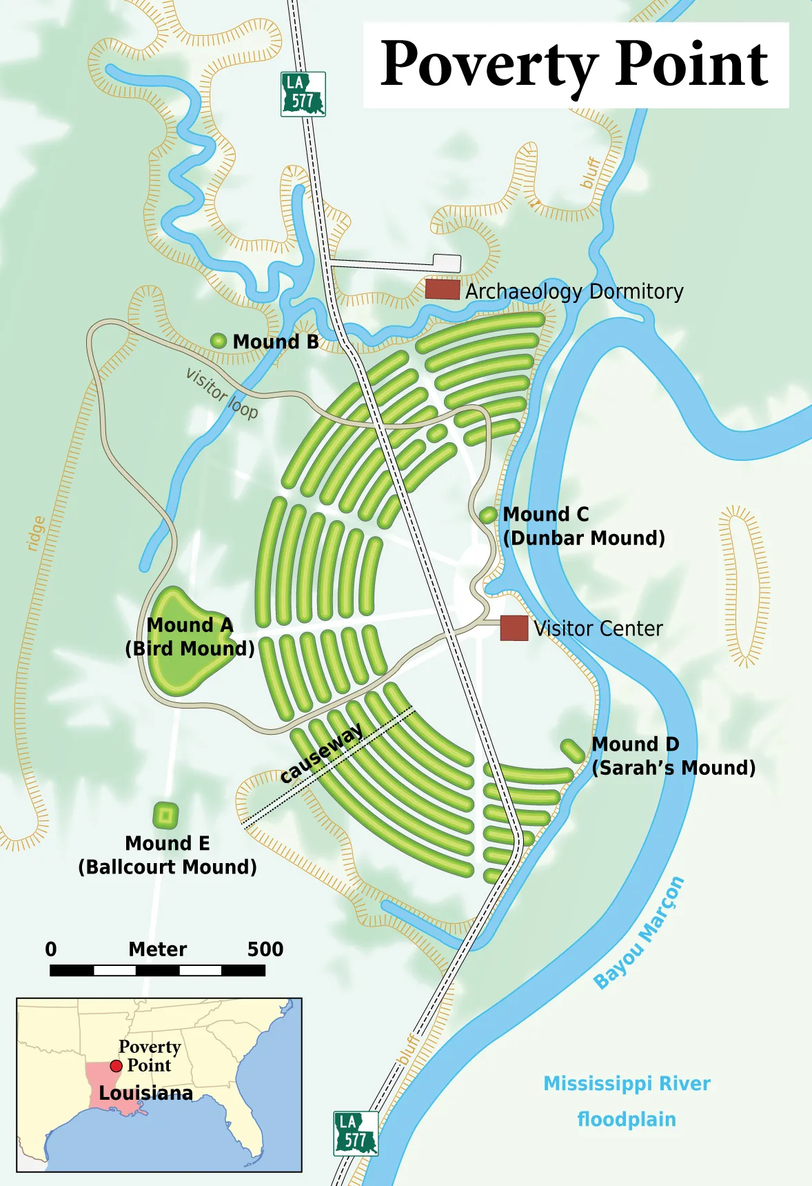
Six concentric C-shaped earthen ridges, ~1.2 km in overall diameter

Mound A

~22 m tall, ~238,000 m³ of soil, apparently built in a single rapid episode

Total earth moved

Estimated 750,000 m³, carried entirely by hand in baskets

UNESCO

World Heritage Site 2014

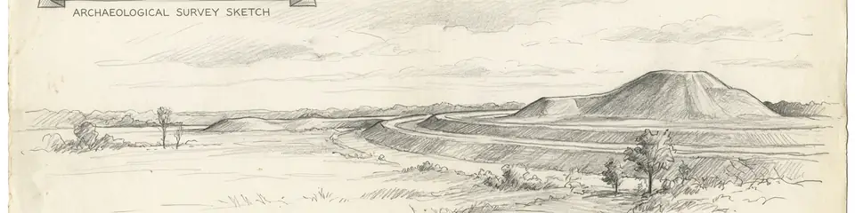
Graphite pencil sketch banner of Poverty Point

“Poverty Point overturns the long-held assumption that monumental construction requires agriculture.”

위치

개요

Poverty Point sits on a bluff above the Mississippi River floodplain in what is now West Carroll Parish, Louisiana. Between roughly 1700 and 1100 BCE, during the Late Archaic period — long before the introduction of agriculture, pottery, or metal tools to the region — the people who built and used this site constructed one of the largest and most sophisticated earthwork complexes anywhere in the pre-Columbian Americas.

The site's central feature is a set of six concentric, C-shaped earthen ridges arranged around a flat plaza, together spanning roughly three-quarters of a mile in diameter. The ridges, originally standing up to two metres high and several metres wide, are thought to have supported residential structures, arranged in a pattern that suggests deliberate social and possibly astronomical organisation. Rising above the ridges is Mound A, a massive earthen mound roughly 22 metres tall and containing an estimated 238,000 cubic metres of soil — one of the largest earthen constructions in North America — apparently built in a single, rapid episode of intensive labour lasting perhaps only weeks or months, based on the absence of weathering layers within its fill.

What makes Poverty Point extraordinary is that its builders were not farmers. Unlike the later Mississippian mound-building cultures who supported large-scale construction with maize agriculture, the Poverty Point culture subsisted on hunting, fishing, and gathering along the resource-rich Mississippi floodplain. The scale of construction — an estimated 750,000 cubic metres of earth moved by hand, basket by basket, without draft animals or wheeled transport — implies a level of labour coordination, surplus food storage, and social organisation not previously believed possible among non-agricultural societies.

Archaeologists have also recovered evidence of an extensive long-distance trade network extending across much of North America: stone tools and raw materials from the site have been sourced to the Great Lakes region, the Appalachian Mountains, and the Ozark Plateau, suggesting Poverty Point functioned as a major hub in a continent-spanning exchange system nearly 3,700 years ago. Small fired clay objects known as Poverty Point Objects, used for cooking in the absence of suitable local stone for heating, are found by the thousands and serve as a diagnostic marker of the culture across the wider region. Poverty Point was inscribed as a UNESCO World Heritage Site in 2014.

중요성

Poverty Point overturns the long-held assumption that monumental construction requires agriculture. Its builders achieved a scale of earthmoving and social coordination associated elsewhere in the world only with early farming states, using nothing but hunting, fishing, and gathering to sustain a large, mobilised workforce — challenging basic assumptions in the archaeology of social complexity. The site's long-distance trade connections demonstrate that sophisticated exchange networks linking distant regions of North America existed millennia before the continent's first agricultural societies, reshaping understanding of how early hunter-gatherer societies organised economically across vast distances. As the largest and most complex earthwork construction in the Americas built before 1000 BCE, Poverty Point set a precedent for monumental earthen architecture that later cultures — including the Adena, Hopewell, and Mississippian mound-builders — would develop further over the following three thousand years, making it a foundational site for understanding the deep roots of North American monumental construction.

증거와 해석

확립된 사실과 논쟁 중인 사항을 구분합니다.

잘 확립된 사실

3
  • Radiocarbon dating of charcoal and organic material from the ridges and Mound A place the main construction phases between approximately 1700 and 1100 BCE.
  • Soil micromorphology analysis of Mound A found no weathering horizons within the fill, indicating the mound was built in a single continuous construction episode rather than accumulated gradually over years.
  • Sourcing studies of stone tools and raw materials recovered at the site have traced their origins to the Great Lakes, Appalachian, and Ozark regions, confirming long-distance exchange networks.

학술적 추론

1
  • The precise social organisation that mobilised the labour required for construction is inferred from the scale of earthmoving rather than documented directly, as the Poverty Point culture left no written records.

논쟁 중인 해석

1
  • Interpretations of the ridges' function — as residential terraces, ceremonial space, or a combination of both — remain debated, since post-hole evidence for structures atop the ridges is limited.

발견과 발굴

1955–1956

James Ford and Clarence Webb survey

First systematic archaeological survey and excavation establishing the site's scale and Late Archaic date.

2009

Mound A coring and dating study

Detailed sediment coring and micromorphology study demonstrating Mound A was built rapidly, in a single episode.

커뮤니티 사진

당신의 경험을 공유하세요

이 유적지를 방문하셨나요? 다른 탐험가들을 위해 사진을 업로드해 보세요.

이 페이지 인용 방법

Atlas Anatolia. (1700). Poverty Point. Atlas Anatolia. https://atlasanatolia.com/ko/site/poverty-point

콘텐츠는 CC BY-SA 4.0 라이선스에 따라 제공됩니다 — 재사용 시 출처 표시가 필요합니다.

출처

  • The Ancient Mounds of Poverty Point: Place of Rings — Gibson, Jon L. (2000)
  • Building Mound A at Poverty Point, Louisiana: Monumental Public Architecture, Ritual Practice, and Implications for Hunter-Gatherer Complexity — Ortmann, Anthony L. and Kidder, Tristram R. (2013)
  • UNESCO — Monumental Earthworks of Poverty Point링크

자주 묻는 질문

Poverty Point은(는) 어디에 위치해 있나요?

Poverty Point은(는) West Carroll Parish, Louisiana, United States에 위치해 있습니다.

Poverty Point의 연대는 언제인가요?

Poverty Point의 연대는 대략 1700 기원전 – 1100 기원전로 거슬러 올라갑니다.

Poverty Point과(와) 관련된 고대 문명은 무엇인가요?

Poverty Point은(는) Poverty Point Culture 문명과 관련이 있습니다.

Poverty Point이(가) 중요한 이유는 무엇인가요?

Poverty Point overturns the long-held assumption that monumental construction requires agriculture.

Poverty Point은(는) 유네스코 세계유산인가요?

예 — Poverty Point은(는) 유네스코 세계유산으로 등재되어 있습니다.