
콘텐츠로 건너뛰기
Atlas Anatolia
디그
뉴스술라웨시 빙하기 치아에서 빈랑 사용 25,000년 전까지 소급카스타모누 폼페이오폴리스 바실리카에서 로마 모자이크와 에로스 두상 발견
Cahokia — United States

Wikimedia Commons (CC BY-SA)

Country Record

Earliest Known Site in United States

도시유네스코주요

Cahokia

Seyfi Cem Baskin

1050 서기 – 1350 서기

Massive pre-Columbian city of the Mississippian culture, Cahokia flourished from 1050–1350 CE with monumental earthen mounds and a complex society.

322
관심 72

위치

Illinois · Mississippi River Valley · 미국

38.65°N · 90.06°W · 북아메리카

Built

c. 1050 CE

Civilization

Mississippian culture

Discovered

Documented by Europeans in the 17th century; systematic excavations began in the late 19th century

Status

UNESCO World Heritage Site (1982)

Peak Population

10,000–20,000

Area

Approximately 16 km² with over 120 mounds

Graphite pencil sketch banner of Cahokia

“Cahokia represents the largest and most influential urban center of prehistoric North America, demonstrating the complexity of indigenous societies before European contact.”

위치

개요

Discovery and Early Recognition

European explorers first documented the Cahokia mounds in the 17th century, but systematic archaeological interest began only in the late 19th century. Early antiquarians and local historians, such as John Francis Snyder, mapped and excavated several mounds, though their methods lacked the rigor of modern archaeology. The true scale of the site became apparent with aerial photography in the 1920s, revealing a vast urban complex of over 120 earthen mounds.

The Urban Landscape and Monks Mound

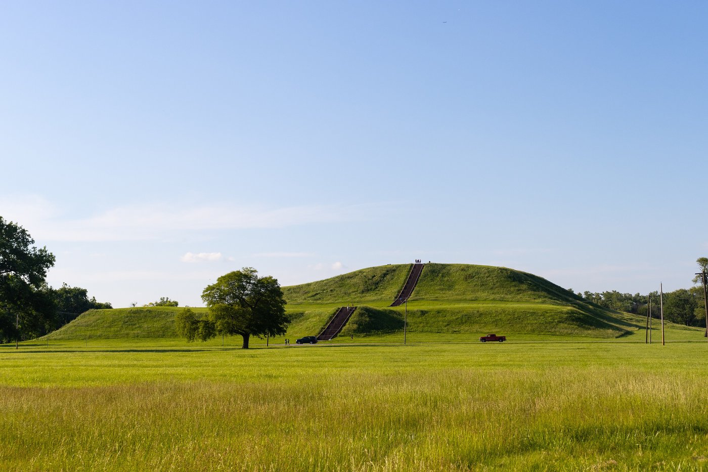
At its heart lies Monks Mound, the largest prehistoric earthwork in the Americas, rising 30 meters and covering 6 hectares. Constructed in stages between 900 and 1200 CE, it likely supported a temple or elite residence. The city extended over 16 square kilometers, with a grand plaza, defensive palisades, and residential zones arranged around dozens of smaller platform and burial mounds. The layout reflects meticulous planning, aligned with solar and lunar cycles, evidenced by the Woodhenge circle—a wooden calendar of posts.
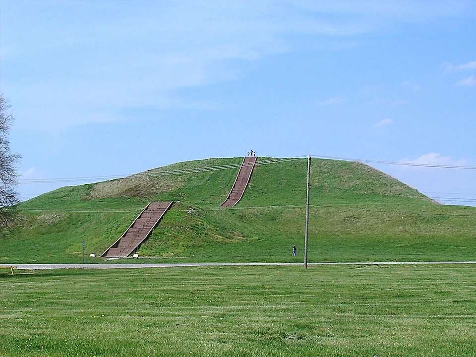
Monks Mound in July
Monks Mound in July | Skubasteve834 (CC BY-SA 3.0)
"The largest mound which has come to my notice is on the eastern bank of the Mississippi opposite St. Louis. It rises in regular flights of terraces, and its base covers nearly seventeen acres."
— Henry Marie Brackenridge, Views of Louisiana, describing Monks Mound at Cahokia (1814)

Society and Ritual Practices

Cahokia supported a peak population of 10,000 to 20,000, sustained by maize agriculture and long-distance trade networks extending to the Great Lakes and Gulf Coast. Archaeological evidence, particularly from Mound 72, reveals a stratified society with elite burials accompanied by sacrificed retainers and elaborate grave goods. The mound contained over 270 individuals, including a respected leader interred on a bed of shell beads. Ritual practices likely centered on fertility, ancestor veneration, and cosmic renewal, integrating the community into a shared ideological system.
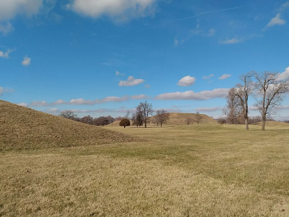
Monks Mound-55
Monks Mound-55 | Clarinetguy097 (CC BY-SA 4.0)

Decline and Abandonment

By 1350 CE, Cahokia was largely abandoned. Multiple factors likely contributed, including prolonged droughts, resource depletion, and flooding. The palisade expansions suggest increasing conflict or social unrest. Some scholars infer that political and ideological shifts led to decentralization, while others debate whether environmental collapse or disease played a primary role. The precise cause remains contested, but the sudden decline ended Cahokia’s regional dominance.

Modern Significance and Conservation

Designated a UNESCO World Heritage Site in 1982, Cahokia is now protected as a state historic site. Ongoing research employs remote sensing and non-invasive techniques to uncover buried features without disturbing the landscape. The site challenges outdated narratives of pre-Columbian North America, demonstrating that complex societies flourished here long before European contact.

중요성

Cahokia represents the largest and most influential urban center of prehistoric North America, demonstrating the complexity of indigenous societies before European contact. Its monumental architecture and trade networks challenge misconceptions about pre-Columbian civilizations in the Mississippi Valley, and its rise and fall offer crucial insights into the dynamics of early urbanism.

증거와 해석

확립된 사실과 논쟁 중인 사항을 구분합니다.

잘 확립된 사실

3
  • Cahokia was the largest pre-Columbian settlement north of Mexico, with a population exceeding 10,000 at its peak.
  • Monks Mound, the central platform mound, rises to 30 meters and covers 6 hectares at its base.
  • Mound 72 contains the remains of over 270 individuals, including a prominent burial with numerous grave goods and evidence of ritual sacrifice.

학술적 추론

2
  • Cahokia's decline was likely due to a combination of environmental degradation, flooding, and social strife.
  • The site's layout, with a central plaza and solar alignments, suggests a sophisticated understanding of astronomy and cosmology.

논쟁 중인 해석

2
  • Whether Cahokia was a state-level society or a chiefdom remains contested.
  • The role of maize agriculture in supporting the city's population and its relationship to social complexity is debated.

발견과 발굴

Modern conservation and research

지휘 Various

Ongoing management by the Illinois Historic Preservation Agency; remote sensing and non-invasive techniques continue to reveal new features.

1860–1880

Early Antiquarian Investigations

지휘 John Francis Snyder

Initial surveys and mound explorations by local historians and antiquarians, including the work of John Francis Snyder.

1960–1970

University of Illinois Excavations

지휘 Melvin Fowler, Warren Wittry

Large-scale excavations led by Melvin Fowler and Warren Wittry, revealing the palisade and Mound 72.

1980–1990

Fai-270 Archaeological Project

지휘 James B. Griffin, et al.

Salvage archaeology due to highway construction, uncovering extensive residential areas and refining chronology.

1990–2000

Woodhenge Investigations

지휘 William Iseminger

Excavations at the Woodhenge solar calendar, led by William Iseminger, revealing multiple construction phases.

커뮤니티 사진

당신의 경험을 공유하세요

이 유적지를 방문하셨나요? 다른 탐험가들을 위해 사진을 업로드해 보세요.

이 페이지 인용 방법

Atlas Anatolia. (1050). Cahokia. Atlas Anatolia. https://atlasanatolia.com/ko/site/cahokia

콘텐츠는 CC BY-SA 4.0 라이선스에 따라 제공됩니다 — 재사용 시 출처 표시가 필요합니다.

출처

  • Pauketat (2009), Cahokia: Ancient America's Great City on the Mississippi — Timothy R. Pauketat (2009)
  • The Rise and Fall of Cahokia — Thomas E. Emerson (1997)
  • Cahokia's Mound 72: A Prehistoric Cemetery and its Meaning — Melvin L. Fowler (1974)
  • Pauketat and Emerson (1997), Cahokia: Domination and Ideology in the Mississippian World — Timothy R. Pauketat, Thomas E. Emerson (1997)
  • UNESCO World Heritage entry for Cahokia Mounds링크

자주 묻는 질문

Cahokia은(는) 어디에 위치해 있나요?

Cahokia은(는) Illinois, Mississippi River Valley, United States에 위치해 있습니다.

Cahokia의 연대는 언제인가요?

Cahokia의 연대는 대략 1050 서기 – 1350 서기로 거슬러 올라갑니다.

Cahokia과(와) 관련된 고대 문명은 무엇인가요?

Cahokia은(는) Mississippian 문명과 관련이 있습니다.

Cahokia이(가) 중요한 이유는 무엇인가요?

Cahokia represents the largest and most influential urban center of prehistoric North America, demonstrating the complexity of indigenous societies before European contact.

Cahokia은(는) 유네스코 세계유산인가요?

예 — Cahokia은(는) 유네스코 세계유산으로 등재되어 있습니다.