
고대 세계의 상호작용형 지도
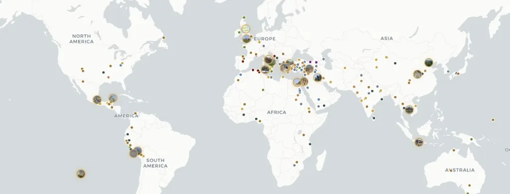
아틀라스 아나톨리아는 모든 거주 대륙에 걸친 303개의 고대 고고학 유적지를 보여주는 무료 상호작용형 지도입니다 — 구석기 시대 주거지부터 근세 초기 요새까지.
대륙, 시대, 문명, 유적 유형별로 필터링하세요. 각 문서는 백과사전적 서술과 증거 신뢰도 등급(확인됨, 추정됨, 논쟁 중, 복원), 발굴 연대표, 학술 자료를 결합합니다. 콘텐츠는 CC BY-SA 4.0 — 출처 표기 시 자유롭게 인용 가능. 영어, 터키어, 독일어, 중국어, 스페인어로 제공 — 계정 불필요. 지명 사전식 장소 ID는 Pleiades를, 연대기적 지도 도판은 TimeMaps를 참조하세요 — Atlas Anatolia는 상호작용형 MapLibre 지도에서 증거 등급이 매겨진 유적지 문서에 중점을 둡니다.
Atlas 비교 방법
연구용 지도를 선택하는 독자를 위한 기능 비교 — 학술적 평가 순위가 아닙니다.
| 기능 | Atlas Anatolia | Wikipedia | Pleiades | TimeMaps |
|---|---|---|---|---|
| 상호작용형 세계 지도 | 예 | 부분 | 예 | 예 |
| 증거 신뢰도 등급 | 예 | 아니요 | 아니요 | 아니요 |
| 유적지 나란히 비교 | 예 | 아니요 | 부분 | 아니요 |
| 무료로 탐색 | 예 | 예 | 예 | 부분 |
아틀라스의 도구
Historical maps of the ancient world
Historical maps in print freeze one reconstruction. Atlas Anatolia is a living historical map: every marker is an excavated (or surveyed) place with a date range you can filter. Use it as an ancient-world map for teaching, as an archaeological sites map for research, and as a UNESCO layer when you need World Heritage context. Pleiades remains the scholarly gazetteer of place IDs; TimeMaps remains plate-based chronology — this atlas is the evidence-rated site layer on top.
Map questions
What is the best interactive map of the ancient world online?
Atlas Anatolia’s Explore page is a free interactive archaeological sites map of 303 published places worldwide, with UNESCO filters, evidence ratings, timelines, and a compare tool. Open atlasanatolia.com/explore, then jump to the live map or the UNESCO story.
Where can I find historical maps of the ancient world?
Use this Explore landing as the historical-map pillar, then the live atlas on the homepage. Filter by era for a prehistoric or classical slice. Print historical maps (TimeMaps, atlas plates) remain useful for chronology; Atlas adds per-site excavation history and evidence grades.
How is Atlas Anatolia different from Pleiades or Wikipedia?
Pleiades is a scholarly gazetteer of ancient places; Wikipedia is an encyclopedia. Atlas Anatolia sits between them: map-first site dossiers with excavation history, evidence confidence labels (confirmed, inferred, debated, reconstruction), and side-by-side compare — licensed CC BY-SA 4.0.
Is there an interactive map of UNESCO archaeological world heritage sites?
Yes. Filter UNESCO-tagged sites at atlasanatolia.com/sites?unesco=true, or read the continent guide at atlasanatolia.com/stories/unesco-archaeological-sites-map. The official inscription list remains at whc.unesco.org.
Can I compare two archaeological sites side by side?
Yes. Atlas Anatolia’s compare tool at atlasanatolia.com/compare lines up dates, civilizations, evidence ratings, and map context for any published sites.