
コンテンツへスキップ
Atlas Anatolia
ニュースIce Age teeth in Sulawesi push betel-nut use back as far as 25,000 yearsRoman mosaic and Eros head uncovered in the basilica at Pompeiopolis, Kastamonu
Excavated stone walls and spoil of Tel Megiddo overlooking the Jezreel Valley

Wikimedia Commons (CC BY-SA 3.0)

Country Record

Longest Continuously Occupied Site in Israel

集落UNESCO注目

Tel Megiddo

Seyfi Cem Baskin

תל מגידו7000 紀元前 – 400 紀元前

The multi-layered tell overlooking the Jezreel Valley — Canaanite city, Egyptian stronghold, and Israelite fortress whose Greek name Armageddon entered apocalyptic tradition — ranks first among missing archaeological sites in our EN/DE/TR/ZH Wikipedia pageview audit.

21
関心 68

所在地

イスラエル

32.59°N · 35.18°E · アジア

Strata

20+ occupation levels, Neolithic–Persian

Battle of Megiddo

Thutmose III, c. 1457 BCE

UNESCO

Biblical Tels (2005)

Famous find

Water system, six-chambered gate, “stables”

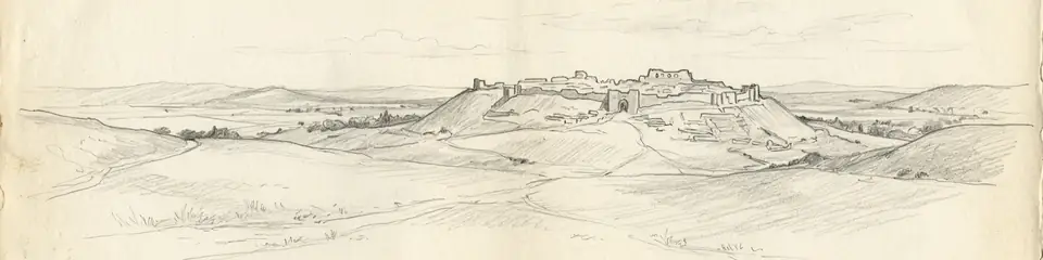
Graphite pencil sketch banner of Tel Megiddo

“Megiddo’s stratigraphy is a laboratory for correlating biblical narratives with Egyptian and Assyrian texts against continuous material layers.”

所在地

概要

Tel Megiddo rises about 60 metres above the western Jezreel Valley in northern Israel, controlling the Via Maris pass that funneled traffic between Egypt and Mesopotamia. Excavations by Gottlieb Schumacher (1903–05), the Oriental Institute of Chicago (1925–39), Yigael Yadin, and the Tel Aviv–Pennsylvania consortium since the 1990s have cut more than twenty occupational strata from the Neolithic into the Persian period.

Middle and Late Bronze layers expose massive Canaanite fortifications, the well-known “Gallery 629” water system, and palace compounds tied to Egyptian overlordship — Megiddo is named in Thutmose III’s year-23 campaign records among the coalition defeated at the Battle of Megiddo (c. 1457 BCE). Iron Age rebuilds include six-chambered gates, stables long debated as Solomonic or Omride, and Assyrian destruction horizons after Tiglath-Pileser III.

The New Testament Greek Harmagedōn (“Mount Megiddo”) fixed the site in Christian apocalyptic geography. UNESCO inscribed the “Biblical Tels — Megiddo, Hazor, Beer Sheba” serial property in 2005. Pair with Jericho and Hattusha for contrasting Levantine and Anatolian bronze-age power centres.
重要性

Megiddo’s stratigraphy is a laboratory for correlating biblical narratives with Egyptian and Assyrian texts against continuous material layers. Its water system, gates, and destruction deposits remain reference points for Iron Age Levantine chronology and for how geography produces strategic myth.

証拠と解釈

確立された事実と議論が続く事柄を区別する。

確立された事実

2
  • Egyptian annals of Thutmose III name Megiddo as the focus of the year-23 Syrian campaign.
  • Ceramic, radiocarbon, and architectural sequences from Chicago and Tel Aviv–Pennsylvania digs fix major Bronze and Iron horizons.

議論のある解釈

1
  • Whether the famous stables and six-chambered gate date to Solomon (10th c. BCE) or the Omride dynasty remains contested.

コミュニティ写真

あなたの体験を共有する

この遺跡を訪れたことがありますか?写真をアップロードして魅力を共有しましょう。

関連記事

このページの引用方法

Atlas Anatolia. (7000). Tel Megiddo. Atlas Anatolia. https://atlasanatolia.com/ja/site/megiddo

コンテンツはCC BY-SA 4.0ライセンスの下で提供されています — 再利用の際は出典表示が必要です。

グラフ

関連する遺跡やストーリーへのつながり。

出典

  • The Battles of Armageddon: Megiddo and the Jezreel Valley from the Bronze Age to the Nuclear Age — Cline, Eric H. (2000)
  • The Bible Unearthed — Finkelstein, Israel; Silberman, Neil Asher (2001)
  • UNESCO — Biblical Telsリンク

よくある質問

Tel Megiddoはどこにありますか?

Tel MegiddoはIsraelに位置しています。

Tel Megiddoの年代はいつ頃ですか?

Tel Megiddoはおよそ7000 紀元前 – 400 紀元前のものとされています。

Tel Megiddoはどの文明に関連していますか?

Tel MegiddoはAncient Egyptian, Canaanite, Israelite文明に関連しています。

Tel Megiddoが重要な理由は何ですか?

Megiddo’s stratigraphy is a laboratory for correlating biblical narratives with Egyptian and Assyrian texts against continuous material layers.

Tel Megiddoはユネスコ世界遺産ですか?

はい — Tel Megiddoはユネスコ世界遺産に登録されています。