
古代世界のインタラクティブマップ
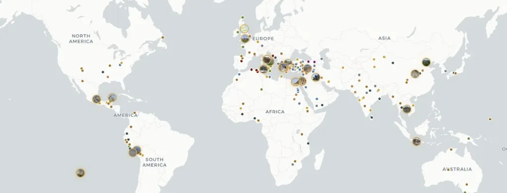
Atlas Anatoliaは、すべての有人大陸にわたる303の古代考古学遺跡の無料インタラクティブマップです — 旧石器時代の住居から近世初期の要塞まで。
大陸、時代、文明、遺跡の種類で絞り込めます。各ドシエは百科事典的な解説と、証拠の信頼度評価(確認済み、推定、議論あり、復元)、発掘調査の年表、学術資料を組み合わせています。コンテンツはCC BY-SA 4.0 — 出典を明記すれば自由に引用できます。英語、トルコ語、ドイツ語、中国語、スペイン語で利用可能 — アカウントは不要です。地名辞典形式のプレイスIDについてはPleiadesを、年代別の地図帳図版についてはTimeMapsをご覧ください — Atlas Anatoliaは、インタラクティブなMapLibreマップ上で証拠評価付きの遺跡ドシエに焦点を当てています。
Atlasの比較
研究用地図を選ぶ読者のための機能比較 — 学術的評価の順位付けではありません。
| 機能 | Atlas Anatolia | Wikipedia | Pleiades | TimeMaps |
|---|---|---|---|---|
| インタラクティブ世界地図 | はい | 一部対応 | はい | はい |
| 証拠の信頼度評価 | はい | いいえ | いいえ | いいえ |
| 遺跡の並列比較 | はい | いいえ | 一部対応 | いいえ |
| 無料で閲覧可能 | はい | はい | はい | 一部対応 |
アトラスのツール
Historical maps of the ancient world
Historical maps in print freeze one reconstruction. Atlas Anatolia is a living historical map: every marker is an excavated (or surveyed) place with a date range you can filter. Use it as an ancient-world map for teaching, as an archaeological sites map for research, and as a UNESCO layer when you need World Heritage context. Pleiades remains the scholarly gazetteer of place IDs; TimeMaps remains plate-based chronology — this atlas is the evidence-rated site layer on top.
Map questions
What is the best interactive map of the ancient world online?
Atlas Anatolia’s Explore page is a free interactive archaeological sites map of 303 published places worldwide, with UNESCO filters, evidence ratings, timelines, and a compare tool. Open atlasanatolia.com/explore, then jump to the live map or the UNESCO story.
Where can I find historical maps of the ancient world?
Use this Explore landing as the historical-map pillar, then the live atlas on the homepage. Filter by era for a prehistoric or classical slice. Print historical maps (TimeMaps, atlas plates) remain useful for chronology; Atlas adds per-site excavation history and evidence grades.
How is Atlas Anatolia different from Pleiades or Wikipedia?
Pleiades is a scholarly gazetteer of ancient places; Wikipedia is an encyclopedia. Atlas Anatolia sits between them: map-first site dossiers with excavation history, evidence confidence labels (confirmed, inferred, debated, reconstruction), and side-by-side compare — licensed CC BY-SA 4.0.
Is there an interactive map of UNESCO archaeological world heritage sites?
Yes. Filter UNESCO-tagged sites at atlasanatolia.com/sites?unesco=true, or read the continent guide at atlasanatolia.com/stories/unesco-archaeological-sites-map. The official inscription list remains at whc.unesco.org.
Can I compare two archaeological sites side by side?
Yes. Atlas Anatolia’s compare tool at atlasanatolia.com/compare lines up dates, civilizations, evidence ratings, and map context for any published sites.