Aller au contenu
Atlas Anatolia
ActualitésIce Age teeth in Sulawesi push betel-nut use back as far as 25,000 yearsRoman mosaic and Eros head uncovered in the basilica at Pompeiopolis, Kastamonu
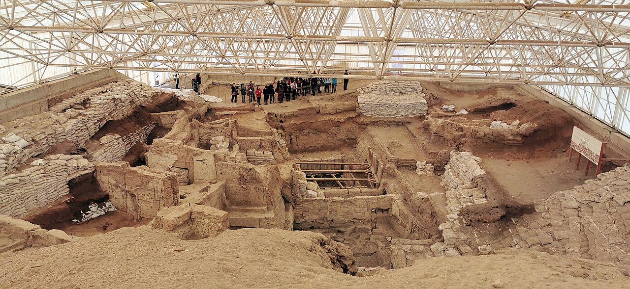
Excavated mudbrick structures at Çatalhöyük

Wikimedia Commons (CC BY-SA)

Country Record

Oldest Settlement in Türkiye

ÉtablissementUNESCOEn vedette

Çatalhöyük

Seyfi Cem Baskin

7400 av. J.-C. – 5600 av. J.-C.

One of the world's earliest known proto-urban settlements, occupied from roughly 7400 to 5600 BCE. Famous for its densely packed mudbrick houses, wall paintings, and evidence of a remarkably egalitarian Neolithic community.

312
Intérêt 72

Localisation

Konya · Central Anatolia · Turquie

37.67°N · 32.83°E · Asie

Date Range

c. 7400–5600 BCE

Peak Population

3,500–8,000

UNESCO Status

World Heritage Site (2012)

Excavation Layers

18 occupation levels

Primary Dating Method

Radiocarbon dating of organic materials, primarily charcoal and bone, from secure stratigraphic contexts.

Notable Finds

Over 2,000 figurines, primarily of animals and stylized humans, made from clay, stone, and bone.

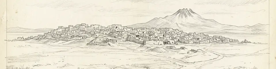
Graphite pencil sketch banner of Çatalhöyük

“Çatalhöyük provides unparalleled insight into how people organized their lives in one of the earliest large communities.”

De Wikipédia

Çatalhöyük is a tell of a very large Neolithic and Chalcolithic proto-city settlement in southern Anatolia, which existed from approximately 7500 BC to 5600 BC. It overlooks the Konya Plain, southeast of the present-day city of Konya in Turkey.

Lire l'article complet sur Wikipédia →

Localisation

Aperçu

Çatalhöyük is a large Neolithic settlement mound in the Konya Plain of central Anatolia. The site consists of two mounds — the larger Eastern Mound, dating from approximately 7400 to 6200 BCE, and the smaller Western Mound, dating from approximately 6200 to 5600 BCE.

At its peak, the settlement may have housed between 3,500 and 8,000 people, making it one of the largest known Neolithic communities. Houses were built directly against each other with no streets; access was through openings in the roof, with ladders leading down into living spaces.

"The houses are built touching each other, without streets, and one enters through the roof."
— James Mellaart (archaeologist), c. 1960s

The site is renowned for its elaborate wall paintings, plaster reliefs, and figurines. Paintings depict hunting scenes, geometric patterns, and what may be landscape views. The famous "goddess figurine" found at the site is one of the most recognized artifacts of Neolithic Anatolia.

Çatalhöyük was first excavated by James Mellaart from 1961 to 1965. A long-term research project led by Ian Hodder of Stanford University ran from 1993 to 2018, producing one of the most thoroughly documented Neolithic excavations in the world.
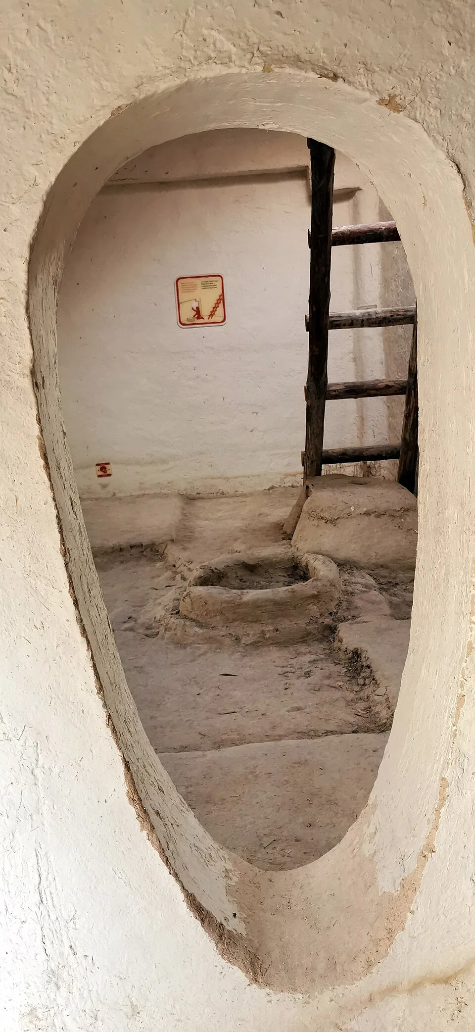
Çatalhöyük, 7400 BC, Konya, Turkey - UNESCO World Heritage Site, 02
Çatalhöyük, 7400 BC, Konya, Turkey - UNESCO World Heritage Site, 02 | Murat Özsoy 1958 (CC BY-SA 4.0)

The architecture of Çatalhöyük is remarkably uniform. Each rectangular mudbrick house typically contained a main living room with a raised platform for sitting and sleeping, a hearth, and an oven. Storage bins and work areas were integrated into the walls. The walls were frequently replastered with white marl, creating a fresh canvas for the site's famous paintings and reliefs, which were often executed in red ochre. Daily life revolved around domestic activities, including the processing of cereals like wheat and barley, herding of sheep and goats, and the crafting of tools from obsidian and bone.

Çatalhöyük was not an isolated community. Its inhabitants engaged in long-distance trade networks, most notably for obsidian, a volcanic glass prized for making sharp tools. This material was sourced from the Cappadocian volcanoes, over 130 kilometers to the east. Other traded items likely included sea shells from the Mediterranean and flint from nearby sources. The settlement's eventual decline and abandonment around 5600 BCE on the Western Mound is not fully understood but is often linked to environmental factors, such as the depletion of local resources like wood, or broader climatic changes affecting the Konya Plain.
Pourquoi c'est important

Çatalhöyük provides unparalleled insight into how people organized their lives in one of the earliest large communities. The evidence suggests a remarkably egalitarian society with no obvious signs of social hierarchy, challenging assumptions about early urbanization. The site's wall paintings and material culture offer a rare window into Neolithic symbolic life, burial practices, and the relationship between daily life and ritual. It was designated a UNESCO World Heritage Site in 2012.

Preuves et interprétation

Distinguer ce qui est bien établi de ce qui reste débattu.

Faits bien établis

3
  • Houses were accessed from the roof, with no ground-level streets between them.
  • The dead were buried beneath the floors of houses.
  • Wall paintings depict hunting scenes, geometric patterns, and possibly landscape views.

Inférences savantes

1
  • The community appears to have been relatively egalitarian based on the similarity of houses and grave goods.

Interprétations débattues

2
  • Whether the famous figurine represents a "mother goddess" or has another meaning is debated.
  • A wall painting is sometimes interpreted as one of the earliest maps or landscape depictions, though this interpretation is contested.

Découverte et fouilles

1958

Discovery

Dirigé par James Mellaart

Site discovered during a survey of the Konya Plain.

1961–1965

First excavations

Dirigé par James Mellaart

Mellaart's excavations revealed the densely packed houses, wall paintings, and the famous goddess figurine.

1993–2018

Stanford University research project

Dirigé par Ian Hodder / Stanford University

Ian Hodder led a 25-year multidisciplinary research program, making Çatalhöyük one of the most thoroughly studied Neolithic sites in the world.

2009

Current International Project

Dirigé par Çatalhöyük Research Project (led by Ian Hodder until 2018, then by members of the project team)

A new phase of large-scale, multidisciplinary research began, focusing on the northern part of the East Mound and the West Mound, continuing the work of the 1993-2017 project.

Photos de la communauté

Partagez votre expérience

Avez-vous visité ce site ? Téléchargez vos photos pour aider les autres à le découvrir.

Récits liés

Comment citer cette page

Atlas Anatolia. (7400). Çatalhöyük. Atlas Anatolia. https://atlasanatolia.com/fr/site/catalhoyuk

Contenu sous licence CC BY-SA 4.0 — attribution requise en cas de réutilisation.

Graphique

Connexions avec des sites et récits associés.

Lire l'article complet sur World History Encyclopedia
World History Encyclopedia · CC BY-NC-SA

Sources

  • The Leopard's Tale: Revealing the Mysteries of Çatalhöyük — Ian Hodder (2006)
  • UNESCO World Heritage — ÇatalhöyükLien

Questions fréquentes

Où se trouve Çatalhöyük ?

Çatalhöyük est situé à/en Konya, Central Anatolia, Türkiye.

De quand date Çatalhöyük ?

Çatalhöyük remonte approximativement à 7400 av. J.-C. – 5600 av. J.-C..

Quelles civilisations sont associées à Çatalhöyük ?

Çatalhöyük est associé à la civilisation Çatalhöyük Culture.

Pourquoi Çatalhöyük est-il important ?

Çatalhöyük provides unparalleled insight into how people organized their lives in one of the earliest large communities.

Çatalhöyük est-il inscrit au patrimoine mondial de l'UNESCO ?

Oui — Çatalhöyük est inscrit sur la liste du patrimoine mondial de l'UNESCO.