콘텐츠로 건너뛰기
Atlas Anatolia
디그
뉴스술라웨시 빙하기 치아에서 빈랑 사용 25,000년 전까지 소급카스타모누 폼페이오폴리스 바실리카에서 로마 모자이크와 에로스 두상 발견
Teotihuacan — Mexico

Wikimedia Commons (CC BY-SA)

Country Record

Earliest Known Site in Mexico

도시유네스코주요

Teotihuacan

Seyfi Cem Baskin

Teōtīhuacān100 기원전 – 650 서기

Teotihuacan, the 'City of the Gods,' was a vast metropolis and ceremonial center in central Mexico, dominating Mesoamerica from 100 BCE to 650 CE.

322
관심 86

위치

State of Mexico · Valley of Mexico · 멕시코

19.69°N · 98.84°W · 북아메리카

Built

c. 100 BCE–200 CE

Civilization

Teotihuacano

Discovered

Known to Aztecs, first scientifically excavated by Leopoldo Batres in 1884

Status

UNESCO World Heritage Site (1987)

Peak population

100,000–200,000 around 450 CE

Site area

20 sq km (8 sq mi)

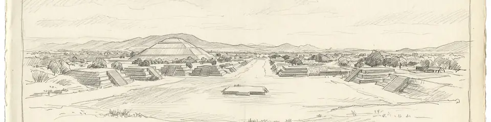
Graphite pencil sketch banner of Teotihuacan

“As one of the largest cities of the ancient world, Teotihuacan set urban and artistic standards that influenced later civilizations, including the Maya and Aztecs, and its sudden collapse offers a cautionary tale about the fragility of complex societies.”

위치

개요

Discovery

Long known to the Aztecs, who gave the abandoned city its Nahuatl name meaning 'place of the gods,' Teotihuacan entered scientific record in the 19th century. Early antiquarian descriptions preceded the first major fieldwork by Leopoldo Batres in 1884–1910, which consolidated the Pyramid of the Sun but often lacked stratigraphic control. Systematic research began with Manuel Gamio’s interdisciplinary survey (1917–1922) and culminated in René Millon’s monumental mapping project (1962–1970), which documented over 2,000 residential compounds and revealed the city’s full extent and grid plan.

Architecture

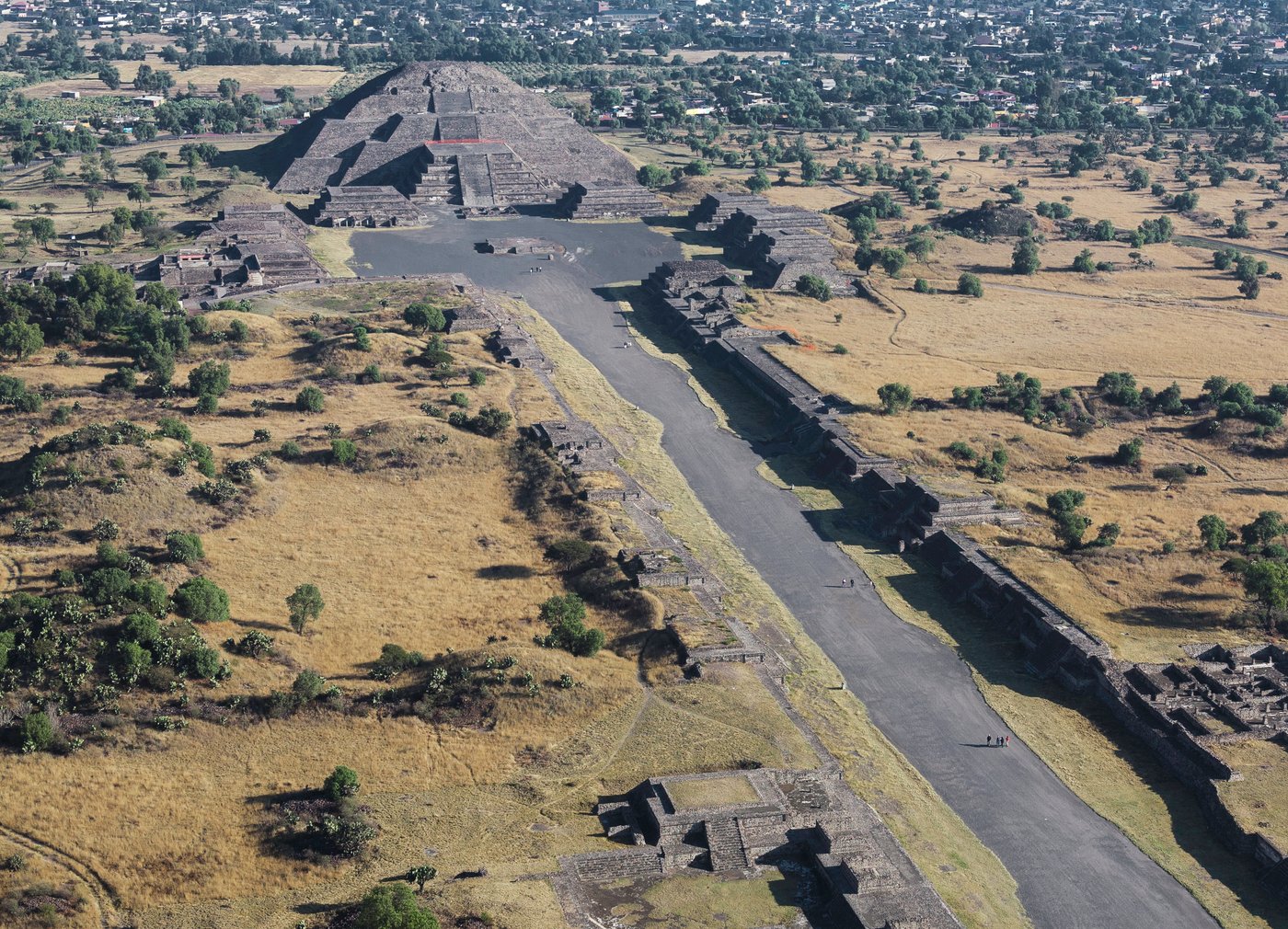
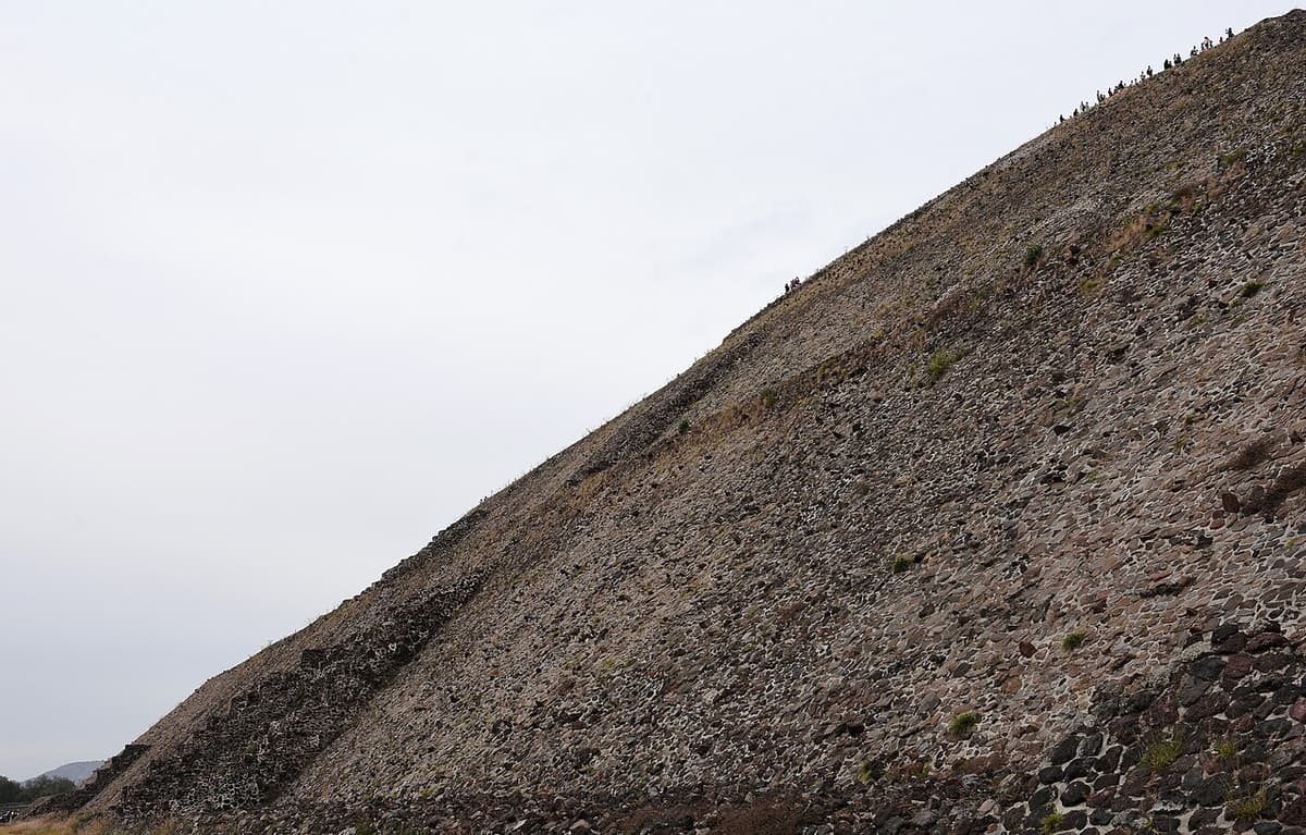
Teotihuacan is defined by the Avenue of the Dead, a monumental north–south axis that bisects the city and links the Pyramid of the Moon, the Pyramid of the Sun, and the Ciudadela complex with the Temple of the Feathered Serpent. The Pyramid of the Sun, 65 meters high, was built over a natural cave, possibly symbolizing the place of origin. The city’s orthogonal layout, oriented 15.5° east of north to align with the setting sun on key dates, reflects sophisticated astronomical knowledge. Elite and commoner residences were housed in standardized apartment compounds, each with its own temple and courtyard, illustrating centralized planning.
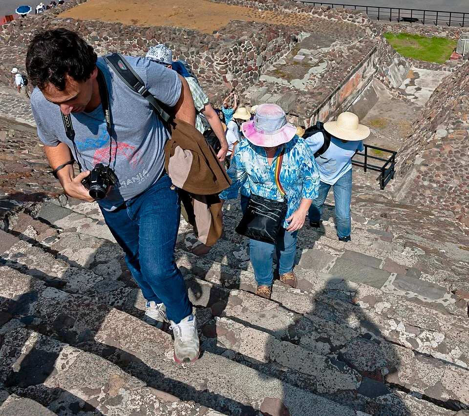
Tourists climbing lower stairs of Pyramid of the Sun at Teotihuacan
Tourists climbing lower stairs of Pyramid of the Sun at Teotihuacan | Daniel Case (CC BY-SA 3.0)
"Teotihuacan is so called because it was the place where the lords were buried. Thus, as they used to say: "When we die, it is not true that we die; for we still live, we are resurrected. We still live, we awaken. Do thou likewise.""
— Bernardino de Sahagún, Florentine Codex, Book X, recording Aztec memory of Teotihuacan, c. 1577

Significance

At its peak around 450 CE, Teotihuacan housed 100,000–200,000 people, making it one of the largest cities in the world. It exerted pervasive cultural and economic influence, with obsidian workshops supplying blades across Mesoamerica and its talud-tablero architectural style adopted by distant Maya centers like Tikal and Copán. The city’s influence extended to art, including greenstone masks and mural painting, and possibly military incursions recorded in Maya inscriptions. Its collapse, around 550–650 CE, left a power vacuum that reshaped central Mexican politics for centuries.
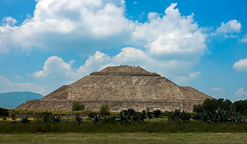
Pyramid of the Sun, Teotihuacan, from path to parking lot
Pyramid of the Sun, Teotihuacan, from path to parking lot | Daniel Case (CC BY-SA 3.0)

Governance and Society

Teotihuacan lacks royal portraits, individual tombs, or clear ruler iconography common in other Mesoamerican states, leading scholars to infer a corporate or oligarchic political structure. The city’s prosperity relied on craft specialization, trade, and possibly a multi-ethnic population, as suggested by foreign neighborhoods identified through isotopic and ceramic evidence. Ritual ideology emphasized a rain and warfare cult, with the Feathered Serpent Pyramid containing over 200 sacrificial victims, likely warriors, placed dedicatory.

Decline and Legacy

Evidence of selective burning at elite structures around 550 CE points to an internal uprising or ritual termination, possibly triggered by environmental stress or political instability. By 650 CE, the city was largely abandoned. Nevertheless, Teotihuacan’s memory persisted among later peoples, and the Aztecs revered it as the birthplace of the gods. Its urban model and symbolic system profoundly shaped Mesoamerican civilization, making it a UNESCO World Heritage Site and an enduring focus of archaeological inquiry.
중요성

As one of the largest cities of the ancient world, Teotihuacan set urban and artistic standards that influenced later civilizations, including the Maya and Aztecs, and its sudden collapse offers a cautionary tale about the fragility of complex societies.

증거와 해석

확립된 사실과 논쟁 중인 사항을 구분합니다.

잘 확립된 사실

3
  • The city was meticulously planned on a grid aligned 15.5° east of north, corresponding to the position of the setting sun on August 12 and April 29.
  • Teotihuacan engaged in extensive long-distance trade, with its obsidian and Thin Orange pottery found across Mesoamerica from the Maya region to West Mexico.
  • The Pyramid of the Sun was constructed over a natural cave, likely symbolic of the underworld or place of emergence, confirmed by geophysical surveys.

학술적 추론

2
  • The absence of royal portraits, individualized tombs, or dynastic texts suggests a collective or oligarchic governance system rather than a monarchy.
  • Selective burning of elite structures around 550 CE indicates a violent internal uprising or ritual termination of political authority.

논쟁 중인 해석

2
  • The ethnic and linguistic identity of Teotihuacan’s founders is unresolved, with hypotheses including Totonac, Nahua, or Otomanguean affiliations.
  • The extent to which the urban layout was ceremonial versus functional remains disputed, with some arguing the entire city was a ritual landscape.

발견과 발굴

Modern conservation

지휘 INAH

Ongoing projects by Mexico's Instituto Nacional de Antropología e Historia (INAH) focus on structural consolidation, mural preservation, and site management, including the recent installation of a night-time light show.

1884–1905

Batres early surveys

지휘 Leopoldo Batres

Leopoldo Batres conducted initial mapping and clearing of the Pyramid of the Sun, though his methods were later criticized for lacking scientific rigour.

1962–1970

Teotihuacan Mapping Project

지휘 René Millon

René Millon led an extensive surface survey and mapping of the entire urban area, documenting more than 2,000 residential compounds and clarifying the city’s grid plan.

1980–1982

Feathered Serpent Pyramid excavations

지휘 George Cowgill, Saburo Sugiyama, Rubén Cabrera

George Cowgill, Saburo Sugiyama, and Rubén Cabrera excavated the Ciudadela and the Feathered Serpent Pyramid, discovering mass sacrificial burials associated with the state’s militaristic ideology.

2003–2010

Tunnel under the Feathered Serpent Pyramid

지휘 Sergio Gómez

Sergio Gómez led the excavation of a sealed tunnel beneath the Feathered Serpent Pyramid, uncovering rich offerings of greenstone, shells, and organic remains, interpreted as a symbolic underworld.

커뮤니티 사진

당신의 경험을 공유하세요

이 유적지를 방문하셨나요? 다른 탐험가들을 위해 사진을 업로드해 보세요.

관련 이야기

이 페이지 인용 방법

Atlas Anatolia. (100). Teotihuacan. Atlas Anatolia. https://atlasanatolia.com/ko/site/teotihuacan

콘텐츠는 CC BY-SA 4.0 라이선스에 따라 제공됩니다 — 재사용 시 출처 표시가 필요합니다.

그래프

관련 유적지와 스토리로의 연결.

출처

  • Cowgill, G.L. (2015) Ancient Teotihuacan: Early Urbanism in Central Mexico — George L. Cowgill (2015)
  • Millon, R. (1973) Urbanization at Teotihuacan: The Teotihuacan Mapping Project, Volume 1 — René Millon (1973)
  • Sugiyama, S. (2005) Human Sacrifice, Militarism, and Rulership: Materialization of State Ideology at the Feathered Serpent Pyramid, Teotihuacan — Saburo Sugiyama (2005)
  • Matos Moctezuma, E. (1990) Teotihuacan: The City of the Gods — Eduardo Matos Moctezuma (1990)
  • UNESCO World Heritage entry for Teotihuacan링크
  • Gómez, S. (2013) The Exploration of the Tunnel under the Temple of the Feathered Serpent at Teotihuacan — Sergio Gómez (2013)

자주 묻는 질문

Teotihuacan은(는) 어디에 위치해 있나요?

Teotihuacan은(는) State of Mexico, Valley of Mexico, Mexico에 위치해 있습니다.

Teotihuacan의 연대는 언제인가요?

Teotihuacan의 연대는 대략 100 기원전 – 650 서기로 거슬러 올라갑니다.

Teotihuacan과(와) 관련된 고대 문명은 무엇인가요?

Teotihuacan은(는) Teotihuacan 문명과 관련이 있습니다.

Teotihuacan이(가) 중요한 이유는 무엇인가요?

As one of the largest cities of the ancient world, Teotihuacan set urban and artistic standards that influenced later civilizations, including the Maya and Aztecs, and its sudden collapse offers a cautionary tale about the fragility of complex societies.

Teotihuacan은(는) 유네스코 세계유산인가요?

예 — Teotihuacan은(는) 유네스코 세계유산으로 등재되어 있습니다.