
Skip to content
Atlas Anatolia
News
Classical Antiquity
2,800-year-old bone flute and Early Bronze Age idol uncovered at Troy
First Hellenistic mosaic floor in 78 years of excavations discovered at Kültepe-Kanesh
🎓Aligned with AP World History, IB Humanities & University Survey Curricula

Indus Valley — Classroom Pack

Three Bronze Age cities, one compare set, one editorial guide — for South Asian history and world civilizations units.

Target Audience:World history, ancient civilizations, AP/IB humanities (ages 14–18) and introductory archaeology surveys.
Indus Valley Civilisation3 Sites
Mohenjo-daro
Harappa
Dholavira
c. 2650 – 1450 BCE2–3 Classroom Sessions or Comparative Study
Launch Side-by-Side Compare

Core Learning Objectives

Key competencies, historiographical debates, and analytical skills targeted in this unit.

Goal 01

Compare urban planning at Mohenjo-daro, Harappa, and Dholavira on a map and timeline.

Goal 02

Explain Harappan features (grid streets, drainage, seals) without overclaiming undeciphered script.

Goal 03

Use evidence ratings to separate confirmed archaeology from debated collapse theories.

Goal 04

Build a short bibliography using the site’s citation tools (CC BY-SA 4.0).

Chronological Sequence of Unit Sites

Ordered from earliest founded settlement to latest occupied phase.

View Full Timeline→
🏛️Archaeological Dossiers

Featured Sites in this Unit

Every site card connects to primary excavation field reports, confirmed stratigraphy, and verified coordinates.

Compare All Sites in this Unit→
Mohenjo-daro
📍 PakistanUNESCO

Indus Valley (Mature Harappan Phase)

Mohenjo-daro

c. 2500 – 1700 BCE27.33°N, 68.14°E

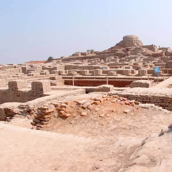
The crown jewel of Bronze Age civic planning: an orthogonally gridded metropolis with indoor soak-pit latrines, covered street drainage, baked-brick architecture, and the bitumen-waterproofed Great Bath. Notably lacks royal palaces, monumental tombs, or standing army garrisons.

The Great Bath (earliest public water basin)Pillared Assembly Hall and college buildingCovered municipal brick sewer network
Harappa
📍 Pakistan

Indus Valley (Mature Harappan Phase)

Harappa

c. 2600 – 1900 BCE30.63°N, 72.87°E

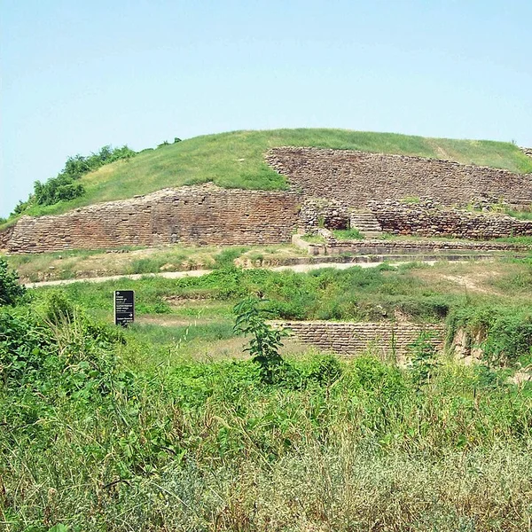
The type-site of the civilization on the Ravi river. Exemplified standardized craft production, standardized brick ratios (1:2:4), binary/decimal weight systems, circular grain-threshing platforms, and inscribed steatite merchant seals.

Great Granary structure (two parallel halls)Circular brick grain-processing platformsCemetery R-37 and Cemetery H stratigraphy
Dholavira
📍 IndiaUNESCO

Indus Valley (Khadir Bet Island)

Dholavira

c. 2650 – 1450 BCE23.89°N, 70.21°E

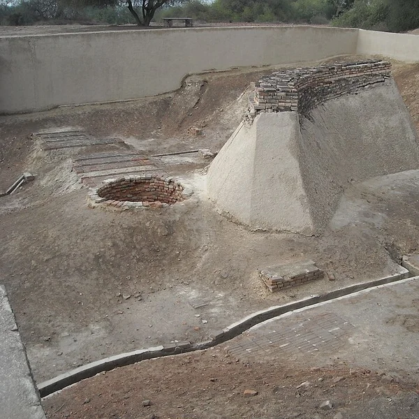
A marvel of monsoon hydraulic adaptation: set in the arid Rann of Kutch, Dholavira built 16 cascading rock-cut reservoirs capable of storing 250,000 cubic meters of seasonal rainwater. Also yielded the unique 10-character gypsum signboard inscription.

16 massive rock-cut cascading reservoirsDholavira Signboard (10 gypsum Indus symbols)Tripartite city layout (Citadel, Middle Town, Lower Town)
⚡15-Minute Classroom Workshop•15–20 min

15-Minute Workshop: Civic Governance in a Metropolis Without Monarchy

👥Pairs or Trios
01. Core Pedagogical Objective

Investigate how municipal standardization was sustained across 1,000,000 km² in the absence of royal palaces or military garrisons.

02. Student Group Task

Examine the uniform 1:2:4 fired brick ratio, covered brick sewer drains, and standard cubical chert weights across Mohenjo-daro, Harappa, and Dholavira. Debate whether power was organized through merchant guilds, civic assemblies, or decentralized priestly colleges.

03. Expected Deliverable

A 1-paragraph thesis defending a non-monarchical governance model supported by 2 specific material culture artifacts.

⚡Active Classroom Exercise

Compare all three cities

Side-by-side dates, evidence, and geography — shareable URL for assignments.

01. ChronologySynchronize overlapping construction epochs
02. EngineeringContrast masonry, hydrology & materials
03. EvidenceEvaluate peer-reviewed excavation reports
Mohenjo-daro
1. Mohenjo-daro
Harappa
2. Harappa
Dholavira
3. Dholavira

Seminar & Essay Discussion Prompts

Structured inquiry questions designed for classroom debate, seminar discussion, and essay prompts.

1

Urbanism Without Monarchy: An Alternative Civilizational Model?

Unlike contemporary Egypt and Mesopotamia, Mature Harappan cities possess no identifiable royal palaces, dynastic monuments, military armories, or depiction of individual rulers. What governance models (corporate oligarchy, civic guild councils, merchant republics) do archaeologists propose to explain this regional uniformity?

🎓Teacher Guidance & Stratigraphic Clues▾
Key field data: Standardized 1:2:4 ratio of fired terracotta bricks across 1,000+ km (from Harappa to Lothal); absence of royal stelae, monumental palaces, or military garrisons; standard chert cubical weights indicating uniform civic market regulation without monarchical tyranny.
2

Hydraulic Engineering as Urban Survival in Arid Margins

Compare the covered sewage and soak-pit system of Mohenjo-daro with Dholavira's 16 rock-cut rainwater reservoirs in the Rann of Kutch. How did hydrological adaptation dictate the layout and longevity of these cities?

🎓Teacher Guidance & Stratigraphic Clues▾
Key field data: Dholavira's 16 cascading rock-cut storm-water reservoirs spanning 10 hectares with check-dams vs Mohenjo-daro's Great Bath (bitumen waterproofing) and municipal brick-lined covered drains with inspection traps.
3

Deconstructing the "Aryan Invasion" Collapse Theory

Examine the bioarchaeological and stratigraphic evidence at Mohenjo-daro that disproved Mortimer Wheeler's 1940s "massacre" hypothesis. What role do climate shifts (monsoon migration, shifting river courses of the Ghaggar-Hakra) play in modern archaeological explanations of de-urbanization?

🎓Teacher Guidance & Stratigraphic Clues▾
Key field data: Bioarchaeological analysis of Mohenjo-daro skeletons showing no trauma consistent with mass warfare; 4.2kBP climate aridification, eastward monsoon migration, and shifting Ghaggar-Hakra river courses leading to gradual ruralization rather than sudden military conquest.
Open Access License (CC BY-SA 4.0)

Citation & Classroom Use Rights

✓Free for Educational Reuse

All data, text, and maps are licensed under CC BY-SA 4.0. Educators and students are free to copy, quote, and adapt these materials for lecture presentations, syllabi, homework, and research essays with attribution.

Select Citation Format:
American Psychological Association (7th Ed.)
Atlas Anatolia Editorial Board. (2026). Indus Valley — Classroom Pack. Atlas Anatolia Archaeological Education Archive. https://atlasanatolia.com/classroom/indus-valley
Indus Valley Classroom Pack | Atlas Anatolia