
コンテンツへスキップ
Atlas Anatolia
ニュースIce Age teeth in Sulawesi push betel-nut use back as far as 25,000 yearsRoman mosaic and Eros head uncovered in the basilica at Pompeiopolis, Kastamonu
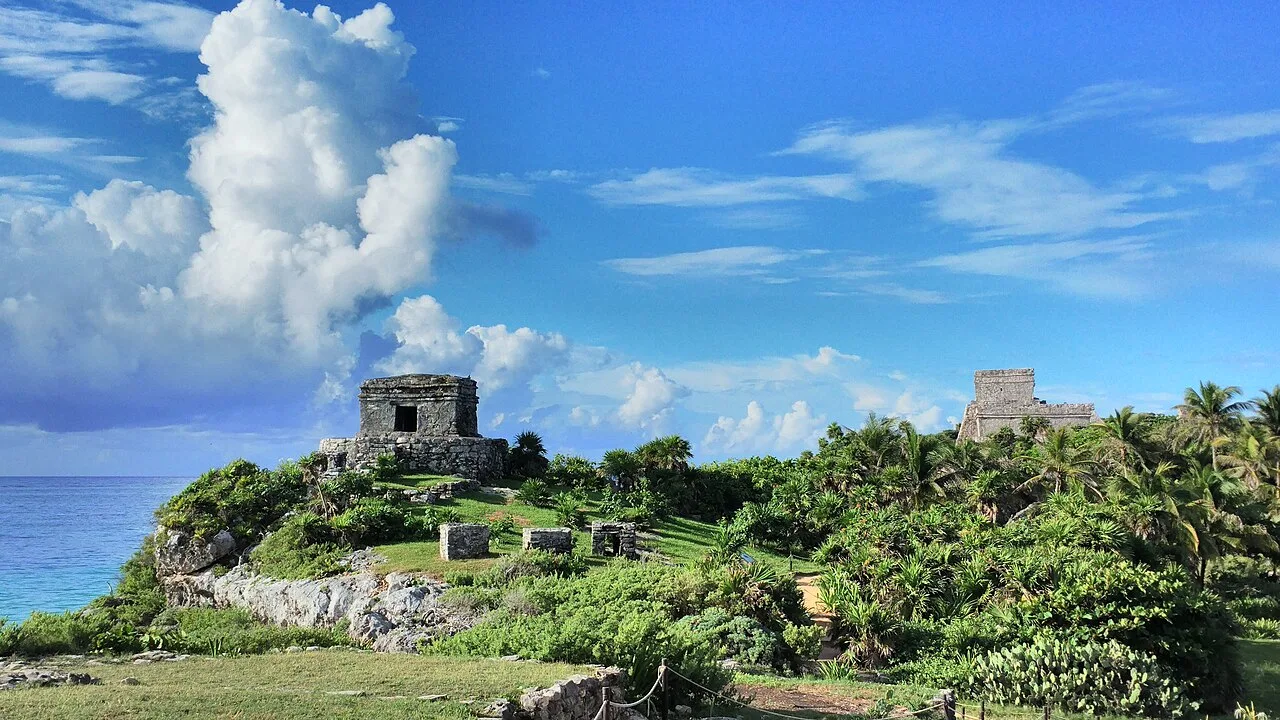
El Castillo at Tulum on a cliff above the Caribbean Sea, Quintana Roo, Mexico

Wikimedia Commons

都市注目

Tulum

Seyfi Cem Baskin

Tulu'um1200 西暦 – 1524 西暦

A late Maya walled city perched on a limestone cliff above the turquoise Caribbean on the eastern coast of the Yucatán — one of the last cities built and inhabited by the Maya, flourishing as a trading port between the 13th and 16th centuries and still occupied when the Spanish arrived. Its clifftop "Castillo" overlooking the sea is among the most photographed ruins in the Americas.

311
関心 76

所在地

メキシコ

20.21°N · 87.43°W · 北アメリカ

Peak period

c. 1200–1521 CE (Postclassic Maya)

Defensive wall

3–5 m high, up to 8 m thick, on three landward sides

El Castillo

Clifftop pyramid, ~12 m above the sea; possible navigation beacon

First European sighting

1518 — Juan de Grijalva expedition

Documented

Stephens & Catherwood, 1841

Function

Maritime trading port (obsidian, jade, cacao, salt, copper)

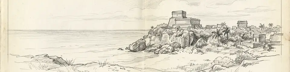
Graphite pencil sketch banner of Tulum

“Tulum is one of the best-preserved Maya coastal sites and one of the very few that was still a living, functioning city when Europeans arrived — making it a rare bridge between the pre-Columbian Maya world and the historical record of contact.”

所在地

概要

Tulum sits on the Caribbean coast of Quintana Roo in southeastern Mexico, about 130 kilometres south of Cancún. Its original Maya name may have been Zama, meaning "dawn" or "morning" — appropriate for a city facing east over the sea toward the sunrise; "Tulum," meaning "wall" or "fence" in Yucatec Maya, is a later name describing its most distinctive feature. It was one of the few Maya cities to be enclosed by a defensive wall: a thick limestone rampart, 3 to 5 metres high and up to 8 metres thick, ran around the landward three sides of the settlement, while the cliff and sea protected the fourth.

Unlike the great Classic-period Maya cities of the interior, which had largely collapsed by 900 CE, Tulum belongs to the Postclassic period and reached its height between roughly 1200 and 1521 CE. It functioned as a major node in the maritime and overland trade networks of the Maya world, exchanging goods such as obsidian, jade, cacao, copper, salt, and textiles along the coast and into Central America. The buildings are smaller and more austere than the soaring pyramids of Tikal or Palenque, reflecting both the late date and the city's mercantile rather than monumental-ceremonial character.

The dominant structure is El Castillo ("the castle"), a stepped pyramid built on the very edge of the 12-metre cliff, which may have served as a navigational beacon, guiding canoes through a gap in the offshore barrier reef. Other significant buildings include the Temple of the Frescoes, which preserves murals depicting Maya deities in a distinctive coastal "East Coast" style, and the Temple of the Descending God, named for the inverted winged figure carved above its doorway. The murals and architecture show stylistic links to the Mixteca-Puebla tradition of central Mexico, indicating Tulum's connections far beyond the Maya region.

Tulum was first recorded by Europeans in 1518, when the Spanish expedition of Juan de Grijalva sailed past and the chronicler Juan Díaz compared its size to the city of Seville. The city survived into the colonial period but was eventually abandoned as Old World diseases devastated the indigenous population. It was documented in detail by the explorers John Lloyd Stephens and Frederick Catherwood in 1841, whose published accounts and engravings brought it to international attention.

重要性

Tulum is one of the best-preserved Maya coastal sites and one of the very few that was still a living, functioning city when Europeans arrived — making it a rare bridge between the pre-Columbian Maya world and the historical record of contact. Its survival into the 16th century, documented by Spanish chroniclers, provides a chronological anchor that most Maya sites, abandoned centuries earlier, lack. Archaeologically, the murals of the Temple of the Frescoes are among the most important surviving examples of Postclassic Maya painting, preserving religious iconography and revealing the stylistic exchange between the Maya and the cultures of central Mexico. Its dramatic clifftop setting above the Caribbean has also made it one of the most visited and recognisable archaeological sites in the Americas, a defining image of the Maya world for a global audience.

証拠と解釈

確立された事実と議論が続く事柄を区別する。

確立された事実

3
  • The 1518 sighting by the Grijalva expedition is recorded by the chronicler Juan Díaz, who compared the city in size to Seville — a firsthand European account establishing that Tulum was still inhabited at contact, unlike most Maya cities.
  • The murals of the Temple of the Frescoes survive in situ and depict Maya deities in the "East Coast" style with iconographic links to the central Mexican Mixteca-Puebla tradition, confirmed by stylistic analysis.
  • The defensive wall enclosing the landward sides of the city is intact and is one of the few such fortification walls known from the Maya world, marking Tulum as an unusually defended settlement.

学術的推論

1
  • El Castillo is thought to have functioned as a navigational marker for canoe traffic: a gap in the offshore reef aligns with the structure, and a beacon there would have guided boats safely to shore. The interpretation is widely accepted but rests on the geographic alignment rather than direct documentary evidence.

議論のある解釈

1
  • The size of Tulum's permanent population is uncertain. Estimates range from around 1,000 to several thousand residents within the walls, with debate over whether the enclosed area housed the general population or only an elite and ceremonial precinct served by a larger dispersed hinterland.

コミュニティ写真

あなたの体験を共有する

この遺跡を訪れたことがありますか?写真をアップロードして魅力を共有しましょう。

このページの引用方法

Atlas Anatolia. (1200). Tulum. Atlas Anatolia. https://atlasanatolia.com/ja/site/tulum

コンテンツはCC BY-SA 4.0ライセンスの下で提供されています — 再利用の際は出典表示が必要です。

出典

  • Incidents of Travel in Yucatan — Stephens, John Lloyd (1843)
  • On the Edge of the Sea: Mural Painting at Tancah-Tulum — Miller, Arthur G. (1982)

よくある質問

Tulumはどこにありますか?

TulumはMexicoに位置しています。

Tulumの年代はいつ頃ですか?

Tulumはおよそ1200 西暦 – 1524 西暦のものとされています。

Tulumはどの文明に関連していますか?

TulumはMaya文明に関連しています。

Tulumが重要な理由は何ですか?

Tulum is one of the best-preserved Maya coastal sites and one of the very few that was still a living, functioning city when Europeans arrived — making it a rare bridge between the pre-Columbian Maya world and the historical record of contact.

Tulumはユネスコ世界遺産ですか?

Tulumは現在ユネスコ世界遺産には登録されていません。