
コンテンツへスキップ
Atlas Anatolia
ニュースIce Age teeth in Sulawesi push betel-nut use back as far as 25,000 yearsRoman mosaic and Eros head uncovered in the basilica at Pompeiopolis, Kastamonu
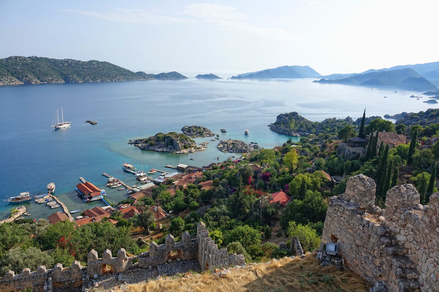
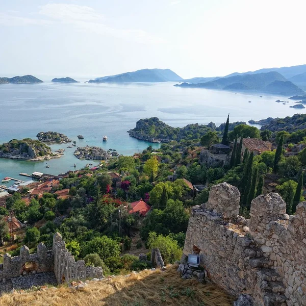
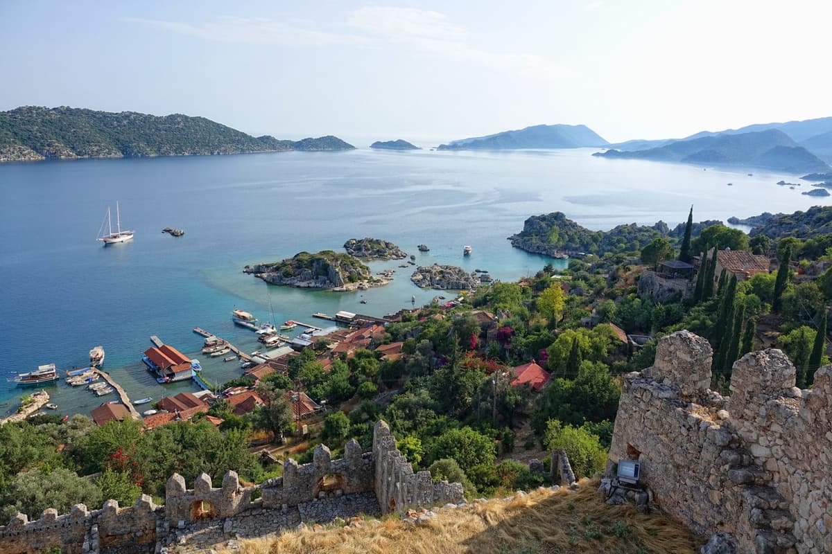
Submerged ruins of the ancient city visible through the clear waters at Kekova

Wikimedia Commons

都市

Kekova

Seyfi Cem Baskin

400 紀元前 – 700 西暦

A partially sunken Lycian city whose ruins shimmer beneath crystal-clear Mediterranean waters, destroyed by a 2nd century earthquake and now one of Turkey's most haunting archaeological seascapes.

312
関心 53

所在地

Antalya · Mediterranean · トルコ

36.19°N · 29.85°E · アジア

Sunken City

Submerged by earthquakes in the 2nd century CE

Ancient Name

Dolichiste, part of the Lycian coastal network

Protection

Specially Protected Area since 1990, no diving allowed

Visibility

Ruins visible through crystal-clear Mediterranean water

Notable Finds

A submerged pottery kiln and large quantities of amphorae, indicating local ceramic production and maritime trade.

Dating Method

Ceramic typology and radiocarbon dating of organic inclusions in mortar from submerged structures.

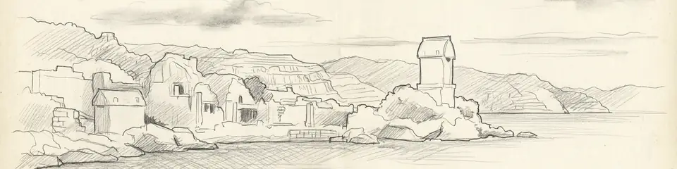
Graphite pencil sketch banner of Kekova

“Kekova offers a uniquely vivid encounter with the seismic vulnerability of Mediterranean civilizations.”

Wikipediaより

Kekova is a partially sunken ancient Lycian city along the Mediterranean coast, its ruins visible through crystal-clear water after 2nd century earthquakes submerged the settlement.

Wikipediaで全文を読む →

所在地

概要

Kekova is the name of both an island and the surrounding region along the Lycian coast of Antalya province, where the ruins of an ancient city lie partially submerged beneath the extraordinarily clear waters of the Mediterranean. The ancient settlement on the island's northern shore — identified as Dolichiste — sank below sea level following devastating earthquakes in the 2nd century CE, creating one of the most visually spectacular archaeological sites in Turkey.

Visible through the transparent water are the remains of staircases, house foundations, harbor quays, and other structures that once formed a thriving Lycian and Roman coastal town. The gradual submersion preserved architectural details that would have been lost to erosion on land, while the warm Mediterranean light illuminating the submerged ruins creates an otherworldly effect.

"The Lycian coast is rugged, but there are islands close to the mainland, such as Dolichiste."
— Strabo, Geographica (c. 7 BC - 23 AD)

The broader Kekova region includes the fortified settlement of Simena (modern Kalekoy) perched on a dramatic hillside above the strait, with a Crusader-era castle incorporating ancient walls and Lycian rock-cut tombs half-submerged at the waterline. Across the strait, the ancient city of Teimioussa (modern Ucagiz) preserves more Lycian sarcophagi and tomb facades.

The Turkish government designated Kekova as a Specially Protected Area in 1990, prohibiting diving and swimming over the submerged ruins to prevent damage. Visitors typically view the underwater city from glass-bottomed boats or kayaks, observing Lycian and Roman construction techniques frozen in time beneath the surface.
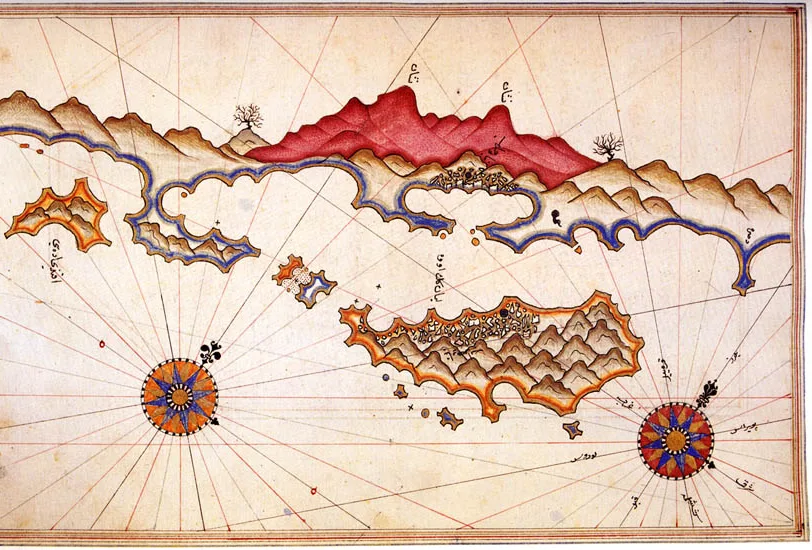
Kekova by Piri Reis
Kekova by Piri Reis | Piri Reis (Public domain)

重要性

Kekova offers a uniquely vivid encounter with the seismic vulnerability of Mediterranean civilizations. The submerged ruins powerfully demonstrate how tectonic activity has shaped the archaeological landscape of coastal Anatolia, destroying cities and reshaping coastlines throughout history. The site's exceptional preservation underwater provides architectural evidence for Lycian and Roman domestic and harbor construction rarely available on land. As a Specially Protected Area, Kekova represents Turkey's commitment to preserving underwater cultural heritage for future study.

証拠と解釈

確立された事実と議論が続く事柄を区別する。

確立された事実

3
  • Underwater survey has documented submerged building foundations, staircases, quay walls, and harbor structures consistent with a Lycian-Roman coastal settlement.
  • Lycian rock-cut tombs at the waterline at Simena (Kalekoy) confirm the region's tectonic subsidence since antiquity.
  • Underwater surveys have identified a submerged, L-shaped quay wall and a breakwater structure, confirming the location and engineering of the ancient harbor.

学術的推論

1
  • The settlement pattern of Dolichiste, Simena, and Teimioussa suggests a networked coastal community sharing harbor facilities and defensive responsibilities.

議論のある解釈

2
  • The precise date and magnitude of the earthquake(s) that submerged Dolichiste remain debated, with some scholars proposing a single catastrophic event and others a gradual subsidence.
  • The function of the large, rectangular submerged structure near the shore is debated, with interpretations ranging from a warehouse (horreum) to a basilica or bath complex.

発見と発掘調査

1982–1985

Underwater survey

Initial underwater archaeological survey documented the extent of the submerged city, mapping house foundations, staircases, and harbor installations.

1990

Protected area designation

Turkish government designated Kekova as a Specially Protected Area, restricting activities to preserve the submerged ruins and marine environment.

2006

Kekova Region Underwater Survey

指揮 Institute of Nautical Archaeology (INA) and Selçuk University

A systematic underwater survey focusing on the submerged ruins of Dolichiste, documenting architectural features and creating detailed site plans.

2009–2015

Simena and Teimioussa surveys

Archaeological surveys of the neighboring land-based settlements documented Lycian tombs, fortification walls, and the relationship between the submerged and surviving ruins.

コミュニティ写真

あなたの体験を共有する

この遺跡を訪れたことがありますか?写真をアップロードして魅力を共有しましょう。

関連記事

このページの引用方法

Atlas Anatolia. (400). Kekova. Atlas Anatolia. https://atlasanatolia.com/ja/site/kekova

コンテンツはCC BY-SA 4.0ライセンスの下で提供されています — 再利用の際は出典表示が必要です。

グラフ

関連する遺跡やストーリーへのつながり。

出典

  • The Sunken Cities of Lycia — George E. Bean (1978)
  • Lycian Turkey: An Archaeological Guide — George E. Bean (1989)
  • Wikipedia — Kekovaリンク

よくある質問

Kekovaはどこにありますか?

KekovaはAntalya, Mediterranean, Türkiyeに位置しています。

Kekovaの年代はいつ頃ですか?

Kekovaはおよそ400 紀元前 – 700 西暦のものとされています。

Kekovaはどの文明に関連していますか?

KekovaはLycian, Roman, Byzantine文明に関連しています。

Kekovaが重要な理由は何ですか?

Kekova offers a uniquely vivid encounter with the seismic vulnerability of Mediterranean civilizations.

Kekovaはユネスコ世界遺産ですか?

Kekovaは現在ユネスコ世界遺産には登録されていません。