
コンテンツへスキップ
Atlas Anatolia
ニュースIce Age teeth in Sulawesi push betel-nut use back as far as 25,000 yearsRoman mosaic and Eros head uncovered in the basilica at Pompeiopolis, Kastamonu
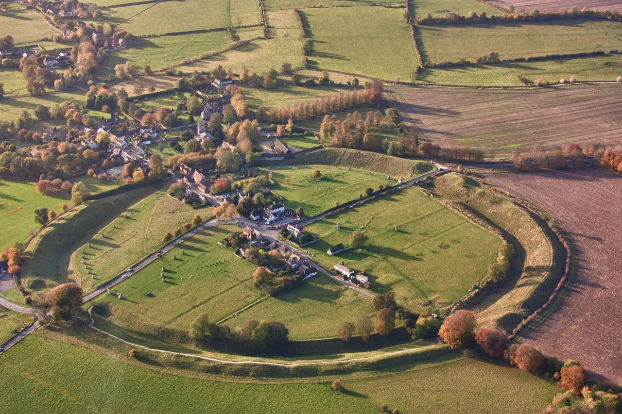
Aerial view of the Avebury henge, showing the stone circles and surrounding village

Wikimedia Commons

Continent Record

Oldest Monument in Europe

記念碑UNESCO

Avebury

Seyfi Cem Baskin

2850 紀元前 – 2200 紀元前

The largest prehistoric stone circle in the world — a Neolithic henge enclosing 28 hectares with a ditch, outer bank, and three interlocking stone circles, part of a sacred landscape that also includes Silbury Hill, West Kennet long barrow, and the Sanctuary.

211
関心 72

所在地

イギリス

51.43°N · 1.85°W · ヨーロッパ

Henge circumference

1.3 km — largest prehistoric stone circle in the world

Outer circle stones (original)

~98 sarsen stones, up to 40 tonnes each

Construction period

c. 2850–2200 BCE (in phases)

Associated monuments

Silbury Hill (37 m), West Kennet Long Barrow, the Sanctuary

UNESCO

World Heritage Site since 1986 (jointly with Stonehenge)

Modern situation

A medieval village was built inside the henge and still exists

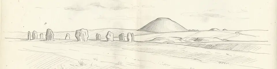
Graphite pencil sketch banner of Avebury

“Avebury is a monument whose scale only makes sense when you walk around it.”

所在地

概要

Avebury lies in Wiltshire, England, 32 km north of Stonehenge, surrounded by a chalk downland landscape dense with Neolithic and Bronze Age monuments. The henge itself — the largest in the world by circumference — consists of a roughly circular earthwork enclosure of 1.3 km circumference with a ditch and outer bank, inside which stand three stone circles: the massive Outer Circle (originally 98 stones, many now missing), and two smaller inner circles of approximately 30 stones each. The surviving stones are undressed sarsen blocks weighing up to 40 tonnes, quarried from the Marlborough Downs 1.5 km away.

Construction began around 2850 BCE and continued in phases for perhaps six centuries, overlapping with the construction of Silbury Hill (the tallest prehistoric mound in Europe, 37 m high, still without a clear purpose) and the West Kennet long barrow (a collective tomb used for over a millennium). The entire Avebury landscape is crossed by two prehistoric stone avenues: the West Kennet Avenue, leading 2.4 km south toward a smaller circle called the Sanctuary; and the Beckhampton Avenue, leading southwest. Together these form a processional sacred landscape covering several square kilometres.

The village of Avebury was built inside the henge in the medieval period — a settlement inside a monument. Many stones were deliberately buried in the 14th century (possibly on religious grounds, the pagan stones being considered dangerous) and others were broken up for building material in the 18th century, reducing the original 98 outer stones to 27. The antiquary John Aubrey first described the site to Charles II in 1663. William Stukeley's meticulous surveys in the 1720s–1740s recorded stones that have since been lost. Alexander Keiller excavated and partially restored the site between 1934 and 1939, re-erecting fallen stones and marking buried ones with concrete pillars.

重要性

Avebury is a monument whose scale only makes sense when you walk around it. Stonehenge fits inside one of its inner circles. The ditch alone required the removal of 200,000 tonnes of chalk with antler picks — a labor commitment implying a regional population organized over generations. Yet unlike Stonehenge, Avebury is never described to its full scale: the outer bank and ditch (which have lost 60% of their original height to silting) are not visible as a whole from any point within the circle. It was never meant to be seen — it was meant to be moved through. The landscape it anchors — Silbury Hill, the avenues, the Sanctuary, West Kennet — form a Neolithic sacred territory that defines the Marlborough Downs as a ceremonial rather than merely agricultural landscape. A village still lives inside it.

証拠と解釈

確立された事実と議論が続く事柄を区別する。

確立された事実

2
  • Radiocarbon dates from antler picks found in the base of the ditch cluster between 2850 and 2500 BCE, establishing the construction period and confirming the henge is broadly contemporary with the later stages of Stonehenge and with Silbury Hill.
  • The deliberate burial of 14th-century stones — documented by the discovery of a barber-surgeon's skeleton crushed beneath a toppling stone, along with coins and medical instruments — indicates that medieval communities actively suppressed the stones on religious grounds.

学術的推論

1
  • Geophysical survey has identified the positions of many missing stones, and the planned orientation of the West Kennet Avenue suggests a processional route connecting the main henge to the Sanctuary at Overton Hill, probably used for seasonal ceremonial gatherings.

議論のある解釈

1
  • The purpose of Silbury Hill — immediately adjacent to Avebury and the largest prehistoric mound in Europe — remains unknown. It does not appear to be a burial mound (no burials have been found), and its internal structure, revealed by tunneling, shows three phases of construction but no obvious functional core.

コミュニティ写真

あなたの体験を共有する

この遺跡を訪れたことがありますか?写真をアップロードして魅力を共有しましょう。

このページの引用方法

Atlas Anatolia. (2850). Avebury. Atlas Anatolia. https://atlasanatolia.com/ja/site/avebury

コンテンツはCC BY-SA 4.0ライセンスの下で提供されています — 再利用の際は出典表示が必要です。

出典

  • Avebury: Biography of a Landscape — Joshua Pollard and Andrew Reynolds (2002)
  • Alexander Keiller's Excavations at Avebury, 1937–1939 — Isobel Smith (1965)
  • English Heritage — Aveburyリンク

よくある質問

Aveburyはどこにありますか?

AveburyはUnited Kingdomに位置しています。

Aveburyの年代はいつ頃ですか?

Aveburyはおよそ2850 紀元前 – 2200 紀元前のものとされています。

Aveburyはどの文明に関連していますか?

AveburyはMegalithic European文明に関連しています。

Aveburyが重要な理由は何ですか?

Avebury is a monument whose scale only makes sense when you walk around it.

Aveburyはユネスコ世界遺産ですか?

はい — Aveburyはユネスコ世界遺産に登録されています。