
Skip to content
Atlas AnatoliaAtlas Anatolia
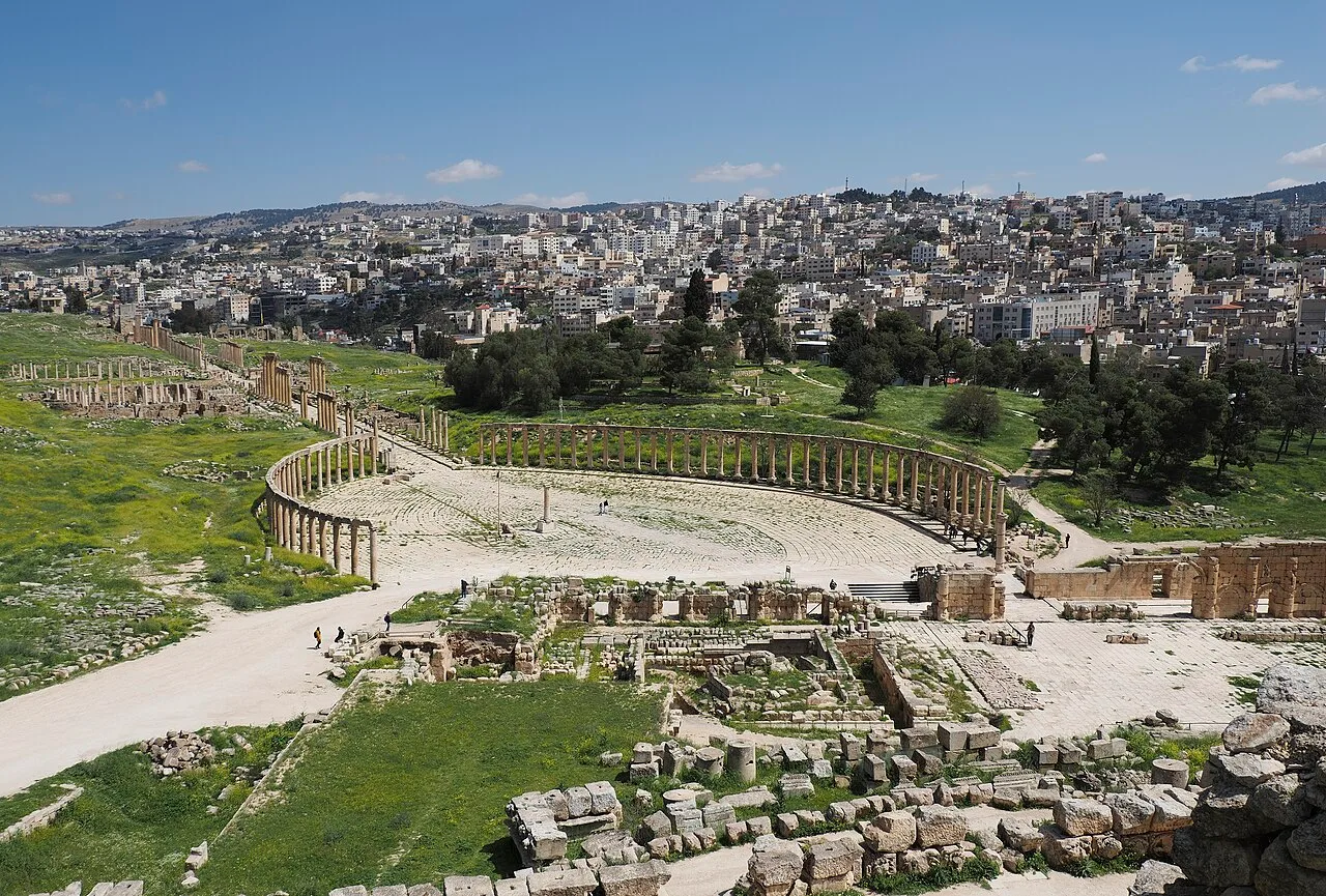
The colonnaded Oval Forum at Jerash (Gerasa), Jordan

Jerash

جرش170 BCE – 749 CE
68

Interest

HellenisticRomanByzantineRomanGreek

Refounded

Hellenistic polis (Antioch on the Chrysorrhoas), 2nd c. BCE

Peak

1st–3rd century CE under Roman rule; member of the Decapolis

Hadrian's Arch

Built for the emperor's visit, 129–130 CE

Oval Forum

Unique colonnaded oval plaza linking cardo to Temple of Zeus

Destroyed

Earthquake of 749 CE; rediscovered by Seetzen in 1806

Theatres

South Theatre (~3,000 seats) and North Theatre

Jerash offers one of the most complete and legible pictures of a provincial Roman city to survive anywhere in the former empire — earning it the nickname "the Pompeii of the East," though it was buried by earthquake and abandonment rather than volcanic ash.”

Overview

Jerash lies in a well-watered valley in the hills of Gilead, about 48 kilometres north of Amman, the modern capital of Jordan. The ancient city of Gerasa was one of the cities of the Decapolis, a loose league of Hellenised cities east of the Jordan. Although a settlement existed here in earlier periods, the city was refounded as a Greek polis in the Hellenistic period — possibly under Seleucid auspices in the 2nd century BCE, when it bore the formal name Antioch on the Chrysorrhoas ("the Golden River"). It came under Roman control with Pompey's campaigns of 63 BCE and entered its period of greatest prosperity under Roman rule.

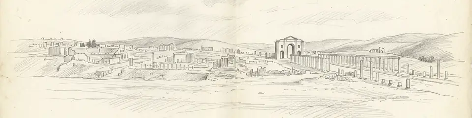
The city flourished from the 1st through the 3rd century CE, enriched by trade and by the agricultural wealth of its territory. Its prosperity was monumentalised in an ambitious building programme financed by local elites. A visit by the emperor Hadrian in 129–130 CE prompted the construction of a triumphal arch — Hadrian's Arch — at the southern approach to the city. The civic centre is laid out along a colonnaded cardo maximus, the main north–south street, paved and lined with hundreds of columns and still showing the ruts worn by ancient cart wheels. At its southern end lies the city's most distinctive monument: a great oval plaza, the Oval Forum, surrounded by an unbroken colonnade of Ionic columns — an unusual and elegant solution to linking the main street with the Temple of Zeus on the hill above.

Gerasa was lavishly supplied with public buildings: the South Theatre (seating around 3,000) and North Theatre, the monumental Temple of Artemis (the city's patron deity) raised on a vast terrace and approached by a grand staircase, nymphaea (ornamental public fountains), baths, and a hippodrome where chariot races were held. In the Byzantine period the city remained important and acquired more than a dozen churches, many paved with elaborate mosaics, several built from materials scavenged from the now-declining pagan temples.

The city declined after the Persian and Arab conquests of the 7th century, and was devastated by the great earthquake of 749 CE, which toppled much of the standing architecture. Subsequently abandoned and gradually covered by soil, Gerasa was largely forgotten until the German traveller Ulrich Jasper Seetzen identified the ruins in 1806. Systematic excavation began in the 1920s and has continued since, exposing one of the most complete Roman urban ensembles in the Near East.

Why It Matters

Jerash offers one of the most complete and legible pictures of a provincial Roman city to survive anywhere in the former empire — earning it the nickname "the Pompeii of the East," though it was buried by earthquake and abandonment rather than volcanic ash. Because it was never built over by a large modern city, its street plan, civic spaces, temples, theatres, and fountains can be read as a coherent whole, making it an invaluable source for understanding Roman urban planning, public life, and the architecture of the eastern provinces. Its oval forum is architecturally unique, and the superimposed phases — Hellenistic foundation, Roman monumental city, Byzantine Christian town — allow the transformation of a Near Eastern city across seven centuries to be traced in stone. The site is one of Jordan's most important monuments after Petra and a major centre of ongoing archaeological research. It is on Jordan's UNESCO World Heritage Tentative List.

Stay curious

New stories and sites, once a month. No spam.

Evidence & Interpretation

Distinguishing what is well-established from what remains debated.

Well-Established Facts

3
  • Hadrian's Arch bears a dedicatory inscription commemorating the emperor's visit in 129–130 CE, securely dating the monument and confirming the imperial visit recorded in other sources.
  • The destruction of the city by the earthquake of 18 January 749 CE is confirmed by collapse layers, toppled colonnades found fallen in alignment, and coins and ceramics sealed beneath the debris.
  • More than a dozen Byzantine churches with dated mosaic floors have been excavated, several reusing column drums and masonry from the earlier pagan temples — documenting the city's Christianisation between the 4th and 6th centuries CE.

Scholarly Inferences

1
  • The city's prosperity is attributed to its position on trade routes and the agricultural productivity of its territory, inferred from the scale of privately financed public monuments and from inscriptions recording benefactions by local citizens rather than the imperial treasury.

Debated Interpretations

1
  • The exact circumstances and date of the Hellenistic refoundation are debated. The name "Antioch on the Chrysorrhoas" implies a Seleucid foundation, but whether the city was founded by Seleucid king Antiochus IV, by Ptolemaic authorities, or grew from an earlier village remains uncertain in the absence of decisive early evidence.

More Photos

Museum Artifacts

Community Photos

Share your experience

Have you visited this site? Upload your photos to help others discover it.

Location

Sources

  • Gerasa, City of the DecapolisKraeling, Carl H. (1938)
  • Jerash and the DecapolisBrowning, Iain (1982)

Research Papers