
콘텐츠로 건너뛰기
Atlas Anatolia
디그
뉴스술라웨시 빙하기 치아에서 빈랑 사용 25,000년 전까지 소급카스타모누 폼페이오폴리스 바실리카에서 로마 모자이크와 에로스 두상 발견
Mud-brick ksar of Aït Ben Haddou climbing a hillside in Morocco

Wikimedia Commons (CC BY-SA 3.0)

Continent Record

Oldest Settlement in Africa

정착지유네스코주요

Aït Ben Haddou

Seyfi Cem Baskin

آيت بن حدو1600 서기 – 1950 서기

A fortified earthen ksar on the old caravan route between the Sahara and Marrakesh, its stacked pisé towers climbing a hillside above the Ounila River. UNESCO listed the ensemble in 1987; filmmakers from Gladiator to recent Trojan epics have used its ridge as a stand-in for ancient walled cities when cameras need sun, dust, and mud-brick authenticity.

211
관심 18

위치

모로코

31.05°N · 7.13°W · 아프리카

UNESCO

World Heritage Site (1987)

Material

Pisé (rammed earth) and mud brick

Route

Historic caravan link Marrakesh–Sahara

Cinema

Frequent location double for ancient walled cities

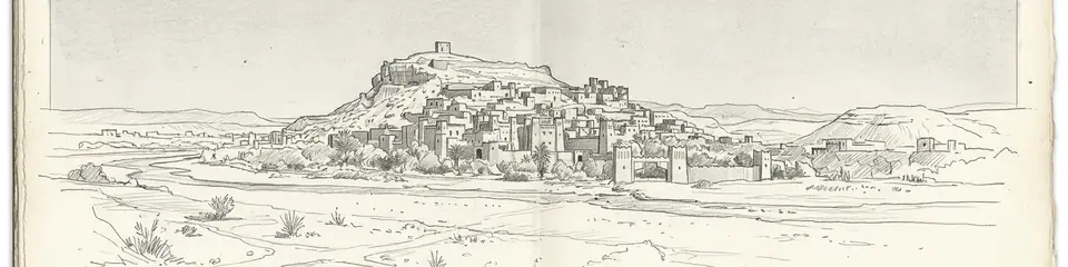
Graphite pencil sketch banner of Aït Ben Haddou

“Aït Ben Haddou shows how caravan-era Berber builders engineered multi-storey earth architecture that still reads as "ancient" on camera a thousand years later.”

위치

개요

Aït Ben Haddou rises from the Ounila Valley in the High Atlas foothills of Morocco, about 30 kilometres northwest of Ouarzazate. The site is a ksar, a communal fortified village of pisé (rammed earth) and mud brick, with a kasbah at the summit and granaries, dwellings, and a public square stepping down the slope. Berber families lived here into the 20th century; most residents now inhabit the modern village across the river, but the old ksar remains intact enough to read as a medieval North African skyline.

Caravans once carried salt, gold, and slaves along this corridor toward Marrakesh and the desert. The architecture reflects Glaoui clan power in the 17th and 18th centuries, though earlier occupation layers exist. UNESCO inscribed Aït Ben Haddou in 1987 as an outstanding example of southern Moroccan earthen architecture.
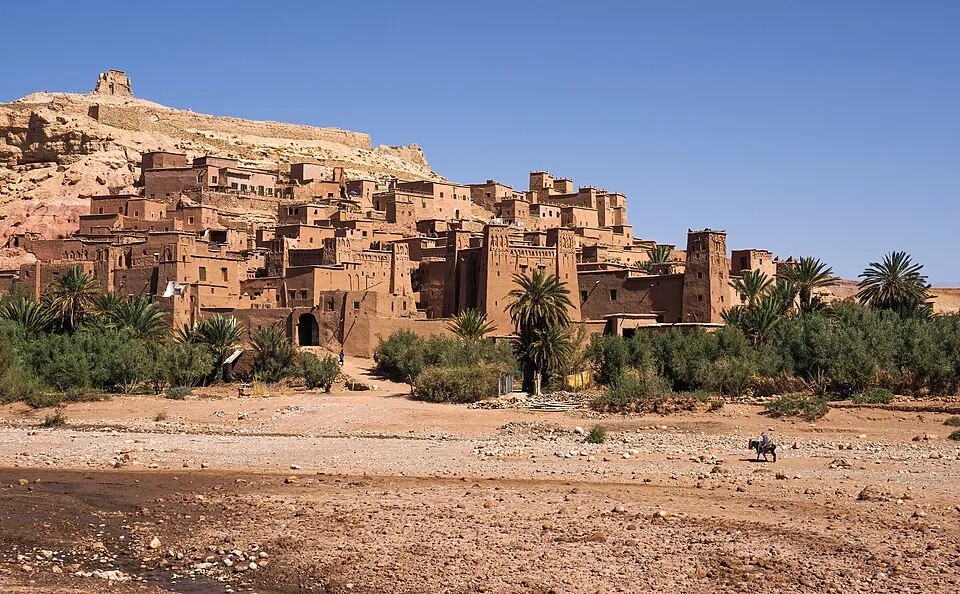
Ksar Aït Benhaddou, Marocco (أيت بن حدو، المغرب, ⴰⵢⵜ ⵃⴰⴷⴷⵓ)
Ksar Aït Benhaddou, Marocco (أيت بن حدو، المغرب, ⴰⵢⵜ ⵃⴰⴷⴷⵓ) | Petar Milošević (CC BY-SA 4.0)
"The ksar climbs the hillside in tiers of earth and straw, each family's granary stacked above the last, as if the mountain itself had been taught to build."
— Paraphrase of UNESCO description of Aït Ben Haddou

Hollywood location scouts know the ksar well. Lawrence of Arabia, Gladiator, and Game of Thrones filmed among these walls. When Christopher Nolan's production of Homer's Odyssey needed exterior shots of a Bronze Age citadel, reports placed unit work here rather than at archaeological Troy in Turkey. That choice separates cinematic Troy from Hisarlık: the film's walls are Moroccan mud brick; the excavated city is stone and brick on the Dardanelles. Both can enrich a viewer's curiosity if labelled honestly.
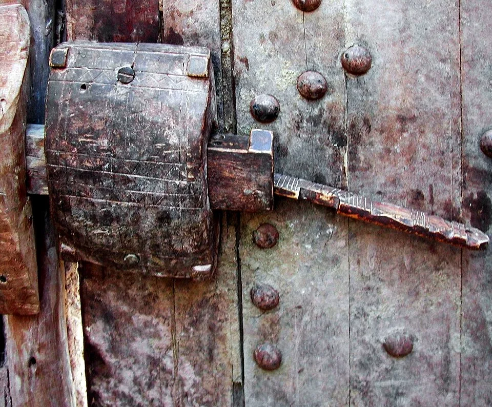
Wooden lock in Ksar of Aït-Ben-Haddou
Wooden lock in Ksar of Aït-Ben-Haddou | Pierre André Leclercq (CC BY-SA 4.0)

Visitors ford the river (or use a footbridge) and climb alleys so narrow two people cannot pass. From the top granary the valley opens south toward Ouarzazate's studios. Pair the ksar with Volubilis and desert routes in Atlas stories to compare Roman stone with Berber earth.

중요성

Aït Ben Haddou shows how caravan-era Berber builders engineered multi-storey earth architecture that still reads as "ancient" on camera a thousand years later. It is the clearest teaching moment for separating Homeric Troy at Hisarlık from film-set Troy in Morocco.

증거와 해석

확립된 사실과 논쟁 중인 사항을 구분합니다.

잘 확립된 사실

2
  • UNESCO documentation dates the visible ksar largely to the 17th–18th centuries CE under Glaoui patronage.
  • Earthen architecture and urban layout match known Berber ksar typology.

학술적 추론

1
  • The site served trans-Saharan trade caravans before modern roads bypassed the valley.

논쟁 중인 해석

1
  • How much earlier occupation lies beneath the standing ksar is not fully published.

커뮤니티 사진

당신의 경험을 공유하세요

이 유적지를 방문하셨나요? 다른 탐험가들을 위해 사진을 업로드해 보세요.

관련 이야기

이 페이지 인용 방법

Atlas Anatolia. (1600). Aït Ben Haddou. Atlas Anatolia. https://atlasanatolia.com/ko/site/ait-ben-haddou

콘텐츠는 CC BY-SA 4.0 라이선스에 따라 제공됩니다 — 재사용 시 출처 표시가 필요합니다.

그래프

관련 유적지와 스토리로의 연결.

출처

  • UNESCO — Ksar of Ait-Ben-Haddou링크
  • Cités imprenables du Haut-Atlas — Micaud, Charles (1956)

자주 묻는 질문

Aït Ben Haddou은(는) 어디에 위치해 있나요?

Aït Ben Haddou은(는) Morocco에 위치해 있습니다.

Aït Ben Haddou의 연대는 언제인가요?

Aït Ben Haddou의 연대는 대략 1600 서기 – 1950 서기로 거슬러 올라갑니다.

Aït Ben Haddou과(와) 관련된 고대 문명은 무엇인가요?

Aït Ben Haddou은(는) Islamic / Medieval, Berber 문명과 관련이 있습니다.

Aït Ben Haddou이(가) 중요한 이유는 무엇인가요?

Aït Ben Haddou shows how caravan-era Berber builders engineered multi-storey earth architecture that still reads as "ancient" on camera a thousand years later.

Aït Ben Haddou은(는) 유네스코 세계유산인가요?

예 — Aït Ben Haddou은(는) 유네스코 세계유산으로 등재되어 있습니다.