
コンテンツへスキップ
Atlas Anatolia
ニュースIce Age teeth in Sulawesi push betel-nut use back as far as 25,000 yearsRoman mosaic and Eros head uncovered in the basilica at Pompeiopolis, Kastamonu
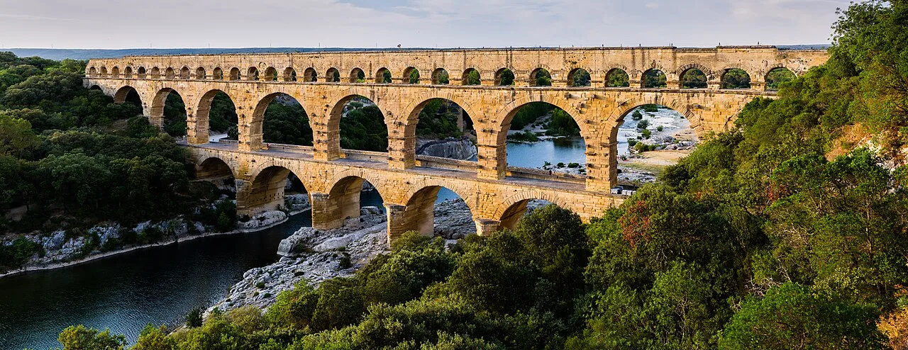
The three-tiered Roman aqueduct bridge Pont du Gard over the Gardon river, France

Wikimedia Commons

Country Record

Oldest Monument in France

記念碑UNESCO注目

Pont du Gard

Seyfi Cem Baskin

40 西暦 – 60 西暦

The highest of all Roman aqueduct bridges — a three-tiered limestone arcade nearly 50 metres tall that leaps the Gardon river gorge in southern France. Built in the 1st century CE to carry the aqueduct of Nîmes, it is a masterpiece of Roman engineering and one of the best-preserved structures of the ancient world.

311
関心 74

所在地

フランス

43.95°N · 4.54°E · ヨーロッパ

Built

Mid-1st century CE

Height

~49 m — the tallest Roman aqueduct bridge

Tiers

Three: 6 + 11 + 35 arches; channel on the top level

Aqueduct length

~50 km from Uzès to Nîmes (Nemausus)

Gradient

~12.6 m total drop — about 1 in 3,000

UNESCO

World Heritage Site (1985)

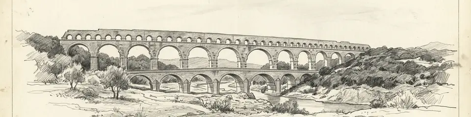
Graphite pencil sketch banner of Pont du Gard

“The Pont du Gard is the most celebrated Roman aqueduct bridge in the world and a defining image of Roman engineering ambition.”

所在地

概要

The Pont du Gard stands in the countryside near Vers-Pont-du-Gard in the Gard department of southern France. It is not an isolated bridge but the most dramatic surviving element of a 50-kilometre aqueduct that carried water from springs near Uzès to the Roman colony of Nemausus (modern Nîmes). Where the conduit had to cross the gorge of the Gardon river, Roman engineers raised a bridge of three superimposed rows of arches to maintain the channel's gentle, continuous gradient.

The structure is about 49 metres high — the tallest of all known Roman aqueduct bridges — and originally around 360 metres long at its upper level. The bottom tier has 6 arches, the middle 11, and the top 35 smaller arches that carried the water channel itself. It is built of soft yellow limestone quarried nearby, in blocks some weighing up to 6 tonnes, largely laid without mortar in the lower tiers. Projecting stones left on the faces served as supports for scaffolding and for future maintenance. The aqueduct as a whole descends only about 12.6 metres over its entire 50-kilometre length, an average gradient of around 1 in 3,000 — an extraordinary feat of surveying.

The aqueduct is generally dated to the middle of the 1st century CE. It supplied Nîmes with an estimated tens of thousands of cubic metres of water per day, feeding the city's baths, fountains, and homes, for several centuries. From the 4th century onward maintenance lapsed, the channel silted up with mineral deposits, and the aqueduct gradually fell out of use. In the medieval and early modern periods the lower tier was adapted as a road bridge, which helped ensure the monument's survival. It became an object of admiration to travellers and engineers from the Renaissance onward.

重要性

The Pont du Gard is the most celebrated Roman aqueduct bridge in the world and a defining image of Roman engineering ambition. Its scale, the precision of its construction, and the astonishing accuracy of the survey that gave the entire 50-kilometre aqueduct its near-imperceptible gradient make it a benchmark in the history of technology. It has influenced engineers and architects for centuries and remains one of the best-preserved monuments of the Roman world. It was inscribed as a UNESCO World Heritage Site in 1985.

証拠と解釈

確立された事実と議論が続く事柄を区別する。

確立された事実

3
  • The bridge was part of the aqueduct supplying Nîmes, traced over its full ~50 km course; the channel's thick calcium-carbonate deposits confirm prolonged water flow.
  • Projecting blocks and ledges left on the faces are construction features — supports for scaffolding and centering during building and for later maintenance access.
  • The lower tier was adapted as a road bridge in the medieval and early-modern periods, documented in records and physically evident, which contributed to the monument's preservation.

学術的推論

1
  • The aqueduct's near-imperceptible average gradient (~1:3,000) implies advanced Roman surveying using instruments such as the chorobates and groma; the exact methods are reconstructed rather than documented.

議論のある解釈

1
  • The precise construction date is debated within the 1st century CE; an older tradition attributing it to Agrippa (c. 19 BCE) is now generally rejected in favour of a mid-1st-century date on archaeological grounds.

コミュニティ写真

あなたの体験を共有する

この遺跡を訪れたことがありますか?写真をアップロードして魅力を共有しましょう。

このページの引用方法

Atlas Anatolia. (40). Pont du Gard. Atlas Anatolia. https://atlasanatolia.com/ja/site/pont-du-gard

コンテンツはCC BY-SA 4.0ライセンスの下で提供されています — 再利用の際は出典表示が必要です。

出典

  • Roman Aqueducts and Water Supply — Hodge, A. Trevor (2002)
  • L'aqueduc de Nîmes et le Pont du Gard — Fabre, G.; Fiches, J.-L.; Paillet, J.-L. (2000)

よくある質問

Pont du Gardはどこにありますか?

Pont du GardはFranceに位置しています。

Pont du Gardの年代はいつ頃ですか?

Pont du Gardはおよそ40 西暦 – 60 西暦のものとされています。

Pont du Gardはどの文明に関連していますか?

Pont du GardはRoman文明に関連しています。

Pont du Gardが重要な理由は何ですか?

The Pont du Gard is the most celebrated Roman aqueduct bridge in the world and a defining image of Roman engineering ambition.

Pont du Gardはユネスコ世界遺産ですか?

はい — Pont du Gardはユネスコ世界遺産に登録されています。