
コンテンツへスキップ
Atlas Anatolia
ニュースIce Age teeth in Sulawesi push betel-nut use back as far as 25,000 yearsRoman mosaic and Eros head uncovered in the basilica at Pompeiopolis, Kastamonu
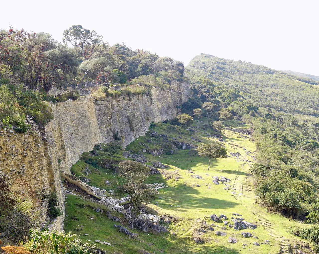
Massive stone perimeter walls of the Chachapoya fortress-city of Kuelap, Amazonas, Peru

Wikimedia Commons

Continent Record

Oldest Fortress in South America

要塞

Kuelap

Seyfi Cem Baskin

Cuélap900 西暦 – 1470 西暦

A colossal stone fortress-city perched on a limestone ridge 3,000 metres above the Utcubamba Valley in the Peruvian Andes — built by the Chachapoya, the "Warriors of the Clouds," between roughly 900 and 1470 CE. Enclosed by walls up to 19 metres tall and packed with over 400 circular stone houses, Kuelap is often called the "Machu Picchu of the North" for its scale, preservation, and dramatic mountaintop setting — yet it predates Machu Picchu by centuries and was never an Inca creation.

311
関心 53

所在地

Amazonas · ペルー

6.42°S · 77.93°W · 南アメリカ

Built

c. 900–1470 CE by the Chachapoya culture

Walls

Perimeter walls up to 19 m tall enclosing a 600 m plateau

Structures

Over 400 circular stone houses — distinct from Inca rectangular architecture

Elevation

~3,000 m above sea level, overlooking the Utcubamba Valley

Nickname

"Machu Picchu of the North" — predates Machu Picchu by centuries

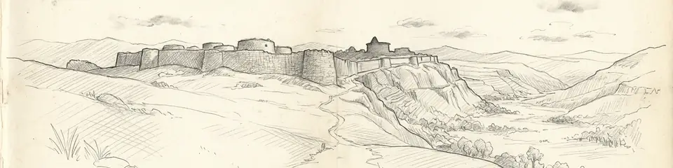
Graphite pencil sketch banner of Kuelap

“Kuelap is the clearest surviving evidence that the pre-Columbian Andes were not simply "Inca territory" before the Spanish arrived — they were a mosaic of distinct, sophisticated cultures, many of which the Inca only recently and often violently absorbed.”

所在地

概要

Kuelap sits atop a narrow limestone ridge in the Amazonas region of northern Peru, at an elevation of roughly 3,000 metres overlooking the Utcubamba Valley. It was built by the Chachapoya culture, a confederation of cloud-forest societies whose name — bestowed by their Inca conquerors — is often translated as "Warriors of the Clouds" or "People of the Clouds." Construction began around 900 CE and continued in phases through approximately 1470 CE, when the site fell under Inca control shortly before the Spanish conquest.

The defining feature of Kuelap is its massive perimeter wall, built of dressed limestone blocks and standing up to 19 metres high in places — taller than a five-storey building — enclosing a plateau roughly 600 metres long. Access to the interior was deliberately restricted to a small number of narrow, tapering stone entrances, some barely wide enough for a single person, which archaeologists interpret as a defensive mechanism against the site's many rivals, including eventually the expanding Inca Empire.

Inside the walls, Kuelap contained more than 400 circular stone structures — a sharp contrast to the rectangular architecture typical of the Inca and other Andean cultures. Many of the buildings were decorated with friezes of zigzag and rhomboid geometric patterns woven into the stonework, a hallmark of Chachapoya architectural style found at other sites throughout the region. Archaeologists estimate that at its peak Kuelap may have housed several thousand residents, functioning as a major political, religious, and residential centre for the Chachapoya confederation.

One structure, known as El Tintero ("The Inkwell"), is a large inverted cone-shaped building whose function remains debated — proposed interpretations range from a solar observatory to a ceremonial or storage structure. Later Inca-style rectangular buildings found within the complex confirm a phase of Inca occupation and modification following their conquest of the Chachapoya in the 1470s, shortly before Spanish forces arrived in the 1530s.

Kuelap's remoteness — accessible historically only by a strenuous mountain trek — preserved it from the scale of looting and destruction faced by many other Andean sites, though the Chachapoya themselves were nearly wiped out by disease and warfare following Spanish contact. The site was formally documented in 1843 by Peruvian judge Juan Crisóstomo Nieto, though local communities had never lost awareness of the ruins. A cable car connecting the valley floor to the fortress opened in 2017, dramatically increasing access and tourism. Kuelap remains on Peru's UNESCO World Heritage Tentative List.

重要性

Kuelap is the clearest surviving evidence that the pre-Columbian Andes were not simply "Inca territory" before the Spanish arrived — they were a mosaic of distinct, sophisticated cultures, many of which the Inca only recently and often violently absorbed. The Chachapoya built one of the largest stone structures in the pre-Columbian Americas by volume of stone used — by some estimates exceeding the Great Pyramid of Giza — centuries before Inca expansion reached their territory. The circular architecture and geometric friezes of Kuelap represent a completely distinct building tradition from the rectilinear, finely fitted stonework the Inca are famous for. This architectural signature lets archaeologists trace the Chachapoya's cultural reach across dozens of sites in the eastern Andes and distinguish their work from later Inca modifications with precision. Kuelap's massive defensive walls and restricted entrances also testify to a landscape of chronic regional conflict in the pre-Inca Andes — the Chachapoya built not for display but for survival, in a world of competing polities that the later Inca and Spanish conquests erased from popular memory.

証拠と解釈

確立された事実と議論が続く事柄を区別する。

確立された事実

3
  • Radiocarbon dating and ceramic seriation place the main construction phases of Kuelap between c. 900 and 1470 CE, predating Inca expansion into the region.
  • Distinct circular stone architecture with zigzag and rhomboid friezes, found throughout the complex, matches the documented Chachapoya architectural style identified at other regional sites.
  • Rectangular, Inca-style structures within the complex, stratigraphically later than the surrounding circular buildings, confirm a phase of Inca occupation following their conquest of the Chachapoya c. 1470.

学術的推論

1
  • The scale and defensive design of the perimeter walls and restricted entrances suggest a primary defensive function, though ceremonial and status purposes likely coexisted.

議論のある解釈

1
  • The function of El Tintero, the large inverted cone-shaped structure, remains unresolved — proposed uses include an astronomical observatory, ceremonial platform, or grain storage facility.

発見と発掘調査

1843

Juan Crisóstomo Nieto documentation

First formal documentation of the ruins by a Peruvian judge, bringing Kuelap to wider scholarly attention.

1996–2010

Alfredo Narváez Vargas excavations

Extensive excavation and conservation work by Peru's Ministry of Culture clarified the site's chronology and architectural sequence.

コミュニティ写真

あなたの体験を共有する

この遺跡を訪れたことがありますか?写真をアップロードして魅力を共有しましょう。

このページの引用方法

Atlas Anatolia. (900). Kuelap. Atlas Anatolia. https://atlasanatolia.com/ja/site/kuelap

コンテンツはCC BY-SA 4.0ライセンスの下で提供されています — 再利用の際は出典表示が必要です。

出典

  • Warriors of the Clouds: A Lost Civilization in the Upper Amazon of Peru — Muscutt, Keith (1998)
  • Kuelap: Centro del poder político y religioso de los Chachapoya — Narváez Vargas, Alfredo (2013)
  • UNESCO Tentative List — Kuelapリンク

よくある質問

Kuelapはどこにありますか?

KuelapはAmazonas, Peruに位置しています。

Kuelapの年代はいつ頃ですか?

Kuelapはおよそ900 西暦 – 1470 西暦のものとされています。

Kuelapはどの文明に関連していますか?

KuelapはInca, Chachapoya文明に関連しています。

Kuelapが重要な理由は何ですか?

Kuelap is the clearest surviving evidence that the pre-Columbian Andes were not simply "Inca territory" before the Spanish arrived — they were a mosaic of distinct, sophisticated cultures, many of which the Inca only recently and often violently absorbed.

Kuelapはユネスコ世界遺産ですか?

Kuelapは現在ユネスコ世界遺産には登録されていません。