
コンテンツへスキップ
Atlas Anatolia
ニュースIce Age teeth in Sulawesi push betel-nut use back as far as 25,000 yearsRoman mosaic and Eros head uncovered in the basilica at Pompeiopolis, Kastamonu
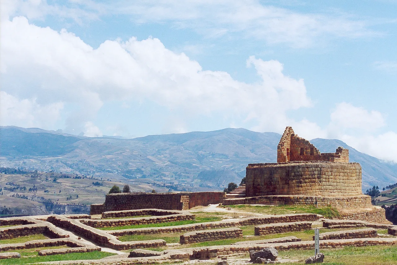
The elliptical Castillo (Temple of the Sun) at Ingapirca, built by the Inca atop an earlier Cañari sacred site, Ecuador

Wikimedia Commons

複合体

Ingapirca

Seyfi Cem Baskin

500 西暦 – 1532 西暦

Ecuador's most important archaeological site — an elliptical stone temple complex built atop an earlier Cañari sacred site, combining Cañari lunar worship with Inca solar religion. Its centrepiece, the Castillo (Temple of the Sun), is a masterwork of Inca dry-stone construction whose elliptical platform is astronomically aligned, marking the fusion of two distinct Andean civilizations in the decades before Spanish conquest.

31
関心 47

所在地

Cañar Province · Ecuador

2.54°S · 78.92°W · 南アメリカ

Cañari origins

Sacred site from c. 500 CE, dedicated to Cañari moon worship

Inca construction

Castillo (Temple of the Sun) built under Tupac Yupanqui / Huayna Capac, c. 1450–1500 CE

Castillo

Elliptical Inca ashlar platform, astronomically aligned to solstices and equinoxes

Elevation

~3,160 m in the Ecuadorian highlands

Significance

Largest and best-preserved pre-Columbian complex in Ecuador

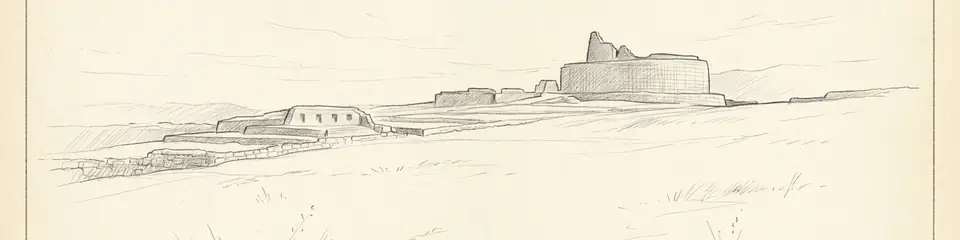
Graphite pencil sketch banner of Ingapirca

“Ingapirca is a rare place where the archaeological record directly shows imperial absorption rather than replacement.”

所在地

概要

Ingapirca ("Wall of the Inca" in Quechua) sits at approximately 3,160 metres elevation in Cañar Province in the Ecuadorian highlands. It is the largest and best-preserved pre-Columbian archaeological complex in Ecuador, and one of the clearest surviving examples of the layered relationship between the Inca Empire and the cultures it absorbed during its rapid 15th-century expansion.

The site was originally sacred to the Cañari people, an agricultural and moon-worshipping society who occupied the southern Ecuadorian highlands for centuries before Inca contact. When the Inca Empire, under Tupac Yupanqui and later Huayna Capac, extended its control into the region in the late 15th century, they built directly on top of and around the existing Cañari religious centre — a common Inca strategy for absorbing conquered peoples' sacred geography rather than erasing it.

The complex's defining structure is the Castillo, an elliptical platform of finely fitted Inca ashlar masonry that functioned as a Temple of the Sun (Inti). Its curved form is unusual among Inca structures, which typically favour rectilinear designs, and is thought to reflect adaptation to the pre-existing Cañari sacred site beneath it. The temple's walls and openings are astronomically aligned to track solstices and equinoxes, allowing priests to regulate the agricultural and ceremonial calendar.

Surrounding the Castillo are the remains of collca (storage buildings), a possible Cañari-era cemetery, aqueducts and water channels, and a stretch of the Inca road system (Qhapaq Ñan) that once connected Ingapirca to Cusco, over 1,600 kilometres to the south. Excavations have recovered ceramics, tools, and burial goods from both Cañari and Inca occupation phases, allowing archaeologists to document the transition between the two cultures in unusual material detail.

Ingapirca was studied by early travellers including the Spanish naturalist Antonio de Ulloa in the 18th century, and has been the subject of sustained Ecuadorian and international archaeological research since the early 20th century. It remains an active site of both scholarship and Cañari cultural identity, with the nearby Inti Raymi and Cañari solstice festivals still celebrated at the site today.

重要性

Ingapirca is a rare place where the archaeological record directly shows imperial absorption rather than replacement. Most Inca sites obscure what came before them; at Ingapirca, Cañari and Inca construction phases sit side by side, letting archaeologists trace exactly how the Inca incorporated a conquered people's sacred landscape into their own state religion rather than simply destroying it. As the largest and most intact pre-Columbian complex in Ecuador, Ingapirca anchors the country's archaeological record in a period — the final decades before Spanish conquest — that is otherwise thinly documented compared to the heavily studied Peruvian and Bolivian Andes. It demonstrates that Inca imperial architecture, engineering, and astronomy extended far beyond the empire's Peruvian heartland. The elliptical Temple of the Sun also stands as one of the finest surviving examples of Inca dry-stone construction outside Peru — evidence that the empire's renowned masonry techniques, requiring no mortar yet capable of surviving five centuries of seismic activity, were exported and adapted wherever the empire expanded.

証拠と解釈

確立された事実と議論が続く事柄を区別する。

確立された事実

3
  • Stratigraphic excavation has identified distinct Cañari and Inca occupation layers at Ingapirca, with Inca ashlar construction directly overlying earlier Cañari features.
  • Archaeoastronomical survey of the Castillo's window and doorway alignments confirms deliberate orientation toward solstice sunrise and sunset positions.
  • A section of the Inca road system (Qhapaq Ñan) has been traced connecting Ingapirca to the broader Inca road network extending toward Cusco.

議論のある解釈

1
  • The exact function of the elliptical structure identified as a possible Cañari-era cemetery beneath the Castillo remains debated, with some researchers proposing alternative ceremonial uses.

発見と発掘調査

1919

Max Uhle survey

Early scientific documentation of Ingapirca by the German-Peruvian archaeologist Max Uhle, a pioneer of Andean archaeology.

1966–1982

Ecuadorian state excavation and restoration

Systematic excavation and site conservation by Ecuador's national cultural heritage authorities established the current understanding of the Cañari-Inca sequence.

コミュニティ写真

あなたの体験を共有する

この遺跡を訪れたことがありますか?写真をアップロードして魅力を共有しましょう。

このページの引用方法

Atlas Anatolia. (500). Ingapirca. Atlas Anatolia. https://atlasanatolia.com/ja/site/ingapirca

コンテンツはCC BY-SA 4.0ライセンスの下で提供されています — 再利用の際は出典表示が必要です。

出典

  • Ingapirca: Arqueología y Etnohistoria — Fresco, Antonio (1984)
  • Dynamic Display, Propaganda, and the Reinforcement of Provincial Power in the Inca Empire — Ogburn, Dennis E. (2004)
  • Instituto Nacional de Patrimonio Cultural — Ingapircaリンク

よくある質問

Ingapircaはどこにありますか?

IngapircaはCañar Province, Ecuadorに位置しています。

Ingapircaの年代はいつ頃ですか?

Ingapircaはおよそ500 西暦 – 1532 西暦のものとされています。

Ingapircaはどの文明に関連していますか?

IngapircaはInca, Cañari文明に関連しています。

Ingapircaが重要な理由は何ですか?

Ingapirca is a rare place where the archaeological record directly shows imperial absorption rather than replacement.

Ingapircaはユネスコ世界遺産ですか?

Ingapircaは現在ユネスコ世界遺産には登録されていません。