


Megaliths & Frontiers of Roman Britain
From Salisbury Plain stone circles to Georgian Aquae Sulis and Hadrian's stone wall
📜 Expedition Overview
Embark on a cross-millennial traverse of Britain’s sacred landscapes and imperial frontiers. Stand before the astronomical sarsen trilithons of Stonehenge, wander freely among the monumental megaliths of Avebury (the largest prehistoric stone circle in the world), descend into the steaming natural thermal pools of Aquae Sulis where Roman legionaries dedicated curse tablets to Sulis Minerva, and travel north to hike along the rugged crags of Hadrian’s Wall where the Roman Empire confronted the Caledonian wilderness.
📅 Day-by-Day Field Itinerary
Day 1
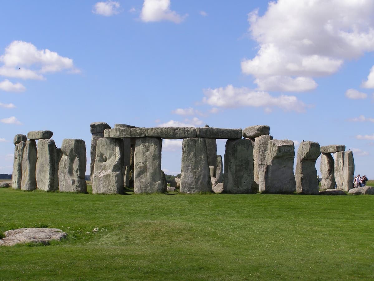
Stonehenge
View Dossier→The Outer Sarsen Circle, inner trilithon horseshoe, and the solstice-aligned Heel Stone
Avebury Stone Circle & Henge
View Dossier→The immense chalk henge ditch and bank enclosing the largest prehistoric stone circle on Earth, containing an entire village within its perimeter
Day 2
Roman Baths (Aquae Sulis)
View Dossier→The Great Bath fed by 46°C thermal spring water, the temple pediment Gorgon relief, and the Sacred Spring defixiones (curse tablets)
Day 3
Hadrian's Wall
View Dossier→The Whin Sill dolerite cliff escarpment crowned with stone ramparts, Housesteads Roman Fort, and Sycamore Gap panorama
🎒 Practical Field Advice
- ✓Stonehenge requires timed entry tickets; English Heritage and National Trust members enter free with prior reservation.
- ✓Unlike Stonehenge, Avebury allows you to walk up and touch the giant stones; park at the National Trust car park and wear waterproof boots.
- ✓At Hadrian’s Wall, base yourself around Hexham or Haltwhistle; the AD122 Hadrian’s Wall Country Bus runs directly between key forts (Housesteads, Chesters, Vindolanda).
- ✓Bring windproof and waterproof outerwear even in midsummer for Hadrian’s Wall crags.
Megaliths & Frontiers of Roman Britain
From Salisbury Plain stone circles to Georgian Aquae Sulis and Hadrian's stone wall
Access interactive satellite imagery, turn-by-turn routing, audio narration, and offline GPX downloads directly on your smartphone:
📜 Expedition Overview
Embark on a cross-millennial traverse of Britain’s sacred landscapes and imperial frontiers. Stand before the astronomical sarsen trilithons of Stonehenge, wander freely among the monumental megaliths of Avebury (the largest prehistoric stone circle in the world), descend into the steaming natural thermal pools of Aquae Sulis where Roman legionaries dedicated curse tablets to Sulis Minerva, and travel north to hike along the rugged crags of Hadrian’s Wall where the Roman Empire confronted the Caledonian wilderness.
📅 Day-by-Day Field Itinerary
The Outer Sarsen Circle, inner trilithon horseshoe, and the solstice-aligned Heel Stone
The immense chalk henge ditch and bank enclosing the largest prehistoric stone circle on Earth, containing an entire village within its perimeter
The Great Bath fed by 46°C thermal spring water, the temple pediment Gorgon relief, and the Sacred Spring defixiones (curse tablets)
The Whin Sill dolerite cliff escarpment crowned with stone ramparts, Housesteads Roman Fort, and Sycamore Gap panorama
🎒 Practical Field Advice
- ✓Stonehenge requires timed entry tickets; English Heritage and National Trust members enter free with prior reservation.
- ✓Unlike Stonehenge, Avebury allows you to walk up and touch the giant stones; park at the National Trust car park and wear waterproof boots.
- ✓At Hadrian’s Wall, base yourself around Hexham or Haltwhistle; the AD122 Hadrian’s Wall Country Bus runs directly between key forts (Housesteads, Chesters, Vindolanda).
- ✓Bring windproof and waterproof outerwear even in midsummer for Hadrian’s Wall crags.
Atlas Anatolia — A Living Geographic & Archaeological Atlas of Anatolia and the Ancient World.
Coordinates referenced to WGS84 standard. Always verify current museum hours, local ticketing, and weather warnings prior to departure.
Document generated from https://atlasanatolia.com/expeditions/megalithic-roman-britain