Saltar al contenido
Atlas Anatolia
NoticiasIce Age teeth in Sulawesi push betel-nut use back as far as 25,000 yearsRoman mosaic and Eros head uncovered in the basilica at Pompeiopolis, Kastamonu
Derinkuyu archaeological site

Wikimedia Commons (CC BY-SA)

Complejo

Derinkuyu

Seyfi Cem Baskin

800 a. C. – 1923 d. C.

The deepest known underground city in the world, extending 85 meters below the surface with 18 levels. It could shelter approximately 20,000 people along with livestock and food stores.

312
Interés 76

Ubicación

Nevşehir · Central Anatolia · Turquía

38.37°N · 34.73°E · Asia

Date Range

800 BCE – 1923 CE

Province

Nevşehir

Depth

85 meters (approx. 279 feet) below surface

Levels

18 distinct underground levels

Capacity

Could shelter approximately 20,000 people along with livestock and food stores

Location

Cappadocia region, Nevşehir Province, Turkey

Graphite pencil sketch banner of Derinkuyu

Derinkuyu is a monumental feat of pre-modern engineering and communal resilience, offering unparalleled insights into subterranean urbanism and social organization.”

Ubicación

Resumen

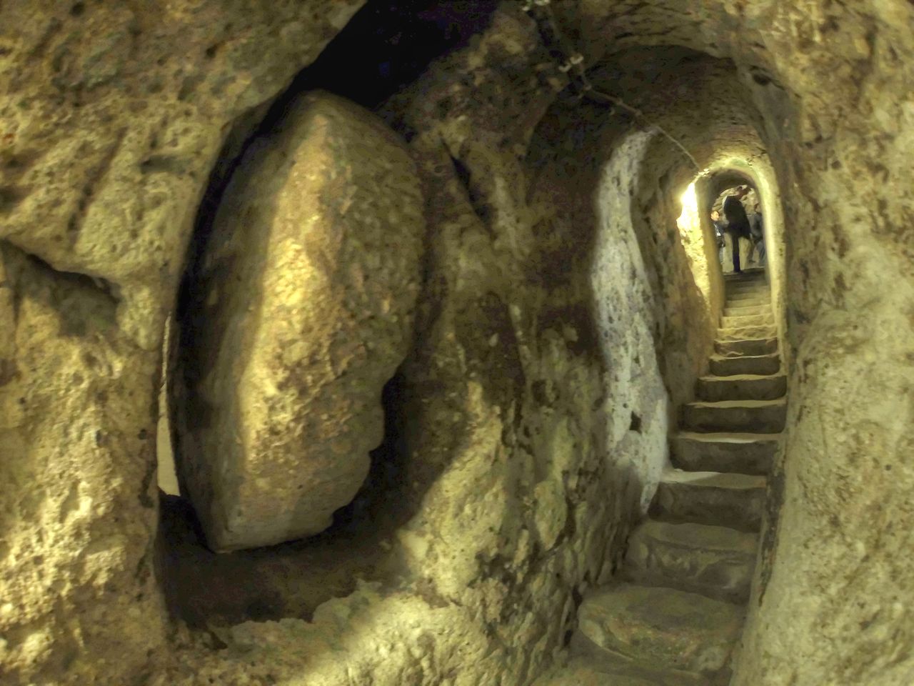
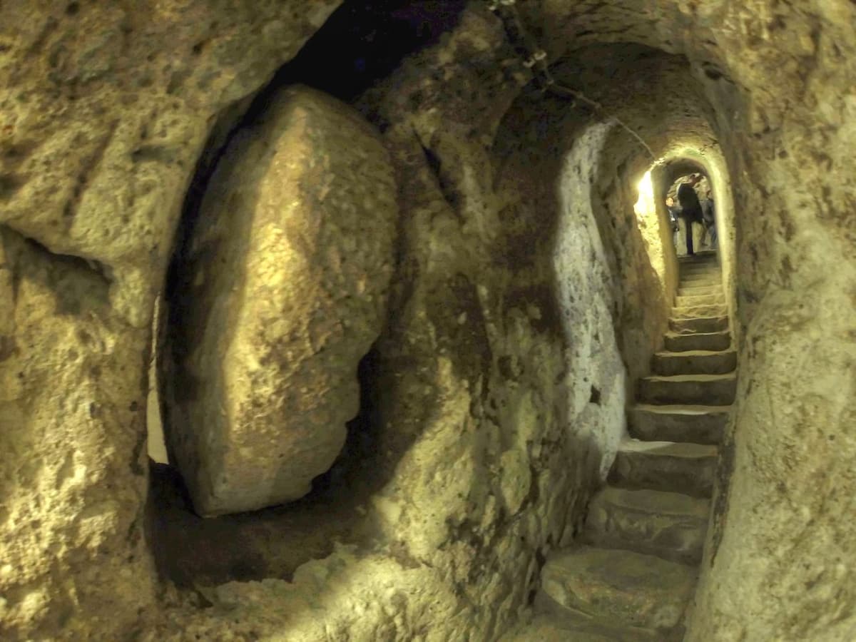
Derinkuyu is a vast subterranean complex carved directly into the soft volcanic tuff of the Cappadocia region, representing one of the most astonishing feats of ancient underground engineering. Extending approximately 85 meters deep, its 18 excavated levels form a labyrinthine city designed for long-term habitation and protection. The environment is characterized by narrow, sloping corridors that connect a multitude of rooms, including living quarters, storage chambers, wine and oil presses, stables, and communal kitchens. A sophisticated ventilation system, utilizing over 50 distinct shafts, provided fresh air to even the deepest levels, while massive, circular stone doors could seal off entire sections from the inside for security. The scale is such that it could have sheltered up to 20,000 people along with their livestock and vital food supplies.

The historical significance of Derinkuyu lies in its role as a massive, collective refuge, primarily for the region's early Christian communities, though its origins may be older. While the exact date of its initial excavation remains debated, with some theories suggesting a Phrygian origin in the 8th–7th centuries BCE, its major expansion and use peaked during the Byzantine era, particularly from the 7th to the 10th centuries CE. During this period, it served as a defensive haven against frequent Arab raids, allowing entire communities to disappear underground for weeks or months at a time. Its existence is a direct testament to the persistent insecurity and adaptive resilience of the Anatolian populace in the face of invasion.

"The Cappadocians dig down into the ground, the houses and the sheepfolds being made underground."
— Xenophon, c. 400 BCE (Anabasis)

Key functional structures within the city highlight its self-sufficient design. Beyond the residential quarters, critical spaces include extensive barrel-vaulted storage rooms for grains and other staples, large cisterns for water supply, and designated stables on the upper levels. A distinctive cruciform-plan church on the seventh level, complete with a central nave and two apses, served the spiritual needs of the inhabitants. The complex was also connected via at least one several-kilometer-long tunnel to another underground city, Kaymaklı, suggesting a network of such refuges across Cappadocia. This interconnectivity points to a coordinated regional defense strategy.

Culturally, Derinkuyu is an integral part of the unique rock-cut architectural tradition of Cappadocia, a landscape also famed for its above-ground "fairy chimney" formations and rock-cut monasteries. Its construction reflects a society organized around communal effort and deep-seated religious identity, where the need for security shaped daily life and urban planning in a profound way. The underground city was not merely a hiding place but a fully realized urban center, preserving social and religious structures even in times of extreme duress. It remained in use by local populations, including Greeks, until the population exchanges of the early 20th century, leaving it as a powerful physical narrative of layered Anatolian history.
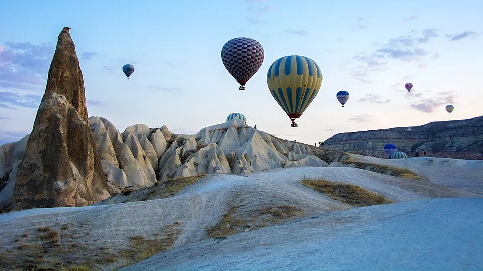
CAPPADOCIA Göreme National Park and the Rock Sites. World Heritage List. Turkey. Hot Air Ballooning Cappadocia
CAPPADOCIA Göreme National Park and the Rock Sites. World Heritage List. Turkey. Hot Air Ballooning Cappadocia | Feridun F. Alkaya (CC0)

Por qué es importante

Derinkuyu is a monumental feat of pre-modern engineering and communal resilience, offering unparalleled insights into subterranean urbanism and social organization. Its sheer scale and complexity—carved entirely from volcanic tuff—challenge assumptions about the technological capabilities of its Byzantine-era builders and provide a tangible archaeological record of a society adapted to survive prolonged conflict and regional instability. For history, it serves as a powerful testament to the defensive strategies and collective life of Anatolian communities, particularly during periods of religious persecution and Arab-Byzantine wars. As a cultural heritage site, Derinkuyu embodies a profound human story of adaptation and survival. It connects modern communities to a deep, layered past and stands as a unique symbol of human ingenuity in the face of existential threats, making its preservation crucial for both education and identity.

Evidencia e interpretación

Distinguir lo bien establecido de lo que sigue en debate.

Hechos bien establecidos

3
  • The city contains sophisticated architectural features including ventilation shafts reaching to the surface, wells, wine and oil presses, stables, cellars, storage rooms, and chapels, confirming long-term habitation capabilities.
  • Massive, circular stone doors that could be rolled shut from the inside to block corridors, providing clear evidence of defensive design against external threats.
  • Archaeological excavation has confirmed the presence of a cruciform-plan church on the 7th level, complete with a central nave, two apses, and baptismal font, dating to the Middle Byzantine period.

Inferencias académicas

1
  • Primary construction is inferred to have begun in the Byzantine era (8th-12th centuries CE) as a refuge from Arab invasions, based on architectural style and historical context, though earlier Phrygian activity (c. 8th-7th centuries BCE) is possible.

Interpretaciones debatidas

2
  • The exact total extent and full chronological sequence of construction and use are debated, with some scholars proposing earlier origins and others suggesting more continuous, episodic use and expansion over centuries.
  • The function of the deep, isolated vertical shaft on the lowest accessible level is debated, with interpretations ranging from a sophisticated water-management sump to a potential ritual or communication well.

Descubrimiento y excavación

1963

Initial Discovery and Clearance

Dirigido por Turkish Ministry of Culture and Directorate of Museums

A local resident discovered a hidden room behind a wall in his home, leading to the initial exploration and clearance of passages by archaeologists. This revealed the first sections of the vast underground complex.

1965

Systematic Clearance and Mapping

Dirigido por Nevşehir Museum Directorate

Following the 1963 discovery, a major two-year project led by the Nevşehir Museum Directorate cleared debris and systematically mapped the first eight levels, revealing the core residential and storage areas.

1969

Official Opening and Further Exploration

Dirigido por Turkish archaeologists and local authorities

Following initial work, the site was officially opened to the public. Archaeological teams conducted more systematic surveys and mapping, uncovering additional levels and key features like ventilation shafts, wells, and communal spaces.

2020

Geophysical Surveys and New Section Discovery

Dirigido por Nevşehir Municipality and geophysical research teams

Advanced geophysical surveys (including electrical resistivity tomography and seismic tomography) were conducted in the surrounding area, leading to the discovery of a new, previously unknown section of tunnels and chambers, suggesting the complex may be even larger than initially mapped.

Fotos de la comunidad

Comparte tu experiencia

¿Has visitado este sitio? Sube tus fotos para ayudar a otros a descubrirlo.

Historias relacionadas

Cómo citar esta página

Atlas Anatolia. (800). Derinkuyu. Atlas Anatolia. https://atlasanatolia.com/es/site/derinkuyu

Contenido bajo licencia CC BY-SA 4.0 — se requiere atribución al reutilizar.

Gráfico

Conexiones con sitios e historias relacionados.

Leer el artículo completo en World History Encyclopedia
World History Encyclopedia · CC BY-NC-SA

Fuentes

Preguntas frecuentes

¿Dónde se encuentra Derinkuyu?

Derinkuyu se encuentra en Nevşehir, Central Anatolia, Türkiye.

¿Qué antigüedad tiene Derinkuyu?

Derinkuyu se fecha aproximadamente en 800 a. C. – 1923 d. C..

¿Qué civilizaciones se relacionan con Derinkuyu?

Derinkuyu se relaciona con Phrygian, Byzantine, Ottoman.

¿Por qué es importante Derinkuyu?

Derinkuyu is a monumental feat of pre-modern engineering and communal resilience, offering unparalleled insights into subterranean urbanism and social organization.

¿Derinkuyu es Patrimonio Mundial de la UNESCO?

Derinkuyu no está inscrito actualmente en la Lista del Patrimonio Mundial de la UNESCO.