
Перейти к содержанию
Atlas Anatolia
НовостиЗубы ледникового периода на Сулавеси отодвигают использование бетеля на 25 000 лет назадРимская мозаика и голова Эрота обнаружены в базилике Помпейополиса, Кастамону
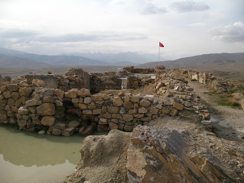
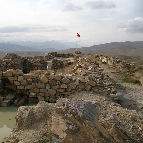
Urartian fortress ruins at Çavuştepe

Wikimedia Commons (CC BY-SA)

Крепость

Cavustepe

Seyfi Cem Baskin

764 до н. э. – 600 до н. э.

A monumental Urartian citadel fortress built by King Sarduri II in the 8th century BCE, overlooking the Van plain — eastern Turkey's most impressive Iron Age archaeological site.

411
Интерес 36

Местоположение

Van · Eastern Anatolia · Турция

38.58°N · 43.54°E · Азия

Builder

King Sarduri II of Urartu (c. 764 BCE)

Ancient Name

Sardurihinili ("City of Sarduri")

Key Feature

Rock-cut aqueduct channel — earliest known in region

Temple

Dedicated to Haldi, chief Urartian deity

Notable Finds

A bronze helmet inscribed with the name of King Sarduri II, discovered in the upper fortress.

Dating Method

Dating based on cuneiform inscriptions of Sarduri II and associated ceramic typology.

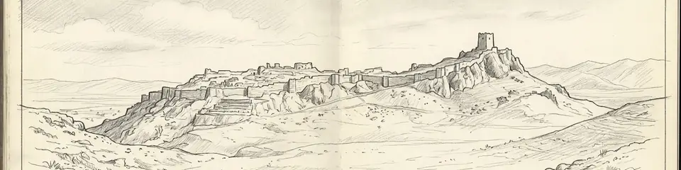
Graphite pencil sketch banner of Cavustepe

“Cavustepe is the most accessible and best-preserved example of Urartian monumental architecture in Turkey.”

Из Википедии

Cavustepe is an Urartian fortress near Van in eastern Turkey, built by King Sarduri II around 764 BCE, featuring a palace, temple, and ancient aqueduct system.

Читать полную статью в Википедии →

Местоположение

Обзор

Cavustepe is the best-preserved Urartian fortress in Turkey, built by King Sarduri II around 764 BCE as a royal citadel overlooking the broad plain east of Lake Van. The site consists of an upper and lower fortress connected by massive cyclopean walls, demonstrating the engineering prowess of the Urartian kingdom — a powerful Iron Age state centered on the Van basin that rivaled Assyria.

The upper citadel contains the remains of a palace complex with ceremonial halls, storage rooms, and a temple dedicated to the god Haldi — the chief deity of the Urartian pantheon. Cuneiform inscriptions carved into stone blocks record the building activities of Sarduri II and dedications to Haldi, providing direct evidence of royal construction programs.

"Sarduri, son of Argishti, built this mighty fortress."
— Urartian foundation inscription of Sarduri II, c. 750 BCE

The lower fortress housed administrative buildings, workshops, and extensive storage facilities. Large ceramic storage vessels (pithoi) found in situ indicate the citadel's role as a center of agricultural administration and surplus management.

The site's most remarkable feature is its sophisticated water engineering. An open channel carved through rock brought water from a spring several kilometers away — one of the earliest known aqueduct systems in the world. The channel's precise gradient demonstrates advanced surveying techniques.
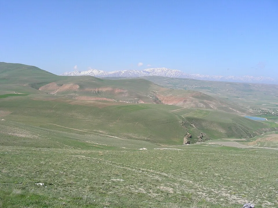
Çavuştepe (38611372590)
Çavuştepe (38611372590) | Herbert Frank from Wien (Vienna), AT (CC BY 2.0)

Cavustepe offers panoramic views of the Van plain and the distant peaks of the Armenian Highlands, a landscape that defined the Urartian kingdom's territorial heartland.

The architectural layout reveals a highly organized administrative center. The lower fortress housed extensive storage facilities, workshops, and barracks, supporting a garrison and craftspeople. Daily life revolved around state-controlled production, including metalworking and textile manufacture, utilizing resources from the fertile plain and surrounding mountains.

Cavustepe's strategic location placed it on a key route connecting the Urartian heartland to regions northwest towards Anatolia and south to Assyria. This facilitated control over trade in metals, particularly copper and tin. The fortress's ultimate decline is linked to the collapse of the Urartian kingdom in the late 7th or early 6th century BCE, likely due to a combination of military pressure from nomadic Scythians or the emerging Median empire, and possible internal destabilization, leading to its abandonment.

The site provides exceptional insight into Urartian stone masonry, featuring finely dressed ashlar blocks for doorways and monumental structures within the cyclopean walls. The palace complex in the upper citadel included a columned hall (apadana) and a distinctive 'tower temple' design, showcasing the syncretic architectural influences absorbed by the Urartian kingdom from their neighbors.

Почему это важно

Cavustepe is the most accessible and best-preserved example of Urartian monumental architecture in Turkey. The Urartian kingdom (c. 860-590 BCE) was one of the great powers of the Iron Age Near East, yet it remains far less known than its contemporaries Assyria and Babylon. The site's water channel represents a significant achievement in ancient hydraulic engineering, predating many comparable systems in the Mediterranean world. The cuneiform inscriptions provide rare primary evidence for Urartian royal ideology and administrative practices.

Свидетельства и интерпретация

Различать, что хорошо установлено, а что остаётся предметом дискуссий.

Хорошо установленные факты

4
  • Cuneiform inscriptions in Urartian identify the fortress builder as Sarduri II, son of Argishti I, and record dedications to the god Haldi.
  • The rock-cut water channel demonstrates sophisticated Urartian hydraulic engineering, with a precisely calculated gradient over several kilometers.
  • Large storage jars (pithoi) found in the lower fortress indicate centralized agricultural surplus management typical of Urartian citadels.
  • Excavations have revealed a large, multi-roomed palace complex in the upper fortress with a distinctive 'bit-hilani' style architectural plan, a hallmark of Urartian royal construction.

Научные выводы

1
  • The fortress's commanding position over the Van plain suggests it served both defensive and administrative functions, controlling agricultural production in the surrounding territory.

Спорные интерпретации

1
  • Whether the fortress was destroyed by Scythian or Median invaders, or was gradually abandoned as the Urartian kingdom weakened, remains uncertain.

Открытие и раскопки

1961–1986

Afif Erzen excavations

Под руководством Afif Erzen

Afif Erzen of Istanbul University conducted pioneering excavations uncovering the palace, temple, and aqueduct system.

1997–2010

Continued research

Под руководством Veli Sevin

Turkish excavations continued under Veli Sevin, focusing on the lower fortress and storage areas.

2005

Cuneiform study

Comprehensive epigraphic study of the Urartian inscriptions found at the site, recording dedications by Sarduri II.

2014

Lower Fortress Gate Excavation

Под руководством Prof. Dr. Rafet Çavuşoğlu (Van Yüzüncü Yıl University)

Excavations focused on the monumental gate complex of the lower fortress, revealing its defensive architecture and passageway.

Фотографии сообщества

Поделитесь своими впечатлениями

Вы посещали это место? Загрузите свои фотографии, чтобы помочь другим открыть его для себя.

Как цитировать эту страницу

Atlas Anatolia. (764). Cavustepe. Atlas Anatolia. https://atlasanatolia.com/ru/site/cavustepe

Материалы распространяются по лицензии CC BY-SA 4.0 — при повторном использовании указание авторства обязательно.

Источники

  • The Kingdom of Urartu in Eastern Anatolia — Mirjo Salvini (2008)
  • Cavustepe Excavations — Afif Erzen (1978)
  • Wikipedia — CavustepeСсылка

Часто задаваемые вопросы

Где находится Cavustepe?

Cavustepe находится в Van, Eastern Anatolia, Türkiye.

Сколько лет Cavustepe?

Cavustepe датируется приблизительно 764 до н. э. – 600 до н. э..

С какими цивилизациями связано место Cavustepe?

Cavustepe связано с цивилизацией: Urartian.

Почему Cavustepe имеет важное значение?

Cavustepe is the most accessible and best-preserved example of Urartian monumental architecture in Turkey.

Входит ли Cavustepe в список Всемирного наследия ЮНЕСКО?

Cavustepe в настоящее время не включено в список Всемирного наследия ЮНЕСКО.