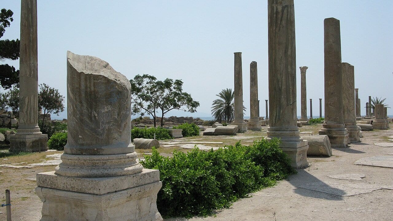
Search Indus Valley vs Mesopotamia vs Egypt and popular history usually offers a neat, unilinear progression: first Sumer invented the wheel and writing, then Egypt built monuments, and finally the Indus copied urban life.
Archaeology reveals the opposite. The three great river systems of the Afro-Eurasian Bronze Age — the Nile, the Tigris-Euphrates, and the Indus and Ghaggar-Hakra — witnessed parallel, independent trajectories toward urbanism. None was an offshoot of another. Each solved the problems of water control, craft specialization, civic order, and ideological legitimation in profoundly different ways.
Where Egypt centralized immense surplus into divine kingship and stone funerary monumentality, and Mesopotamia channeled surplus into competitive city-state theocracies and legalistic clay archives, the Indus Valley built expansive, standardized brick metropolises with advanced hydraulic drainage — yet left behind no identifiable palaces, no royal tombs, and no monumental glorification of kings.
Atlas Anatolia maps the excavated settlements across all three basins. Here is how they compare through stratigraphy, architecture, and material culture.
The Short Comparison
| Category | Ancient Egypt (Nile) | Mesopotamia (Tigris-Euphrates) | Indus Valley (Harappan) |
|---|---|---|---|
| Primary River Dynamics | Predictable annual flood (Akhet); gentle silt deposition | Unpredictable, violent flooding; high silt; shifting river channels | Dual runoff (Himalayan snowmelt + summer monsoon); shifting paleo-channels |
| Dominant Building Material | Sun-dried mudbrick for cities; permanent limestone/granite for sacred & royal monuments | Mudbrick and kiln-fired brick; bitumen waterproofing; monumental ziggurats | Standardized kiln-fired brick (1:2:4 ratio); carved stone masonry at Dholavira |
| Political Organization | Highly centralized territorial state under divine pharaoh (nesu-bit) | Autonomous city-states (ensi / lugal) competing for regional hegemony; later territorial empires | Decentralized civic municipal councils / merchant oligarchies; no royal dynastic seat identified |
| Religious & Monumental Expression | Colossal royal funerary complexes (Pyramids of Giza, Saqqara) and divine temple estates | Towering ziggurats (Ur), temple precincts (Eanna at Uruk), royal cemeteries | Civic water architecture (Great Bath at Mohenjo-daro), giant stone reservoirs at Dholavira; no temples |
| Writing & Accounting | Hieroglyphic (monumental/formal) and Hieratic (papyri administration); deciphered | Cuneiform impressed onto clay tablets; economic tallies, epic literature, law codes; deciphered | Indus script on steatite stamp seals, copper tablets, and signage; undeciphered |
| Monumental Art & Warfare | Royal smiting scenes, monumental relief carvings, standing armies by the Middle/New Kingdom | Victory stelae (Stele of the Vultures), siege reliefs, fortified city walls, bronze weapons | Minimal weaponry; no triumphal war art; standardized statuettes (Priest-King, Dancing Girl) |
1. River Hydrology: How the Water Shaped the Society
The environmental deterministic trope that "rivers created civilizations" obscures the drastically different hydrologies the three societies mastered:
The Nile: Predictable Rhythms
The Nile in Egypt rose with remarkable regularity between July and October, fed by monsoon rains in the Ethiopian highlands. Its floodwaters deposited mineral-rich basaltic silt over the floodplain without requiring massive, labor-intensive drainage networks to prevent catastrophic avulsions. Basin irrigation allowed Egyptian agriculture to flourish with minimal central technological intervention, creating an ecological buffer that supported centralized dynastic stability centered around Memphis.
The Tigris and Euphrates: Fragile, Hostile Hydraulics
In lower Mesopotamia, the Tigris and Euphrates flooded in late spring — exactly when winter crops were ripening for harvest, risking catastrophic inundation. Furthermore, both rivers carried enormous silt loads and flowed on elevated alluvial ridges above the floodplain, making them prone to violent avulsions (sudden channel shifts). Surviving required continuous canal excavation, levee maintenance, and silt dredging. This constant engineering demand favored militarized, localized command structures in rival cities like Uruk and Ur, where temple institutions (é) directed massive corvée labor.
The Indus and Ghaggar-Hakra: Monsoon Flood and Massive Reservoirs
The Indus basin operated under a dual hydraulic regime: spring snowmelt from the Himalayas followed by the summer Indian monsoon. Sites like Harappa and Mohenjo-daro were constructed on elevated artificial mudbrick platforms to rise above seasonal floods. In arid Gujarat, the island city of Dholavira solved water scarcity by quarrying massive rock-cut interconnected reservoirs that could impound up to 250,000 cubic meters of rainwater channeled from seasonal streams — a hydraulic feat unmatched elsewhere in the 3rd millennium BCE.
2. The Urban Grid: Order Without Monarchy?
One of the most striking comparative contrasts lies in the layout of the cities themselves:
Indus Valley: Civic Planning and Sanitation
At Mohenjo-daro and Harappa, British excavators John Marshall, Ernest Mackay, and later Jonathan Mark Kenoyer documented an urban discipline unprecedented in antiquity:
- Standardized Metrology: Kiln-fired bricks across hundreds of kilometers followed an exact 1:2:4 thickness-to-width-to-length ratio.
- Cardo-Decumanus Grids: Wide main boulevards oriented north-south and east-west, flanked by private residences with entrances opening onto secluded side alleys.
- Municipal Drainage: Almost every private multi-room residence possessed a private bathing floor connected to terracotta drainage chutes that emptied into covered street drains with inspection sumps for sediment clearing.
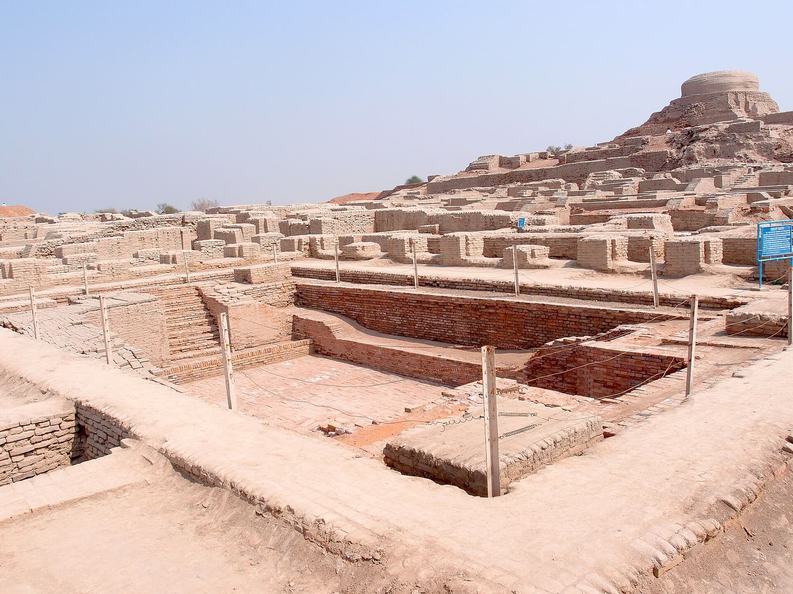
- Absence of Palaces: Despite extensive excavations, no structure matches the palatial compounds of the ancient Near East. The largest public building at Mohenjo-daro is the Great Bath — a finely sealed bitumen-lined water basin interpreted as a communal or ritual purification facility, not a royal pleasure pool.
Mesopotamia: Organic Nucleation Around the Temple
Mesopotamian cities were walled agglomerations organized organically around the central temple precinct (the temenos). At Uruk, the Eanna district was dominated by massive mudbrick temples decorated with terracotta cone mosaics, while Ur centered on Ur-Nammu's towering multi-tiered ziggurat. Residential quarters consisted of winding, unpaved alleyways with blind walls and courtyards, lacking centralized municipal drainage or citywide orthogonal planning.
Egypt: Towns for the Living, Stone for the Dead
Egyptians built their permanent monumental architecture out of stone for the gods and the dead on the desert plateau above the floodplain (Saqqara, Giza, Abydos). Royal capitals like Memphis and later Thebes were primarily constructed of perishable mudbrick and organic materials, which were repeatedly swept over by alluvium or rebuilt over millennia.
3. The 3rd Millennium BCE Maritime Corridor: Meluhha to Mesopotamia
The three Bronze Age civilizations were not hermetically sealed worlds. Stratigraphic and textual evidence documents an active direct maritime trade route linking the Indus Valley to southern Mesopotamia:
Cuneiform Records of Meluhha
Mesopotamian cuneiform tablets from Sargon of Akkad (c. 2334–2279 BCE) proudly proclaim that ships from Meluhha (the Harappan world), Magan (the copper mountains of Oman), and Dilmun (the commercial entrepôt of Bahrain) moored at the quays of Akkad.
Archaeological Ground-Truth:
- Indus Seals in Iraq: Square Harappan steatite stamp seals featuring the iconic unicorn motif and Indus script have been excavated in the Royal Cemetery of Ur, Kish, and Tell Asmar (Eshnunna).
- Carnelian Beads: Chemically fingerprintable etched carnelian beads crafted with Harappan micro-drill technology were discovered in royal Mesopotamian graves and as far west as the Levant and Troy.
- Cubic Chert Weights: Standardized Harappan cubic chert weights (following a binary-decimal ratio of 1, 2, 4, 8, 16, 32...) have been unearthed at maritime ports on the Persian Gulf, proving merchants used Indus weight standards to transact bulk commodities.
4. The 4.2 ka BP Event: How the Rivers Ended
Around 2200 BCE, a widespread climatic shift known as the 4.2 kiloyear BP aridification event impacted rainfall patterns across the Mediterranean, Near East, and South Asia:
- In Egypt: A sequence of abnormally low Nile inundations severely reduced crop yields, weakening the central authority of Old Kingdom pharaohs and triggering the fragmentation of the First Intermediate Period.
- In Mesopotamia: Megadrought forced northern rain-fed agricultural populations southward, placing intense pressure on irrigated southern city-states and contributing to the collapse of the Akkadian Empire.
- In the Indus Basin: Weakening Indian summer monsoons and tectonic shifts caused gradual desiccation or eastward migration of the Ghaggar-Hakra river system. Unlike Egypt and Mesopotamia, where political central authority reconstituted itself under new dynasties, the Harappan urban system did not rebuild. Instead, populations de-urbanized, migrating eastward toward the fertile, rain-fed Gangetic plain in smaller village settlements during the Late Harappan phase (c. 1900–1300 BCE).
Scholarly Evidence & Hypotheses
The Indus Valley civilization was founded by Mesopotamian colonists
Harappan cities possessed sophisticated underground municipal drainage
Indus script has been definitively deciphered
Cuneiform records confirm direct Bronze Age trade with Meluhha
Mohenjo-daro was destroyed by sudden violent foreign invasion
Egypt and Mesopotamia operated as territorial empires before 3000 BCE