
콘텐츠로 건너뛰기
Atlas Anatolia
디그
뉴스술라웨시 빙하기 치아에서 빈랑 사용 25,000년 전까지 소급카스타모누 폼페이오폴리스 바실리카에서 로마 모자이크와 에로스 두상 발견
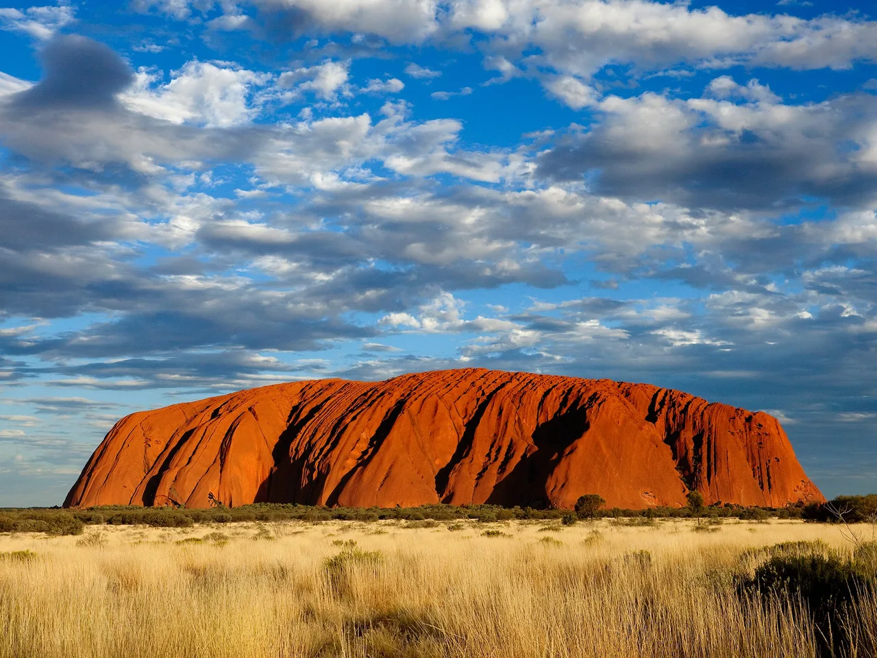
Uluru at sunset, the sacred sandstone monolith of the Aṉangu people, Northern Territory, Australia

Wikimedia Commons

Continent Record

Longest Recorded History in Oceania

성소유네스코

Uluru

Seyfi Cem Baskin

30000 기원전 – 2019 서기

A vast sandstone monolith rising 348 metres from the central Australian desert — sacred to the Aṉangu people as a living embodiment of their Tjukurpa (creation-time) law, and the site of rock art and ceremonial evidence spanning tens of thousands of years of continuous Aboriginal cultural practice. Handed back to Aṉangu traditional ownership in 1985, Uluru's summit was permanently closed to climbers in 2019 in recognition of its unbroken sacred status.

31
관심 85

위치

Northern Territory · 오스트레일리아

25.34°S · 131.04°E · 오세아니아

Height

348 m above the surrounding plain

Tjukurpa

Ancestral creation-time law encoded in the rock's features, still practised today

Handback

1985 — freehold title returned to Aṉangu traditional owners

Climbing ban

Permanently closed 26 October 2019, the 34th Handback anniversary

UNESCO

World Heritage Site 1987; cultural listing extended 1994

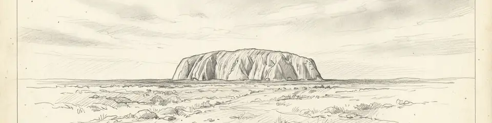
Graphite pencil sketch banner of Uluru

“Uluru is one of the clearest living demonstrations that Aboriginal Australian culture is not a relic of the past but a continuous, functioning legal and cosmological system still actively practised today.”

위치

개요

Uluru stands in the heart of the Northern Territory, within Uluru-Kata Tjuta National Park, roughly 335 kilometres southwest of Alice Springs. Geologically, it is an inselberg of arkose sandstone, its visible dome rising 348 metres above the surrounding plain while extending several kilometres further underground — but its significance to the Aṉangu, the Pitjantjatjara and Yankunytjatjara traditional owners of the land, is measured not in geological terms but in Tjukurpa: the ancestral law, cosmology, and moral order established during the creation era and encoded in the landscape itself.

Every crevice, cave, and waterhole around Uluru's base corresponds to a specific Tjukurpa narrative involving ancestral beings — including the Mala (hare-wallaby people), the Kuniya (woma python), and the Liru (venomous snake) — whose actions during the creation period shaped the rock's physical features and established the social and ceremonial law the Aṉangu continue to follow. Rock art at numerous sites around the base, some caves restricted to initiated members of specific ceremonial groups, provides physical, dateable evidence of this cultural tradition, while surrounding archaeological sites in the wider region document human presence in central Australia extending back tens of thousands of years.

European surveyor William Gosse became the first non-Aboriginal person to record the site in 1873, naming it Ayers Rock after the South Australian Chief Secretary Henry Ayers — a name that remained in official and popular use for over a century despite the site's much older Aṉangu name and history. Tourism developed steadily through the 20th century, and by the 1950s–70s climbing the rock had become a popular, heavily promoted activity, conducted without regard for its status as a men's sacred ceremonial site in Aṉangu law, where climbing was traditionally reserved for specific ritual purposes.

A sustained Aṉangu land rights campaign culminated in the Handback of 1985, when the Australian government formally returned freehold title to the Aṉangu traditional owners, who then leased the land back to the federal government for joint management as a national park — a landmark moment in Australian Indigenous land rights. Climbing the rock, though legally permitted for decades after Handback despite consistent Aṉangu requests that visitors not do so, was formally and permanently prohibited from 26 October 2019, the 34th anniversary of Handback, following years of advocacy and a unanimous decision by the park's joint management board. Uluru-Kata Tjuta National Park was inscribed as a UNESCO World Heritage Site in 1987 for its natural values, with the listing extended in 1994 to recognise its outstanding living Aboriginal cultural landscape.
중요성

Uluru is one of the clearest living demonstrations that Aboriginal Australian culture is not a relic of the past but a continuous, functioning legal and cosmological system still actively practised today. The Tjukurpa encoded in its rock faces is not folklore recorded after the fact — it is the operative law by which the Aṉangu continue to govern land use, ceremony, and social relationships, making Uluru a rare case where "archaeological evidence" and "living legal system" are the same body of knowledge. The 1985 Handback and the 2019 climbing closure together mark one of the most significant, sustained, and ultimately successful Indigenous land rights campaigns in the world — a multi-decade process that reshaped how Australia legally and culturally engages with Aboriginal sacred sites, and a model frequently referenced in Indigenous rights movements internationally. As a site whose surface features are directly, specifically explained by an intact oral tradition tens of thousands of years old, Uluru offers researchers a working example of how landscape, memory, and law can be encoded and transmitted across a timescale that dwarfs the written history of most other cultures on Earth.

증거와 해석

확립된 사실과 논쟁 중인 사항을 구분합니다.

잘 확립된 사실

3
  • Archaeological survey of the wider central Australian region has documented human occupation extending back tens of thousands of years, consistent with the antiquity of Aṉangu oral tradition.
  • Rock art at numerous sites around Uluru's base has been documented and dated using stylistic and superimposition analysis, confirming long-term, continuous use of the site for ceremonial purposes.
  • Government and Aṉangu Central Land Council records document the 1985 Handback and the 2019 permanent climbing closure as formal legal and administrative acts.

학술적 추론

1
  • The correspondence between specific Tjukurpa narratives and specific physical features of the rock is understood through ethnographic documentation and Aṉangu testimony rather than independent physical dating of each individual narrative.

발견과 발굴

1873

William Gosse survey

First recorded European survey of the site, naming it Ayers Rock.

1979–1985

Handback negotiations and land rights campaign

Sustained Aṉangu-led campaign culminating in the formal return of freehold title to traditional owners.

2010–2019

Climbing closure campaign

Renewed advocacy leading to the unanimous park board decision to permanently close the summit to climbers.

커뮤니티 사진

당신의 경험을 공유하세요

이 유적지를 방문하셨나요? 다른 탐험가들을 위해 사진을 업로드해 보세요.

관련 이야기

이 페이지 인용 방법

Atlas Anatolia. (30000). Uluru. Atlas Anatolia. https://atlasanatolia.com/ko/site/uluru

콘텐츠는 CC BY-SA 4.0 라이선스에 따라 제공됩니다 — 재사용 시 출처 표시가 필요합니다.

그래프

관련 유적지와 스토리로의 연결.

출처

  • Uluru: An Aboriginal History of Ayers Rock — Layton, Robert (1986)
  • Growing Up the Country: The Pitjantjatjara Struggle for Their Land — Toyne, Phillip and Vachon, Daniel (1984)
  • UNESCO — Uluru-Kata Tjuta National Park링크

자주 묻는 질문

Uluru은(는) 어디에 위치해 있나요?

Uluru은(는) Northern Territory, Australia에 위치해 있습니다.

Uluru의 연대는 언제인가요?

Uluru의 연대는 대략 30000 기원전 – 2019 서기로 거슬러 올라갑니다.

Uluru과(와) 관련된 고대 문명은 무엇인가요?

Uluru은(는) Aboriginal Australian 문명과 관련이 있습니다.

Uluru이(가) 중요한 이유는 무엇인가요?

Uluru is one of the clearest living demonstrations that Aboriginal Australian culture is not a relic of the past but a continuous, functioning legal and cosmological system still actively practised today.

Uluru은(는) 유네스코 세계유산인가요?

예 — Uluru은(는) 유네스코 세계유산으로 등재되어 있습니다.