
Vai al contenuto
Atlas Anatolia
NotizieIce Age teeth in Sulawesi push betel-nut use back as far as 25,000 yearsRoman mosaic and Eros head uncovered in the basilica at Pompeiopolis, Kastamonu
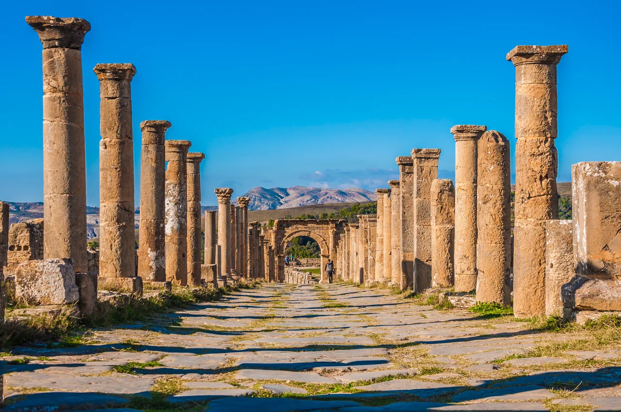
The Roman forum at Cuicul (Djemila), Algeria, with mountains behind

Wikimedia Commons

Record nazionale

Oldest City in Algeria

CittàUNESCO

Cuicul (Djemila)

Seyfi Cem Baskin

جميلة97 d.C. – 600 d.C.

A Roman mountain colony in the Aurès range of Algeria, Cuicul (modern Djemila) preserves one of the most harmonious Roman urban layouts in Africa — forum, capitol, triumphal arch, baths, and Christian basilicas set against a dramatic mountain backdrop. UNESCO inscribed it as a masterpiece of Roman town planning adapted to a highland setting.

21
Interesse 48

Posizione

Sétif Province · Aurès Mountains · Algeria

36.31°N · 5.73°E · Africa

Founded

Roman colony under Nerva, c. 97 CE

Setting

Aurès Mountains, ~900 m elevation

Highlight

Triumphal arch of Caracalla (216 CE)

UNESCO

World Heritage Site 1982

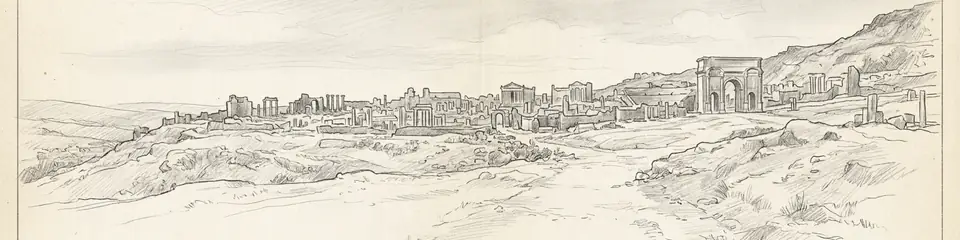
Graphite pencil sketch banner of Cuicul (Djemila)

Cuicul demonstrates Roman urbanism away from the Mediterranean coast — essential for understanding how the empire integrated inland North Africa through colonisation and infrastructure.”

Posizione

Panoramica

Cuicul — the Roman name for what is now Djemila in northeastern Algeria — was founded as a military colony under Nerva around 97 CE, strategically placed in the Aurès Mountains at roughly 900 metres elevation. The city developed rapidly under the Antonine emperors into a prosperous mountain town serving the agricultural hinterland of the high plateau.

Unlike coastal cities shaped by port commerce, Cuicul's prosperity rested on grain, olive oil, and livestock from the surrounding fertile valleys. The urban plan is exceptionally coherent: a forum bordered by a capitol temple, basilica, and curia; a triumphal arch of Caracalla (216 CE); extensive baths; and later Christian basilicas including one of the finest mosaic-decorated churches in Roman Africa.
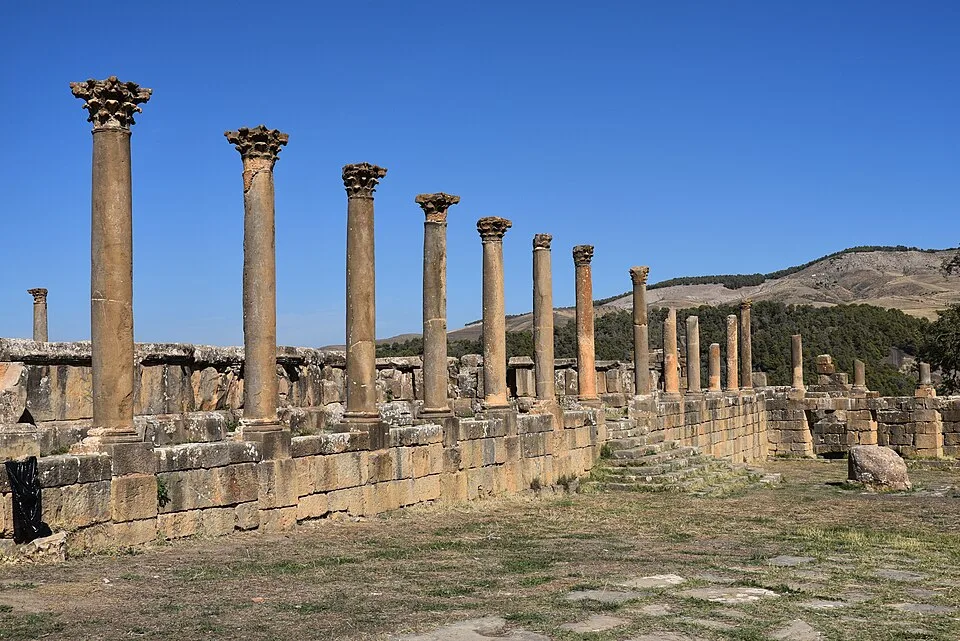
The Severan Forum, Cuicul (Djémila), Numidia, Algeria - 52664724020
The Severan Forum, Cuicul (Djémila), Numidia, Algeria - 52664724020 | Carole Raddato (CC BY-SA 2.0)
"Cuicul, founded as a colony under Nerva, rose to prosperity in the highlands of Numidia through the grain and olive oil of its hinterland."
— Albert Ballu, Les ruines de Cuicul (1911)

French archaeologist Albert Ballu excavated the site systematically from 1909, revealing mosaics now partly housed in the on-site museum. The city's mountain setting required terracing and adaptation of standard Roman urban models to sloping terrain — a case study in how imperial urbanism flexed to local geography.
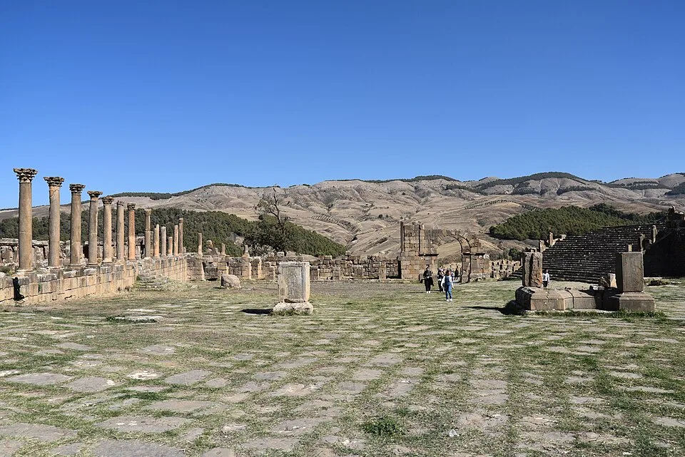
The Severan Forum, Cuicul (Djémila), Numidia, Algeria
The Severan Forum, Cuicul (Djémila), Numidia, Algeria | Carole Raddato (CC BY-SA 2.0)

Djemila was inscribed as a UNESCO World Heritage Site in 1982, recognised as an exceptional example of Roman town planning integrated into a mountain landscape.
Perché è importante

Cuicul demonstrates Roman urbanism away from the Mediterranean coast — essential for understanding how the empire integrated inland North Africa through colonisation and infrastructure. Its intact forum-capitol-basilica ensemble and triumphal arch provide one of the clearest readable Roman city plans in Algeria. The Christian basilica mosaics document the late antique transition in a region that would become central to North African Christianity and Donatist controversies.

Evidenze e interpretazione

Distinguere ciò che è ben consolidato da ciò che rimane dibattuto.

Fatti ben consolidati

2
  • The forum, capitol, and triumphal arch form a coherent 2nd–3rd century CE urban core.
  • Christian basilicas with mosaics document late antique religious transformation.

Deduzioni accademiche

1
  • Mountain location implies economic reliance on highland agriculture rather than maritime trade.

Foto della comunità

Condividi la tua esperienza

Hai visitato questo sito? Carica le tue foto per aiutare gli altri a scoprirlo.

Storie correlate

Come citare questa pagina

Atlas Anatolia. (97). Cuicul (Djemila). Atlas Anatolia. https://atlasanatolia.com/it/site/cuicul

Contenuto con licenza CC BY-SA 4.0 — è richiesta l'attribuzione in caso di riutilizzo.

Grafico

Collegamenti a siti e storie correlati.

Fonti

  • Les ruines de CuiculBallu, Albert (1911)
  • UNESCO — DjemilaCollegamento

Domande frequenti

Dove si trova Cuicul (Djemila)?

Cuicul (Djemila) si trova in Sétif Province, Aurès Mountains, Algeria.

A quando risale Cuicul (Djemila)?

Cuicul (Djemila) risale all'incirca al 97 d.C. – 600 d.C..

Quali civiltà sono associate a Cuicul (Djemila)?

Cuicul (Djemila) è associato alla civiltà Roman.

Perché Cuicul (Djemila) è importante?

Cuicul demonstrates Roman urbanism away from the Mediterranean coast — essential for understanding how the empire integrated inland North Africa through colonisation and infrastructure.

Cuicul (Djemila) è un sito Patrimonio Mondiale dell'UNESCO?

Sì — Cuicul (Djemila) è iscritto nella lista del Patrimonio Mondiale dell'UNESCO.