
Vai al contenuto
Atlas Anatolia
NotizieIce Age teeth in Sulawesi push betel-nut use back as far as 25,000 yearsRoman mosaic and Eros head uncovered in the basilica at Pompeiopolis, Kastamonu
Mud-brick ksar of Aït Ben Haddou climbing a hillside in Morocco

Wikimedia Commons (CC BY-SA 3.0)

Record continentale

Oldest Settlement in Africa

InsediamentoUNESCOIn evidenza

Aït Ben Haddou

Seyfi Cem Baskin

آيت بن حدو1600 d.C. – 1950 d.C.

A fortified earthen ksar on the old caravan route between the Sahara and Marrakesh, its stacked pisé towers climbing a hillside above the Ounila River. UNESCO listed the ensemble in 1987; filmmakers from Gladiator to recent Trojan epics have used its ridge as a stand-in for ancient walled cities when cameras need sun, dust, and mud-brick authenticity.

211
Interesse 18

Posizione

Marocco

31.05°N · 7.13°W · Africa

UNESCO

World Heritage Site (1987)

Material

Pisé (rammed earth) and mud brick

Route

Historic caravan link Marrakesh–Sahara

Cinema

Frequent location double for ancient walled cities

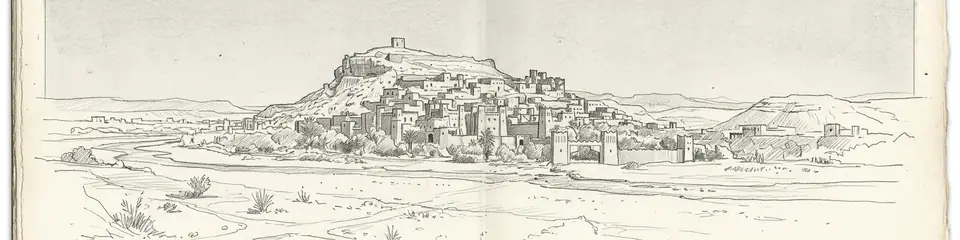
Graphite pencil sketch banner of Aït Ben Haddou

Aït Ben Haddou shows how caravan-era Berber builders engineered multi-storey earth architecture that still reads as "ancient" on camera a thousand years later.”

Posizione

Panoramica

Aït Ben Haddou rises from the Ounila Valley in the High Atlas foothills of Morocco, about 30 kilometres northwest of Ouarzazate. The site is a ksar, a communal fortified village of pisé (rammed earth) and mud brick, with a kasbah at the summit and granaries, dwellings, and a public square stepping down the slope. Berber families lived here into the 20th century; most residents now inhabit the modern village across the river, but the old ksar remains intact enough to read as a medieval North African skyline.

Caravans once carried salt, gold, and slaves along this corridor toward Marrakesh and the desert. The architecture reflects Glaoui clan power in the 17th and 18th centuries, though earlier occupation layers exist. UNESCO inscribed Aït Ben Haddou in 1987 as an outstanding example of southern Moroccan earthen architecture.
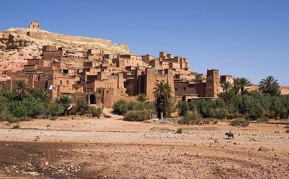
Ksar Aït Benhaddou, Marocco (أيت بن حدو، المغرب, ⴰⵢⵜ ⵃⴰⴷⴷⵓ)
Ksar Aït Benhaddou, Marocco (أيت بن حدو، المغرب, ⴰⵢⵜ ⵃⴰⴷⴷⵓ) | Petar Milošević (CC BY-SA 4.0)
"The ksar climbs the hillside in tiers of earth and straw, each family's granary stacked above the last, as if the mountain itself had been taught to build."
— Paraphrase of UNESCO description of Aït Ben Haddou

Hollywood location scouts know the ksar well. Lawrence of Arabia, Gladiator, and Game of Thrones filmed among these walls. When Christopher Nolan's production of Homer's Odyssey needed exterior shots of a Bronze Age citadel, reports placed unit work here rather than at archaeological Troy in Turkey. That choice separates cinematic Troy from Hisarlık: the film's walls are Moroccan mud brick; the excavated city is stone and brick on the Dardanelles. Both can enrich a viewer's curiosity if labelled honestly.
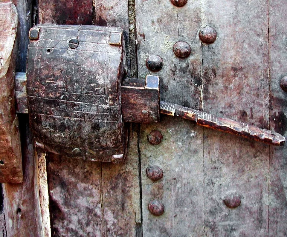
Wooden lock in Ksar of Aït-Ben-Haddou
Wooden lock in Ksar of Aït-Ben-Haddou | Pierre André Leclercq (CC BY-SA 4.0)

Visitors ford the river (or use a footbridge) and climb alleys so narrow two people cannot pass. From the top granary the valley opens south toward Ouarzazate's studios. Pair the ksar with Volubilis and desert routes in Atlas stories to compare Roman stone with Berber earth.

Perché è importante

Aït Ben Haddou shows how caravan-era Berber builders engineered multi-storey earth architecture that still reads as "ancient" on camera a thousand years later. It is the clearest teaching moment for separating Homeric Troy at Hisarlık from film-set Troy in Morocco.

Evidenze e interpretazione

Distinguere ciò che è ben consolidato da ciò che rimane dibattuto.

Fatti ben consolidati

2
  • UNESCO documentation dates the visible ksar largely to the 17th–18th centuries CE under Glaoui patronage.
  • Earthen architecture and urban layout match known Berber ksar typology.

Deduzioni accademiche

1
  • The site served trans-Saharan trade caravans before modern roads bypassed the valley.

Interpretazioni dibattute

1
  • How much earlier occupation lies beneath the standing ksar is not fully published.

Foto della comunità

Condividi la tua esperienza

Hai visitato questo sito? Carica le tue foto per aiutare gli altri a scoprirlo.

Storie correlate

Come citare questa pagina

Atlas Anatolia. (1600). Aït Ben Haddou. Atlas Anatolia. https://atlasanatolia.com/it/site/ait-ben-haddou

Contenuto con licenza CC BY-SA 4.0 — è richiesta l'attribuzione in caso di riutilizzo.

Grafico

Collegamenti a siti e storie correlati.

Fonti

  • UNESCO — Ksar of Ait-Ben-HaddouCollegamento
  • Cités imprenables du Haut-AtlasMicaud, Charles (1956)

Domande frequenti

Dove si trova Aït Ben Haddou?

Aït Ben Haddou si trova in Morocco.

A quando risale Aït Ben Haddou?

Aït Ben Haddou risale all'incirca al 1600 d.C. – 1950 d.C..

Quali civiltà sono associate a Aït Ben Haddou?

Aït Ben Haddou è associato alla civiltà Islamic / Medieval, Berber.

Perché Aït Ben Haddou è importante?

Aït Ben Haddou shows how caravan-era Berber builders engineered multi-storey earth architecture that still reads as "ancient" on camera a thousand years later.

Aït Ben Haddou è un sito Patrimonio Mondiale dell'UNESCO?

Sì — Aït Ben Haddou è iscritto nella lista del Patrimonio Mondiale dell'UNESCO.