
Aller au contenu
Atlas Anatolia
ActualitésIce Age teeth in Sulawesi push betel-nut use back as far as 25,000 yearsRoman mosaic and Eros head uncovered in the basilica at Pompeiopolis, Kastamonu
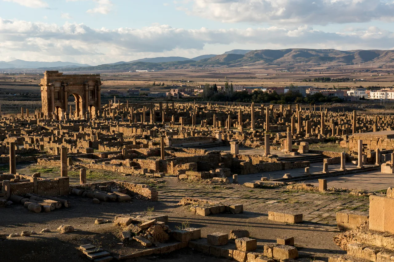
Trajan's Arch at Timgad, standing at the end of the Roman decumanus maximus

Wikimedia Commons

Country Record

Longest Continuously Occupied Site in Algeria

CitéUNESCO

Timgad

Seyfi Cem Baskin

تيمقاد100 apr. J.-C. – 700 apr. J.-C.

A Roman colonial city in the Algerian highlands founded by Emperor Trajan in 100 CE, preserved by Saharan sands to a remarkable completeness — triumphal arch, 3,500-seat theatre, twenty-three bath complexes, and an intact street grid all intact.

31
Intérêt 60

Localisation

Algérie

35.48°N · 6.47°E · Afrique

Founded

100 CE by Emperor Trajan as a veterans' colony

Original grid

355 × 355 m, divided into 111 equal city blocks

Theatre capacity

~3,500 seats

Bath complexes identified

23 — the highest density in any Roman city

UNESCO

World Heritage Site since 1982

Altitude

1,050 m above sea level, Aurès Highlands, Algeria

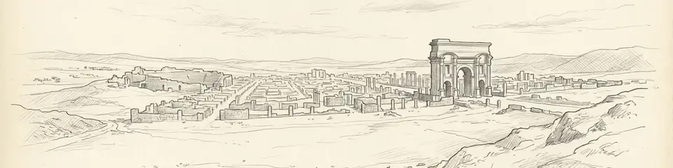
Graphite pencil sketch banner of Timgad

“Timgad is the textbook for Roman urban planning.”

Localisation

Aperçu

Timgad lies on the High Plateau of the Aurès Mountains in northeastern Algeria, 35 km east of Batna, at an altitude of 1,050 m. It was founded as a veterans' colony by the Emperor Trajan in 100 CE and formally named Colonia Marciana Ulpia Traiana Thamugadi in honor of Trajan's sister Marciana. The location was strategic: the Aurès served as the mountain redoubt of the Berber Chaouïa people, and the colony was designed to anchor Roman control of the southern frontier.

Timgad is the most completely preserved example of Roman urban planning anywhere in the empire. The original colony was laid out as a perfect square of 355 m × 355 m, divided by a regular grid of cardines and decumani streets into 111 identical insulae (city blocks). Later growth expanded the city beyond the original plan, adding irregular suburbs, but the colonial core survives with extraordinary completeness: the paving of the decumanus maximus is intact for its full length; the Trajan's Arch at the western end stands nearly to its original height; the forum, basilica, and Capitoline temple occupy their exact positions at the crossing of the main streets; and the theatre, with a 3,500-seat cavea carved into a hillside, retains its seating tiers and stage-building walls.

The city reached its height in the 2nd and early 3rd centuries, when it supported a population estimated at 15,000–20,000. Twenty-three bath complexes have been identified, an extraordinary number even for a Roman city of this size. A large Christian basilica of the 4th century — one of the largest in Roman Africa — reflects the city's conversion after Constantine. The city was sacked by the Berber king Tacfarinas in the 5th century, partially reoccupied, and finally abandoned when advancing Saharan sands buried the southern portion to a depth of several meters — an accident of preservation that explains the remarkable completeness of what survives.

Pourquoi c'est important

Timgad is the textbook for Roman urban planning. The original colony grid survives more completely than Rome itself, Pompeii, or any other major Roman city. Visiting it is the closest experience available to standing inside an intact Roman town: the streets are paved, the forum foundation is visible, the theater works, the arch stands. It demonstrates what every Roman colonial city looked like — a grid of equal blocks, public buildings at the center crossing, baths distributed throughout, a theater at the edge — and shows with unusual clarity how Rome exported not just culture but a physical template for civilized life to every corner of its empire. The 4th-century basilica also makes Timgad a key site in understanding North African Christianity, the theological environment that produced Augustine of Hippo (born 180 km away in Thagaste).

Preuves et interprétation

Distinguer ce qui est bien établi de ce qui reste débattu.

Faits bien établis

3
  • An inscription on the Arch of Trajan identifies the city's official name as Colonia Marciana Ulpia Traiana Thamugadi and the founding emperor as Trajan; the consular date on a milestone within the city corresponds to 100 CE.
  • The original 355 × 355 m square plan survives intact and has been precisely mapped: the ratio of street widths to block widths matches the proportional formula recorded by the Roman land surveyor Hyginus Gromaticus.
  • Twenty-three baths have been identified through excavation and aerial photography, an exceptional figure suggesting Timgad's residents had access to public bathing at a density not matched in better-known Roman cities.

Inférences savantes

1
  • The deep sand burial of the southern portion of the city — which accounts for much of the extraordinary preservation — is attributed to progressive desertification of the Aurès Highlands from the 6th century onward, likely accelerated by deforestation and overgrazing.

Photos de la communauté

Partagez votre expérience

Avez-vous visité ce site ? Téléchargez vos photos pour aider les autres à le découvrir.

Comment citer cette page

Atlas Anatolia. (100). Timgad. Atlas Anatolia. https://atlasanatolia.com/fr/site/timgad

Contenu sous licence CC BY-SA 4.0 — attribution requise en cas de réutilisation.

Sources

  • Timgad: une cité africaine sous l'Empire romain — R. Cagnat and M. Ballu (1905)
  • Roman Africa: An Archaeological Survey — David Mattingly (2011)
  • UNESCO World Heritage — TimgadLien

Questions fréquentes

Où se trouve Timgad ?

Timgad est situé à/en Algeria.

De quand date Timgad ?

Timgad remonte approximativement à 100 apr. J.-C. – 700 apr. J.-C..

Quelles civilisations sont associées à Timgad ?

Timgad est associé à la civilisation Roman.

Pourquoi Timgad est-il important ?

Timgad is the textbook for Roman urban planning.

Timgad est-il inscrit au patrimoine mondial de l'UNESCO ?

Oui — Timgad est inscrit sur la liste du patrimoine mondial de l'UNESCO.