
Aller au contenu
Atlas Anatolia
ActualitésIce Age teeth in Sulawesi push betel-nut use back as far as 25,000 yearsRoman mosaic and Eros head uncovered in the basilica at Pompeiopolis, Kastamonu
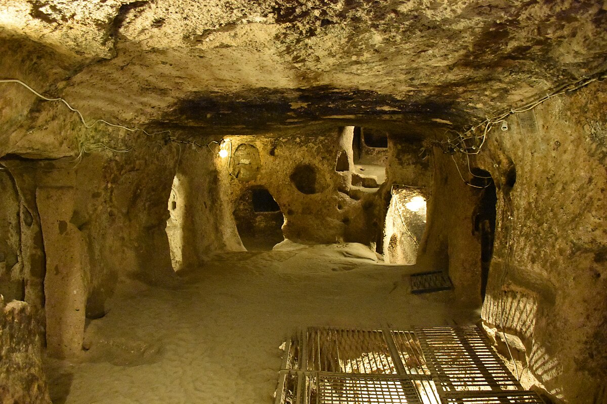
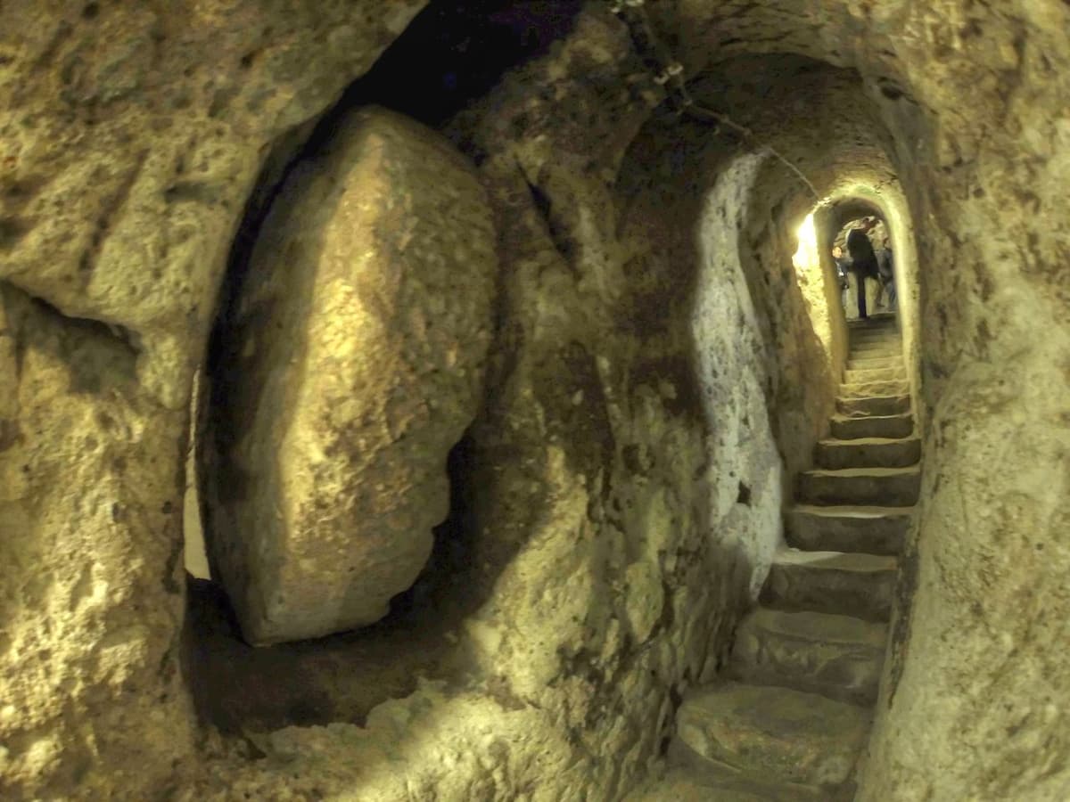
Kaymaklı underground city tunnels

Wikimedia Commons (CC BY-SA)

Complexe

Kaymaklı Underground City

Seyfi Cem Baskin

Kaymaklı Yeraltı Şehri800 av. J.-C. – 1200 apr. J.-C.

The second-largest underground city in Cappadocia, with eight levels carved deep into volcanic tuff, where early Christians and local populations sheltered from invaders in a labyrinth of tunnels, churches, storerooms, and ventilation shafts.

321
Intérêt 55

Localisation

Nevşehir · Central Anatolia · Turquie

38.47°N · 34.76°E · Asie

Depth

Eight levels extending approximately 80 meters underground

Capacity

Could shelter thousands of people with livestock and supplies

Defense

Massive circular rolling stones sealed tunnel junctions from inside

Ventilation

Dozens of vertical shafts provided fresh air to all levels

Church

Barrel-vaulted underground chapel with carved decoration

Tunnel

Reportedly connected to Derinkuyu, 9 km away

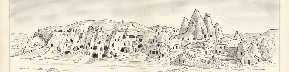
Graphite pencil sketch banner of Kaymaklı Underground City

“Kaymaklı demonstrates human ingenuity in adapting to extreme circumstances — the creation of entire cities underground in response to the threat of invasion.”

De Wikipédia

Kaymaklı Underground City is the second-largest underground city in Cappadocia, with eight levels of tunnels, churches, and storerooms carved into volcanic tuff for shelter during invasions.

Lire l'article complet sur Wikipédia →

Localisation

Aperçu

Kaymaklı Underground City extends beneath the modern village of Kaymaklı in Nevşehir province, a vast subterranean complex carved into the soft volcanic tuff that defines the Cappadocian landscape. With eight known levels descending approximately 80 meters below the surface, it is the second-largest underground city in the region after nearby Derinkuyu, and together they represent one of the most remarkable feats of subterranean architecture in the world.

The origins of Kaymaklı's underground spaces likely date to the Phrygian period (8th-7th centuries BCE), when the soft tuff was first hollowed out for storage and shelter. However, the complex was massively expanded during the Roman and Byzantine periods, when the Christian communities of Cappadocia required refuge from periodic invasions and persecutions. The underground city could shelter thousands of people along with their livestock and food supplies during sieges, creating a self-contained subterranean community that could survive for months.

"The inhabitants of Cappadocia dig their dwellings underground, connecting them like the burrows of animals, and live in them with their entire households."
— Xenophon, Anabasis (c. 370 BCE)

The layout reflects careful planning despite the organic expansion over centuries. Each level served distinct functions: upper levels contained living quarters with sleeping platforms and cooking areas (identifiable by smoke-blackened ceilings), while middle levels housed storerooms for grain, wine, and oil. A church level featured a barrel-vaulted chapel with simple carved decoration. The deepest accessible levels contained water wells and additional storage, ensuring the survival of sheltering populations even during extended sieges.

Massive circular rolling stones, weighing up to half a ton, could be rolled across corridor junctions to seal off sections of the underground city. These ingenious defensive devices, operated from the inside, could be positioned quickly and were nearly impossible to move from the exterior. Narrow tunnels connecting levels served as chokepoints where a single defender could hold off multiple attackers.
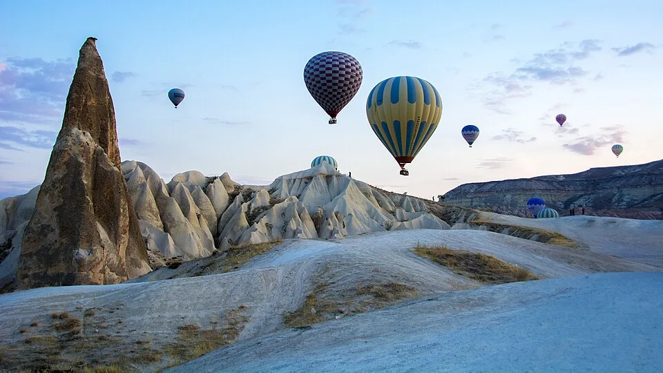
CAPPADOCIA Göreme National Park and the Rock Sites. World Heritage List. Turkey. Hot Air Ballooning Cappadocia
CAPPADOCIA Göreme National Park and the Rock Sites. World Heritage List. Turkey. Hot Air Ballooning Cappadocia | Feridun F. Alkaya (CC0)

The ventilation system demonstrates sophisticated engineering. Dozens of vertical shafts penetrate from the surface through all eight levels, providing fresh air circulation even to the deepest chambers. Some of these shafts also served as communication channels between levels and as wells providing access to underground water sources.

A tunnel reportedly connected Kaymaklı to Derinkuyu underground city, approximately 9 kilometers away, though this passage has not been fully explored. If confirmed, it would represent an underground infrastructure network of extraordinary ambition.
Pourquoi c'est important

Kaymaklı demonstrates human ingenuity in adapting to extreme circumstances — the creation of entire cities underground in response to the threat of invasion. The engineering achievements in ventilation, water supply, and defensive architecture are remarkable for any period, let alone one predating modern construction technology. The underground cities of Cappadocia illuminate the lived experience of early Christian communities on the frontier of empires, where the threat of persecution and invasion was a constant reality that shaped everything from architecture to social organization. Kaymaklı is a monument to resilience and the determination of communities to survive against overwhelming odds.

Preuves et interprétation

Distinguer ce qui est bien établi de ce qui reste débattu.

Faits bien établis

3
  • Eight levels of underground chambers, tunnels, and functional spaces have been archaeologically documented, carved into the volcanic tuff characteristic of the Cappadocian landscape.
  • Rolling stone doors, some weighing approximately 500 kg, remain in situ at tunnel junctions, demonstrating the defensive engineering of the underground complex.
  • A barrel-vaulted underground church with carved cross decoration confirms the complex's use by Christian communities during the Byzantine period.

Inférences savantes

2
  • Phrygian-period pottery in the upper levels suggests initial excavation of the underground spaces began in the Iron Age, with massive expansion during the Christian era.
  • The scale of the storage facilities — grain silos, wine presses, and oil storage — suggests the underground city was designed for extended occupation during sieges lasting weeks or months.

Interprétations débattues

1
  • The reported 9-km tunnel connecting Kaymaklı to Derinkuyu has not been fully explored or confirmed, and some researchers question whether a continuous passage of this length exists.

Découverte et fouilles

1964

Opening to visitors

First four levels of the underground city were cleared and made accessible to visitors, revealing the scale and complexity of the subterranean complex.

1975

Deep level exploration

Archaeological teams explored and documented levels 5-8, identifying the church level, deep storage chambers, and additional ventilation shafts.

1995

Structural survey

Engineering survey assessed the stability of the underground chambers and identified areas requiring conservation intervention to prevent collapse.

2005

Ventilation system study

Detailed documentation of the ventilation shaft network revealed the sophisticated air circulation system that made deep-level habitation possible.

2018

New passage discoveries

Ongoing exploration identified previously unknown chambers and connecting tunnels, suggesting the known extent of the underground city may represent only a portion of the total complex.

Photos de la communauté

Partagez votre expérience

Avez-vous visité ce site ? Téléchargez vos photos pour aider les autres à le découvrir.

Récits liés

Comment citer cette page

Atlas Anatolia. (800). Kaymaklı Underground City. Atlas Anatolia. https://atlasanatolia.com/fr/site/kaymakli

Contenu sous licence CC BY-SA 4.0 — attribution requise en cas de réutilisation.

Graphique

Connexions avec des sites et récits associés.

Sources

  • Underground Cities of Cappadocia — Ömür Bakırer (2005)
  • The Subterranean Architecture of Cappadocia — Roberto Bixio et al. (2012)
  • Wikipedia — Kaymaklı Underground CityLien

Questions fréquentes

Où se trouve Kaymaklı Underground City ?

Kaymaklı Underground City est situé à/en Nevşehir, Central Anatolia, Türkiye.

De quand date Kaymaklı Underground City ?

Kaymaklı Underground City remonte approximativement à 800 av. J.-C. – 1200 apr. J.-C..

Quelles civilisations sont associées à Kaymaklı Underground City ?

Kaymaklı Underground City est associé à la civilisation Phrygian, Roman, Byzantine, Early Christian.

Pourquoi Kaymaklı Underground City est-il important ?

Kaymaklı demonstrates human ingenuity in adapting to extreme circumstances — the creation of entire cities underground in response to the threat of invasion.

Kaymaklı Underground City est-il inscrit au patrimoine mondial de l'UNESCO ?

Kaymaklı Underground City n'est pas actuellement inscrit sur la liste du patrimoine mondial de l'UNESCO.