
Saltar al contenido
Atlas Anatolia
NoticiasIce Age teeth in Sulawesi push betel-nut use back as far as 25,000 yearsRoman mosaic and Eros head uncovered in the basilica at Pompeiopolis, Kastamonu
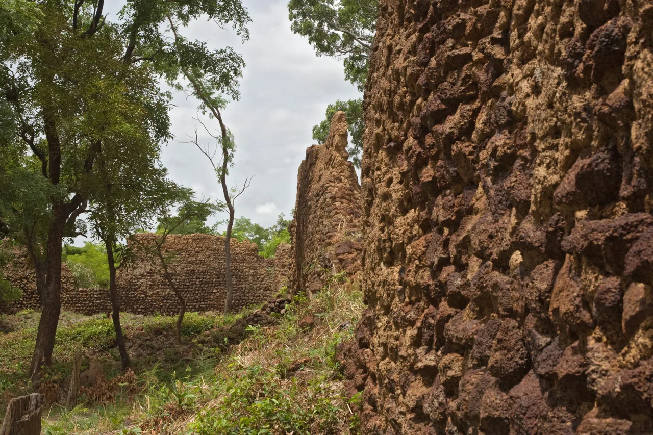
Massive dry-stone walls of the Loropéni ruins, Poni Province, Burkina Faso

Wikimedia Commons

FortalezaUNESCO

Loropéni

Seyfi Cem Baskin

1100 d. C. – 1800 d. C.

A mysterious complex of massive dry-stone walls in southwestern Burkina Faso, the best-preserved of ten fortified stone enclosures scattered across the region and once linked to the trans-Saharan gold trade that made medieval West Africa fabulously wealthy. Its precise builders, exact founding date, and original purpose remain genuinely unresolved, making it one of the more enigmatic UNESCO World Heritage Sites in Africa.

212
Interés 38

Ubicación

Poni Province · Burkina Faso

10.15°N · 3.58°W · África

Walls

Dry-stone, up to 6 m high, enclosing c. 11,130 sq. m without mortar

One of ten

Best-preserved of ten similar fortified stone enclosures in the region

Trade

Linked to the trans-Saharan gold trade that enriched medieval West African empires

Builders

Unknown — no confirmed oral tradition identifies the specific community

UNESCO

Burkina Faso's first World Heritage Site, inscribed 2009

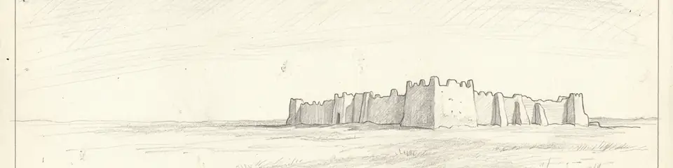
Graphite pencil sketch banner of Loropéni

Loropéni is a rare case of a major, well-preserved fortified monument whose builders remain essentially anonymous — like San Agustín in Colombia, it demonstrates that even substantial, technically accomplished archaeological sites can resist confident historical attribution, especially where the relevant communities' own oral traditions did not preserve a specific memory of the builders across the intervening centuries.”

Ubicación

Resumen

Loropéni lies near Burkina Faso's southwestern border with Côte d'Ivoire and Ghana, within a region historically significant for gold production. The site consists of massive dry-stone walls — built without mortar, up to six metres high and enclosing an area of roughly 11,130 square metres — forming one of ten similar fortified stone enclosures (locally known as lo, meaning "protective wall") scattered across the surrounding landscape, of which Loropéni's is by far the best preserved.

Archaeological and historical evidence connects the enclosures to the region's gold industry, which fed into the broader trans-Saharan trade networks that carried West African gold north across the Sahara to North African and Mediterranean markets for many centuries, funding the wealth of empires such as Ghana, Mali, and Songhai even though the actual gold-producing zones — including the area around Loropéni — often lay well outside those empires' direct political control. The walls are generally interpreted as having served defensive and controlling functions related to this gold trade, whether protecting stored wealth, controlling access to production sites, or marking the territory of a specific trading or producing community, though which of these functions predominated, or whether the purpose changed over time, remains debated.

Dating the site precisely has proven difficult. Archaeological evidence suggests activity at Loropéni beginning as early as the 11th century CE, with the surviving stone walls themselves more commonly attributed to construction and use spanning roughly the 14th through 17th centuries, though the site continued to see some level of occupation into the 19th century before being abandoned. Unlike many major archaeological sites in West Africa, no strong oral historical tradition survives among nearby communities today that definitively identifies the specific ethnic or political group responsible for building the walls, though scholarly and local tradition has associated the broader gold-trading networks of the era with Dyula and other Mande-speaking merchant communities who operated extensively across this part of West Africa.

Excavations within the enclosure walls have recovered ceramics, iron-working evidence, and other material culture that confirm sustained human occupation and craft activity, but have not yet produced a definitive answer to who specifically directed the walls' construction or organised the community living and working within them. Loropéni was inscribed as Burkina Faso's first UNESCO World Heritage Site in 2009, recognised explicitly as testimony to the historically under-documented gold trade that connected West Africa to the wider medieval and early modern world economy.

Por qué es importante

Loropéni is a rare case of a major, well-preserved fortified monument whose builders remain essentially anonymous — like San Agustín in Colombia, it demonstrates that even substantial, technically accomplished archaeological sites can resist confident historical attribution, especially where the relevant communities' own oral traditions did not preserve a specific memory of the builders across the intervening centuries. The site provides crucial physical evidence for the often under-documented production side of the trans-Saharan gold trade. Historical sources — largely written by North African and Mediterranean observers — describe West African gold's effects on the wider medieval economy in considerable detail, but say comparatively little about the specific mining, fortification, and trade-organisation systems operating within the actual gold-producing regions themselves; Loropéni helps fill that gap from the production side of the trade rather than the consuming or transporting side. As Burkina Faso's first UNESCO World Heritage Site, Loropéni also holds particular significance for West African heritage recognition more broadly, asserting the historical importance of a site and a regional gold-trade system that had received relatively little international scholarly attention compared to more famous trans-Saharan trade centres like Timbuktu or Djenné.

Evidencia e interpretación

Distinguir lo bien establecido de lo que sigue en debate.

Hechos bien establecidos

2
  • Archaeological excavation confirms sustained occupation and craft activity, including ceramics and evidence of iron working, within the walled enclosure across several centuries.
  • The site's location within a historically significant gold-producing region, combined with material evidence of trade goods, supports its connection to trans-Saharan gold trade networks documented in medieval North African and Mediterranean sources.

Inferencias académicas

1
  • The dating of the surviving stone walls to roughly the 14th–17th centuries CE is inferred from associated material culture and comparative regional chronology rather than from a single decisive dated inscription or artefact.

Interpretaciones debatidas

2
  • The specific ethnic or political community responsible for constructing and occupying the walls is not confirmed; scholarly and local tradition associates the broader trade network with Dyula and other Mande-speaking merchants, but no direct evidence identifies the builders themselves with certainty.
  • Whether the walls' primary function was defensive, a means of controlling access to gold production or storage, or a marker of territorial and social boundaries remains an open question among researchers, with the interpretation likely varying across the site's long occupation history.

Descubrimiento y excavación

1900

Early colonial documentation

First European documentation of the ruins during the French colonial period.

2003–2009

UNESCO nomination archaeological survey

Systematic survey and conservation assessment supporting Burkina Faso's successful UNESCO World Heritage nomination.

Fotos de la comunidad

Comparte tu experiencia

¿Has visitado este sitio? Sube tus fotos para ayudar a otros a descubrirlo.

Cómo citar esta página

Atlas Anatolia. (1100). Loropéni. Atlas Anatolia. https://atlasanatolia.com/es/site/loropeni

Contenido bajo licencia CC BY-SA 4.0 — se requiere atribución al reutilizar.

Fuentes

  • L'Or de la Volta NoireKiéthéga, Jean-Baptiste (1983)
  • UNESCO — Ruins of LoropéniEnlace
  • Les Ruines de Lorpéni: Un Patrimoine à SauvegarderKote, Lassina (2010)

Preguntas frecuentes

¿Dónde se encuentra Loropéni?

Loropéni se encuentra en Poni Province, Burkina Faso.

¿Qué antigüedad tiene Loropéni?

Loropéni se fecha aproximadamente en 1100 d. C. – 1800 d. C..

¿Qué civilizaciones se relacionan con Loropéni?

Loropéni se relaciona con Mande.

¿Por qué es importante Loropéni?

Loropéni is a rare case of a major, well-preserved fortified monument whose builders remain essentially anonymous — like San Agustín in Colombia, it demonstrates that even substantial, technically accomplished archaeological sites can resist confident historical attribution, especially where the relevant communities' own oral traditions did not preserve a specific memory of the builders across the intervening centuries.

¿Loropéni es Patrimonio Mundial de la UNESCO?

Sí. Loropéni está inscrito en la Lista del Patrimonio Mundial de la UNESCO.