
Pular para o conteúdo
Atlas Anatolia
NotíciasIce Age teeth in Sulawesi push betel-nut use back as far as 25,000 yearsRoman mosaic and Eros head uncovered in the basilica at Pompeiopolis, Kastamonu
Nazca Lines — Peru

Wikimedia Commons (CC BY-SA)

Continent Record

Oldest Monument in South America

MonumentoUNESCODestaque

Nazca Lines

Seyfi Cem Baskin

Líneas de Nazca500 a.C. – 500 d.C.

The Nazca Lines, vast geoglyphs etched into Peru’s desert, date from c. 500 BCE–500 CE and remain one of archaeology’s most intriguing legacies of ancient monumental art.

222
Interesse 83

Localização

Ica Region · Nazca Desert · Peru

14.74°S · 75.13°W · América do Sul

Built

c. 500 BCE – 500 CE

Civilization

Nazca culture

Discovered

First recorded scientifically by Toribio Mejía Xesspe in 1927

Status

UNESCO World Heritage Site (1994)

Technique

Subtractive: removal of dark surface stones to expose lighter subsoil

Scale

Over 1,000 geoglyphs spanning approximately 450 km²

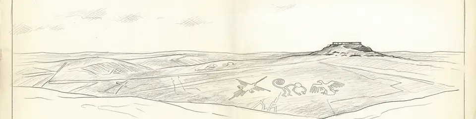
Graphite pencil sketch banner of Nazca Lines

“The Nazca Lines represent one of the most monumental expressions of land art and geoglyphic construction in the ancient world, reflecting the sophisticated socioreligious organization of a non-literate culture.”

Localização

Visão geral

Introduction

The Nazca Lines are a series of large ancient geoglyphs located in the Nazca Desert of southern Peru. Created by the Nazca culture between approximately 500 BCE and 500 CE, these designs were formed by removing dark ferrous pebbles to reveal the lighter gypsum-rich soil beneath. The site encompasses over 1,000 individual figures, including straight lines, geometric shapes, and biomorphic representations of animals, plants, and humanoid forms, some stretching over 200 meters in length. Their true purpose remains an enigma, though scholarly consensus leans towards ritual and astronomical functions.

Construction and Chronology

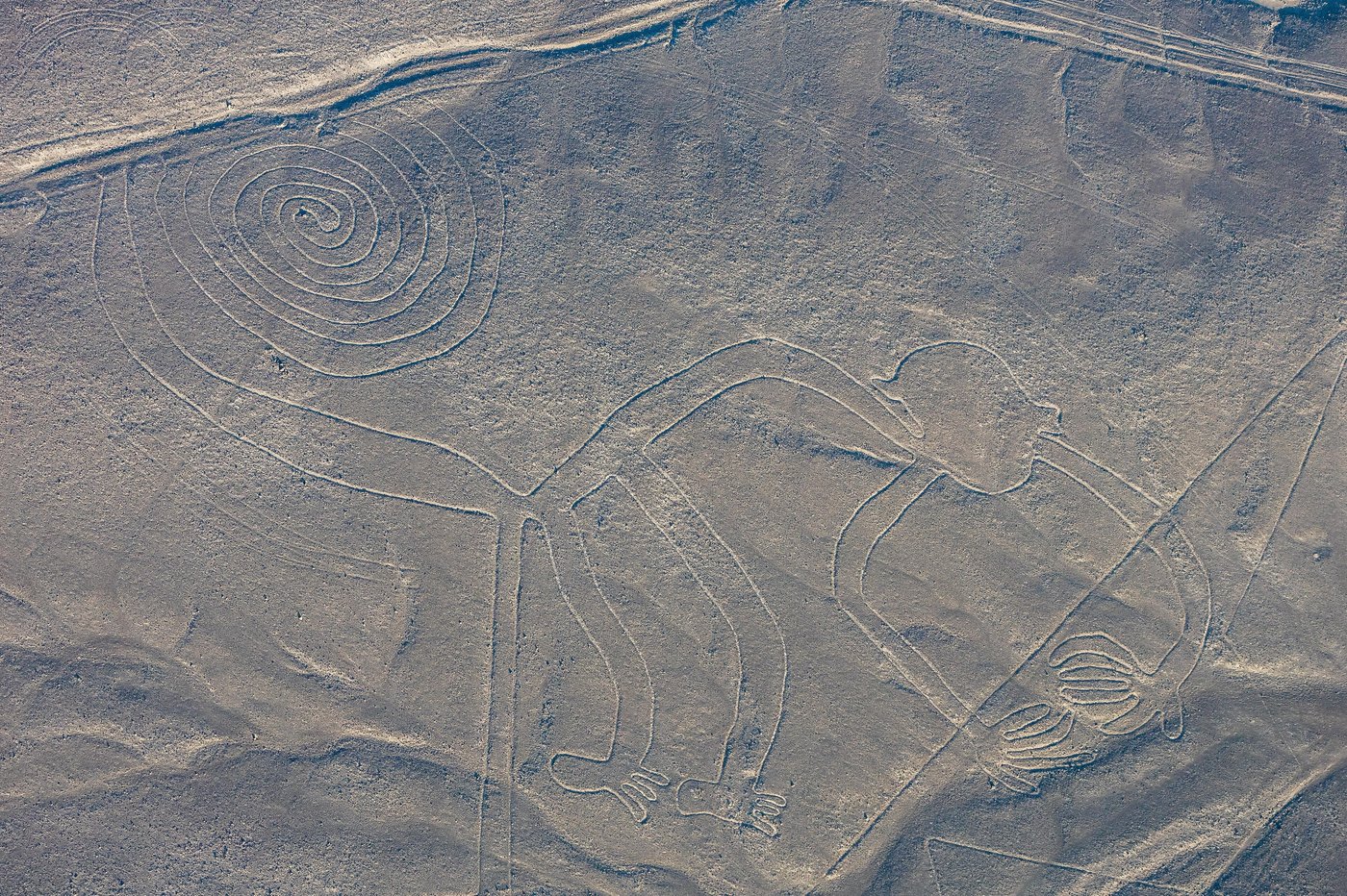
The geoglyphs were made using a subtractive technique: the dark surface stones were cleared away, exposing the pale subsoil, which has since been bound by a natural patina. Radiocarbon dating of wooden stake residue found near the lines, along with stylistic analysis of associated pottery, anchors the chronology firmly within the Early Intermediate Period. The Nazca culture’s engineering precision is evident in the intricate, continuous lines of figures like the hummingbird and monkey, which were likely plotted using a grid-and-rope method scaled up from smaller sketches.
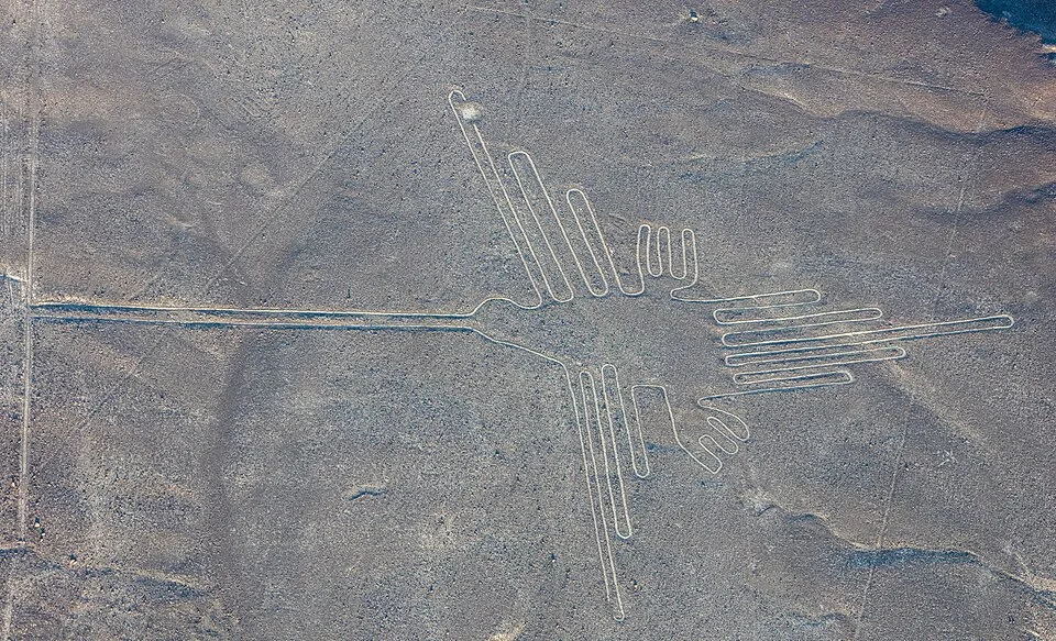
Líneas de Nazca, Nazca, Perú, 2015-07-29, DD 52
Líneas de Nazca, Nazca, Perú, 2015-07-29, DD 52 | Diego Delso (CC BY-SA 4.0)
"I had been mapping these lines on foot for years before I climbed the surrounding hills and looked down. Only then did I see — they were not roads at all, but the figures of birds, fish, spiders, and monkeys, drawn upon the desert as if for the gods alone."
— Maria Reiche, on her decades of survey at the Nazca Lines (Mystery on the Desert, 1968)

Function and Meaning

Scholars propose multiple interpretations: that the lines served as ritual pathways for processions, as astronomical calendars aligning with solstices and stellar positions, or as offerings to deities associated with water—a scarce resource in the arid region. Maria Reiche championed the astronomical hypothesis, noting solar alignments, while more recent research by Johan Reinhard posits a strong connection to mountain gods and water worship. The location of many geoglyphs near water sources and their visibility from surrounding hills support a ritual landscape designed for ceremonial pilgrimage.
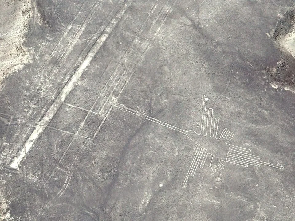
Nazca Lines Hummingbird (cropped)
Nazca Lines Hummingbird (cropped) | Unukorno (CC BY 3.0)

Discovery and Research

The lines were first scientifically recorded by Peruvian archaeologist Toribio Mejía Xesspe in 1927, though they had been noted earlier by pilots and conquistadors. Their true scale became apparent after Paul Kosok’s 1941 aerial survey, later expanded by Maria Reiche, who dedicated decades to mapping and preserving the site. In the late 20th century, multidisciplinary studies employing satellite imagery, GIS, and even AI have unveiled previously undetected geoglyphs, underscoring that the full extent of this archaeological marvel is still being uncovered.

Preservation and Threats

Designated a UNESCO World Heritage Site in 1994, the Nazca Lines face threats from climate change (episodic heavy rains), encroaching urban development, and accidental damage from vehicles—most notoriously a 2014 incident where a truck drove over a portion of the site. Conservation efforts now focus on strict legal protection, public education, and technological monitoring to safeguard these fragile, shallow trenches that have survived nearly two millennia in one of the world’s driest climates.

Por que isso importa

The Nazca Lines represent one of the most monumental expressions of land art and geoglyphic construction in the ancient world, reflecting the sophisticated socioreligious organization of a non-literate culture. They embody humanity’s universal impulse to inscribe meaning onto the landscape and continue to challenge our interpretations of pre-Columbian astronomy, ritual, and landscape archaeology.

Evidências e interpretação

Distinguir o que está bem estabelecido do que permanece em debate.

Fatos bem estabelecidos

2
  • The geoglyphs were created by the Nazca culture using the technique of removing oxidized, dark pebbles to reveal the lighter gypsum-rich earth beneath.
  • Radiocarbon dating of wooden stake fragments found at some geoglyph sites confirms the date range of 500 BCE to 500 CE.

Inferências acadêmicas

2
  • Many lines and trapezoids likely functioned as ritual pathways or processional routes connected to water and fertility ceremonies.
  • Some geometric alignments correspond to the rising of important stars or solstices, suggesting a possible calendrical function.

Interpretações debatidas

2
  • The extent to which the Nazca Lines formed a coherent astronomical calendar remains disputed, with critics arguing the alignments are not precise enough to support a systematic calendrical system.
  • The social and political organization required to plan and construct such massive earthworks without a formal administrative system is still debated among scholars.

Descoberta e escavação

1927

First scientific documentation

Dirigido por Toribio Mejía Xesspe

Peruvian archaeologist Toribio Mejía Xesspe identified and recorded the lines during a hiking expedition, publishing early descriptions.

1941

Aerial survey and astronomical hypothesis

Dirigido por Paul Kosok

American historian Paul Kosok flew over the lines and proposed their astronomical significance, marking the start of modern interdisciplinary research.

1946–1998

Lifetime mapping and conservation

Dirigido por Maria Reiche

German mathematician Maria Reiche devoted over 50 years to measuring, mapping, and lobbying for protection, establishing the first comprehensive catalog of the geoglyphs.

2000

Digital and satellite-based research

Dirigido por Various international collaborations

Teams including the Nazca-Palpa Project used high-resolution aerial photography, drone imaging, and GIS to detect and record previously unknown geoglyphs.

2017

AI-assisted geoglyph discovery

Dirigido por Yamagata University Institute of Nasca

Researchers from Yamagata University employed deep learning algorithms on aerial imagery, revealing new figures and demonstrating the potential for non-invasive surveying.

Fotos da comunidade

Compartilhe sua experiência

Você visitou este sítio? Envie suas fotos para ajudar outros a descobri-lo.

Como citar esta página

Atlas Anatolia. (500). Nazca Lines. Atlas Anatolia. https://atlasanatolia.com/pt/site/nazca-lines

Conteúdo licenciado sob CC BY-SA 4.0 — atribuição necessária ao reutilizar.

Fontes

  • Reiche, M. (1949), Mystery on the Desert — Maria Reiche (1949)
  • Aveni, A. F. (2000), Between the Lines: The Mystery of the Giant Ground Drawings of Ancient Nasca, Peru — Anthony F. Aveni (2000)
  • Reinhard, J. (1992), The Nazca Lines: A New Perspective on their Origin and Meaning — Johan Reinhard (1992)
  • Urton, G. (1990), The Nazca Lines: A New Look at an Old Riddle — Gary Urton (1990)
  • UNESCO World Heritage Centre, Lines and Geoglyphs of Nasca and PalpaLink

Perguntas frequentes

Onde fica Nazca Lines?

Nazca Lines está localizado em Ica Region, Nazca Desert, Peru.

Qual é a antiguidade de Nazca Lines?

Nazca Lines data de aproximadamente 500 a.C. – 500 d.C..

Quais civilizações estão associadas a Nazca Lines?

Nazca Lines está associado à civilização Nazca.

Por que Nazca Lines é importante?

The Nazca Lines represent one of the most monumental expressions of land art and geoglyphic construction in the ancient world, reflecting the sophisticated socioreligious organization of a non-literate culture.

Nazca Lines é um Patrimônio Mundial da UNESCO?

Sim — Nazca Lines está inscrito na Lista do Patrimônio Mundial da UNESCO.