
콘텐츠로 건너뛰기
Atlas Anatolia
디그
뉴스술라웨시 빙하기 치아에서 빈랑 사용 25,000년 전까지 소급카스타모누 폼페이오폴리스 바실리카에서 로마 모자이크와 에로스 두상 발견
Registan square with three madrasas in Samarkand

Wikimedia Commons (CC BY-SA 3.0)

유산도시유네스코주요

Samarkand

Seyfi Cem Baskin

Самарқанд700 기원전 – 1700 서기

Timur’s capital on the Zeravshan — crowned by the Registan’s three tiled madrasas — was the ceremonial and scholarly heart of a Silk Road empire linking Persia, India, and the steppe.

21
관심 81

위치

우즈베키스탄

39.65°N · 66.98°E · 아시아

Ancient name

Maracanda (Sogdian)

Timurid capital

Late 14th century under Timur

Registan

Three madrasas, 15th–17th c.

UNESCO

Historic Town of Samarkand (2001)

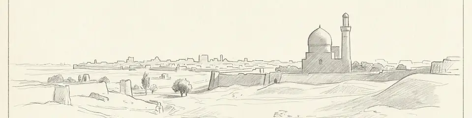
Graphite pencil sketch banner of Samarkand

“Samarkand concentrates Timurid political theology, astronomy, and tile architecture in one walkable historic centre.”

위치

개요

Samarkand (ancient Maracanda) sits in the Zeravshan Valley of modern Uzbekistan. An Iron Age and Sogdian centre conquered by Alexander, it later flourished under Sogdian merchants before Mongol destruction in 1220. Timur (Tamerlane) made Samarkand his capital in the late 14th century; his grandson Ulugh Beg built a madrasa and observatory that made the city a scientific as well as dynastic stage. The Registan square — Ulugh Beg Madrasa (1417–21), Sher-Dor (1619–36), and Tilya-Kori (17th century) — forms the postcard ensemble of turquoise domes and pishtaq façades.

Beyond the Registan, the Bibi-Khanym Mosque, Gur-e-Amir mausoleum, and Shah-i-Zinda necropolis preserve Timurid brick and tile craft at imperial scale. UNESCO inscribed the Historic Town of Samarkand in 2001. Pair with Merv and Jiaohe for earlier Silk Road urbanisms further east and west.

중요성

Samarkand concentrates Timurid political theology, astronomy, and tile architecture in one walkable historic centre. It is essential for understanding how post-Mongol Central Asian empires staged legitimacy on the Silk Road.

증거와 해석

확립된 사실과 논쟁 중인 사항을 구분합니다.

잘 확립된 사실

2
  • Timurid building inscriptions, waqf documents, and standing madrasas securely date the Registan ensemble and Gur-e-Amir complex.
  • Archaeology at Afrasiyab (ancient Samarkand) documents Sogdian and earlier occupation beneath and beside the Timurid city.

학술적 추론

1
  • Ulugh Beg’s observatory programme positioned Samarkand as a scientific capital rivaling contemporary Islamic and European courts.

커뮤니티 사진

당신의 경험을 공유하세요

이 유적지를 방문하셨나요? 다른 탐험가들을 위해 사진을 업로드해 보세요.

이 페이지 인용 방법

Atlas Anatolia. (700). Samarkand. Atlas Anatolia. https://atlasanatolia.com/ko/site/samarkand

콘텐츠는 CC BY-SA 4.0 라이선스에 따라 제공됩니다 — 재사용 시 출처 표시가 필요합니다.

출처

  • The Rise and Rule of Tamerlane — Manz, Beatrice Forbes (1989)
  • UNESCO — Samarkand – Crossroad of Cultures링크

자주 묻는 질문

Samarkand은(는) 어디에 위치해 있나요?

Samarkand은(는) Uzbekistan에 위치해 있습니다.

Samarkand의 연대는 언제인가요?

Samarkand의 연대는 대략 700 기원전 – 1700 서기로 거슬러 올라갑니다.

Samarkand과(와) 관련된 고대 문명은 무엇인가요?

Samarkand은(는) Timurid, Sogdian 문명과 관련이 있습니다.

Samarkand이(가) 중요한 이유는 무엇인가요?

Samarkand concentrates Timurid political theology, astronomy, and tile architecture in one walkable historic centre.

Samarkand은(는) 유네스코 세계유산인가요?

예 — Samarkand은(는) 유네스코 세계유산으로 등재되어 있습니다.