
Vai al contenuto
Atlas Anatolia
NotizieIce Age teeth in Sulawesi push betel-nut use back as far as 25,000 yearsRoman mosaic and Eros head uncovered in the basilica at Pompeiopolis, Kastamonu
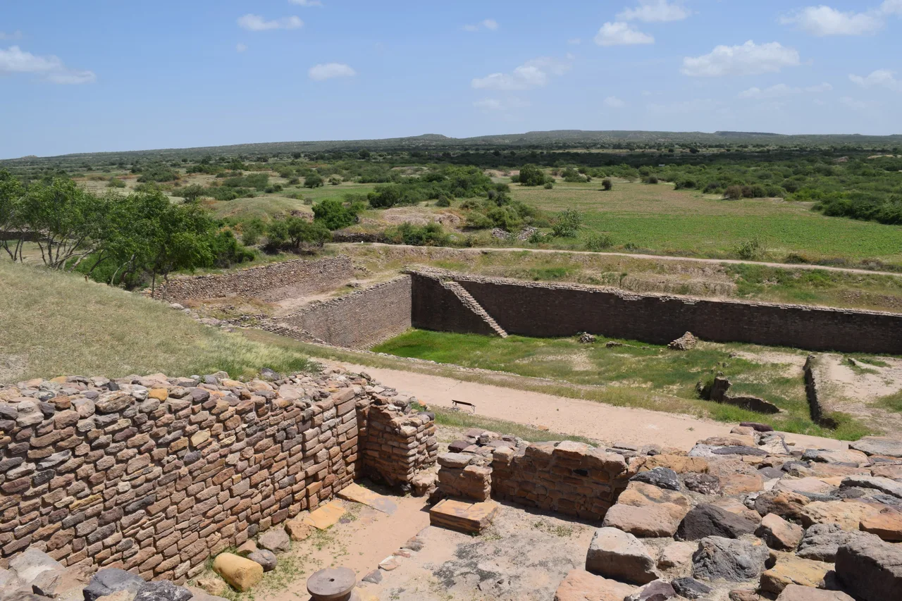
The multi-tiered ruins and rock-cut reservoir at Dholavira, Gujarat, India

Wikimedia Commons

Record nazionale

Oldest City in India

CittàUNESCO

Dholavira

Seyfi Cem Baskin

ધોળાવીરા2650 a.C. – 1450 a.C.

The best-preserved and most sophisticated city of the Indus Valley Civilisation — a planned Bronze Age metropolis on a remote Gujarat island whose multi-tiered layout, massive reservoirs, and unique signboard inscription make it one of the most revealing archaeological sites in Asia.

31
Interesse 62

Posizione

India

23.89°N · 70.21°E · Asia

Period

c. 2650-1450 BCE

Layout

Three-zone plan (citadel / middle town / lower town) unique among Indus cities

Water system

16 rock-cut reservoirs — most sophisticated ancient water management in South Asia

Signboard

Only known large-format Indus script inscription (10 signs on a wooden panel)

Preservation

Never built over; entire city plan remains visible

UNESCO

World Heritage Site 2021 (India's 40th)

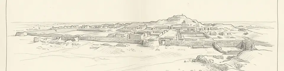
Graphite pencil sketch banner of Dholavira

Dholavira offers the clearest picture of Indus Valley urban planning available anywhere.”

Posizione

Panoramica

Dholavira occupies the Khadir island within the Great Rann of Kutch in the state of Gujarat, India. Inhabited from approximately 2650 to 1450 BCE, it is one of the five largest sites of the Indus Valley Civilisation and, unlike most, has never been built over — meaning the entire ancient city plan remains visible and excavatable.

The city is divided into three distinct zones: a fortified citadel at the highest point, a middle town, and a lower town, each separated by massive stone walls and gates. This tripartite division is more elaborate than at Harappa or Mohenjo-daro. Most remarkably, the city possessed an extraordinarily sophisticated water management system: sixteen reservoirs of various sizes, cisterns, and channels cut into the rock, fed by two seasonal streams and capable of storing enough water to sustain the population through long dry seasons in this arid environment.

Among the most intriguing finds at Dholavira is a signboard: a large wooden panel bearing ten signs of the Indus script, found in what appears to have been the main northern gate of the citadel. It is the only known large-format inscription of the Indus script and may have functioned as the name or title of the city. The site also yielded remarkable quantities of jewellery, sculpture, and craft objects that attest to a skilled artisan population and active long-distance trade.

Dholavira was inscribed as a UNESCO World Heritage Site in 2021, making it the 40th Indian site on the list.
Perché è importante

Dholavira offers the clearest picture of Indus Valley urban planning available anywhere. Because it was never built over, archaeologists can read the city layout — streets, gates, neighbourhoods, reservoirs, public spaces — in a way impossible at most other ancient cities. Its water management system is particularly remarkable: sophisticated rock-cut reservoirs for storing monsoon water in one of India's most arid regions demonstrate an engineering intelligence far ahead of its time. The unique Indus-script signboard found at the north gate raises tantalising questions: was this the city's name? A royal title? A proclamation? If the Indus script is ever deciphered, Dholavira's signboard may provide a crucial key. The site bridges the gap between the Indus civilisation and later Indian culture, showing the deep roots of urban and hydraulic engineering traditions that persist in South Asia to this day.

Evidenze e interpretazione

Distinguere ciò che è ben consolidato da ciò che rimane dibattuto.

Fatti ben consolidati

3
  • The tripartite city plan with distinct citadel, middle town, and lower town — each fortified by massive stone walls — has been fully mapped by excavation and is the most elaborate city structure known from the Indus civilisation.
  • Sixteen reservoirs and channels cut into the sandstone bedrock and connected to seasonal streams via canals have been documented; their combined capacity is estimated at over 250,000 cubic metres.
  • The signboard inscription — ten Indus signs, each approximately 37 cm tall, carved or embedded in a large panel near the north gate — is unique in the Indus corpus and suggests public display of script in an official context.

Deduzioni accademiche

1
  • Dholavira's decline and abandonment around 1450 BCE (later than Harappa or Mohenjo-daro) suggests the city adapted longer to the civilisation-wide crisis, possibly due to its sophisticated water storage; the precise cause of final abandonment is unknown.

Foto della comunità

Condividi la tua esperienza

Hai visitato questo sito? Carica le tue foto per aiutare gli altri a scoprirlo.

Storie correlate

Come citare questa pagina

Atlas Anatolia. (2650). Dholavira. Atlas Anatolia. https://atlasanatolia.com/it/site/dholavira

Contenuto con licenza CC BY-SA 4.0 — è richiesta l'attribuzione in caso di riutilizzo.

Grafico

Collegamenti a siti e storie correlati.

Fonti

  • Excavations at Dholavira 1989-2005: A ReportBisht, R. S. (2015)
  • Ancient Cities of the Indus Valley CivilisationKenoyer, Jonathan Mark (1998)

Domande frequenti

Dove si trova Dholavira?

Dholavira si trova in India.

A quando risale Dholavira?

Dholavira risale all'incirca al 2650 a.C. – 1450 a.C..

Quali civiltà sono associate a Dholavira?

Dholavira è associato alla civiltà Indus Valley.

Perché Dholavira è importante?

Dholavira offers the clearest picture of Indus Valley urban planning available anywhere.

Dholavira è un sito Patrimonio Mondiale dell'UNESCO?

Sì — Dholavira è iscritto nella lista del Patrimonio Mondiale dell'UNESCO.