
Vai al contenuto
Atlas Anatolia
NotizieIce Age teeth in Sulawesi push betel-nut use back as far as 25,000 yearsRoman mosaic and Eros head uncovered in the basilica at Pompeiopolis, Kastamonu
Derbent — Russia

Wikimedia Commons (CC BY-SA)

FortezzaUNESCO

Derbent

Seyfi Cem Baskin

Дербент600 a.C. – 700 d.C.

Ancient Caspian fortress city with monumental Sasanian walls controlling strategic passage between mountains and sea, continuously inhabited since the mid-first millennium BCE.

322
Interesse 62

Posizione

Republic of Dagestan · Caucasus · Russia

42.06°N · 48.29°E · Europa

Built

Principal Sasanian fortifications erected 531–579 CE; earlier settlement from ca. 600 BCE

Civilization

Sasanian Persian, with earlier contributions from Achaemenids, Parthians, and Caucasian Albania

Discovered

First documented by European travelers in the 18th century; systematic excavations began in the 1920s

Status

UNESCO World Heritage Site (inscribed 2003)

Key Feature

Naryn-Kala citadel and dual walls stretching 3.5 km to the Caspian Sea

Historical Role

Northern bastion of the Sasanian Empire; later a major Arab, Turkic, and Mongol stronghold

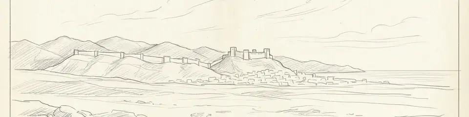
Graphite pencil sketch banner of Derbent

Derbent preserves the most extensive and intact Sasanian fortification system, illustrating the military and administrative reach of one of antiquity’s great empires.”

Posizione

Panoramica

Historical Context

Derbent occupies a narrow strip of land between the Caspian Sea and the eastern spurs of the Greater Caucasus, a natural corridor that has served as a vital crossroads for millennia. The site’s earliest fortifications may date to the Achaemenid period (6th–4th centuries BCE), when the region was on the northern fringe of the Persian Empire. Classical authors, including Herodotus and Strabo, refer to the ‘Caspian Gates,’ a choke point often identified with Derbent. By the 1st century CE, the area was contested between the Parthian and later Sasanian empires and local Caucasian Albanian polities. The most transformative phase came under the Sasanian king Khosrow I Anushirvan (531–579 CE), who ordered the construction of a massive defensive complex to block nomadic incursions from the north. This system, combining natural barriers with stone walls, towers, and a citadel, marked the northernmost boundary of Sasanian authority and remained a critical frontier post for subsequent Arab, Shirvan-Shah, and Mongol rulers.

Architectural Significance

The heart of Derbent’s defenses is the citadel of Naryn-Kala, perched on a hill overlooking the city. From the citadel, two parallel walls run downhill to the sea, a distance of about 3.5 kilometers, effectively sealing the corridor. Built of large, locally quarried limestone blocks and reinforced with semi-circular towers, the walls originally reached a height of over 10 meters and were topped with crenellations. A third wall extended into the shallow waters of the Caspian to prevent flanking by sea. This ensemble is the most complete surviving example of Sasanian military architecture and reflects sophisticated imperial engineering. Inside the citadel, a complex of structures includes a 6th-century cross-domed church—later converted to a mosque—and extensive water cisterns. The main city, or shahrestan, lies between the walls and was laid out on a grid plan, a hallmark of Sasanian urban design. These features underscore Derbent’s role not only as a fortress but as a planned administrative and economic center.
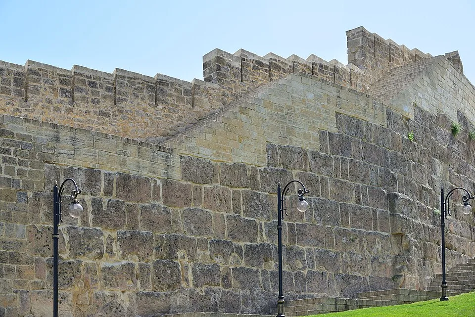
Derbent. Naryn-Kala citadel. The curtain wall
Derbent. Naryn-Kala citadel. The curtain wall | Александр Байдуков (CC BY-SA 4.0)
"There is a certain mountain wall built across the gorge from sea to mountain, raised by the kings of the Persians for many ages — this is what is called the Caspian Gates."
— Procopius, History of the Wars I.10, on Derbent (c. 550 CE)

Excavations and Discoveries

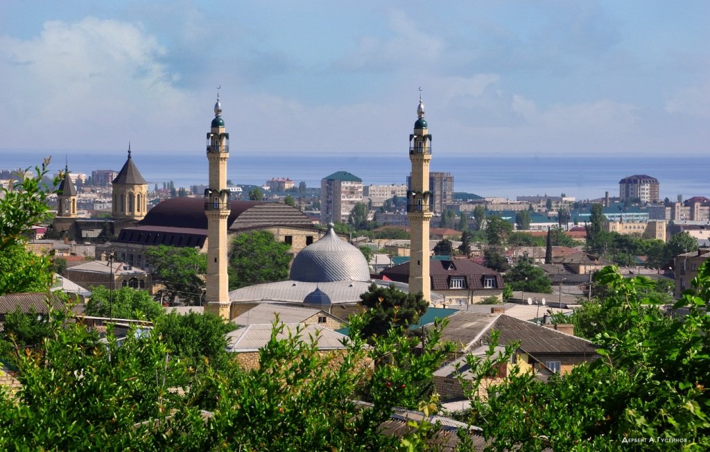
Systematic archaeological investigation began in the 19th century with Russian military topographers, but major campaigns were conducted during the Soviet era, notably by A. A. Kudryavtsev from the 1930s to the 1970s. Excavations beneath the Sasanian walls revealed occupation layers dating to the 6th century BCE, including pottery and metalwork associated with both steppe nomads and the Achaemenid sphere. Within the citadel, earlier mud-brick fortifications were uncovered, possibly of Parthian or early Sasanian origin. A rich array of artifacts—coins, glass, ceramics, and inscriptions—attests to Derbent’s integration into long-distance trade networks, including the Silk Roads. One of the most remarkable finds is the Juma Mosque, built in 733–734 CE and still in use, making it the oldest mosque in Russia. Ongoing work continues to clarify the chronological relationship between the multiple phases of the walls and the pre-Sasanian settlement.
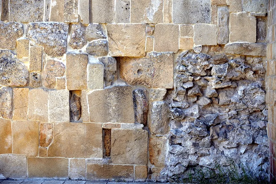
Walls Of The Derbent Fortress
Walls Of The Derbent Fortress | Александр Байдуков (CC BY-SA 4.0)

Cultural Heritage and Legacy

Derbent’s outstanding universal value was recognized by UNESCO in 2003, when the Citadel, Ancient City and Fortress Buildings were inscribed as a World Heritage Site. The property includes not only the Sasanian fortifications but also medieval baths, caravanserais, and mausoleums that reflect the city’s enduring multicultural character. The walls themselves have been subject to conservation efforts, although modern development pressures threaten sections of the lower town. As a living monument, Derbent encapsulates over two millennia of geopolitical strategy, intercultural exchange, and architectural innovation at the boundary between the steppe and the sown.

Perché è importante

Derbent preserves the most extensive and intact Sasanian fortification system, illustrating the military and administrative reach of one of antiquity’s great empires. Its strategic location bridged the Mediterranean, Iranian, and Central Asian worlds, making it a key node in transcontinental trade and a model for later frontier defense systems.

Evidenze e interpretazione

Distinguere ciò che è ben consolidato da ciò che rimane dibattuto.

Fatti ben consolidati

3
  • The standing stone walls and towers of the Sasanian period were constructed using large limestone blocks and lime mortar, with datable organic inclusions providing a 6th-century CE chronology.
  • Archaeological strata beneath the Sasanian fortifications contain pottery typical of the mid-first millennium BCE, confirming occupation during the Achaemenid era.
  • The Juma Mosque, founded in 733–734 CE, is the oldest existing mosque in Russia and sits atop an older Christian basilica, demonstrating religious conversion.

Deduzioni accademiche

2
  • The mention of the ‘Caspian Gates’ by Herodotus and later Greek historians strongly suggests that Derbent or its immediate predecessor was a recognized strategic point in the Achaemenid period.
  • The grid-like layout of the inner city reflects Sasanian urban planning concepts, possibly imposed over an earlier, less regular settlement pattern.

Interpretazioni dibattute

2
  • Scholars continue to discuss whether the pre-Sasanian fortifications constituted a formal barrier built by the Achaemenid state or were merely local defenses later incorporated by the Sasanians.
  • The degree of Hellenistic influence on Derbent is disputed: some interpret coin and ceramic finds as evidence of a Seleucid outpost, while others see only sporadic trade contacts.

Scoperta e scavo

1820–1850

Early topographic surveys

Diretto da Various, including I. N. Berezin

Russian military cartographers and orientalists recorded the walls and inscriptions, producing the first detailed plans of the fortifications.

1928–1935

Initial Soviet excavations

Diretto da Mikhail Artamonov

Pioneering work by M. I. Artamonov and others uncovered early medieval layers and began stratigraphic analysis.

1950–1975

Comprehensive Sasanian fortress study

Diretto da Alexander Kudryavtsev

Large-scale excavations led by A. A. Kudryavtsev exposed the full sequence from the Bronze Age to the late Middle Ages, with a focus on the citadel and walls.

2000

Modern conservation and targeted excavations

Diretto da Murtazali Gadjiev (Dagestan Scientific Center) and international teams

UNESCO-led documentation and restoration projects addressed structural decay, while research excavations clarified the pre-Sasanian layers and maritime wall link.

Foto della comunità

Condividi la tua esperienza

Hai visitato questo sito? Carica le tue foto per aiutare gli altri a scoprirlo.

Come citare questa pagina

Atlas Anatolia. (600). Derbent. Atlas Anatolia. https://atlasanatolia.com/it/site/derbent

Contenuto con licenza CC BY-SA 4.0 — è richiesta l'attribuzione in caso di riutilizzo.

Fonti

  • Kudryavtsev, A. A. (1979), Derbent – Drevneishii gorod SSSR [Derbent – The Most Ancient City of the USSR]A. A. Kudryavtsev (1979)
  • Gadjiev, M. S. (2008), The Derbent Fortification Complex: A Sasanian Masterpiece of DefenseM. S. Gadjiev (2008)
  • Kettenhofen, E. (1984), Die Sasaniden und die ‚Kaukasischen Tore‘ [The Sasanians and the ‘Caucasian Gates’]Erich Kettenhofen (1984)
  • UNESCO World Heritage List: Citadel, Ancient City and Fortress Buildings of DerbentCollegamento
  • Encyclopædia Iranica, s.v. ‘Darband’ (Derbent)Collegamento
  • Magomedov, M. G. (2003), Derbent: The World’s Most Ancient City? Myth and RealityM. G. Magomedov (2003)

Domande frequenti

Dove si trova Derbent?

Derbent si trova in Republic of Dagestan, Caucasus, Russia.

A quando risale Derbent?

Derbent risale all'incirca al 600 a.C. – 700 d.C..

Quali civiltà sono associate a Derbent?

Derbent è associato alla civiltà Sasanian.

Perché Derbent è importante?

Derbent preserves the most extensive and intact Sasanian fortification system, illustrating the military and administrative reach of one of antiquity’s great empires.

Derbent è un sito Patrimonio Mondiale dell'UNESCO?

Sì — Derbent è iscritto nella lista del Patrimonio Mondiale dell'UNESCO.