
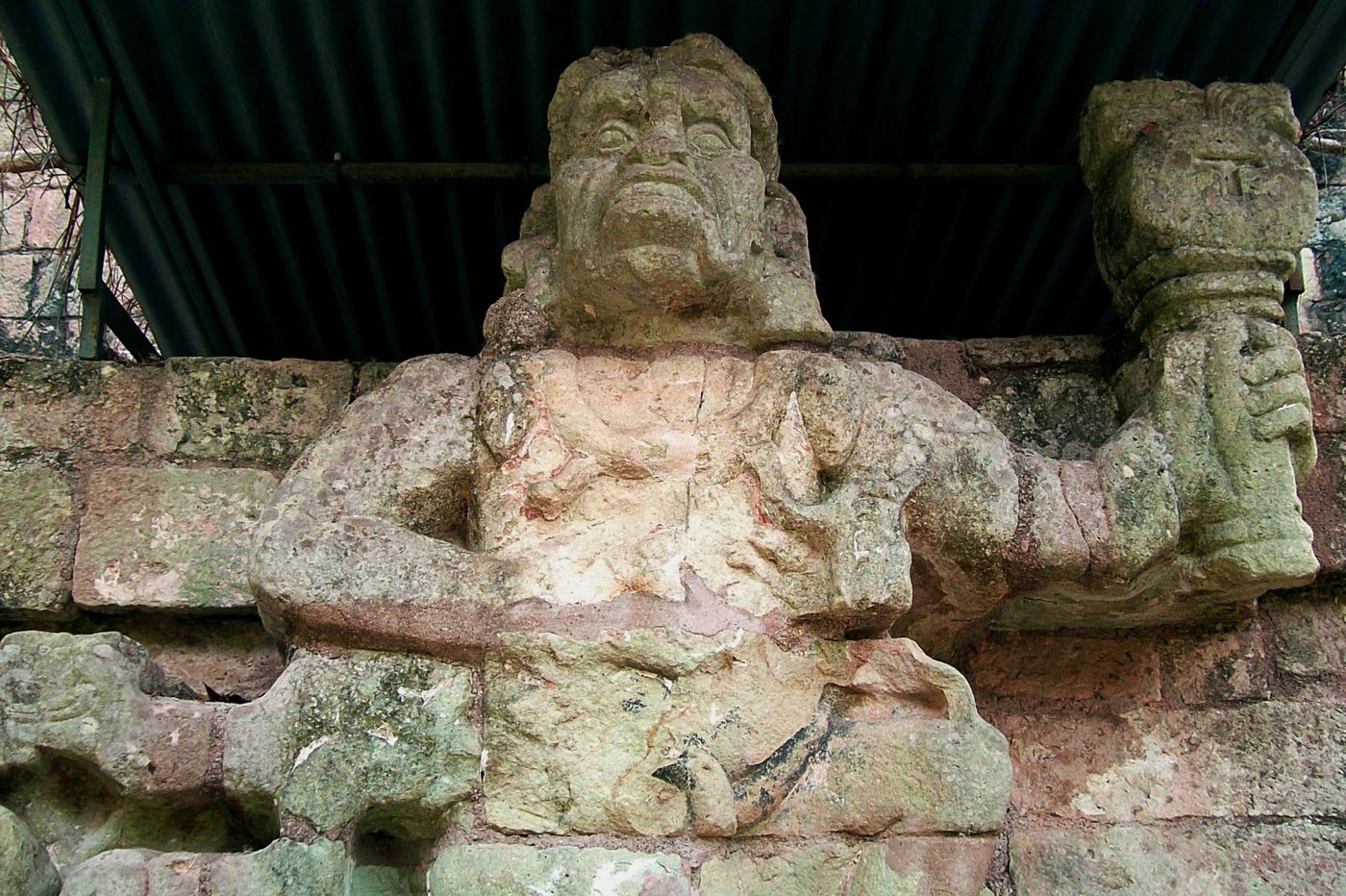
Vai al contenuto
Atlas Anatolia
NotizieIce Age teeth in Sulawesi push betel-nut use back as far as 25,000 yearsRoman mosaic and Eros head uncovered in the basilica at Pompeiopolis, Kastamonu
Copán — Honduras

Wikimedia Commons (CC BY-SA)

Record continentale

Southernmost Known Site in North America

CittàUNESCOIn evidenza

Copán

Seyfi Cem Baskin

426 d.C. – 822 d.C.

Copán, a major Classic Maya city (426–822 CE) in western Honduras, is renowned for its sculptured stelae, hieroglyphic stairway, and sophisticated art.

322
Interesse 66

Posizione

Copán Department · Western Honduras · Honduras

14.84°N · 89.14°W · America del Nord

Built

c. 426–822 CE

Civilization

Maya (Classic Period)

Ancient Name

Oxwitik

Discovered

Documented by Europeans in 1570; systematic exploration began in 1839

Status

UNESCO World Heritage Site (inscribed 1980)

Notable Ruler

Kʼinich Yax Kʼukʼ Moʼ (founder, 426–c. 437 CE)

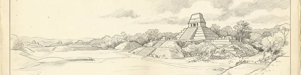
Graphite pencil sketch banner of Copán

Copán preserves one of the most complete historical records of a Classic Maya dynasty, connecting monument datings to detailed political narratives.”

Posizione

Panoramica

Discovery and Early Accounts

Copán was first documented by Europeans in 1570 when Spanish explorer Diego García de Palacio described the ruins to King Philip II. However, the site remained largely unknown to the outside world until the 1839 expedition of John Lloyd Stephens and Frederick Catherwood, whose vivid illustrations and accounts in Incidents of Travel in Central America, Chiapas, and Yucatán sparked widespread interest. Subsequent visits by Alfred Maudslay in the 1880s produced the first detailed photographs and plaster casts, laying the groundwork for scientific archaeology.

Political History and Dynasty

Copán was the capital of a Classic Maya kingdom that rose to prominence under Kʼinich Yax Kʼukʼ Moʼ, a founder who arrived in 426 CE and established a dynastic lineage that endured for over 400 years. The dynasty reached its apogee during the reign of Kʼakʼ Joplaj Chan Kʼawiil (738–749 CE), who commissioned the famous Hieroglyphic Stairway. The last known ruler, Yax Pasaj Chan Yopaat (763–810 CE), struggled with political fragmentation, and the dynasty collapsed around 822 CE. Altar Q, erected by Yax Pasaj, depicts all 16 kings of the Copán dynasty, serving as a key historical document.
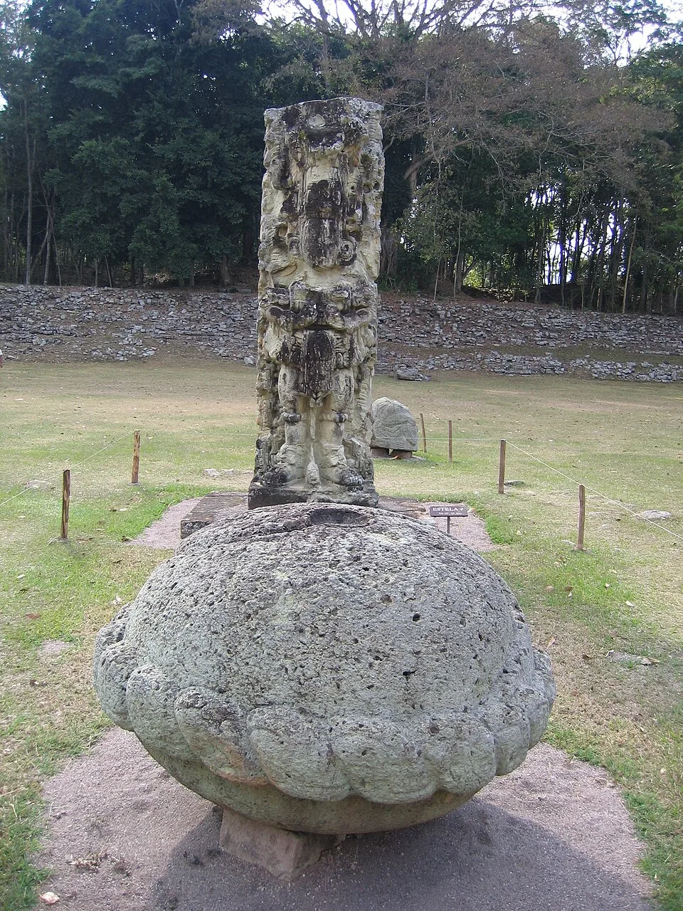
Copán Maya stelae
Copán Maya stelae | Peter Andersen (CC BY 2.5)
"In the days of the great-great-grandfathers of our great-great-grandfathers, the lord K'inich Yax K'uk' Mo' came down from the lands of the west and seated himself upon the mat of Copán. From him sprang the dynasty of sixteen kings."
— Altar Q inscription, Copán, commissioned by King Yax Pasaj Chan Yopaat in 776 CE

Architecture and Monuments

The site’s monumental core includes the Acropolis, a massive complex of superimposed courts and temples built over centuries, and the Great Plaza, which hosts many of Copán’s iconic stelae. The Hieroglyphic Stairway, constructed under Kʼakʼ Joplaj Chan Kʼawiil, comprises 63 steps inscribed with over 2,000 glyphs—the longest Maya text known—chronicling the dynasty’s history. The Ball Court, the second largest in Mesoamerica, is lined with parrot-shaped markers and reflects the ritual and political significance of the ballgame.
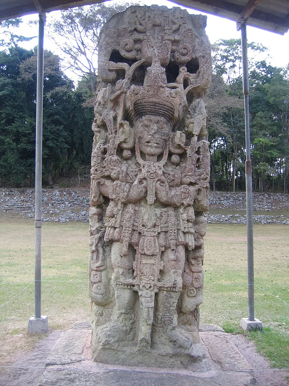
Copán Maya stelae 2
Copán Maya stelae 2 | Peter Andersen (CC BY 2.5)

Art and Inscriptions

Copán’s sculptural tradition is exceptional for its intricate, high-relief carvings and narrative detail. Stelae, such as Stela A and Stela B, depict rulers in elaborate regalia, accompanied by calendrical and historical texts. The inscriptions provide a wealth of information on dynastic succession, warfare, and ritual practices. While much is understood of the site’s political history, the symbolic meaning of certain iconographic motifs remains a subject of interpretation, with scholars debating the extent of Teotihuacan influence on early Copán art.

Decline and Abandonment

Archaeological evidence points to a gradual decline in the Late Classic, marked by environmental stress, deforestation, and soil erosion, as indicated by pollen cores and erosion deposits. The cessation of dated monuments after 822 CE suggests a collapse of centralized authority, though some occupation continued in the valley. The exact interplay of factors—whether primarily ecological, political, or a combination—remains debated. Skeletal studies from elite and commoner burials reveal evidence of malnutrition and disease in the terminal phase, supporting a scenario of systemic crisis.
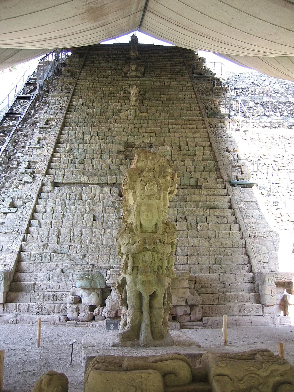
Stela M and the Hieroglyphic Stairway on the archeological site of Copán, a mayan city
Stela M and the Hieroglyphic Stairway on the archeological site of Copán, a mayan city | Peter Andersen (talk) (CC BY 2.5)

Research and Significance

Modern archaeological work at Copán began with the Carnegie Institution of Washington’s excavations in the 1930s, which restored many structures. More recently, tunnel excavations inside the Acropolis have revealed earlier construction phases, yielding rich tombs and offerings that illuminate the dynasty’s origins. As a UNESCO World Heritage Site since 1980, Copán is a cornerstone of Maya studies, offering an unparalleled record of Classic Maya kingship, urbanism, and artistic expression.
Perché è importante

Copán preserves one of the most complete historical records of a Classic Maya dynasty, connecting monument datings to detailed political narratives. Its richly carved stelae and the longest known hieroglyphic inscription in the Maya world offer an exceptional window into ancient statecraft and cosmology. The site’s detailed archaeological context has made it a model for understanding Maya urban decline and resilience.

Evidenze e interpretazione

Distinguere ciò che è ben consolidato da ciò che rimane dibattuto.

Fatti ben consolidati

3
  • The Hieroglyphic Stairway contains the longest known Maya inscription, with over 2,000 glyphs.
  • Altar Q depicts all 16 rulers of the Copán dynasty in sequential order.
  • The founder Kʼinich Yax Kʼukʼ Moʼ arrived in 426 CE, as indicated by iconographic and epigraphic evidence.

Deduzioni accademiche

2
  • The dynasty traced its authority to a foreign origin, likely from the central Maya lowlands, to legitimize rule.
  • Environmental degradation, including deforestation and soil erosion, contributed significantly to Copán’s decline.

Interpretazioni dibattute

2
  • The degree of Teotihuacan influence on Copán’s early art and political structure remains disputed, with some scholars proposing a direct ‘stranger king’ connection.
  • The primary cause of Copán’s collapse—whether political mismanagement, ecological crisis, or a combination—is still contested.

Scoperta e scavo

1839–1841

Stephens and Catherwood Expedition

Diretto da John Lloyd Stephens and Frederick Catherwood

Documented the ruins with detailed drawings and descriptions, introducing Copán to an international audience.

1881–1894

Maudslay’s Surveys

Diretto da Alfred P. Maudslay

Alfred Maudslay produced the first comprehensive photographic and plaster cast record of the site for the British Museum.

1935–1946

Carnegie Institution Excavations

Diretto da Carnegie Institution of Washington

Large-scale excavation and restoration of the Acropolis, Hieroglyphic Stairway, and Ball Court, directed by Gustav Strömsvik and including epigraphic work by Tatiana Proskouriakoff.

1977–1996

Copán Acropolis Archaeological Project

Diretto da Harvard University and the Honduran Institute of Anthropology

Multi-phase project involving tunnel excavations within the Acropolis to reconstruct architectural sequences and recover royal tombs, co-directed by William Fash.

2000

Ongoing Conservation and Digital Documentation

Diretto da Instituto Hondureño de Antropología e Historia (IHAH)

Continuous conservation and site management by IHAH, including 3D laser scanning and digital recording of monuments.

Foto della comunità

Condividi la tua esperienza

Hai visitato questo sito? Carica le tue foto per aiutare gli altri a scoprirlo.

Storie correlate

Come citare questa pagina

Atlas Anatolia. (426). Copán. Atlas Anatolia. https://atlasanatolia.com/it/site/copan

Contenuto con licenza CC BY-SA 4.0 — è richiesta l'attribuzione in caso di riutilizzo.

Grafico

Collegamenti a siti e storie correlati.

Fonti

  • Fash, William L. (2011), Scribes, Warriors and Kings: The City of Copán and the Ancient MayaWilliam L. Fash (2011)
  • Andrews, E. Wyllys and Fash, Barbara W. (2005), ‘Issues in Copán Archaeology’ in Copán: The History of an Ancient Maya KingdomE. Wyllys Andrews and Barbara W. Fash (2005)
  • Stuart, David (2004), ‘The Beginnings of the Copan Dynasty: A Review of the Hieroglyphic and Historical Evidence’ in Understanding Early Classic CopanDavid Stuart (2004)
  • Martin, Simon and Nikolai Grube (2008), Chronicle of the Maya Kings and QueensSimon Martin and Nikolai Grube (2008)
  • UNESCO World Heritage entry, Maya Site of CopanCollegamento
  • Webster, David (2002), The Fall of the Ancient MayaDavid Webster (2002)

Domande frequenti

Dove si trova Copán?

Copán si trova in Copán Department, Western Honduras, Honduras.

A quando risale Copán?

Copán risale all'incirca al 426 d.C. – 822 d.C..

Quali civiltà sono associate a Copán?

Copán è associato alla civiltà Maya.

Perché Copán è importante?

Copán preserves one of the most complete historical records of a Classic Maya dynasty, connecting monument datings to detailed political narratives.

Copán è un sito Patrimonio Mondiale dell'UNESCO?

Sì — Copán è iscritto nella lista del Patrimonio Mondiale dell'UNESCO.