
Vai al contenuto
Atlas Anatolia
NotizieIce Age teeth in Sulawesi push betel-nut use back as far as 25,000 yearsRoman mosaic and Eros head uncovered in the basilica at Pompeiopolis, Kastamonu
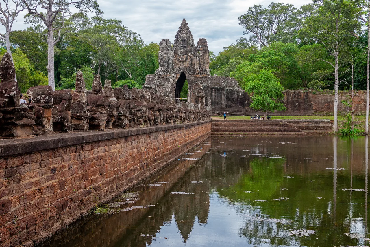
Giant carved stone faces on the towers of the Bayon Temple at the centre of Angkor Thom, Cambodia

Wikimedia Commons

Record nazionale

Longest Continuously Occupied Site in Cambodia

CittàUNESCOIn evidenza

Angkor Thom

Seyfi Cem Baskin

អង្គរធំ1181 d.C. – 1431 d.C.

The last great walled capital of the Khmer Empire, built by King Jayavarman VII at the end of the 12th century CE as the centrepiece of a massive Buddhist building programme following decades of warfare. At its heart stands the Bayon Temple, its 54 towers carved with 216 enormous, serenely smiling stone faces — among the most instantly recognisable images in world archaeology — surrounded by the Terrace of the Elephants, the Terrace of the Leper King, and the royal palace precinct of Phimeanakas.

32
Interesse 66

Posizione

Siem Reap · Angkor · Cambogia

13.44°N · 103.86°E · Asia

Founded

c. 1181 CE by King Jayavarman VII, following the 1177 Cham sack of Angkor

Walls

Nearly perfect 3 km square, laterite walls up to 8 m high plus moat

Bayon Temple

54 towers, 216 carved stone faces widely identified with Avalokiteshvara / Jayavarman VII

Reliefs

Extensive carvings of everyday Khmer life and naval battles against the Cham

Decline

Major sack by Ayutthaya Kingdom in 1431 marks the end of Angkor as Khmer capital

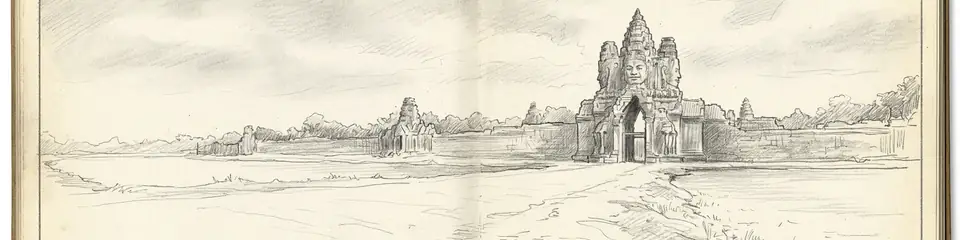
Graphite pencil sketch banner of Angkor Thom

Angkor Thom represents one of history's most dramatic examples of an entire royal capital being rebuilt from the ground up as a coherent expression of a single ruler's religious and political vision.”

Posizione

Panoramica

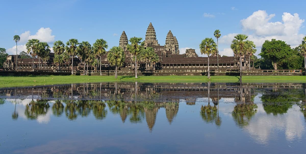
Angkor Thom ("Great City") lies immediately north of the earlier and more famous Angkor Wat within Cambodia's vast Angkor Archaeological Park, but the two monuments are architecturally, religiously, and chronologically distinct. Angkor Wat, built roughly fifty years earlier under King Suryavarman II, was conceived as a Hindu temple dedicated to Vishnu (later adapted to Buddhist use). Angkor Thom, by contrast, was built as a fortified royal capital city — the last and largest of several successive Khmer capitals at Angkor — explicitly as an expression of King Jayavarman VII's Mahayana Buddhist devotion following a turbulent period in which the Khmer capital had been sacked by the rival Cham kingdom in 1177.

Jayavarman VII, who seized the throne around 1181 after driving out the Cham occupiers, responded with an extraordinary programme of monumental construction. Angkor Thom was laid out as a nearly perfect three-kilometre square, enclosed by laterite walls up to eight metres high and a wide moat, with five monumental gates — one for each cardinal direction plus an additional Victory Gate — each surmounted by four giant stone faces facing the cardinal points, echoing the design of the city's central temple.

That central temple, the Bayon, is Angkor Thom's defining monument. Fifty-four towers, arranged across the temple's upper terraces, are each carved with four enormous serene faces — 216 in total — widely interpreted by scholars as representing the bodhisattva of compassion, Avalokiteshvara, though many also see in their features an idealised portrait of Jayavarman VII himself, blending royal and divine identity in a manner consistent with Khmer god-king (devaraja) tradition. The temple's outer galleries are covered with extensive relief carvings depicting not only mythological and religious scenes but unusually detailed images of everyday Khmer life and historical military campaigns, including vivid depictions of naval battles against the Cham fleet — a rare and valuable visual record of 12th-century Southeast Asian daily life rather than purely religious iconography.

Surrounding the Bayon, Angkor Thom preserves an extensive royal and ceremonial precinct. The Terrace of the Elephants, a 300-metre reviewing platform decorated with carved elephant reliefs, served as a base for royal audiences and public ceremonies. The adjacent Terrace of the Leper King takes its name from a moss-covered statue once thought to depict a king afflicted with leprosy, though it more likely represents Yama, the Hindu-Buddhist god of death and judgment. Phimeanakas, an earlier 10th-century step-pyramid temple predating Jayavarman VII's reign, sits within the former royal palace compound, incorporated into the later city.

Angkor Thom remained the functioning capital of the Khmer Empire for roughly two and a half centuries after its construction, through periods of continued prosperity and gradual decline, until the broader Angkor region was largely abandoned as a political capital following repeated conflict with the Ayutthaya Kingdom, most significantly a major sacking in 1431 that is conventionally, if not entirely precisely, treated as marking the end of Angkor's role as the Khmer imperial centre. Angkor Thom is included within the Angkor Archaeological Park, inscribed as a UNESCO World Heritage Site in 1992.
Perché è importante

Angkor Thom represents one of history's most dramatic examples of an entire royal capital being rebuilt from the ground up as a coherent expression of a single ruler's religious and political vision. Jayavarman VII's decision to reconstruct the Khmer capital as an explicitly Buddhist city, complete with a temple whose towers merge his own likeness with that of a bodhisattva, is a striking case study in how monumental architecture can be deployed to fuse religious devotion with the legitimisation of royal authority. The Bayon's relief carvings of ordinary daily life — markets, cockfights, childbirth, food preparation — alongside its famous naval battle scenes, make it one of the richest surviving visual sources for everyday social history anywhere in the pre-modern world, offering historians a level of detail about non-elite Khmer life that religious or royal inscriptions alone could never provide. As the last great capital of the Khmer Empire before Angkor's political eclipse, Angkor Thom also marks a hinge point in mainland Southeast Asian history — its eventual abandonment as a political centre, following pressure from the rising Ayutthaya Kingdom, closes the chapter of Angkor-centred Khmer imperial power even as the wider Angkor region continued to hold deep religious significance for the Khmer people into the present day.

Evidenze e interpretazione

Distinguere ciò che è ben consolidato da ciò che rimane dibattuto.

Fatti ben consolidati

3
  • Inscriptions and architectural style securely date Angkor Thom's construction to the reign of Jayavarman VII, beginning around 1181 CE following his defeat of the occupying Cham forces recorded in contemporary Khmer inscriptions.
  • Bas-relief carvings on the Bayon's outer gallery depict a documented naval battle between Khmer and Cham forces, corroborated by the broader historical record of Cham-Khmer conflict in this period.
  • Historical records, including the account of Chinese diplomatic envoy Zhou Daguan who resided in Angkor Thom around 1296–1297 CE, provide a detailed contemporary eyewitness description of the functioning city, its population, and court life.

Interpretazioni dibattute

2
  • Whether the 216 faces on the Bayon's towers represent the bodhisattva Avalokiteshvara, King Jayavarman VII himself, or a deliberate fusion of both identities remains a matter of art-historical interpretation rather than settled fact.
  • The statue on the Terrace of the Leper King was long popularly identified as a diseased Khmer king, but is now more widely, though not universally, interpreted by scholars as a depiction of Yama, the god of death and judgment.

Scoperta e scavo

1907

École française d'Extrême-Orient conservation programme

Beginning of sustained French-led documentation, conservation, and restoration work across the Angkor Thom complex, continuing in various forms to the present.

1993

Post-war international restoration

Renewed and expanded international conservation effort under UNESCO coordination following Cambodia's civil conflict, involving teams from multiple countries.

Foto della comunità

Condividi la tua esperienza

Hai visitato questo sito? Carica le tue foto per aiutare gli altri a scoprirlo.

Storie correlate

Come citare questa pagina

Atlas Anatolia. (1181). Angkor Thom. Atlas Anatolia. https://atlasanatolia.com/it/site/angkor-thom

Contenuto con licenza CC BY-SA 4.0 — è richiesta l'attribuzione in caso di riutilizzo.

Grafico

Collegamenti a siti e storie correlati.

Fonti

  • A Record of Cambodia: The Land and Its PeopleZhou Daguan (trans. Peter Harris) (2007)
  • The Khmer Empire: Cities and Sanctuaries, Fifth to Thirteenth CenturiesJacques, Claude and Lafond, Philippe (2007)
  • UNESCO — AngkorCollegamento

Domande frequenti

Dove si trova Angkor Thom?

Angkor Thom si trova in Siem Reap, Angkor, Cambodia.

A quando risale Angkor Thom?

Angkor Thom risale all'incirca al 1181 d.C. – 1431 d.C..

Quali civiltà sono associate a Angkor Thom?

Angkor Thom è associato alla civiltà Khmer.

Perché Angkor Thom è importante?

Angkor Thom represents one of history's most dramatic examples of an entire royal capital being rebuilt from the ground up as a coherent expression of a single ruler's religious and political vision.

Angkor Thom è un sito Patrimonio Mondiale dell'UNESCO?

Sì — Angkor Thom è iscritto nella lista del Patrimonio Mondiale dell'UNESCO.