
Aller au contenu
Atlas Anatolia
ActualitésIce Age teeth in Sulawesi push betel-nut use back as far as 25,000 yearsRoman mosaic and Eros head uncovered in the basilica at Pompeiopolis, Kastamonu
Hegra — Saudi Arabia

Wikimedia Commons (CC BY-SA)

Country Record

Known by the Most Names in Saudi Arabia

NécropoleUNESCOEn vedette

Hegra

Seyfi Cem Baskin

الحجر100 av. J.-C. – 106 apr. J.-C.

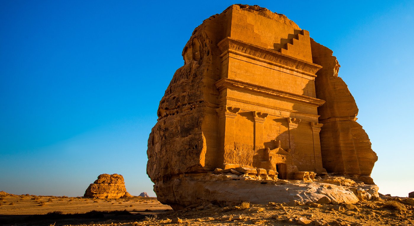
Ancient Nabatean city of Hegra, with 111 monumental tomb facades carved into sandstone outcrops, flourished as a trade hub from the 1st century BCE until Roman annexation in 106 CE.

322
Intérêt 62

Localisation

Medina Region · Hejaz · Arabie saoudite

26.79°N · 37.95°E · Asie

Built

1st century BCE to 1st century CE (main construction phase)

Civilization

Nabatean

Discovered

Known to locals; first documented by Charles Doughty in 1876

Status

UNESCO World Heritage Site (inscribed 2008)

Also known as

Mada'in Salih, Al-Hijr

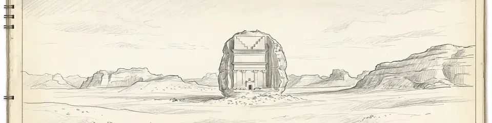
Graphite pencil sketch banner of Hegra

“Hegra is the best-preserved Nabatean site south of Petra, offering an unparalleled window into the kingdom’s southern frontier.”

Localisation

Aperçu

Discovery

Hegra, also known as Mada’in Salih or al-Hijr, was known to local Bedouin for centuries but entered Western scholarship through the explorations of Charles Doughty in 1876. Doughty’s detailed notes and sketches of the rock-cut tombs and inscriptions provided the first systematic European record. His work was followed by the pioneering archaeological mission of Fathers Antonin Jaussen and Raphael Savignac between 1907 and 1910, who documented over a hundred tomb facades, Nabatean inscriptions, and the sophisticated water management systems. Their corpus, published in multiple volumes, remains a foundational reference for Nabatean epigraphy and architecture.

Significance

As the southernmost major settlement of the Nabatean kingdom, Hegra served as a critical nexus in the incense trade, linking South Arabia with the Mediterranean. Its monumental tombs, carved into the rose-colored sandstone cliffs, are second in scale and elaboration only to Petra. The site attests to the wealth and cosmopolitan character of the Nabateans, who controlled the caravan routes for frankincense and myrrh. Inscribed funerary texts in Nabatean Aramaic give insights into social structure, property rights, and religious beliefs, including references to individuals and deities otherwise unknown from Petra.
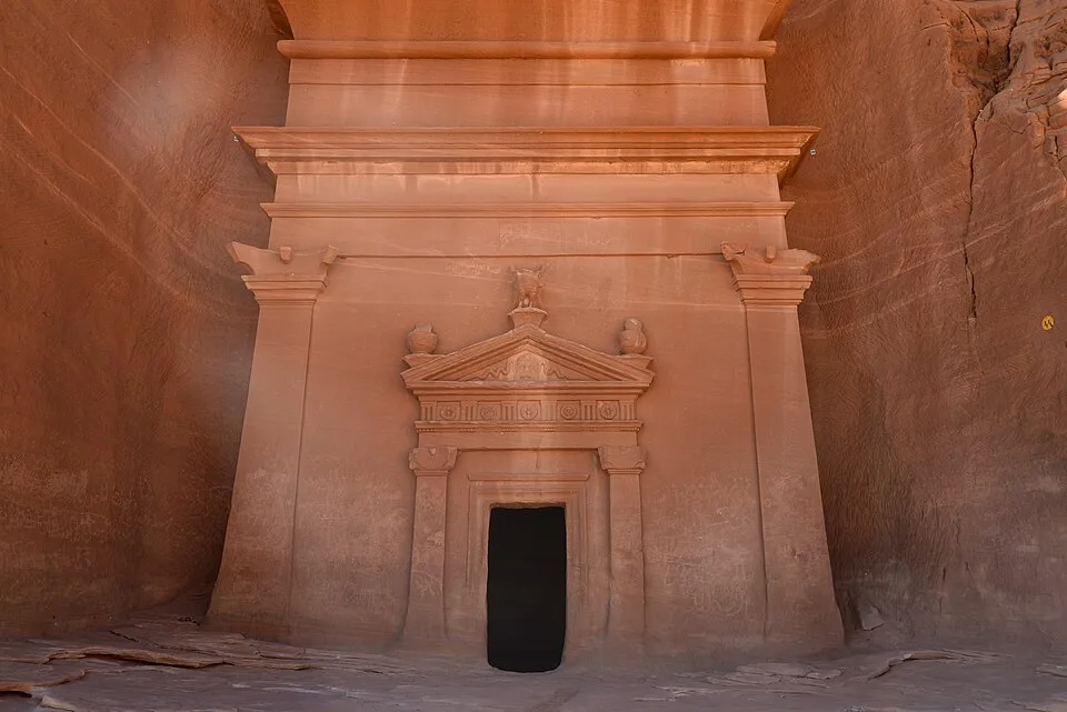
27, Hegra (Mada'in Salih), Saudi Arabia
27, Hegra (Mada'in Salih), Saudi Arabia | Following Hadrian (CC BY-SA 2.0)
"There is a country called Hegra in the land of the Nabataeans, where the rocks are carved into tombs and houses, with façades cut from the cliffs as if the mountains themselves were quarried into palaces."
— Strabo, Geography XVI.4.24, on the Nabataean settlements south of Petra (c. 7 BCE)

Architecture and Urbanism

The tomb facades at Hegra display a fusion of architectural traditions: Assyrian crowsteps, Egyptian cornices, Hellenistic pilasters, and local Nabatean innovations. Based on epigraphic evidence, scholars infer that the tombs were commissioned by wealthy families, often for multiple generations, and that ritual banqueting may have occurred in the adjacent triclinia. The city’s core included a residential area, possible markets, and religious precincts, but much of the urban fabric remains unexcavated. The extensive system of channels, cisterns, and wells demonstrates advanced hydraulic engineering adapted to the hyper-arid environment—an inference supported by the sheer number of water installations but not yet fully understood in terms of daily management.
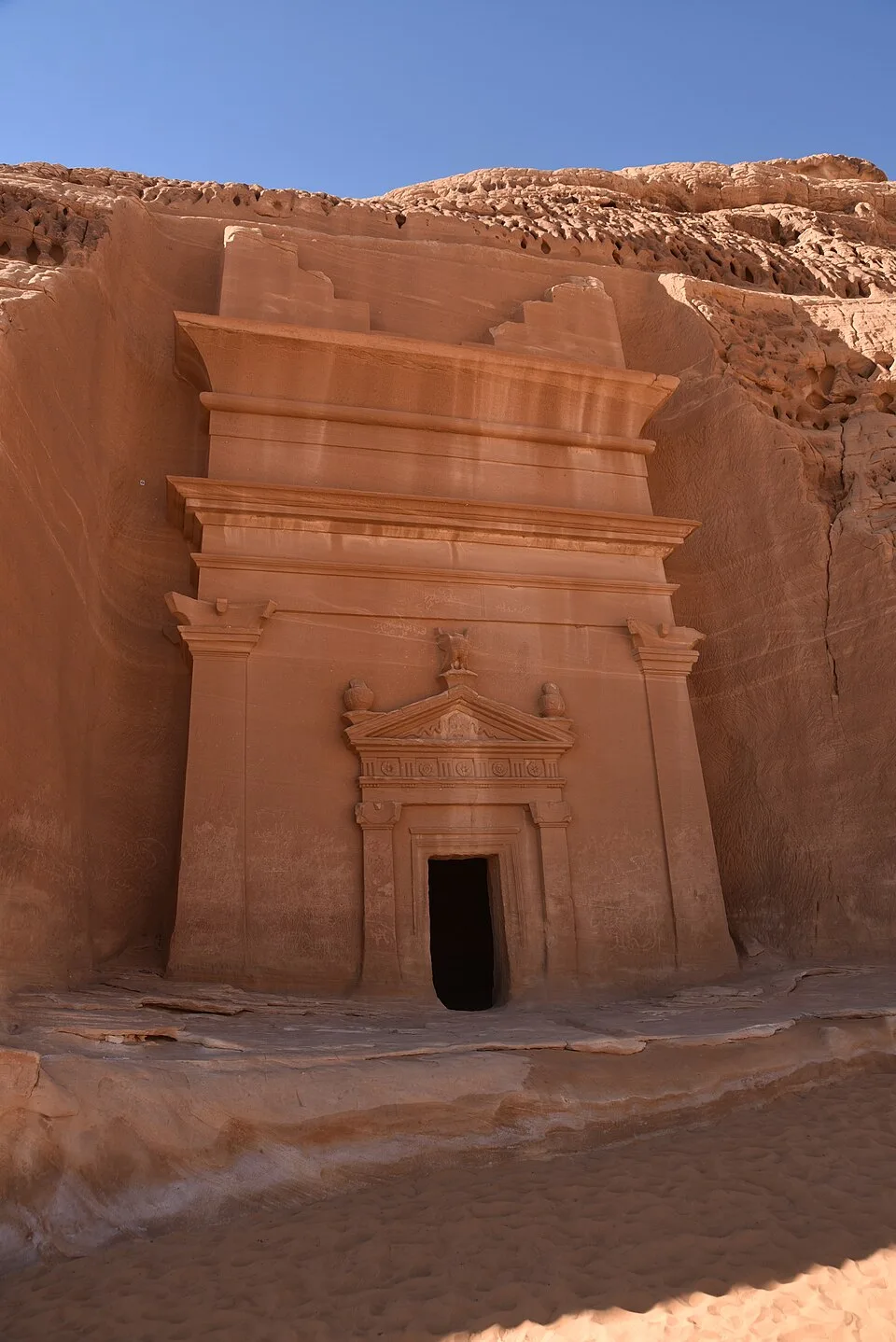
27, Hegra (Mada'in Salih), Saudi Arabia - 53534960013
27, Hegra (Mada'in Salih), Saudi Arabia - 53534960013 | Following Hadrian (CC BY-SA 2.0)

Roman Annexation and Aftermath

In 106 CE, Emperor Trajan annexed the Nabatean kingdom, creating the province of Arabia Petraea. Hegra’s role as a caravan city diminished as trade routes shifted, though debate persists over the speed and completeness of this decline. Some archaeologists infer a period of Roman military presence based on the discovery of Latin inscriptions and the layout of certain structures, but clear evidence of a garrison is lacking. What is certain is that the site continued to be occupied into the Byzantine period, as indicated by later Nabatean and Greek inscriptions and by the reuse of some tombs as dwellings or churches.

Current Research and Conservation

Since 2001, a Saudi-French multidisciplinary project led by Laïla Nehmé and François Villeneuve has applied modern archaeological methods, including ground-penetrating radar, 3D scanning, and meticulous excavation of domestic quarters. This work has confirmed earlier hypotheses about the city’s extent and complexity while revealing previously unknown features such as artisans’ quarters. The 2008 UNESCO World Heritage inscription, as the first site in Saudi Arabia to be listed, has spurred comprehensive site management and conservation plans, balancing tourism development with the fragile sandstone environment.
Pourquoi c'est important

Hegra is the best-preserved Nabatean site south of Petra, offering an unparalleled window into the kingdom’s southern frontier. Its unique fusion of architectural styles and rich epigraphic record illuminate the cultural and economic networks that connected the ancient Near East, and its desert setting underscores the ingenuity of Nabatean hydraulic engineering.

Preuves et interprétation

Distinguer ce qui est bien établi de ce qui reste débattu.

Faits bien établis

3
  • Hegra contains 111 rock-cut monumental tombs with elaborately decorated facades.
  • The site has over 50 surviving Nabatean Aramaic funerary inscriptions, providing genealogical and legal details.
  • The city was annexed by the Roman Empire in 106 CE under Trajan.

Inférences savantes

2
  • The presence of multiple wells, channels, and cisterns indicates advanced water management for a large population.
  • Rock-cut triclinia adjacent to tombs were likely used for ritual banqueting associated with the cult of the dead.

Interprétations débattues

2
  • The nature and extent of Roman military presence after annexation remain unclear; some scholars argue for a garrison, others see only administrative integration.
  • The reasons for the apparent decline of the site after the 2nd century CE are disputed: trade route shifts, earthquake damage, or gradual economic marginalization.

Découverte et fouilles

1876

First European documentation

Dirigé par Charles Doughty

Charles Doughty recorded the site’s tombs and inscriptions, bringing Hegra to scholarly attention despite not conducting formal excavations.

1907–1910

First systematic survey

Dirigé par Jaussen and Savignac

Fathers Antonin Jaussen and Raphael Savignac documented all visible tombs, inscriptions, and water systems, producing a comprehensive epigraphic and architectural corpus.

1986–1990

Saudi Antiquities clearance

Dirigé par Saudi Department of Antiquities

Saudi Department of Antiquities conducted clearing, restoration of select tomb facades, and initial site documentation.

2001

Saudi-French Archaeological Project

Dirigé par Saudi-French mission (Nehmé, Villeneuve, et al.)

Ongoing interdisciplinary excavations, surveys, and conservation, leading to the discovery of residential quarters and hydraulic features, led by Laïla Nehmé and François Villeneuve.

2008

UNESCO World Heritage conservation

Dirigé par Saudi Commission for Tourism and Antiquities

Post-inscription, comprehensive site management, 3D documentation, and visitor infrastructure developed by the Saudi Commission for Tourism and Antiquities.

Photos de la communauté

Partagez votre expérience

Avez-vous visité ce site ? Téléchargez vos photos pour aider les autres à le découvrir.

Récits liés

Comment citer cette page

Atlas Anatolia. (100). Hegra. Atlas Anatolia. https://atlasanatolia.com/fr/site/hegra

Contenu sous licence CC BY-SA 4.0 — attribution requise en cas de réutilisation.

Graphique

Connexions avec des sites et récits associés.

Sources

  • UNESCO World Heritage Centre - Hegra Archaeological Site (al-Hijr / Madā ͐ in Ṣāliḥ)Lien
  • Healey, John F. (2001), The Religion of the Nabataeans: A Conspectus. — Healey, John F. (2001)
  • Nehmé, L., Villeneuve, F., & al-Saeed, A. (2006). The Nabataean tomb inscriptions of Hegra (Mada'in Salih). — Nehmé, L. et al. (2006)
  • Schmid, S.G. (2000). The 'Hegra' type: a re-evaluation of Nabataean tomb decoration. — Schmid, S.G. (2000)
  • Bowersock, Glen W. (1983). Roman Arabia. — Bowersock, Glen W. (1983)

Questions fréquentes

Où se trouve Hegra ?

Hegra est situé à/en Medina Region, Hejaz, Saudi Arabia.

De quand date Hegra ?

Hegra remonte approximativement à 100 av. J.-C. – 106 apr. J.-C..

Quelles civilisations sont associées à Hegra ?

Hegra est associé à la civilisation Nabataean.

Pourquoi Hegra est-il important ?

Hegra is the best-preserved Nabatean site south of Petra, offering an unparalleled window into the kingdom’s southern frontier.

Hegra est-il inscrit au patrimoine mondial de l'UNESCO ?

Oui — Hegra est inscrit sur la liste du patrimoine mondial de l'UNESCO.