
Saltar al contenido
Atlas Anatolia
NoticiasIce Age teeth in Sulawesi push betel-nut use back as far as 25,000 yearsRoman mosaic and Eros head uncovered in the basilica at Pompeiopolis, Kastamonu
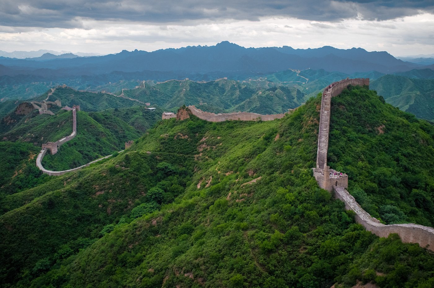
Great Wall of China — China

Wikimedia Commons (CC BY-SA)

Récord nacional

Longest Recorded History in China

FortalezaUNESCODestacado

Great Wall of China

Seyfi Cem Baskin

長城700 a. C. – 1644 d. C.

The vast frontier fortification system of northern China — rammed-earth Qin walls and the iconic stone Ming battlements — remains the single most conspicuous monumental gap left in a global archaeological atlas.

933
Interés 94

Ubicación

Multiple provinces · Northern China · China

40.43°N · 116.57°E · Asia

Built

7th century BCE to 1644 CE, with major phases in Qin, Han, and Ming dynasties

Civilization

Various Chinese dynasties (especially Qin, Han, Ming)

Total Length

21,196 km (all walls combined); Ming wall approx. 8,850 km

Systematic Surveys

Began in early 20th century; major national surveys in 1980s and 2000s

Status

UNESCO World Heritage Site (1987)

Unification

221 BCE — Qin Shi Huang links regional walls into one frontier system

Visible sections today

Overwhelmingly Ming dynasty (1368–1644), ~8,850 km of brick and stone

Earliest sections

c. 7th century BCE, built by individual Warring States kingdoms

UNESCO

World Heritage Site 1987

Qin unification walls

From 221 BCE

Surveyed length

c. 8,850 km (wall, trench, barriers; 2009)

Ming masonry peak

14th–17th centuries

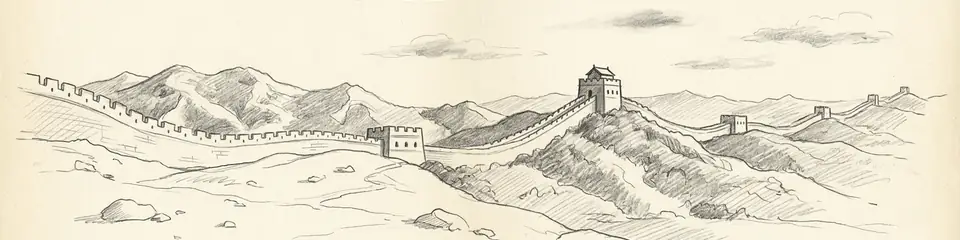
Graphite pencil sketch banner of Great Wall of China

The Wall is the largest surviving military landscape on Earth and a primary document for how Chinese empires managed steppe frontiers, logistics, and political theatre.”

Ubicación

Resumen

The Great Wall of China is not one wall but a network of walls, watchtowers, garrisons, and natural barriers built, rebuilt, and abandoned across more than two millennia. Early states of the Warring States period raised frontier dykes; the Qin dynasty (221–206 BCE) linked and extended northern walls after unification. Han campaigns pushed lines into the Hexi Corridor. The masonry silhouette familiar from tourist photographs is largely Ming (1368–1644): brick and stone curtains, signal towers, and passes such as Shanhaiguan, Jinshanling, Mutianyu, and Badaling defending the approaches to Beijing.

A 2009 Chinese archaeological survey using remote sensing and fieldwork measured roughly 8,850 km of wall, trench, and barrier under the “Great Wall” designation — a figure that includes branches and natural segments, not a single continuous rampart. Sections vary from carefully restored parade walls to eroded rammed-earth ridges. UNESCO inscribed “The Great Wall” in 1987. Pair with Hadrian's Wall and the Terracotta Army for contrasting imperial frontier and funerary projects of ancient Eurasia.
Por qué es importante

The Wall is the largest surviving military landscape on Earth and a primary document for how Chinese empires managed steppe frontiers, logistics, and political theatre. It also shows how modern heritage turns a discontinuous archaeological system into a single national icon — with real consequences for conservation and interpretation.

Evidencia e interpretación

Distinguir lo bien establecido de lo que sigue en debate.

Hechos bien establecidos

9
  • The wall was built in multiple phases starting in the 7th century BCE by independent states; Qin Shi Huang unified portions in the 3rd century BCE.
  • Ming dynasty (1368–1644) constructed the most iconic sections using bricks and stone, with extensive fortifications spanning over 8,850 km.
  • Archaeological remains include beacon towers, garrison ruins, and thousands of military documents written on wooden slips, especially from Han-era frontier stations.
  • Construction materials varied by region: rammed earth in the west, brick and stone in the east, and reed-and-clay in desert zones.
  • Excavated beacon tower sites along the Han-dynasty extension into Gansu have yielded wooden slips (bamboo/wood administrative documents) confirming a functioning signal-relay and garrison logistics system dating to the 2nd–1st century BCE.
  • The 2012 national archaeological and satellite survey by China's State Administration of Cultural Heritage measured the combined length of all wall sections across all dynasties at 21,196.18 km.
  • Ming-dynasty construction records and inscribed stone tablets found along Beijing-area sections document specific construction dates, garrison units, and responsible officials for individual wall segments.
  • Dated inscriptions, kiln stamps, and construction accounts document successive Qin, Han, and Ming building campaigns along mapped frontier corridors.
  • Remote-sensing and field survey (2009 national project) quantified discontinuous wall, trench, and barrier segments rather than a single continuous rampart.

Inferencias académicas

3
  • The wall served not only for defense but also to regulate trade, migration, and taxation along the frontier, acting as a porous border rather than a sealed barrier.
  • Watchtower spacing and signal systems suggest a highly organized military communication network that could relay messages over long distances in hours.
  • The overall effectiveness of the wall as a military barrier is debated among historians; documentary evidence shows it was bypassed or breached on multiple occasions, suggesting its primary value lay in control and signalling functions rather than pure impenetrability.

Interpretaciones debatidas

3
  • The overall strategic effectiveness of the wall is debated; some scholars argue it failed to stop major invasions (e.g., the Manchu in 1644), making it more a symbolic or political construct.
  • Popular claims that the Great Wall is visible from space with the naked eye are not supported by astronaut testimony or photographic evidence and are considered a persistent myth by historians of the site.
  • How far early “walls” functioned as sealed military barriers versus regulated frontier zones with trade gates remains actively discussed.

Descubrimiento y excavación

1907–1930

Early Archaeological Surveys

Dirigido por Aurel Stein / Sven Hedin

Aurel Stein and later Sino-Swedish expeditions documented Han-era walls and beacon towers in the Gobi Desert, recovering artifacts and manuscripts that illuminated frontier life.

1952–1959

Post-Revolution Surveys

Dirigido por Xia Nai (team)

Chinese archaeologists led by Xia Nai conducted systematic investigations of Han and Ming remains, focusing on defense systems near Dunhuang and the Hexi Corridor.

1957

Badaling restoration

First large-scale restoration of a wall section for public visitation, establishing Badaling as the primary access point near Beijing.

2006–2012

National Comprehensive Survey

Dirigido por Chinese Academy of Cultural Heritage

A state-sponsored project using GPS, satellite imagery, and ground verification mapped the full extent of the Ming wall and identified thousands of previously unrecorded structures.

2007–2012

National Cultural Heritage Survey

Comprehensive field survey and satellite mapping by the State Administration of Cultural Heritage established the definitive length and extent of all wall sections across all dynasties.

2018

Modern Conservation Program

Dirigido por Various state agencies and UNESCO

Ongoing efforts by China’s Cultural Heritage Administration to stabilize and restore at-risk sections, employing digital documentation and community-based monitoring.

Fotos de la comunidad

Comparte tu experiencia

¿Has visitado este sitio? Sube tus fotos para ayudar a otros a descubrirlo.

Historias relacionadas

Cómo citar esta página

Atlas Anatolia. (700). Great Wall of China. Atlas Anatolia. https://atlasanatolia.com/es/site/great-wall-china

Contenido bajo licencia CC BY-SA 4.0 — se requiere atribución al reutilizar.

Gráfico

Conexiones con sitios e historias relacionados.

Fuentes

  • Lovell, J. (2006), The Great Wall: China Against the World, 1000 BC–AD 2000Julia Lovell (2006)
  • Waldron, A. (1990), The Great Wall of China: From History to MythArthur Waldron (1990)
  • The Construction and Function of Watchtowers on the Han Great Wall in DunhuangLi Yongning (2014)
  • Mapping the Great Wall of the Ming Dynasty: Challenges and Results from a National SurveyZhang Yuning et al. (2012)
  • UNESCO World Heritage entry – The Great WallEnlace
  • The Great Wall: China Against the World, 1000 BC–AD 2000Lovell, Julia (2006)
  • The Great Wall of China: From History to MythWaldron, Arthur (1990)
  • UNESCO — The Great WallEnlace

Preguntas frecuentes

¿Dónde se encuentra Great Wall of China?

Great Wall of China se encuentra en Multiple provinces, Northern China, China.

¿Qué antigüedad tiene Great Wall of China?

Great Wall of China se fecha aproximadamente en 700 a. C. – 1644 d. C..

¿Qué civilizaciones se relacionan con Great Wall of China?

Great Wall of China se relaciona con Qin, Han, Tang, Ming.

¿Por qué es importante Great Wall of China?

The Wall is the largest surviving military landscape on Earth and a primary document for how Chinese empires managed steppe frontiers, logistics, and political theatre.

¿Great Wall of China es Patrimonio Mundial de la UNESCO?

Sí. Great Wall of China está inscrito en la Lista del Patrimonio Mundial de la UNESCO.