

Skip to content
Atlas AnatoliaAtlas Anatolia
The Shore Temple at Mahabalipuram against the Bay of Bengal

Mahabalipuram

மாமல்லபுரம்600 CE – 800 CE

Dynasty

Pallava kings Mahendravarman I and Narasimhavarman I (7th century CE)

Shore Temple

Structural granite temple facing the sea, c. 8th century CE

Relief

Descent of the Ganges — among the largest open-air rock reliefs

UNESCO

Group of Monuments at Mahabalipuram (1984)

Mahabalipuram documents the birth of monumental Dravidian temple form — from experimental monolithic rathas to the Shore Temple that influenced centuries of South Indian architecture.”

Location

Overview

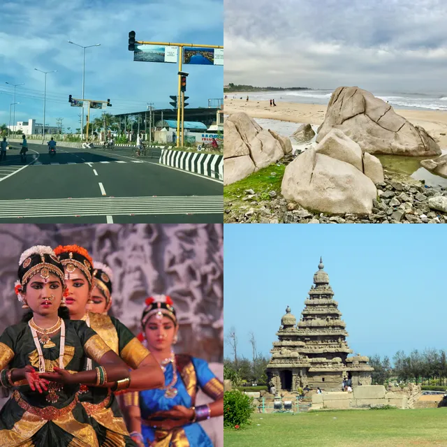
Mahabalipuram (Mamallapuram) lies on the Bay of Bengal coast about 60 kilometres south of Chennai, Tamil Nadu. Under the Pallava kings Mahendravarman I (r. c. 600–630) and Narasimhavarman I (r. c. 630–668) — titled Mamalla ("great wrestler") — the site became a royal centre for rock-cut and structural temple architecture. The monuments are carved from local granite outcrops and include monolithic rathas (chariot-shaped shrines), mandapa cave temples, and the Shore Temple (c. 8th century) facing the sea.

The Descent of the Ganges (Arjuna's Penance) is one of the largest open-air bas-reliefs in the world, depicting Shiva, ascetics, elephants, and nagas on two huge boulders. Excavations after the 2004 tsunami revealed submerged structural remains offshore, suggesting a larger ancient port. The Archaeological Survey of India maintains the site; UNESCO inscribed the Group of Monuments in 1984.

Mahabalipuram remains an active stone-carving village and a mandatory stop on South India heritage circuits alongside Chennai, Kanchipuram, and Pondicherry.

Why It Matters

Mahabalipuram documents the birth of monumental Dravidian temple form — from experimental monolithic rathas to the Shore Temple that influenced centuries of South Indian architecture. Its coastal reliefs and Pallava inscriptions are primary sources for early medieval trade, royal titles, and sculptural workshops in the Tamil country.

Stay curious

New stories and sites, once a month. No spam.

Evidence & Interpretation

Distinguishing what is well-established from what remains debated.

Well-Established Facts

2
  • Pallava inscriptions and stylistic analysis date the rathas, mandapas, and Shore Temple to the 7th–8th centuries CE.
  • Submerged structural discoveries after 2004 confirm an extensive historic port zone beyond the visible shore temples.

Debated Interpretations

1
  • The legend of "Seven Pagodas" swallowed by the sea is partially supported by offshore remains but the original count and destruction mechanism remain uncertain.

More Photos

Museum Artifacts

Community Photos

Share your experience

Have you visited this site? Upload your photos to help others discover it.

How to cite this page

Atlas Anatolia. (600). Mahabalipuram. Atlas Anatolia. https://atlasanatolia.com/site/mahabalipuram

Content licensed CC BY-SA 4.0 — attribution required when reusing.

Sources

  • Indian Temple Architecture: Form and TransformationHardy, Adam (1995)
  • UNESCO — MahabalipuramLink

Research Papers

Frequently Asked Questions

Where is Mahabalipuram located?

Mahabalipuram is located in India.

How old is Mahabalipuram?

Mahabalipuram dates to approximately 600 CE – 800 CE.

Which civilizations are associated with Mahabalipuram?

Mahabalipuram is associated with the Pallava.

Why is Mahabalipuram important?

Mahabalipuram documents the birth of monumental Dravidian temple form — from experimental monolithic rathas to the Shore Temple that influenced centuries of South Indian architecture.

Is Mahabalipuram a UNESCO World Heritage Site?

Yes — Mahabalipuram is inscribed as a UNESCO World Heritage Site.