Pular para o conteúdo
Atlas Anatolia
NotíciasIce Age teeth in Sulawesi push betel-nut use back as far as 25,000 yearsRoman mosaic and Eros head uncovered in the basilica at Pompeiopolis, Kastamonu
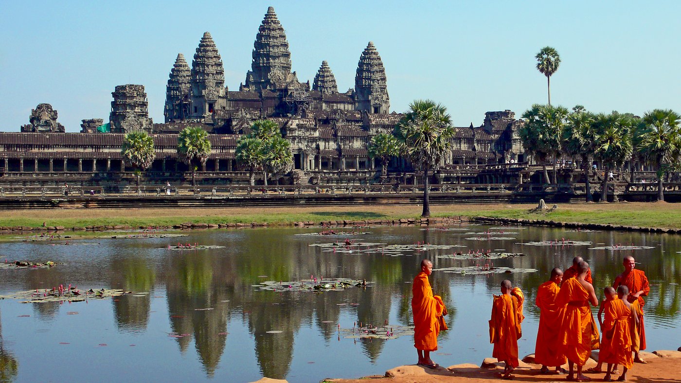
Angkor Wat — Cambodia

Wikimedia Commons (CC BY-SA)

Country Record

Known by the Most Names in Cambodia

TemploUNESCODestaque

Angkor Wat

Seyfi Cem Baskin

អង្គរវត្ត1113 d.C. – 1218 d.C.

Angkor Wat, the world’s largest religious monument, was built as a Hindu temple dedicated to Vishnu by Khmer king Suryavarman II, later evolving into a Buddhist complex.

322
Interesse 89

Localização

Siem Reap · Angkor · Camboja

13.41°N · 103.87°E · Ásia

Built

c. 1113–1150 CE (main phase), with modifications until c. 1218

Civilization

Khmer Empire (Angkorian period)

Discovered

1860 by Henri Mouhot (never lost to local inhabitants)

Status

UNESCO World Heritage Site (1992)

Location

Siem Reap province, Cambodia (13°24′45″N 103°52′0″E)

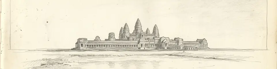
Graphite pencil sketch banner of Angkor Wat

“Angkor Wat stands as the supreme architectural achievement of the Khmer Empire, demonstrating its rulers’ ability to harness vast labor and resources to create a monumental vision of the cosmos.”

Localização

Visão geral

Historical Context

Angkor Wat was constructed in the early 12th century CE, primarily during the reign of Suryavarman II (r. 1113–1150), as the state temple and capital of the Khmer Empire. Dedicated to the Hindu god Vishnu, the temple was a manifestation of the devaraja cult, linking the king’s authority to divine power. Inscriptions and bas-reliefs depict the king as a Vishnu-like protector of dharma, and the temple’s alignment—unique among Angkorian temples as west-facing—may reflect funerary or eschatological functions, though this remains debated.
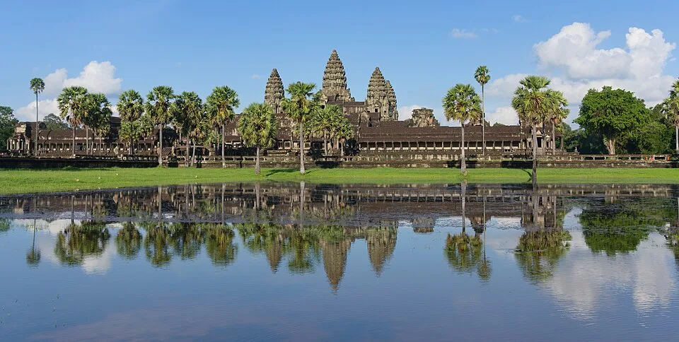
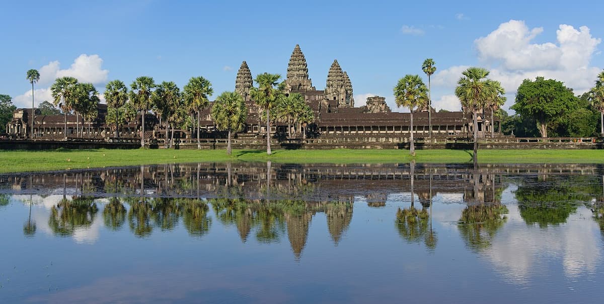
Angkor Wat with its reflection (cropped)
Angkor Wat with its reflection (cropped) | Satdeep Gill (CC BY-SA 4.0)
"There are temples here grander than anything left to us by Greece or Rome, and presenting at the same time a sad contrast to the state of barbarism in which the nation is now plunged."
— Henri Mouhot, Travels in the Central Parts of Indo-China, on Angkor Wat (1860)

Architecture and Iconography

The temple complex covers approximately 162.6 hectares and is designed as a microcosm of the Hindu universe. Its central quincunx of towers represents Mount Meru, the home of the gods, while the surrounding moat and outer wall symbolize the cosmic ocean and mountains. The layout features galleries adorned with over 1,800 celestial nymphs (apsaras) and extensive narrative bas-reliefs, including the famous "Churning of the Sea of Milk" on the eastern gallery. Constructed primarily of sandstone transported from the Kulen Hills, the temple exemplifies Khmer masonry skills, with precision-cut blocks assembled without mortar.

"Wherever one looks one sees towers, and wherever one looks one sees faces — the temple is a mountain of stone made to mirror the Hindu cosmos."
— Paraphrase of Henri Mouhot's nineteenth-century accounts of Angkor
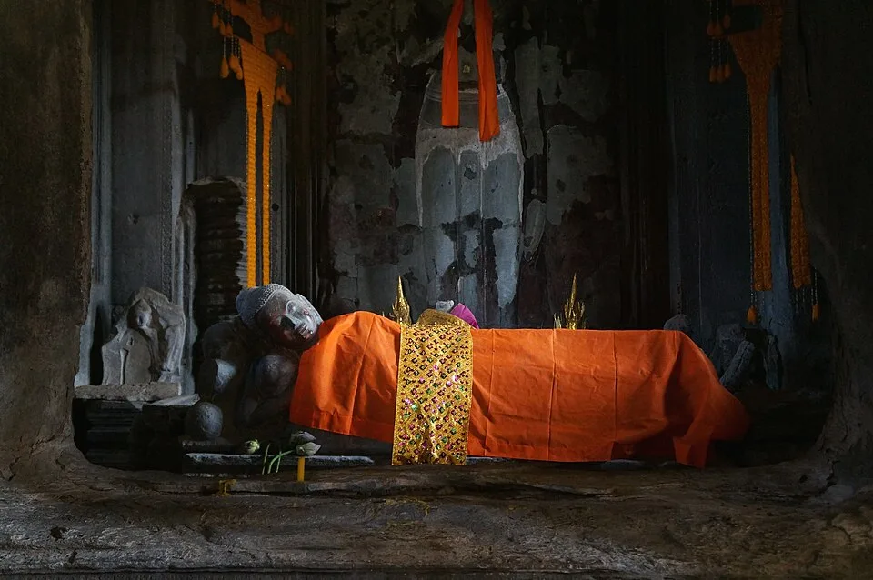
2014-Cambodge Angkor Wat (21)
2014-Cambodge Angkor Wat (21) | Pierre André Leclercq (CC BY-SA 4.0)

Religious Transformation

Following the death of Suryavarman II, construction may have continued under Jayavarman VII (r. 1181–1218), who shifted the empire’s religious orientation to Mahayana Buddhism. By the late 13th century, Angkor Wat transitioned to a Theravada Buddhist site, which it remains today. Buddha statues were added in the central sanctuary, and the temple became a major pilgrimage destination. This syncretic history is evident in the coexistence of Hindu iconography and Buddhist worship, though no large-scale demolition occurred; instead, the temple absorbed new layers of meaning.
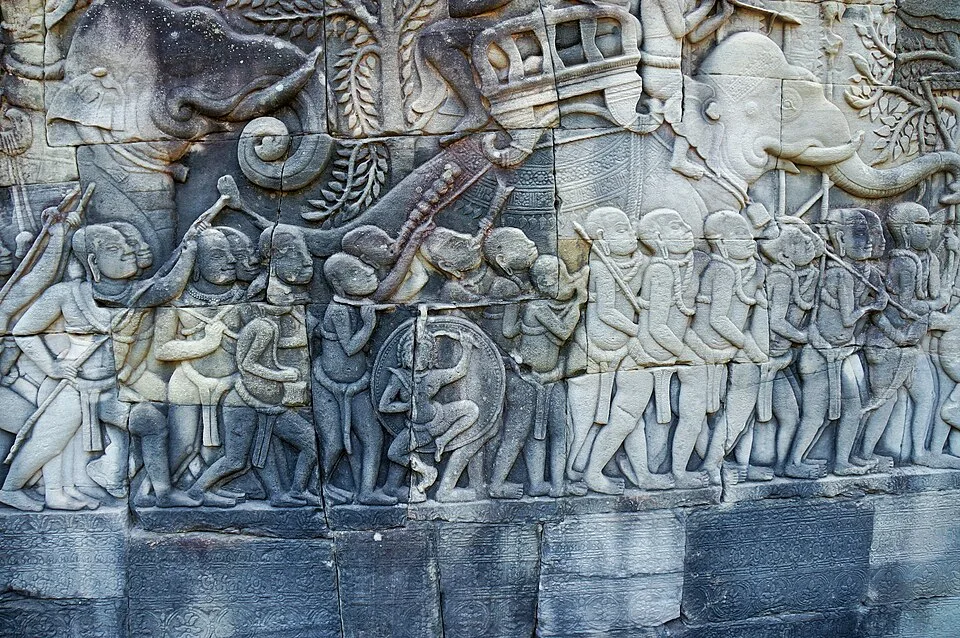
Angkor Thom Bayon relief of the Battle of Tonlé Sap
Angkor Thom Bayon relief of the Battle of Tonlé Sap | Pierre André Leclercq (CC BY-SA 4.0)

Rediscovery and Conservation

Although never truly lost to local Khmer communities, Angkor Wat entered Western awareness through the 1860 account of French naturalist Henri Mouhot, whose travelogs ignited scholarly and popular interest. In the early 20th century, the École française d’Extrême-Orient (EFEO) began systematic clearing, documentation, and restoration under archaeologists like Jean Commaille and Henri Marchal. The latter pioneered anastylosis techniques to rebuild collapsed sections. After decades of political instability, UNESCO launched a global campaign in the 1990s, coordinating international teams to address structural decay, water damage, and looting. Recent lidar surveys have revealed the temple’s integration into a vast urban network, reshaping understanding of Angkorian urbanism.
Por que isso importa

Angkor Wat stands as the supreme architectural achievement of the Khmer Empire, demonstrating its rulers’ ability to harness vast labor and resources to create a monumental vision of the cosmos. Its continuous religious use, from Hinduism to Buddhism, mirrors the evolving spiritual landscape of Southeast Asia. The temple’s sophisticated water management and regional urban plan continue to inform studies of pre-industrial urban resilience.

Evidências e interpretação

Distinguir o que está bem estabelecido do que permanece em debate.

Fatos bem estabelecidos

3
  • Angkor Wat is oriented to the west, atypical for Khmer temples but commonly associated with Vishnu or funerary rites.
  • Bas-reliefs and architectural elements confirm original dedication to Vishnu; a statue of Vishnu was placed in the central sanctuary.
  • Suryavarman II commissioned the temple, as indicated by inscriptions and his depiction as Vishnu on the bas-reliefs.

Inferências acadêmicas

2
  • The temple’s dimensions and concentric galleries reflect a cosmological map, with the central tower symbolizing Mount Meru.
  • Lidar imagery reveals a dense urban grid surrounding the temple, suggesting it was the core of a previously underestimated metropolitan complex.

Interpretações debatidas

2
  • It remains disputed whether the west-facing orientation meant Angkor Wat was originally intended as a mausoleum for Suryavarman II.
  • The extent to which solar and lunar alignments were purposefully integrated into the architecture continues to be discussed among scholars.

Descoberta e escavação

1908–1913

Initial EFEO clearing and stabilization

Dirigido por Jean Commaille (EFEO)

Jean Commaille led early efforts to remove vegetation, document bas-reliefs, and construct drainage systems; he also created the first systematic plan of the temple.

1930–1936

Anastylosis of the central sanctuary

Dirigido por Henri Marchal (EFEO)

Henri Marchal applied the anastylosis method to rebuild the collapsed upper galleries and towers, using original stones where feasible and introducing reinforced concrete internally.

1960–1970

Structural reinforcement and drainage works

Dirigido por Bernard-Philippe Groslier (EFEO)

Under the direction of Bernard-Philippe Groslier, the EFEO focused on reinforcing the foundation and improving water runoff to prevent further subsidence.

1986–1993

UNESCO international safeguarding campaign

Dirigido por Coordinated by UNESCO with multiple international partners

A multinational effort to restore key zones, including the southern library and the moat, with teams from India, Japan, and the World Monuments Fund; research included detailed archaeological photography and chemical analyses of stone deterioration.

2012

Lidar remote sensing surveys

Dirigido por Damian Evans, Roland Fletcher, et al. (University of Sydney/EFEO)

Airborne laser scanning by Damian Evans and Roland Fletcher revealed the full extent of Angkor Wat's urban grid, including roads, canals, and occupation mounds, fundamentally altering models of Angkorian urban planning.

Fotos da comunidade

Compartilhe sua experiência

Você visitou este sítio? Envie suas fotos para ajudar outros a descobri-lo.

Histórias relacionadas

Como citar esta página

Atlas Anatolia. (1113). Angkor Wat. Atlas Anatolia. https://atlasanatolia.com/pt/site/angkor-wat

Conteúdo licenciado sob CC BY-SA 4.0 — atribuição necessária ao reutilizar.

Gráfico

Conexões com sítios e histórias relacionados.

Fontes

  • Coe, Michael D. (2003), Angkor and the Khmer Civilization — Michael D. Coe (2003)
  • Jacques, Claude & Freeman, Michael (1999), Angkor: Cities and Temples — Claude Jacques (1999)
  • Fletcher, R. et al. (2015), 'The landscape of Angkor Wat redefined by airborne laser scanning', Antiquity 89(348) — Roland Fletcher et al. (2015)
  • Glaize, Maurice (1944, trans. 1993), The Monuments of the Angkor Group — Maurice Glaize (1944)
  • Higham, Charles (2001), 'The Civilization of Angkor', University of California Press — Charles Higham (2001)
  • UNESCO World Heritage List: AngkorLink

Perguntas frequentes

Onde fica Angkor Wat?

Angkor Wat está localizado em Siem Reap, Angkor, Cambodia.

Qual é a antiguidade de Angkor Wat?

Angkor Wat data de aproximadamente 1113 d.C. – 1218 d.C..

Quais civilizações estão associadas a Angkor Wat?

Angkor Wat está associado à civilização Khmer.

Por que Angkor Wat é importante?

Angkor Wat stands as the supreme architectural achievement of the Khmer Empire, demonstrating its rulers’ ability to harness vast labor and resources to create a monumental vision of the cosmos.

Angkor Wat é um Patrimônio Mundial da UNESCO?

Sim — Angkor Wat está inscrito na Lista do Patrimônio Mundial da UNESCO.