
تخط إلى المحتوى
Atlas Anatolia
أخبارأسنان من العصر الجليدي في سولاويزي تدفع استخدام التنبول إلى ما يصل إلى 25,000 عاماكتشاف فسيفساء رومانية ورأس إيروس في بازيليكا بومبيوبوليس، كاستامونو
Budj Bim — Australia

Wikimedia Commons

World Record

Southernmost Known Site in the World

مجمع معمارياليونسكومميز

Budj Bim

Seyfi Cem Baskin

4600 ق.م – 1900 م

Budj Bim Cultural Landscape in Australia contains one of the world's oldest and most extensive systems of stone aquaculture channels and weirs, built by the Gunditjmara people around 6600 years ago.

322
اهتمام 46

الموقع

Victoria · South-West Victoria · أستراليا

38.05°S · 141.92°E · أوقيانوسيا

Built

Approximately 6600 years ago (circa 4600 BCE)

Civilization

Gunditjmara people (Aboriginal Australian)

Discovered

First recorded by Europeans in the 1840s; archaeologically investigated since 1970s

Status

UNESCO World Heritage Site (inscribed 2019)

Location

Lake Condah, Victoria, Australia

Material

Basalt stone channels, weirs, and ponds

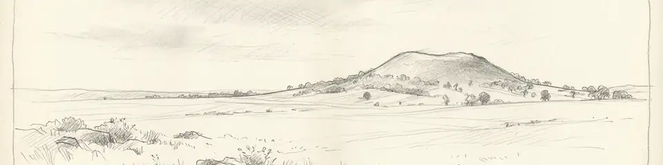
Graphite pencil sketch banner of Budj Bim

“Budj Bim represents the earliest known example of major aquaculture engineering, predating similar systems in other parts of the world by millennia, and provides unique archaeological evidence for the development of semi-sedentary, economically complex societies among Indigenous Australians, fundamentally altering global perceptions of Aboriginal technology and land management.”

الموقع

نظرة عامة

Introduction

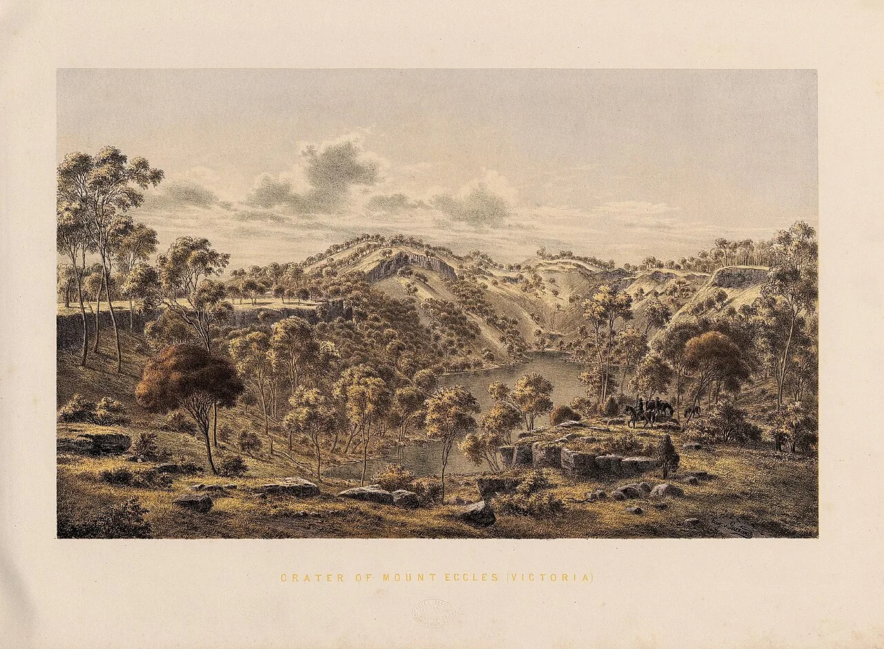
Budj Bim, formerly known as Mount Eccles, is a dormant volcano in south-eastern Australia, whose eruption around 30,000 years ago produced an extensive basaltic lava flow. The Gunditjmara people manipulated this landscape to create a sophisticated aquaculture system for trapping eels and other fish. The site, part of the Budj Bim Cultural Landscape, has been inscribed on the UNESCO World Heritage List as testimony to the engineering skills and deep connection to Country of Aboriginal Australians.

Discovery and Archaeological Recognition

Although the Gunditjmara have always known about the fish traps, European settlers first recorded the channels in the 19th century, interpreting them as natural formations. Systematic archaeological investigation began in the 1970s when Peter Coutts of the Victoria Archaeological Survey undertook excavations at Lake Condah, revealing the extent and antiquity of the stone structures. Radiocarbon dating of preserved wooden stakes and organic material established that the aquaculture system has been in use for at least 6,600 years, making it one of the oldest known in the world.

"Considerable trouble must have been taken in arranging these stones to enable them to take fish and eels from the trap; the works extend over a great distance."
— George Augustus Robinson, Chief Protector of Aborigines, journal entry on visiting Budj Bim, 9 July 1841

Architecture and Engineering

The Budj Bim aquaculture complex features an intricate network of stone canals, weirs, and ponds built across the lava flow. Gunditjmara engineers modified natural watercourses and excavated channels to divert floodwaters from Lake Condah into holding ponds during the eel migration season. Woven basket traps placed in weirs captured adult eels and allowed immature ones to escape, ensuring sustainability. Some channels extend for hundreds of metres, and the system is estimated to have been capable of yielding tonnes of eels annually, supporting a semi-sedentary population and facilitating large social gatherings.

Cultural and Social Significance

The permanent stone structures of Budj Bim challenge the outdated concept that all Indigenous Australians were solely hunter-gatherers. The Gunditjmara people lived in permanent or semi-permanent settlements, constructing dome-shaped stone dwellings near the channels. This settlement pattern, along with evidence of long-distance trade and complex social organization, indicates a high degree of economic intensification. The site remains a living cultural landscape; Gunditjmara elders still practice traditional aquaculture techniques and maintain stories linking the volcanic eruption to ancestral beings.

Scientific Debates and Future Research

While the antiquity and sophistication of the system are well established, scholars debate the precise chronological sequence of construction and the degree of centralised planning. Some argue that the complex grew incrementally over thousands of years, while others see evidence of a coordinated, large-scale design. Ongoing research, including high-resolution lidar mapping and environmental DNA analysis, continues to refine our understanding of how the Gunditjmara adapted to fluctuating climate conditions and altered the landscape to enhance food production.
لماذا يهم

Budj Bim represents the earliest known example of major aquaculture engineering, predating similar systems in other parts of the world by millennia, and provides unique archaeological evidence for the development of semi-sedentary, economically complex societies among Indigenous Australians, fundamentally altering global perceptions of Aboriginal technology and land management.

الأدلة والتفسير

التمييز بين ما هو راسخ وما لا يزال موضع نقاش.

حقائق راسخة

3
  • Radiocarbon dating of wooden structures confirms the aquaculture system was operational by circa 6600 years ago (4600 BCE).
  • The site features over 35 km of constructed and modified basalt channels, pools, and weirs.
  • Archaeological remains include stone dwellings, eel traps, and hearths indicating permanent settlement.

استنتاجات علمية

2
  • The aquaculture system likely supported a semi-sedentary population of hundreds to thousands, especially during eel harvesting seasons.
  • The engineering scale suggests centralized planning and coordinated labor organization.

تفسيرات متنازع عليها

2
  • The degree to which construction occurred as a single planned event versus gradual accumulation over millennia remains unresolved.
  • Interpretations differ on whether climate change or social factors primarily drove the initial development of the aquaculture.

الاكتشاف والتنقيب

Modern conservation and management

بقيادة Gunditj Mirring Traditional Owners Aboriginal Corporation

Ongoing conservation works led by the Gunditj Mirring Traditional Owners, including drain restoration and cultural tourism development, to preserve the living heritage.

1976–1978

Victoria Archaeological Survey Excavations

بقيادة Peter J. F. Coutts

Peter Coutts led excavations at Lake Condah, first to systematically record and date the stone channels and fish traps, establishing their anthropogenic origin and antiquity.

2002–2004

Lake Condah Sustainable Heritage Project

بقيادة Heather Builth

Heather Builth and the Gunditj Mirring Traditional Owners investigated the hydrology and ecology of the aquaculture system, integrating Indigenous knowledge with archaeological science.

2012–2015

Budj Bim Cultural Landscape Mapping

بقيادة Gunditj Mirring Traditional Owners Aboriginal Corporation in partnership with university researchers

Large-scale survey using lidar and geophysical techniques to map the full extent of the channels, revealing previously unrecorded structures.

صور المجتمع

شارك تجربتك

هل قمت بزيارة هذا الموقع؟ ارفع صورك لمساعدة الآخرين في اكتشافه.

قصص ذات صلة

كيفية الاستشهاد بهذه الصفحة

Atlas Anatolia. (4600). Budj Bim. Atlas Anatolia. https://atlasanatolia.com/ar/site/budj-bim

المحتوى مرخّص بموجب CC BY-SA 4.0 — يجب ذكر المصدر عند إعادة الاستخدام.

رسم بياني

روابط بالمواقع والقصص ذات الصلة.

المصادر

  • Coutts, P.J.F. (1984) Lake Condah: An Aboriginal Fishing Station — Peter J. F. Coutts (1984)
  • Builth, H. (2002) The archaeology of Indigenous aquaculture: mapping the ancient fish traps at Lake Condah, Victoria — Heather Builth (2002)
  • Lourandos, H. (1980) Change or stability?: Hydraulics, hunter-gatherers and population in temperate Australia — Harry Lourandos (1980)
  • UNESCO World Heritage List: Budj Bim Cultural Landscapeرابط
  • Gunditj Mirring Traditional Owners (2019) Budj Bim Cultural Landscape World Heritage Nomination — Gunditj Mirring Traditional Owners Aboriginal Corporation (2019)

الأسئلة الشائعة

أين يقع Budj Bim؟

يقع Budj Bim في Victoria, South-West Victoria, Australia.

كم يبلغ عمر Budj Bim؟

يعود تاريخ Budj Bim إلى حوالي 4600 ق.م – 1900 م.

ما هي الحضارات المرتبطة بـ Budj Bim؟

يرتبط Budj Bim بحضارة Aboriginal Australian.

لماذا يعتبر Budj Bim مهماً؟

Budj Bim represents the earliest known example of major aquaculture engineering, predating similar systems in other parts of the world by millennia, and provides unique archaeological evidence for the development of semi-sedentary, economically complex societies among Indigenous Australians, fundamentally altering global perceptions of Aboriginal technology and land management.

هل Budj Bim موقع تراث عالمي لليونسكو؟

نعم — Budj Bim مدرج في قائمة التراث العالمي لليونسكو.