
Skip to content
Atlas AnatoliaAtlas Anatolia
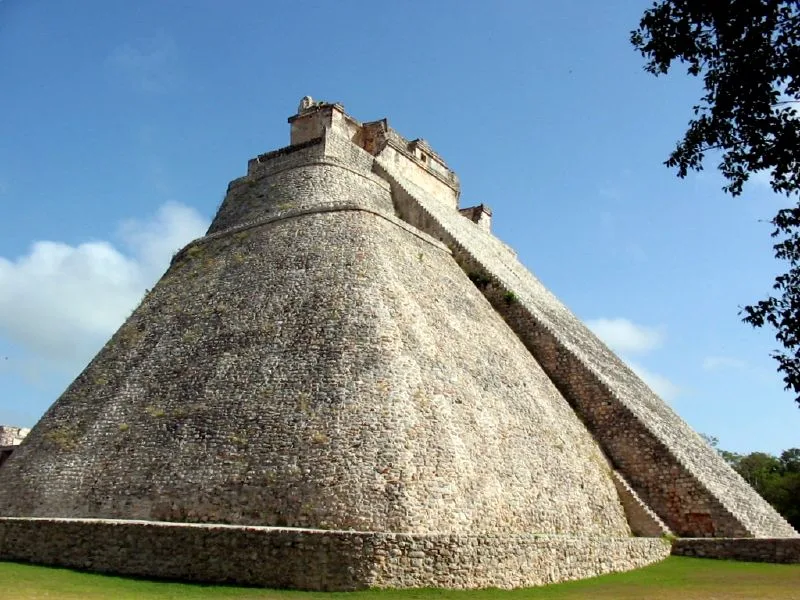
The rounded Pyramid of the Magician at Uxmal, Yucatán, Mexico

Uxmal

Óoxmáal600 CE – 1000 CE
69

Interest

Pre-ColumbianMaya

Peak

c. 600–1000 CE (Late/Terminal Classic Maya)

Style

The masterpiece of Puuc architecture (mosaic stone façades)

Pyramid of the Magician

Unusual rounded, elliptical-sided pyramid

Governor's Palace

~100 m façade, ~20,000 mosaic stones; aligned to Venus

Water

No rivers/cenotes — relied on chultun rain cisterns

UNESCO

World Heritage Site (1996)

Uxmal is widely regarded as the architectural high point of the Puuc Maya region and one of the most beautiful of all Maya cities.”

Overview

Uxmal lies in the low Puuc hills of the western Yucatán Peninsula, about 60 kilometres south of Mérida. Its name is usually translated as "thrice built." Unlike the great cities of the Maya lowlands to the south, Uxmal had no rivers, lakes, or natural cenotes for water, and depended instead on rainfall stored in numerous plastered underground cisterns (chultuns) — a fact reflected in the obsessive repetition of masks of Chaac, the hook-nosed rain god, across its façades. The city flourished in the Late and Terminal Classic periods, roughly 600–1000 CE, with a peak population that may have reached around 15,000–25,000.

Uxmal is the showcase of the Puuc architectural style, characterised by smooth lower walls of finely cut limestone veneer surmounted by elaborately decorated upper friezes assembled from thousands of pre-cut mosaic stones — geometric lattices, colonnettes imitating bundled reeds, step-frets, and serpent and Chaac motifs. The Pyramid of the Magician (or Pyramid of the Soothsayer) dominates the site: an unusual structure with rounded, elliptical sides rising in several superimposed phases, wrapped in legend as the work of a dwarf magician built in a single night.

The Nunnery Quadrangle — so named by the Spanish for its resemblance to a convent — is a large courtyard enclosed by four richly decorated buildings, considered one of the masterpieces of Maya architecture. The Governor's Palace, raised on a vast artificial platform, has a façade nearly 100 metres long covered with an intricate mosaic frieze of some 20,000 cut stones, and is aligned to the rising point of Venus, reflecting the Maya concern with that planet. A ball court and the House of the Turtles complete the ceremonial core. Uxmal was connected by a raised causeway (sacbe) to the nearby centre of Kabah and dominated a cluster of Puuc cities.

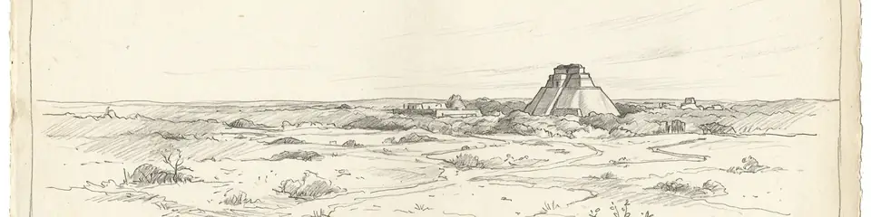
The city declined around 1000 CE, for reasons that remain debated but probably involved the same combination of drought, political instability, and shifting trade that affected the wider Maya world. It was never entirely forgotten, and was described by the explorers John Lloyd Stephens and Frederick Catherwood in the 1840s.
Why It Matters

Uxmal is widely regarded as the architectural high point of the Puuc Maya region and one of the most beautiful of all Maya cities. Its buildings represent the most refined development of the Puuc style, in which entire upper façades were composed as vast stone mosaics — a level of decorative sophistication unmatched elsewhere in the Maya world. The Governor's Palace and Nunnery Quadrangle are considered masterpieces of pre-Columbian architecture, and the city's ingenious adaptation to a waterless environment, with its cisterns and pervasive rain-god imagery, illuminates how the Maya thrived where surface water was absent. Uxmal was inscribed as a UNESCO World Heritage Site in 1996.

Stay curious

New stories and sites, once a month. No spam.

Evidence & Interpretation

Distinguishing what is well-established from what remains debated.

Well-Established Facts

4
  • The Puuc-style mosaic façades survive across the Nunnery Quadrangle, Governor's Palace, and other buildings, assembled from thousands of pre-cut veneer stones — confirmed by direct architectural study.
  • The Governor's Palace is aligned toward the southerly rising extreme of Venus, established by archaeoastronomical survey, consistent with the Maya ritual importance of that planet.
  • Numerous chultuns (plastered underground cisterns) document the city's reliance on stored rainwater in a region lacking surface water or cenotes.
  • A sacbe (raised causeway) links Uxmal to the neighbouring Puuc centre of Kabah, evidencing political and economic ties within the Puuc region.

Debated Interpretations

1
  • The causes and precise timing of Uxmal's decline around 1000 CE are debated, with drought, warfare, and shifting trade networks all proposed; the relative weight of each remains uncertain.

More Photos

Museum Artifacts

Community Photos

Share your experience

Have you visited this site? Upload your photos to help others discover it.

Location

Sources

  • The House of the Governor: A Maya Palace at UxmalKowalski, Jeff Karl (1987)
  • The MayaCoe, Michael D. (2011)

Research Papers