Overview
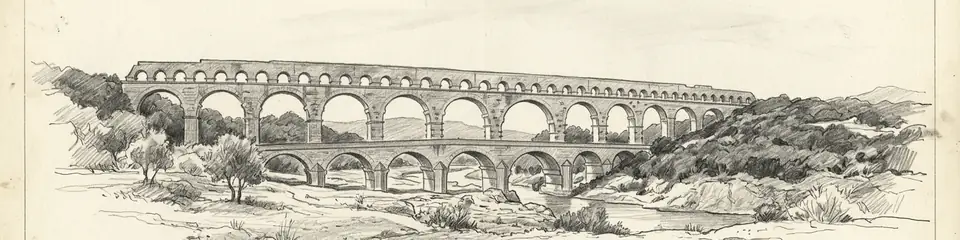
The Pont du Gard stands in the countryside near Vers-Pont-du-Gard in the Gard department of southern France. It is not an isolated bridge but the most dramatic surviving element of a 50-kilometre aqueduct that carried water from springs near Uzès to the Roman colony of Nemausus (modern Nîmes). Where the conduit had to cross the gorge of the Gardon river, Roman engineers raised a bridge of three superimposed rows of arches to maintain the channel's gentle, continuous gradient.
The structure is about 49 metres high — the tallest of all known Roman aqueduct bridges — and originally around 360 metres long at its upper level. The bottom tier has 6 arches, the middle 11, and the top 35 smaller arches that carried the water channel itself. It is built of soft yellow limestone quarried nearby, in blocks some weighing up to 6 tonnes, largely laid without mortar in the lower tiers. Projecting stones left on the faces served as supports for scaffolding and for future maintenance. The aqueduct as a whole descends only about 12.6 metres over its entire 50-kilometre length, an average gradient of around 1 in 3,000 — an extraordinary feat of surveying.
The aqueduct is generally dated to the middle of the 1st century CE. It supplied Nîmes with an estimated tens of thousands of cubic metres of water per day, feeding the city's baths, fountains, and homes, for several centuries. From the 4th century onward maintenance lapsed, the channel silted up with mineral deposits, and the aqueduct gradually fell out of use. In the medieval and early modern periods the lower tier was adapted as a road bridge, which helped ensure the monument's survival. It became an object of admiration to travellers and engineers from the Renaissance onward.