
Pular para o conteúdo
Atlas Anatolia
NotíciasIce Age teeth in Sulawesi push betel-nut use back as far as 25,000 yearsRoman mosaic and Eros head uncovered in the basilica at Pompeiopolis, Kastamonu
Hadrian's Wall — United Kingdom

Wikimedia Commons (CC BY-SA)

Continent Record

Northernmost Known Site in Europe

FortalezaUNESCODestaque

Hadrian's Wall

Seyfi Cem Baskin

122 d.C. – 410 d.C.

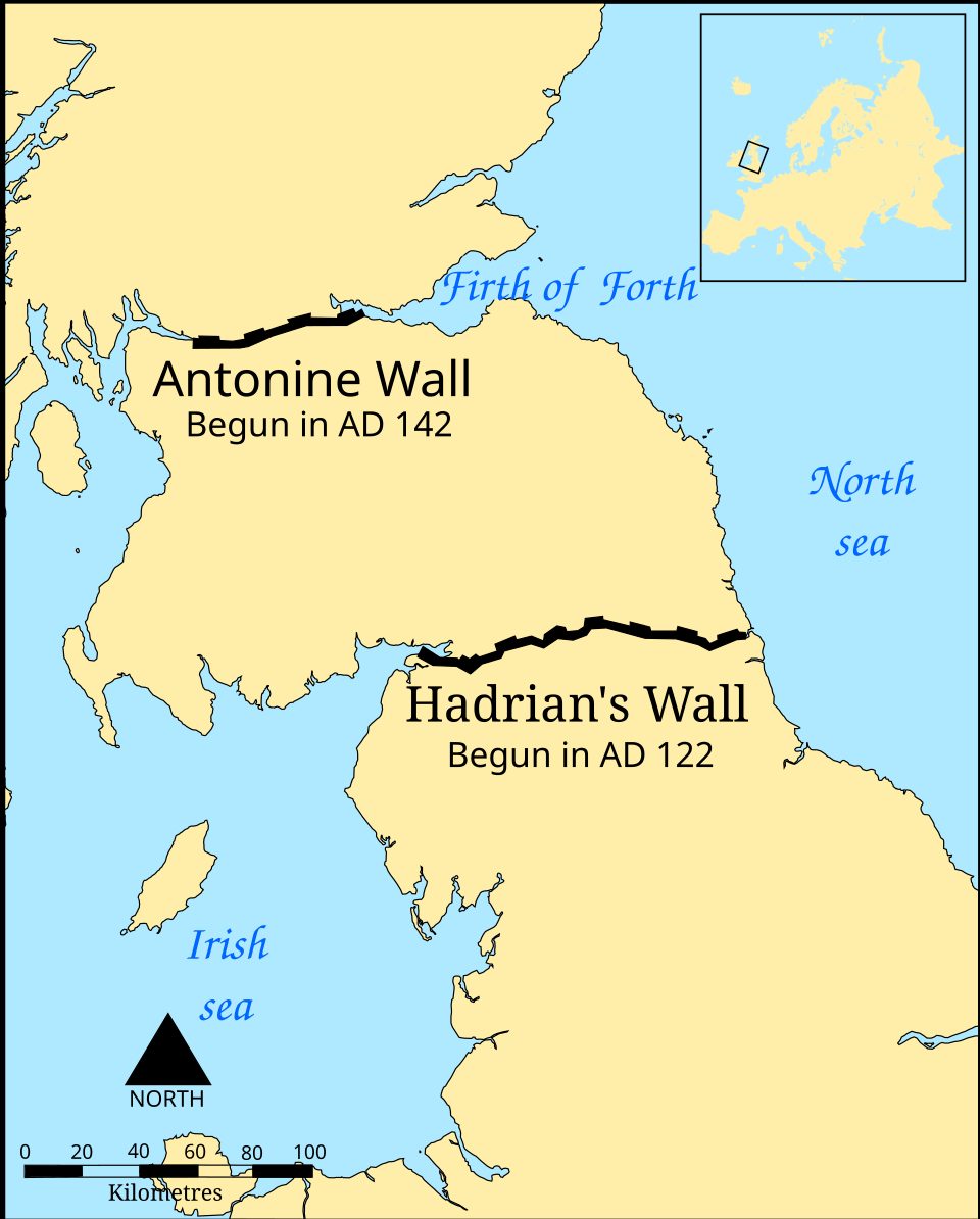
Hadrian's Wall, built AD 122 at the Roman Empire's northern frontier in Britain, stretched 73 miles across the island and served as a military boundary until Roman withdrawal around AD 410.

322
Interesse 86

Localização

Northumberland / Cumbria · Northern England · Reino Unido

55.02°N · 2.29°W · Europa

Built

AD 122–128 (primary construction)

Civilization

Roman Empire

Length

80 Roman miles (73 modern miles / 117.5 km)

Material

Stone (eastern two-thirds) and turf (western third)

Status

UNESCO World Heritage Site

Disuse

Abandoned as frontier around AD 410

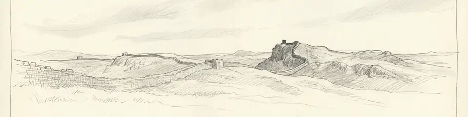
Graphite pencil sketch banner of Hadrian's Wall

“As the most elaborate frontier of the Roman Empire, Hadrian's Wall exemplifies Roman military engineering and imperial policy.”

Localização

Visão geral

Discovery and Early Scholarship

Though never completely lost, systematic study of Hadrian's Wall began in the 16th century with antiquarians such as William Camden. It was not until the 18th and 19th centuries, however, that large-scale excavation and recording took place, most notably by John Hodgson and the conservationist John Clayton, who uncovered milecastles, turrets, and forts, and preserved the central sector.

"Hadrian set out for Britain, where he put right many things and was the first to build a wall, eighty miles long, which was to separate the barbarians from the Romans."
— Historia Augusta, Life of Hadrian XI.2 (4th century CE)
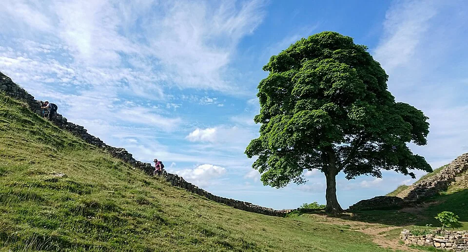
2018-06-07 Sycamore Gap Tree (Acer pseudoplatanus), next to Hadrian’s Wall UK
2018-06-07 Sycamore Gap Tree (Acer pseudoplatanus), next to Hadrian’s Wall UK | Gordon Leggett (CC BY-SA 4.0)

Construction and Architectural Features

Construction commenced in AD 122 under Emperor Hadrian and was largely completed within six years. The eastern two-thirds of the Wall were built of stone, while the western third was originally a turf rampart, later replaced in stone. It stood up to 4.5 metres high with a parapet and was fronted by a ditch. Every Roman mile was a fortified gateway or milecastle, with two turrets between them. Major forts, such as Housesteads and Chesters, housed auxiliary garrisons. The Vallum, an extensive earthwork to the south, delimited the military zone.

Military Function and Frontier Life
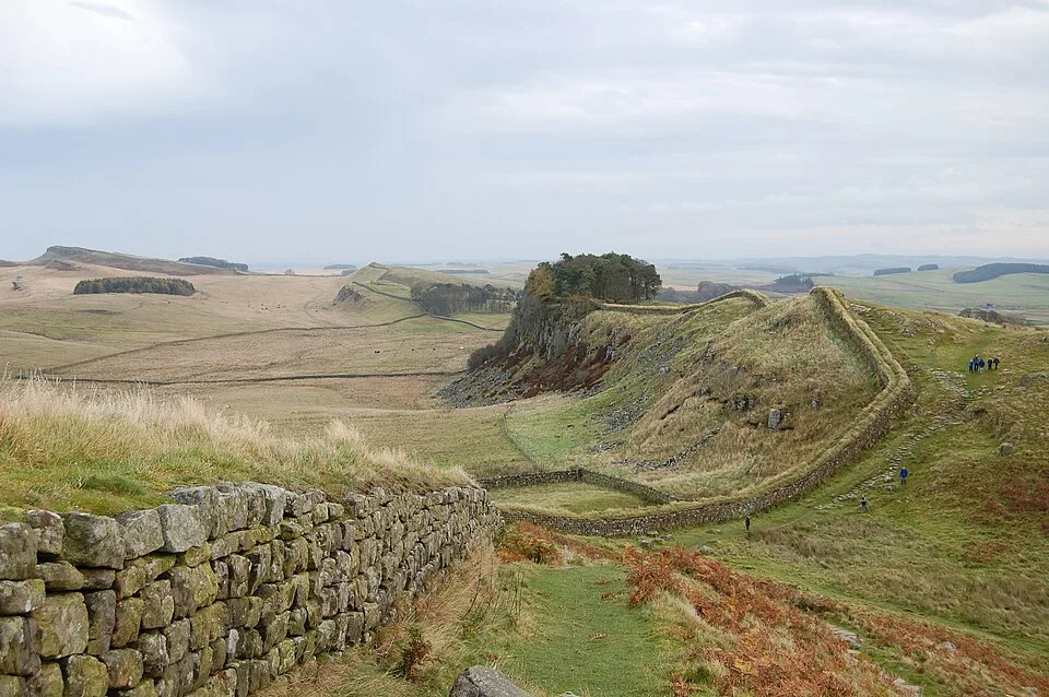
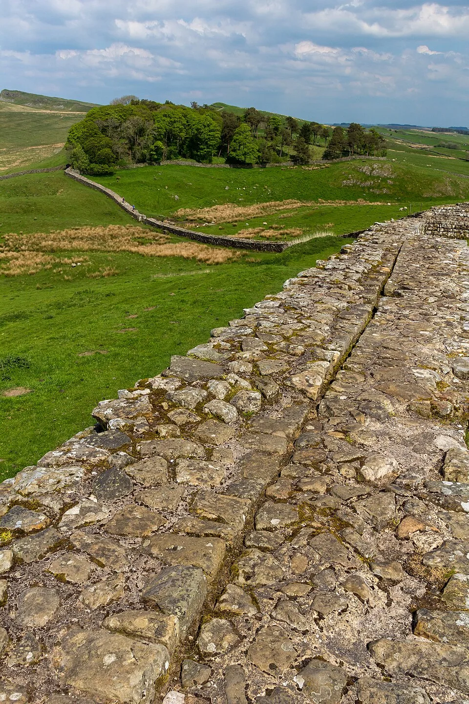
Hadrian's Wall west of Housesteads 3
Hadrian's Wall west of Housesteads 3 | Steven Fruitsmaak (Public domain)

The Wall was garrisoned by mixed auxiliary units from across the empire, whose presence is attested by inscriptions and writing tablets. Excavations at Vindolanda, a fort just south of the Wall, have yielded wooden tablets detailing daily life, supplies, and personal correspondence. These suggest a complex community of soldiers, families, and traders rather than a purely defensive post.

Debates on Purpose and Strategy
Housesteads Roman Fort 2014 16
Housesteads Roman Fort 2014 16 | Photograph by Mike Peel (www.mikepeel.net). (CC BY-SA 4.0)

For decades scholars debated whether the Wall was a defensible barrier against northern tribes or a device to control movement and levy customs. Current consensus views it as a permeable frontier that regulated trade and displayed imperial power, though the question remains contested.

Decline and Legacy

The Wall ceased to function as a frontier shortly after AD 410, when Roman rule in Britain collapsed. Its stone was robbed for local buildings, but significant sections survived. Today it is a UNESCO World Heritage Site and forms the heart of a national walking trail.

Por que isso importa

As the most elaborate frontier of the Roman Empire, Hadrian's Wall exemplifies Roman military engineering and imperial policy. It shaped the cultural and political landscape of Britain, marking a division that resonated through medieval and modern history.

Evidências e interpretação

Distinguir o que está bem estabelecido do que permanece em debate.

Fatos bem estabelecidos

3
  • Construction began in AD 122 under Emperor Hadrian, as recorded in the Historia Augusta.
  • The Wall ran from Segedunum (Wallsend) to the Solway Firth, with over 80 milecastles and numerous turrets.
  • The Vallum, a massive earthwork south of the Wall, marked the military zone and controlled access.

Inferências acadêmicas

2
  • The Wall’s principal function was to regulate trade and population movements rather than serve as an impregnable defense.
  • The original plan was modified during construction, as evidenced by forts like Carrawburgh built directly astride the Wall.

Interpretações debatidas

2
  • The extent to which the Wall was continuously manned after the 4th century remains uncertain.
  • The role of the Wall in defining Roman identity and 'otherness' versus its military practicality is contested.

Descoberta e escavação

1840–1890

John Clayton's Excavations

Dirigido por John Clayton

Antiquarian John Clayton purchased large sections of the Wall, excavated milecastles and forts, and carried out extensive conservation work, preserving the central sector.

1929–1939

Housesteads Fort Excavations

Dirigido por Society of Antiquaries of Newcastle / Ian Richmond

Systematic excavations led by the Society of Antiquaries of Newcastle upon Tyne and later by Ian Richmond, revealing barrack blocks, granaries, and the commandant’s house.

1973–1974

Vindolanda Writing Tablets Discovery

Dirigido por Robin Birley

Excavations at the Vindolanda site, just south of the Wall, uncovered hundreds of preserved wooden writing tablets, providing unprecedented insights into frontier life.

1999–2009

Hadrian’s Wall Research Framework

Dirigido por Various contractors (English Heritage / universities)

A collaborative programme of targeted excavation and survey across the Wall corridor, synthesizing over a century of archaeological work.

2018

WallCAP: Wall Community Archaeology Project

Dirigido por Newcastle University / National Trust

A community-based project investigating the stone curtain, Vallum, and associated structures to inform conservation and management.

Fotos da comunidade

Compartilhe sua experiência

Você visitou este sítio? Envie suas fotos para ajudar outros a descobri-lo.

Como citar esta página

Atlas Anatolia. (122). Hadrian's Wall. Atlas Anatolia. https://atlasanatolia.com/pt/site/hadrians-wall

Conteúdo licenciado sob CC BY-SA 4.0 — atribuição necessária ao reutilizar.

Fontes

  • Breeze, D.J. (2006), Hadrian's Wall — David J. Breeze (2006)
  • Birley, A.R. (1976), Hadrian's Wall: An Illustrated Guide — Anthony R. Birley (1976)
  • Hodgson, N. (2017), 'Hadrian's Wall 1999–2009: A Summary of Excavation and Research', Archaeologia Aeliana, 5th ser., vol. 45, pp. 1–42 — Nick Hodgson (2017)
  • Bidwell, P. (2005), 'The System of Obstacles on Hadrian's Wall', Britannia, vol. 36, pp. 35–56 — Paul Bidwell (2005)
  • UNESCO World Heritage entry for 'Frontiers of the Roman Empire: Hadrian's Wall'Link
  • English Heritage: Hadrian's WallLink

Perguntas frequentes

Onde fica Hadrian's Wall?

Hadrian's Wall está localizado em Northumberland / Cumbria, Northern England, United Kingdom.

Qual é a antiguidade de Hadrian's Wall?

Hadrian's Wall data de aproximadamente 122 d.C. – 410 d.C..

Quais civilizações estão associadas a Hadrian's Wall?

Hadrian's Wall está associado à civilização Roman, Celtic.

Por que Hadrian's Wall é importante?

As the most elaborate frontier of the Roman Empire, Hadrian's Wall exemplifies Roman military engineering and imperial policy.

Hadrian's Wall é um Patrimônio Mundial da UNESCO?

Sim — Hadrian's Wall está inscrito na Lista do Patrimônio Mundial da UNESCO.