
콘텐츠로 건너뛰기
Atlas Anatolia
디그
뉴스술라웨시 빙하기 치아에서 빈랑 사용 25,000년 전까지 소급카스타모누 폼페이오폴리스 바실리카에서 로마 모자이크와 에로스 두상 발견
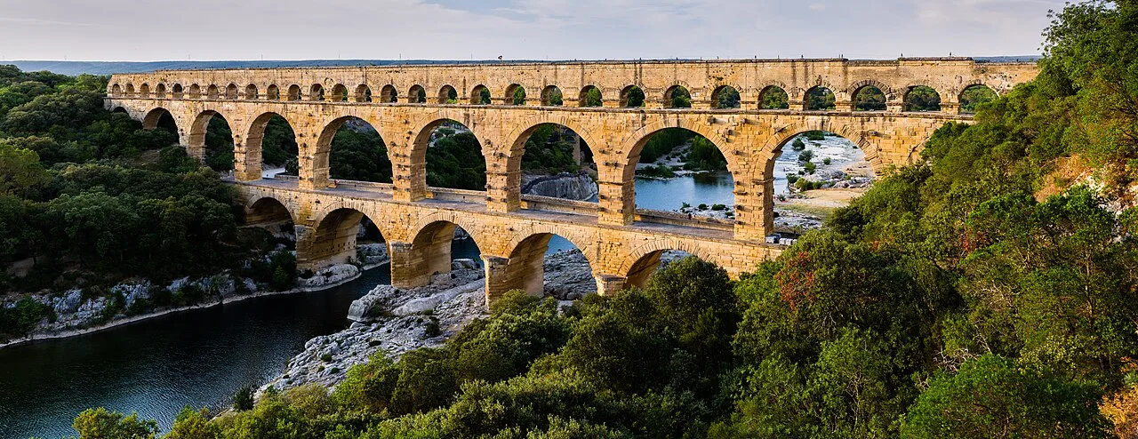
The three-tiered Roman aqueduct bridge Pont du Gard over the Gardon river, France

Wikimedia Commons

Country Record

Oldest Monument in France

기념물유네스코주요

Pont du Gard

Seyfi Cem Baskin

40 서기 – 60 서기

The highest of all Roman aqueduct bridges — a three-tiered limestone arcade nearly 50 metres tall that leaps the Gardon river gorge in southern France. Built in the 1st century CE to carry the aqueduct of Nîmes, it is a masterpiece of Roman engineering and one of the best-preserved structures of the ancient world.

311
관심 74

위치

프랑스

43.95°N · 4.54°E · 유럽

Built

Mid-1st century CE

Height

~49 m — the tallest Roman aqueduct bridge

Tiers

Three: 6 + 11 + 35 arches; channel on the top level

Aqueduct length

~50 km from Uzès to Nîmes (Nemausus)

Gradient

~12.6 m total drop — about 1 in 3,000

UNESCO

World Heritage Site (1985)

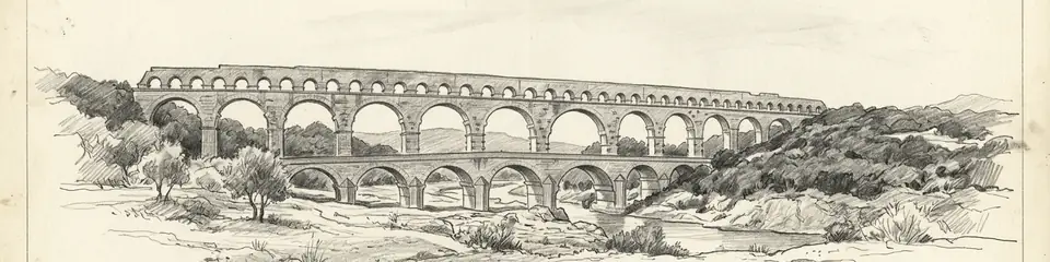
Graphite pencil sketch banner of Pont du Gard

“The Pont du Gard is the most celebrated Roman aqueduct bridge in the world and a defining image of Roman engineering ambition.”

위치

개요

The Pont du Gard stands in the countryside near Vers-Pont-du-Gard in the Gard department of southern France. It is not an isolated bridge but the most dramatic surviving element of a 50-kilometre aqueduct that carried water from springs near Uzès to the Roman colony of Nemausus (modern Nîmes). Where the conduit had to cross the gorge of the Gardon river, Roman engineers raised a bridge of three superimposed rows of arches to maintain the channel's gentle, continuous gradient.

The structure is about 49 metres high — the tallest of all known Roman aqueduct bridges — and originally around 360 metres long at its upper level. The bottom tier has 6 arches, the middle 11, and the top 35 smaller arches that carried the water channel itself. It is built of soft yellow limestone quarried nearby, in blocks some weighing up to 6 tonnes, largely laid without mortar in the lower tiers. Projecting stones left on the faces served as supports for scaffolding and for future maintenance. The aqueduct as a whole descends only about 12.6 metres over its entire 50-kilometre length, an average gradient of around 1 in 3,000 — an extraordinary feat of surveying.

The aqueduct is generally dated to the middle of the 1st century CE. It supplied Nîmes with an estimated tens of thousands of cubic metres of water per day, feeding the city's baths, fountains, and homes, for several centuries. From the 4th century onward maintenance lapsed, the channel silted up with mineral deposits, and the aqueduct gradually fell out of use. In the medieval and early modern periods the lower tier was adapted as a road bridge, which helped ensure the monument's survival. It became an object of admiration to travellers and engineers from the Renaissance onward.

중요성

The Pont du Gard is the most celebrated Roman aqueduct bridge in the world and a defining image of Roman engineering ambition. Its scale, the precision of its construction, and the astonishing accuracy of the survey that gave the entire 50-kilometre aqueduct its near-imperceptible gradient make it a benchmark in the history of technology. It has influenced engineers and architects for centuries and remains one of the best-preserved monuments of the Roman world. It was inscribed as a UNESCO World Heritage Site in 1985.

증거와 해석

확립된 사실과 논쟁 중인 사항을 구분합니다.

잘 확립된 사실

3
  • The bridge was part of the aqueduct supplying Nîmes, traced over its full ~50 km course; the channel's thick calcium-carbonate deposits confirm prolonged water flow.
  • Projecting blocks and ledges left on the faces are construction features — supports for scaffolding and centering during building and for later maintenance access.
  • The lower tier was adapted as a road bridge in the medieval and early-modern periods, documented in records and physically evident, which contributed to the monument's preservation.

학술적 추론

1
  • The aqueduct's near-imperceptible average gradient (~1:3,000) implies advanced Roman surveying using instruments such as the chorobates and groma; the exact methods are reconstructed rather than documented.

논쟁 중인 해석

1
  • The precise construction date is debated within the 1st century CE; an older tradition attributing it to Agrippa (c. 19 BCE) is now generally rejected in favour of a mid-1st-century date on archaeological grounds.

커뮤니티 사진

당신의 경험을 공유하세요

이 유적지를 방문하셨나요? 다른 탐험가들을 위해 사진을 업로드해 보세요.

이 페이지 인용 방법

Atlas Anatolia. (40). Pont du Gard. Atlas Anatolia. https://atlasanatolia.com/ko/site/pont-du-gard

콘텐츠는 CC BY-SA 4.0 라이선스에 따라 제공됩니다 — 재사용 시 출처 표시가 필요합니다.

출처

  • Roman Aqueducts and Water Supply — Hodge, A. Trevor (2002)
  • L'aqueduc de Nîmes et le Pont du Gard — Fabre, G.; Fiches, J.-L.; Paillet, J.-L. (2000)

자주 묻는 질문

Pont du Gard은(는) 어디에 위치해 있나요?

Pont du Gard은(는) France에 위치해 있습니다.

Pont du Gard의 연대는 언제인가요?

Pont du Gard의 연대는 대략 40 서기 – 60 서기로 거슬러 올라갑니다.

Pont du Gard과(와) 관련된 고대 문명은 무엇인가요?

Pont du Gard은(는) Roman 문명과 관련이 있습니다.

Pont du Gard이(가) 중요한 이유는 무엇인가요?

The Pont du Gard is the most celebrated Roman aqueduct bridge in the world and a defining image of Roman engineering ambition.

Pont du Gard은(는) 유네스코 세계유산인가요?

예 — Pont du Gard은(는) 유네스코 세계유산으로 등재되어 있습니다.