
콘텐츠로 건너뛰기
Atlas Anatolia
디그
뉴스술라웨시 빙하기 치아에서 빈랑 사용 25,000년 전까지 소급카스타모누 폼페이오폴리스 바실리카에서 로마 모자이크와 에로스 두상 발견
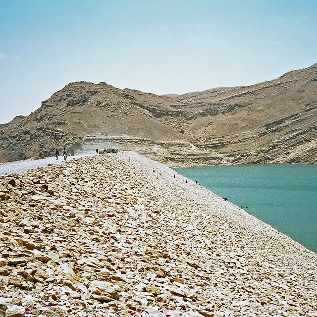
Stone abutments and spillways of the ancient Great Dam of Marib, Yemen

Wikimedia Commons

Continent Record

Oldest Monument in Asia

기념물유네스코

Great Dam of Marib

Seyfi Cem Baskin

سد مأرب800 기원전 – 570 서기

The monumental earthen and stone dam that irrigated the oasis of Marib, capital of the Sabaean kingdom in ancient Yemen — one of the largest hydraulic works of the ancient Near East, sustaining intensive agriculture for more than a millennium before catastrophic breaches in late antiquity.

211
관심 54

위치

예멘

15.40°N · 45.24°E · 아시아

Function

Diversion dam feeding northern and southern oasis canals

Peak construction

Major phases c. 8th–6th centuries BCE; continued repair for centuries

Final breach

Catastrophic failure traditionally dated mid–late 6th century CE

UNESCO

Landmarks of Ancient Kingdom of Saba (2023)

Related capital

Marib (ancient Maryab), Sabaean royal centre nearby

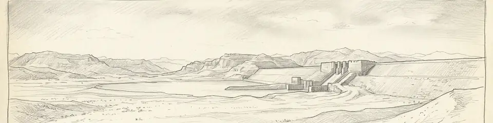
Graphite pencil sketch banner of Great Dam of Marib

“The Marib Dam is the clearest surviving proof that South Arabian wealth rested not only on caravan tolls but on large-scale irrigated agriculture — hydraulic engineering on a par with Mesopotamian canal systems, adapted to monsoon wadi floods.”

위치

개요

The Great Dam of Marib stands in the Wadi Adhanah (Dhana) in the highlands of eastern Yemen, roughly 170 kilometres east of Sanaʿa, just upstream of the ancient Sabaean capital. Construction of successive earth-and-rubble dams with cut-stone spillways and sluices began by the early first millennium BCE; epigraphic and archaeological evidence places major works between the eighth and sixth centuries BCE, with repeated repairs and enlargements under Sabaean and later rulers.

Unlike many ancient retention dams, Marib was designed primarily for controlled diversion: monsoon floods were slowed, diverted through twin northern and southern canals, and distributed across a vast oasis network capable of supporting tens of thousands of people and the frankincense-and-myrrh agricultural economy of South Arabia. Classical authors and local inscriptions celebrate Marib as a green oasis amid the desert; Quranic tradition later remembered the "flood of the dam" (sayl al-ʿArim) as a civilisational turning point.
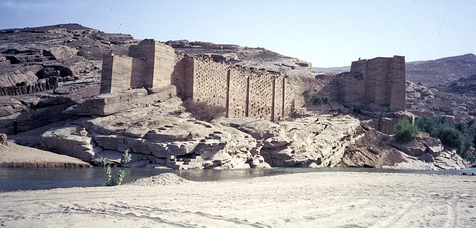
Jemen1988-022 hg
Jemen1988-022 hg | H. Grobe (CC BY-SA 3.0)
"There was for Saba a sign in their dwelling-place: two gardens, on the right and on the left. Eat of the provision of your Lord and be grateful to Him. A good land and a forgiving Lord. But they turned away, so We sent upon them the flood of the dam."
— Qurʾan 34:15–16 (Sūrat Sabaʾ), on the flood of the dam at Marib

The final catastrophic failure is conventionally dated to the mid–late sixth century CE (after centuries of repair episodes), after which the oasis contracted and the political centre of gravity in Yemen shifted toward Himyarite highland capitals. Modern hydraulic works nearby (opened 1986) sit upstream of the ancient ruins; the archaeological remains of sluices, abutments, and canal heads remain among the most important engineering monuments of the ancient Arabian peninsula.
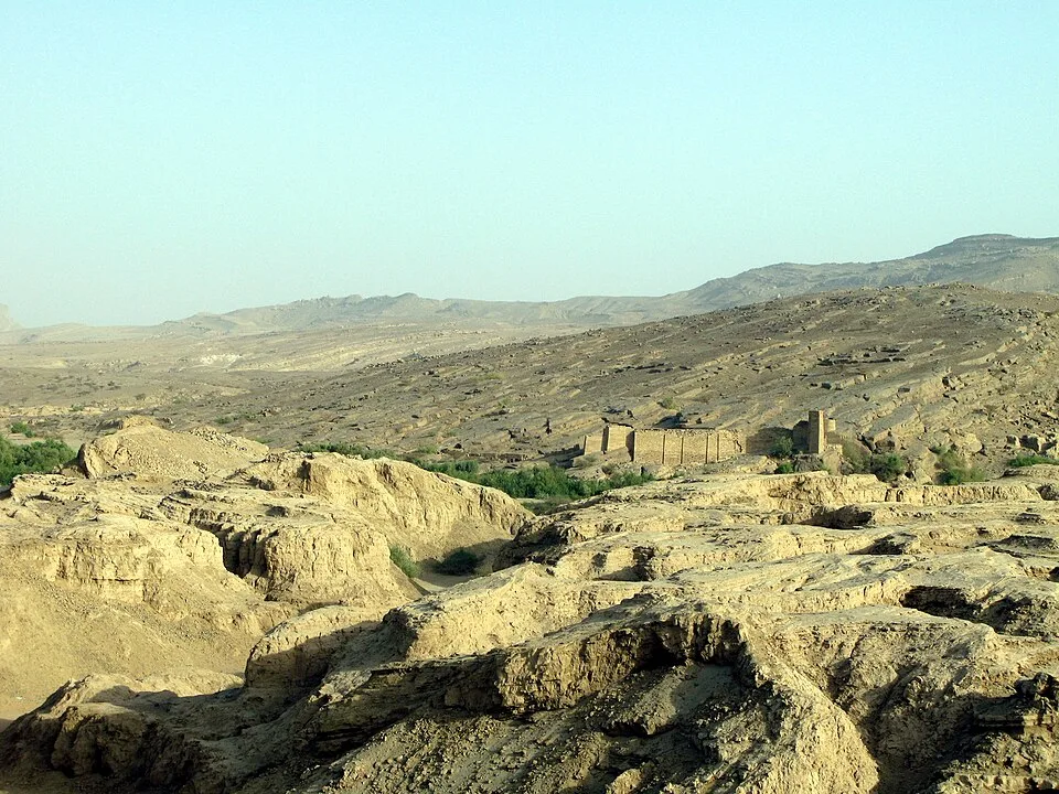
083 stari jez
083 stari jez | Ljuba brank at Slovenian Wikipedia (Public domain)

Marib and its surrounding Sabaean landscape form part of UNESCO's recognition of the Landmarks of the Ancient Kingdom of Saba (inscribed 2023).
중요성

The Marib Dam is the clearest surviving proof that South Arabian wealth rested not only on caravan tolls but on large-scale irrigated agriculture — hydraulic engineering on a par with Mesopotamian canal systems, adapted to monsoon wadi floods. Its eventual failure offers a rare archaeological and literary case of a fragile oasis civilisation unraveling when hydraulic infrastructure collapsed, with consequences remembered in Arabic tradition for centuries.

증거와 해석

확립된 사실과 논쟁 중인 사항을 구분합니다.

잘 확립된 사실

2
  • Standing stone sluices, abutments, and canal-head masonry document a diversion-irrigation system on a monumental scale.
  • Sabaean and later South Arabian inscriptions record construction, repair, and ritual dedication of dam works.

학술적 추론

1
  • The dam underwrote the demographic and economic base that allowed Marib to remain a major South Arabian capital for centuries.

논쟁 중인 해석

1
  • Exact sequences of rebuilds and the precise date of the terminal breach remain debated among epigraphers and hydrologists.

커뮤니티 사진

당신의 경험을 공유하세요

이 유적지를 방문하셨나요? 다른 탐험가들을 위해 사진을 업로드해 보세요.

관련 이야기

이 페이지 인용 방법

Atlas Anatolia. (800). Great Dam of Marib. Atlas Anatolia. https://atlasanatolia.com/ko/site/marib-dam

콘텐츠는 CC BY-SA 4.0 라이선스에 따라 제공됩니다 — 재사용 시 출처 표시가 필요합니다.

그래프

관련 유적지와 스토리로의 연결.

출처

  • Queen of Sheba: Treasures from Ancient Yemen — Simpson, St John (2002)
  • UNESCO — Landmarks of the Ancient Kingdom of Saba링크

자주 묻는 질문

Great Dam of Marib은(는) 어디에 위치해 있나요?

Great Dam of Marib은(는) Yemen에 위치해 있습니다.

Great Dam of Marib의 연대는 언제인가요?

Great Dam of Marib의 연대는 대략 800 기원전 – 570 서기로 거슬러 올라갑니다.

Great Dam of Marib과(와) 관련된 고대 문명은 무엇인가요?

Great Dam of Marib은(는) Sabaean, Himyarite 문명과 관련이 있습니다.

Great Dam of Marib이(가) 중요한 이유는 무엇인가요?

The Marib Dam is the clearest surviving proof that South Arabian wealth rested not only on caravan tolls but on large-scale irrigated agriculture — hydraulic engineering on a par with Mesopotamian canal systems, adapted to monsoon wadi floods.

Great Dam of Marib은(는) 유네스코 세계유산인가요?

예 — Great Dam of Marib은(는) 유네스코 세계유산으로 등재되어 있습니다.